Zilwaukee Township, Michigan | |
|---|---|
 Zilwaukee Township Hall | |
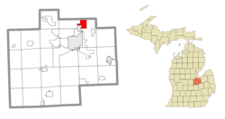 Location within Saginaw County | |
 Zilwaukee Township Location within the state of Michigan  Zilwaukee Township Location within the United States | |
| Coordinates: 43°30′12″N83°53′48″W / 43.50333°N 83.89667°W | |
| Country | United States |
| State | Michigan |
| County | Saginaw |
| Established | 1854 |
| Government | |
| • Supervisor | Scott Clark |
| • Clerk | Patricia Brandt |
| Area | |
• Total | 5.98 sq mi (15.50 km2) |
| • Land | 3.58 sq mi (9.27 km2) |
| • Water | 2.41 sq mi (6.23 km2) |
| Elevation | 577 ft (176 m) |
| Population (2020) | |
• Total | 62 |
| • Density | 17.3/sq mi (6.7/km2) |
| Time zone | UTC-5 (Eastern (EST)) |
| • Summer (DST) | UTC-4 (EDT) |
| ZIP code(s) | 48604 (Saginaw) |
| Area code | 989 |
| FIPS code | 26-89340 [1] |
| GNIS feature ID | 1627305 [2] |
Zilwaukee Township is a civil township of Saginaw County in the U.S. state of Michigan. The population was 62 at the 2020 census, which ranks the township the fourth-least populated municipality in the state of Michigan after Pointe Aux Barques Township, Grand Island Township, and West Branch Township.
Contents
The city of Zilwaukee is southwest of the township, but the two are administered separately. The township is home to the Crow Island State Game Area, which covers a large portion of the township's area.
