Dubbo is a city in the Orana Region of New South Wales, Australia. It is the largest population centre in the Orana region, with a population of 43,516 at June 2021.

Orange is a city in the Central Tablelands region of New South Wales, Australia. It is 254 km (158 mi) west of the state capital, Sydney [206 km (128 mi) on a great circle], at an altitude of 862 metres (2,828 ft). Orange had an urban population of 41,920 at the 2021 Census, making the city a significant regional centre. A significant nearby landmark is Mount Canobolas with a peak elevation of 1,395 m (4,577 ft) AHD and commanding views of the district. Orange is situated within the traditional lands of the Wiradjuri Nation.

Wellington is a town in the Central Western Slopes region of New South Wales, Australia, located at the junction of the Wambuul Macquarie and Bell Rivers. It is within the local government area of Dubbo Regional Council. The town is 362 kilometres (225 mi) northwest of Sydney on the Mitchell Highway and Main Western Railway, and 50 km southeast of Dubbo, the main centre of the Central Western Slopes region.

Mudgee is a town in the Central West of New South Wales, Australia. It is in the broad fertile Cudgegong River valley 261 km (162 mi) north-west of Sydney and is the largest town in the Mid-Western Regional Council local government area as well as being the council seat. At the 2021 Census, its population was 11,457. The district lies across the edge of the geological structure known as the Sydney Basin.

Uralla is a town on the Northern Tablelands, New South Wales, Australia. It is located at the intersection of the New England Highway and Thunderbolts Way, 465 kilometres (289 mi) north of Sydney and about 23 kilometres (14 mi) south-west of the city of Armidale. At the 2016 census, the township of Uralla had a population of 2,388 people. According to the 2021 census, the population of Uralla had increased to 2,728.
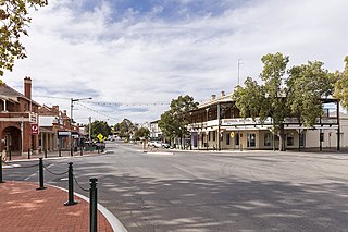
Narrandera, until around 1949 also spelled "Narandera", is a town located in the Riverina region of southern New South Wales, Australia. The town lies on the junction of the Newell and Sturt highways, adjacent to the Murrumbidgee River, and it is considered the gateway to the Murrumbidgee Irrigation Area. At the 2016 census, Narrandera had a population of 3,746 people.

Liverpool Plains Shire is a local government area located in the North West Slopes region of New South Wales, Australia. The Shire was formed on 17 March 2004 by the amalgamation of Quirindi Shire with parts of Parry, Murrurundi and Gunnedah shires.

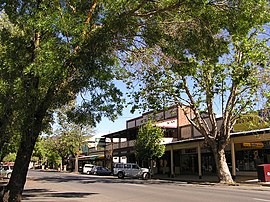
Junee is a medium-sized town in the Riverina region of New South Wales, Australia. The town's prosperity and mixed services economy is based on a combination of agriculture, rail transport, light industry and government services, and in particular correctional services. In 2015 Junee's urban population was 4,762.
Tarcutta is a town in south-western New South Wales, Australia. The town is 438 kilometres (272 mi) south-west of Sydney, 3 kilometres (1.9 mi) east of the Hume Highway, It was proclaimed as a village on 28 October 1890. As of 2016, the town had a population of 446.

Tumut is a town in the Riverina region of New South Wales, Australia, situated on the banks of the Tumut River.
Wentworth Falls is a town in the Blue Mountains region of New South Wales, situated approximately 100 kilometres (62 mi) west of the Sydney central business district, and about 8 kilometres (5.0 mi) east of Katoomba, Australia on the Great Western Highway, with a Wentworth Falls railway station on the Main Western line. The town is at an elevation of 867 metres (2,844 ft) AHD . At the 2016 census, Wentworth Falls had a population of 6,076.

Leeton Shire is a local government area in the Riverina region of New South Wales, Australia. The Shire is located adjacent to the Murrumbidgee River and falls within the Murrumbidgee Irrigation Area.

Sofala is a village in New South Wales, Australia, 255 kilometres (158 mi) north-west of Sydney, within Bathurst Regional Council. It is located beside the Turon River. Sofala is just off the Bathurst-Ilford Road, with only local traffic through the town itself. At the 2006 census, Sofala had a population of 208.
The Adelong Creek, a perennial river that is part of the Murrumbidgee catchment within the Murray–Darling basin, is located in the South West Slopes, and Riverina regions of New South Wales, Australia.

The Snowy Monaro Regional Council is a local government area located in the Snowy Mountains and Monaro regions of New South Wales, Australia. The council was formed on 12 May 2016 through a forced merger of the Bombala, Cooma-Monaro and Snowy River shires.

The Snowy Valleys Council is a local government area located in the South West Slopes region of New South Wales, Australia. This area was formed in 2016 from the merger of the Tumut Shire with the neighbouring Tumbarumba Shire.
Cadia is a locality in the Cabonne Council of New South Wales, Australia. It was formerly a private township established c. 1860s by the Cadiangullong Consolidated Copper company. It is now part of the Cadia-Ridgeway Mine lease, operated by Newcrest. It had a population of zero as of the 2016 census.

The Adelong Falls Gold Workings is a heritage-listed former gold processing site and now picnic reserve at Adelong, Snowy Valleys Council, New South Wales, Australia. It was designed and built in 1860 by David Wilson and William Ritchie. It is also known as Adelong Falls Gold Workings/Reserve. The property is owned by the Snowy Valleys Council. It was added to the New South Wales State Heritage Register on 2 April 1999.

Hillas Hut is a heritage-listed historic hut at Hillas Creek, Adelong, Cootamundra-Gundagai Regional Council, New South Wales, Australia. It was added to the New South Wales State Heritage Register on 2 April 1999.
Matthews Cottage is a heritage-listed cottage at Kiandra in the Kosciuszko National Park, Snowy Valleys Council, New South Wales, Australia. The property is owned by the Office of Environment and Heritage, an agency of the Government of New South Wales. It was added to the New South Wales State Heritage Register on 2 April 1999.