
Binda is a village in the Southern Tablelands region of New South Wales, Australia in Upper Lachlan Shire.

Yanco is a village with a population of 432 in Leeton Shire in south western New South Wales, Australia. Yanco is a Wiradjuri aboriginal language word meaning the sound of running water. Yanco is located 3 kilometres (1.9 mi) from Leeton along Irrigation Way. Yanco is home to the Powerhouse Museum, McCaughey Park, Murrumbidgee Rural Studies Centre and Yanco Agricultural High School.

Mulwala is a town in the Federation Council local government area in the Riverina district of New South Wales, Australia. The town is situated on Lake Mulwala, an artificial lake formed by the damming of the Murray River. At the 2021 census, Mulwala had a population of 2,557 people. The town's name is derived from an aboriginal word for 'rain'.
Bunnaloo is a village community in the central southern part of the Riverina and situated about 37 kilometres (23 mi) west of Mathoura and 45 kilometres (28 mi) south west of Deniliquin. In 2006, Bunnaloo had a population of 126.

Caldwell is an Australian village community in the Deniboota Irrigation Area in the central south part of the Riverina and situated about 45 kilometres (28 mi) west from Deniliquin, New South Wales and 10 kilometres (6.2 mi) north west from Tantonan.

Eurongilly is a locality in the central part of the Riverina and situated about 19 kilometres north west of Nangus and 21 kilometres south east of Junee.

Harefield is a locality in New South Wales, Australia. It in the central east part of the Riverina and situated about 11 kilometres south of Junee and 35 kilometres north by road from Wagga Wagga.

Adjungbilly is a rural community in the central east part of the Riverina and on the north-western edge of the Snowy Mountains. It is situated about 29 kilometres south-east of Gobarralong and 35 kilometres north-east of Tumut.

Jugiong is a locality and town on the banks of the Murrumbidgee River near its confluence with Jugiong Creek. in the Hilltops Council Local Government area, New South Wales, Australia. It is situated just off the Hume Highway, by road, about 30 kilometres southwest from Bookham and 40 kilometres northeast from Gundagai.

Muttama is a rural community in the central east part of the Riverina. It is situated by road, about 24 kilometres south of Cootamundra and 17 kilometres north of Coolac.
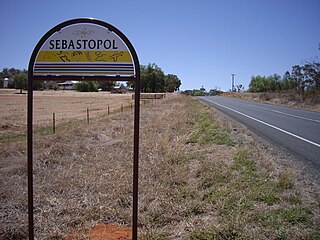
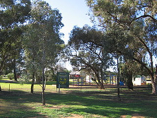
Sebastopol is a village community in the north east part of the Riverina, in New South Wales, Australia. It is situated about 15 kilometres south of Temora and 19 kilometres north of Junee Reefs.

Junee Reefs is a locality in the south east part of the Riverina, Australia. It is situated by road, about 19 kilometres north of Old Junee and 19 kilometres south of Sebastopol. At the 2021 census, Junee Reefs had a population of 86 people.
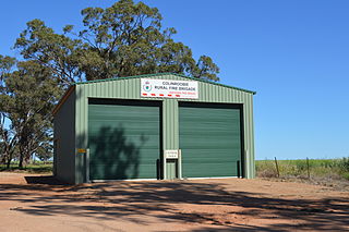
Colinroobie is a rural community in the central part of the Riverina in southern New South Wales, Australia. Previously referred to as Bents Hill its name was changed in January 2005.

Darbalara is a rural community on the east bank of the junction of the Murrumbidgee River and Tumut River in the Riverina. It is situated by road, about 25 kilometres north east of Gundagai and 25 kilometres south of Coolac.

Womboota is a locality in the centre south part of the Riverina. It is situated by road, about 26 kilometres (16 mi) north from Moama and 28 kilometres (17 mi) south west from Bunnaloo. At the 2016 census, Womboota had a population of 105.

Corobimilla is a village locality in the central east part of the Riverina. It is situated by road, about 12 kilometres northeast of Morundah and 20 kilometres south west of Narrandera.
Nyora is a rural locality in the central south part of the Riverina and the previous site of a public school. It is situated by road, about 21 kilometres west of Oaklands and 27 kilometres north east of Berrigan.
Shooters Hill is a locality and mountain located 25 kilometres (16 mi) south of Oberon, New South Wales. It is the fourth highest point in the Central Tablelands at 1,355 metres (4,446 ft) AHD , behind Mount Canobolas at 1,394 metres (4,573 ft) AHD , Mount Bindo at 1,363 metres (4,472 ft) AHD and Mount Trickett at 1,362 metres (4,469 ft) AHD . Shooters Hill is a common location for snowfalls in the Central Ranges.
Kellys Plains is a small rural locality situated about 8 kilometres west south west of Armidale, New South Wales. The settlement is at an altitude of about 1,044 metres on the Northern Tablelands in the New England region of New South Wales, Australia.

The Murray River Council is a local government area in the Riverina region of New South Wales, Australia. This area was formed in 2016 from the merger of Murray Shire with Wakool Shire.

