Griffith and other towns were created as part of the New South Wales State Government's Murrumbidgee Irrigation Area (MIA) project, a plan to supply irrigation from the Murrumbidgee river to open up western New South Wales for farming.[5]
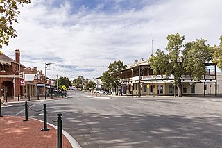
The town plan for Griffith, and nearby Leeton, was designed by Walter Burley Griffin in 1914, an unusual geometric pattern centred on a set of circular streets, with broad avenues radiating out in an octagonal arrangement.[6][7] The streets were surveyed mostly according to that plan, and Griffith was declared a town in August 1916.[8]
Plan of Griffith, 1914
The main dam of the scheme was the large Burrinjuck Dam on the Murrumbidgee between Gundagai and Canberra, but was not completed until 1928. The Berembed Weir, near Narrandera, was built in 1912, diverting water from the Murrumbidgee River into the Bundidgerry Creek then into the Main Canal of the MIA at Narrandera.[9] The Canal, almost a river in its own right, flows through the MIA, supplying water to the entire area, then flows through Griffith as part of the geometric plan, and peters out to the northwest of the town in rice farms.
The water supply was further enhanced with the construction of the Snowy River scheme by the Australian Federal Government in the 1950s and 1960s. The Blowering Dam, a large dam near Tumut, stores a significant amount of water to be released down the Murrumbidgee for irrigation around Leeton, Griffith and the newer Coleambally area south of the river and Griffith.[5]
From the start of the MIA, citrus and other fruit and vegetables were grown in abundance around Griffith. In the 1950s the irrigation area expanded to include large rice farms. Vineyards were established early, and wineries followed, beginning with McWilliam's Wines at Hanwood and Yenda, two villages just outside the city.
From its earliest days, the MIA was populated by Italian workers, some of whom were initially employed by Australian farmers to run steamboats on the Murrumbidgee and Murray Rivers. Approximately 60% of today's Griffith population claim Italian background.[10] These include the initial settlement of Italians from the boat crews and other Italians who came out to Australia in the Depression, or from a second wave of immigrant Italians who came to Griffith in the late 1950s and early 1960s.
In the 1970s, Griffith was often associated with drug distribution (particularly marijuana) and organised crime,[11] as depicted in 2009 by Underbelly: A Tale of Two Cities. However, Griffith is now associated with good wine and food, primarily as a result of its diverse population, with notable contributions by Italian-Australians. Griffith's multi-ethnic population is now absorbing new national groups, including a significant Sikh Indian community.[12] The city is sister city with the Italian city of Treviso in the Veneto Region. Many Italians in Griffith are from the Veneto Region or the Calabria Region of Italy.
St Alban's Cathedral
The Italian influence expanded the range of fruit and vegetables, and also significantly increased the number of wineries and the range of wines produced by the existing wineries in the region, such as McWilliam's. De Bortoli, Rosetto, Calabria and other wineries were established by Italian immigrants, and today they are well known around Australia. In recent times they have been joined by one of the country's best known wine labels, Yellow Tail, produced by Casella Family Brands. Casella, DeBortoli, McWilliam's, Warburn and Berton Vineyards are now among the top 20 wine producers in Australia.[13]
Griffith is the cathedral city of the AnglicanDiocese of Riverina. The foundation stone of the Parish Church of St Alban the Martyr was dedicated in 1954. It was proclaimed as a cathedral in 1984.
Heritage listings
Griffith has a number of heritage-listed sites, including:
This section needs expansion. You can help by adding to it. (April 2008)
Griffith has a semi-arid climate (BSk) under the Köppen climate classification with hot summers and cool winters, and rather uniform rainfall spread through the months with a slight peak in spring.[15] Extreme temperatures at Griffith Airport AWS have ranged from 47.2°C (117.0°F) on 04 January 2020 to −5.9°C (21.4°F) on 17 July 1977.[16] The city features 123.8 clear days annually.
Climate data for Griffith Airport AWS (1970–2022, rainfall to 1958); 134 m AMSL; 34.25° S, 146.07° E
Griffith is the regional service centre for the vast Murrumbidgee Irrigation Area, one of the most productive agricultural regions in Australia.[17] Thanks to irrigation, Griffith is rich in agriculture and the city is also known as Australia's "Wine and Food Country".[18]
Griffith has experienced strong commercial growth in recent years. Griffith's high streets are Banna Avenue and Yambil Street but commercial growth has occurred throughout the city. Shopping centre developments include:
In addition to Griffith, the area includes the towns and villages of Willbriggie, Hanwood, Beelbangera, Bilbul, Yoogali, Widgelli, Yenda, Lake Wyangan, Tharbogang and Warburn. The city contains the main suburbs of Collina, Driver, North Griffith, East Griffith, West Griffith, South Griffith, Murrumbidgee, Mayfair, Pioneer Mooreville and Wickhams Hill. The newest development of the suburb Collina has been constructed to the north east of the city's centre.
Demography
Griffith City Council
In the 2021 Census, there were 20,569 people in Griffith.
Aboriginal and Torres Strait Islander people made up 5.8% of the population.
The most common ancestries were Australian 26.7%, English 25.7%, Italian 22.4%, Irish 7.0% and Indian 6.4%
66.8% of people were born in Australia. The next most common countries of birth were India 8.8%, Italy 3.4%, Philippines 1.8%, New Zealand 1.8%, and Malaysia 1.2%.
65.8% of people spoke only English at home. Other languages spoken at home included Italian 5.2%, Gujarati 4.6%, Punjabi 4.4%, Samoan 1.5% and Mandarin 1.2%.
The most common responses for religion were Catholic 34.9%, No Religion 18.0% and Anglican 10.4%.[20]
in the forecast.id.com.au Griffith City population forecast for 2023 is 27,666, and is forecast to grow to 30,494 by 2036
Education
St Patricks Primary SchoolGriffith Library
Griffith is the third largest centre for education in the Riverina after Wagga Wagga and Leeton. Griffith is home to three high schools:
Murrumbidgee Regional High School – MRHS is a merged high school, made up of two sites, formerly known as Wade High School and Griffith High School
Griffith also has 13 primary schools and various day care and pre-school facilities. Griffith has one of the largest campuses of Riverina Institute of TAFE.
Transport
Griffith is a major junction for the Kidman Way, Burley Griffin Way and Irrigation Way. Griffith is located 550km (340mi) south west of Sydney via Burley Griffin Way and Irrigation Way and 450km (280mi) north of Melbourne via the Kidman Way. Griffith has daily bus services to the major metropolitan areas.
Griffith Buslines operates buses through Griffith and surrounding towns and villages, with seven main services and routes.
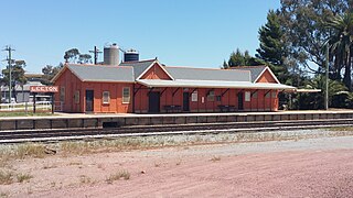
The railway reached Griffith on 3 July 1916 and since that date has provided a service transporting passengers and goods to and from the area. Regular goods trains continue, making it a unique railway centre.[21]
Griffith railway station is served by a twice weekly NSW TrainLinkXplorer service from Sydney. NSW TrainLink also operates several coach services connecting to Sydney-Melbourne XPT trains at either Wagga Wagga or Cootamundra:
0538 Ex. Wagga Wagga to Griffith (Saturday & Monday mornings)
0920 Griffith to Wagga Wagga (daily)
0936 Ex. Mildura to Cootamundra (daily)
1653 Ex. Wagga Wagga to Griffith (daily)
1731 Ex. Cootamundra to Mildura (daily)
2055 Griffith to Wagga Wagga (Friday & Sunday nights)
V/Line operates a daily rail/road coach service between Melbourne and Griffith, changing with the train at Shepparton. Melbourne (Southern Cross Station) to Griffith (Bus Terminal at Visitors Centre) is an evening service (daily), and Griffith to Melbourne service is overnight on Monday to Saturday and afternoon on Sunday. Travel time is approximately six and a half to seven hours.[22]
In February 2010, the city's first set of traffic lights was installed at the intersection of Burrell Place and Wakaden Street to reduce traffic congestion in the Griffith CBD.[23][24]
Events
Riverina Field Days, which is held annually in May.
La Festa, Wine, Food and Multicultural Festival, which is held annually over the Easter weekend.
Festival of Gardens, which is held annually in October
Sikh Games, held annually on the June Long Weekend
unWINEd, held annually on the June Long Weekend
Multicultural Festival of Griffith – each year in October
Festa delle Salsicce (Festival of the Sausage) – each year in August
Media
Radio
Griffith is serviced by a number of commercial, community, narrowcast SBS, and ABC stations
ABC Riverina, is the local ABC station in Griffith, servicing the entire MIA region. It broadcasts a local breakfast show and a local morning show each weekday broadcast from the ABC studios in Wagga Wagga. Wednesday and Saturday's local morning show is also broadcast to each station on the ABC Local Radio network enabling listeners from outside of the local listening area to call into the popular gardening talk back program. ABC Riverina also has a local news service, produced by local journalists. As well as rural reports, the station also airs a local Saturday breakfast show, which is followed by a local Saturday morning sports program. Apart from local programming, ABC Riverina takes national programs like AM, Conversations, The World Today, PM, Nightlife, Overnights, ABC Radio Grandstand, Saturday Night Country and Australia All Over along with a mid-afternoon program, an evening show and a weekend morning program, all broadcast from ABC Radio Sydney, along with a drive program, broadcast from regional NSW. Other national ABC services that are available in Griffith on separate FM frequencies include Triple J, Radio National, ABC Classic FM and ABC News on Radio.
Triple M Riverina MIA 963 is the Griffith-based commercial FM station owned by Southern Cross Austereo broadcasting from Griffith studios during the day, and then taking networked programming sourced from 2GB, Triple M Gold Coast, Authentic Entertainment Sydney and Triple M. 2RG in Griffith also produces a local news service with a journalist based at the station, compiling and recording local news bulletins for 2RG and sister station 99.7 Star FM.
Hit FM, also owned by Southern Cross Austereo, is a commercial FM station servicing Griffith on a local FM frequency, although its local breakfast show is broadcast from a studio in Griffith. Hit FM is skewed towards the younger listeners with a Top 40/pop music format. Following the local breakfast show, the station takes Hit Music Network programming sourced from Southern Cross Austereo's hub at Sea FM on the Gold Coast or from metropoliton stations such as 2Day FM and Fox FM.
2MIA is the local community station, broadcasting local programs, presented by radio announcers. The station is skewed towards the older demographic and plays a lot of music. All programs are locally produced apart from the regular programming the station takes from the national community radio network.
MTN carries programming from Seven Network, AMN carries programming from Nine Network and MDN carries programming from Ten Network, WIN also broadcasts the Riverina and MIA WIN News bulletin each weeknight.
Regional news coverage of the Griffith and MIA area is provided on all three commercial networks with WIN Griffith airing 90-second local news updates during the day. WIN News are produced from newsrooms in the city but presented from studios in Wollongong.
The most popular sport in Griffith is Rugby League. Griffith is home to two clubs in the Group 20 Rugby League competition, the Griffith Black & White Panthers, and the Griffith Waratahs Tigers. The two clubs are among the most successful in the league with 6 and 13 titles respectively, with a cross-town derby in the 2017 Grand Final attracting a crowd of over 2,000 people to EW Moore Oval. A third club, the Yenda Blueheelers, based in the small town of Yenda, 15 kilometres from the city centre in the Griffith City Council area, also compete in this competition and have won 7 titles and a Clayton Cup as the best team in the state in 2009. The city has also produced many National Rugby League players, with some going on to represent their state and country.
Griffith Rugby League teams:
Griffith Black & Whites
Yenda Blueheelers
Griffith Waratahs (in recess)
The Griffith and District Football Association (Soccer) comprises six participating clubs in the Griffith area - Griffith City FC, Hanwood FC, West Griffith SC, Yenda Tigers SC (seniors only), Yoogali FC and Yoogali SC. Yoogali SC also fields teams in the Capital Football competition, while Hanwood FC fields senior men's and women's teams in the Wagga competition.
The Griffith District Cricket Association (GDCA) operates a four-grade, six team premiership over the summer months across both the Twenty20, One Day and Two Day formats. Five of the six clubs (Coro Cougars, Exies Diggers, Exies Eagles, Leagues Panthers and Hanwood Wanderers) are based in Griffith itself, whilst the Coly Nomads are based in nearby Coleambally.
Griffith is also home to the Griffith Swans who compete in the Riverina Football League. They have won one title, in 2003. They previously played in the South West League. Griffith also has a rugby union team, the Griffith Blacks who play in the Southern Inland Rugby Union. The city also has strong local hockey and basketball (GBA) competitions.
Attractions
Griffith from Scenic Hill lookout
Griffith has many tourist attractions. These include Pioneer Park, a 510-seat Regional Theatre, the Italian museum, the Griffith Regional Art Gallery, craft and antique shops, and its many high standard restaurants. Many of the Griffith wineries also have wine tasting at the cellar door, notably De Bortoli Wines, Beelgara Estate (formally Rossetto Wines), West End Wines, Berton Vineyards and Warburn Estate. Griffith is famous for its botrytis including Debortoli'sNoble One and its fortified wine such as McWilliam's Hanwood Port. Ecotourism is also available in Griffith. Scenic Hill has various walking trails, lookouts and is home to the famous Hermit's Cave. Campbells and Nericon Swamps, part of the Griffith Wetlands Important Bird Area, are important sites for migratory birds.[25] Nearby Cocoparra National Park offers walking trails and there are opportunities to explore along the Murrumbidgee River and Lake Wyangan.
Simon Bonetti, Australian rugby league footballer who played in the 1990s and 2000s, winning a premiership in 2002
Ray Brown, Australian rugby league footballer who played in the 1980s
Joseph Colpitts, Sgt, Australian Infantry. Fought in nine countries during WWII.[27] Helped rescue many allied soldiers from occupied Crete whilst fighting with the Greek Resistance. Manager of Griffith Baths. Colpitts Place in Griffith is named in his honour.[28][29]
↑ Kelly, Bryan Morris (1988). From wilderness to eden: a history of the City of Griffith, its region and its people. Griffith, N.S.W.: City of Griffith Council. p.18. ISBN0-7316-3994-4.
Wagga Wagga is a major regional city in the Riverina region of New South Wales, Australia. Straddling the Murrumbidgee River, with an urban population of more than 57,003 as of 2021, Wagga Wagga is the state's largest inland city, and is an important agricultural, military, and transport hub of Australia. The ninth largest inland city in Australia, Wagga Wagga is located midway between the two largest cities in Australia—Sydney and Melbourne—and is the major regional centre for the Riverina and South West Slopes regions.
Narrandera, until around 1949 also spelled "Narandera", is a town located in the Riverina region of southern New South Wales, Australia. The town lies on the junction of the Newell and Sturt highways, adjacent to the Murrumbidgee River, and it is considered the gateway to the Murrumbidgee Irrigation Area. At the 2016 census, Narrandera had a population of 3,746 people.
The Riverina is an agricultural region of south-western New South Wales, Australia. The Riverina is distinguished from other Australian regions by the combination of flat plains, warm to hot climate and an ample supply of water for irrigation. This combination has allowed the Riverina to develop into one of the most productive and agriculturally diverse areas of Australia. Bordered on the south by the state of Victoria and on the east by the Great Dividing Range, the Riverina covers those areas of New South Wales in the Murray and Murrumbidgee drainage zones to their confluence in the west.
Burley Griffin Way is a New South Wales state route, is located in south eastern Australia. Named after the American architect Walter Burley Griffin, designer of the cities of Canberra and Griffith, the road links these two cities via Yass and Barton Highway.
Leeton is a town located in the Riverina region of New South Wales, Australia. Leeton is situated in the Murrumbidgee Irrigation Area. It is the administrative centre of the Leeton Shire Council local government area, which includes neighbouring suburbs, towns and localities such as Yanco, Wamoon, Whitton, Gogeldrie, Stanbridge and Murrami. Situated in one of the most productive farming regions in the state, the town was designed by Walter Burley Griffin and purpose-built for the irrigation schemes announced by the New South Wales government in the early 20th century. The Leeton Shire possesses numerous citrus, rice, cotton, grape, walnut and wheat farms. Leeton is known as Australia's Rice Capital, as well as The Heart of SunRice Country, as it is home to the headquarters of SunRice corporation, one of Australia's largest food exporters. Other industry includes Arnott's Biscuits, the Daily Drinks Company, JBS Australia, Webster Limited, and Murrumbidgee Irrigation Limited. Tony Reneker is the current mayor of Leeton.
Leeton railway station is a heritage-listed former goods yard and railway station and now bus station and railway station located on the Yanco–Griffith line at Dunn Avenue in Leeton in the Leeton Shire local government area of New South Wales, Australia. It is also known as Leeton Railway Station and yard group. The property was added to the New South Wales State Heritage Register on 2 April 1999.
Temora is a town in the north-east of the Riverina area of New South Wales, 418 kilometres (260 mi) south-west of the state capital, Sydney. At the 2021 census the population of Temora was 4,016.
Group 20 is a rugby league competition in the region of Griffith, New South Wales, Australia. The competition is played in six grades, with these being Under 16s, Under 18s, Women's League-Tag, Women's Tackle, Reserve Grade and First Grade.
The Murrumbidgee Irrigation Area (MIA) is geographically located within the Riverina area of New South Wales. It was created to control and divert the flow of local river and creek systems for the purpose of food production. The main river systems feeding and fed by the area are the Murrumbidgee and the Tumut. It is one of the most diverse and productive regions in Australia contributing over A$5 billion annually to the Australian economy.
Coleambally is a small town in the Riverina of New South Wales, Australia, in Murrumbidgee Local Government Area.
Grong Grong is a small town that is located in the Riverina region of New South Wales, Australia. The town is situated on the Newell Highway, 23 kilometres (14 mi) east of Narrandera in the Shire of Narrandera.
MTN is a television station licensed to serve Griffith and the surrounding Murrumbidgee Irrigation Area (M.I.A.). The station is owned and operated by WIN Corporation as a Seven Network affiliate.
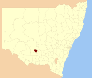
The City of Griffith is a local government area in the Riverina region of south-western New South Wales, Australia. The area comprises 1,640 square kilometres (630 sq mi) and is located in the Murrumbidgee Irrigation Area and on Kidman Way.
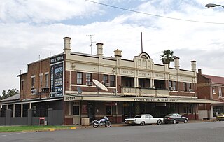
Yenda is a town in the Riverina district of New South Wales, Australia. The town is located about 16 kilometres (9.9 mi) east of Griffith, 65 kilometres (40 mi) north-west of Narrandera, and 550 kilometres (340 mi) west of Sydney in the Murrumbidgee Irrigation Area of southern New South Wales. Although most of the original 15-acre farms have been consolidated into large vineyards and most farmhouses have disappeared, farm roads are named after the original settlers. In 1940 Yenda had two clothing stores, two bakers, two butchers, two grocery stores, two barbers, one newsagency, one pharmacy, one cinema, one Greek restaurant and one bank but residents now do their shopping in nearby Griffith. At the 2011 census, Yenda had a population of 1,503.
Hanwood is a town in the central Riverina region of New South Wales, Australia. The town is located 5 kilometres south of Griffith, New South Wales and is in the City of Griffith local government area. At the 2021 census, Hanwood had a population of 1,388.
AMN is a television station licensed to serve Griffith and the surrounding Murrumbidgee Irrigation Area (M.I.A.). The station is owned and operated by WIN Corporation as a Nine Network affiliate, WIN Television.
ABC Riverina is an ABC Local Radio station based in Wagga Wagga and broadcasting to the Riverina and Murrumbidgee Irrigation Area regions in New South Wales. This includes the towns and cities of Griffith, Goulburn, Leeton and Hay.
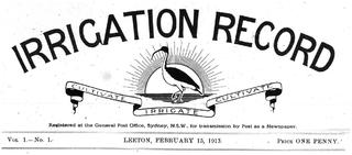
The Irrigation Record was a fortnightly newspaper published in Leeton, New South Wales, Australia from 15 February 1913 to 15 June 1917 by the NSW Water Conservation and Irrigation Commission. Its purpose was to educate new settlers of the fledgling Murrumbidgee Irrigation Area (MIA), about agricultural methods, irrigation techniques, crops, stock and machinery.
The South West District Football League was a major Australian rules football competition which ran from 1910 until 1981 in the Riverina region of New South Wales.
This page is based on this Wikipedia article Text is available under the CC BY-SA 4.0 license; additional terms may apply. Images, videos and audio are available under their respective licenses.