
Darlington is a large market town and the main administrative centre of the Borough of Darlington, in County Durham, North East England. In 2011 the town had a population of 92,363 and the district 105,564. The town lies on the River Skerne, a tributary of the River Tees. The town is administered as part of the Darlington Borough Council, a unitary authority which is administrated independently of Durham County Council.

Tenkasi is a Town and headquarters of the newly created Tenkasi district in the Indian state of Tamil Nadu.

Piercebridge is a village and civil parish in the borough of Darlington and the ceremonial county of Durham, England. The population of the civil parish as of the 2011 census was 113. It is situated a few miles west of the town of Darlington. It is on the site of a Roman fort of AD 260–270, which was built at the point where Dere Street crossed the River Tees. Part of the fort is under the village green. The village is sited where the York-Newstead Roman road known as Dere Street crosses the River Tees.

Unorganized North Algoma District is an unorganized area in northeastern Ontario, Canada, comprising all areas in Algoma District, north of the Sault Ste. Marie to Elliot Lake corridor, which are not part of an incorporated municipality or a First Nation. It covers 44,077.03 km2 (17,018.24 sq mi) of land, and had a population of 5739 in 2016.

Henty is a town in southwestern New South Wales close to the boundaries of the South West Slopes and the Riverina districts, almost midway between the regional cities of Albury and Wagga Wagga. At the 2006 census, Henty had a population of 863 people.

Outer Harbor is a suburb in the Australian state of South Australia located at the northern tip of the Lefevre Peninsula about 22 kilometres (14 mi) north-west of the Adelaide city centre.

Darlington Point is a small town on the banks of the Murrumbidgee River in the Riverina district of western New South Wales, Australia. It is part of the Murrumbidgee Council local government area. The centre of town is four kilometres from the Sturt Highway, along Kidman Way. Darlington Point is 631 kilometres (392 mi) south west of Sydney and 33 kilometres (21 mi) south of Griffith. At the 2011 census, Darlington Point had a population of 1,016.

The Rock is a town with a population of 1,236, in the Riverina region of southern New South Wales, Australia, in Lockhart Shire. It is 32 kilometres (20 mi) south-west of Wagga Wagga on the Olympic Highway.

Culcairn is a town in the south-east Riverina region of New South Wales, Australia. Culcairn is located in the Greater Hume Shire local government area on the Olympic Highway between Albury and Wagga Wagga. The town is 514 kilometres (319 mi) south-west of the state capital, Sydney and at the 2006 census had a population of 1,120.

Zealand is a Canadian rural community in York County, New Brunswick close to the intersection of Route 104 and Route 616.

Gypsumville is a community in Manitoba, Canada. It is 242 kilometres north-northwest of Winnipeg in the Interlake Region of Manitoba on the north bank of Lake St. Martin in the Rural Municipality of Grahamdale.

Oaklands is a town in the Riverina district of southern New South Wales, Australia. The town is located 615 kilometres south west of the state capital, Sydney and 105 kilometres north west of Albury. Oaklands is in the Federation Council local government area and at the 2011 census, had a population of 238.

Carrathool is a village in the western Riverina region of New South Wales, Australia, in Carrathool Shire. In 2011 census, Carrathool had a population of 296 people. It is about 5 kilometres (3 mi) north of the Sturt Highway between Darlington Point and Hay. The village is situated on the plain a few kilometres north of the river, clustered around the now-disused railway station.
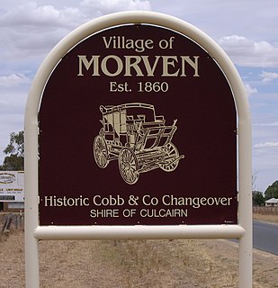
Morven is a small village about 7 kilometres east of Culcairn in the eastern Riverina district of New South Wales, Australia. At the 2006 census, Morven had a population of 464 people.
Beckom is a village in the central part of the Riverina. It is situated about 5 kilometres north-east of Ardlethan, and situated about 90 kilometres (56 mi) east of Griffith. It had a population of 170 people on the 2006 Census night. The town was established with the opening of the railway line in 1908. Passenger services ceased in 1983 and the station closed in 1985 however the line remains open for goods trains.

Kamarah, is a village community in the central north part of the Riverina. It is situated by road, about 11 kilometres west of Ardlethan and 12 kilometres east of Moombooldool. At the 2006 census, Kamarah had a population of 130 people.

Kenebri is a locality in northern New South Wales, Australia.

Mysia is a locality in north central Victoria, Australia in the Shire of Loddon local government area, 243 kilometres (151 mi) north of the state capital, Melbourne. At the 2006 census, Mysia and the surrounding area had a population of 105. In 2016, this had declined to 43.

Barney Point is a beachside coastal suburb of Gladstone in the Gladstone Region, Queensland, Australia.

Murrumbidgee Council is a local government area in the Riverina region of New South Wales, Australia. This area was formed in 2016 from the merger of the Murrumbidgee Shire with the neighbouring Jerilderie Shire.

