
The classical albedo features of Mars are the light and dark features that can be seen on the planet Mars through an Earth-based telescope. Before the age of space probes, several astronomers created maps of Mars on which they gave names to the features they could see. The most popular system of nomenclature was devised by Giovanni Schiaparelli, who used names from classical antiquity. Today, the improved understanding of Mars enabled by space probes has rendered many of the classical names obsolete for the purposes of cartography; however, some of the old names are still used to describe geographical features on the planet.
Planum Australe is the southern polar plain on Mars. It extends southward of roughly 75°S and is centered at 83.9°S 160.0°E. The geology of this region was to be explored by the failed NASA mission Mars Polar Lander, which lost contact on entry into the Martian atmosphere.

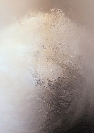
Planum Boreum is the northern polar plain on Mars. It extends northward from roughly 80°N and is centered at 88.0°N 15.0°E. Surrounding the high polar plain is a flat and featureless lowland plain called Vastitas Borealis which extends for approximately 1500 kilometers southwards, dominating the northern hemisphere.

Olympia Undae is a vast dune field in the north polar region of the planet Mars. It consists of a broad "sand sea" or erg that partly rings the north polar plateau from about 120° to 240°E longitude and 78° to 83°N latitude. Stretching about 1,100 km (680 mi) across and covering an area of 470,000 km2, Olympia Undae is the largest continuous dune field on Mars. It is similar in size to the Rub' Al Khali in the Arabian Peninsula, the largest active erg on Earth.

The Mare Boreum quadrangle is one of a series of 30 quadrangle maps of Mars used by the United States Geological Survey (USGS) Astrogeology Research Program. The Mare Boreum quadrangle is also referred to as MC-1. Its name derives from an older name for a feature that is now called Planum Boreum, a large plain surrounding the polar cap.

Korolev is an ice-filled impact crater in the Mare Boreum quadrangle of Mars, located at 73° north latitude and 165° east longitude. It is 81.4 kilometres (50.6 mi) in diameter and contains about 2,200 cubic kilometres (530 cu mi) of water ice, comparable in volume to Great Bear Lake in northern Canada. The crater was named after Sergei Korolev (1907–1966), the head Soviet rocket engineer and designer during the Space Race in the 1950s and 1960s.

Hesperia Planum is a broad lava plain in the southern highlands of the planet Mars. The plain is notable for its moderate number of impact craters and abundant wrinkle ridges. It is also the location of the ancient volcano Tyrrhena Mons. The Hesperian time period on Mars is named after Hesperia Planum.

Icaria Planum is a region on Mars in the Thaumasia quadrangle. It is located roughly south-southwest of the Tharsis Rise. Icaria Planum is named after the island of Ikaria, where, according to Greek mythology, Icarus fell and died in the sea.

Coexistence is the property of things existing at the same time and in a proximity close enough to affect each other, without causing harm to one another. The term is often used with respect to people of different persuasions existing together, particularly where there is some history of antipathy or violence between those groups.

Hagal is the informal name of a dune field on Mars located below the north pole of Mars. Its name derives from the sand dunes in Frank Herbert's novel Dune and the fictional planet Hagal. It is located at coordinates 78.0° N latitude, 84.0° E longitude, and consists of linear and round dunes with a southeast slipface orientation. It was one of the dune formations targeted for imaging by the HiRISE camera, on board the Mars Reconnaissance Orbiter, at the rate of one image every six weeks. in the third year of its seasonal expedition. It is also known as the "Martian Morse Code" due to the linear and rounded formations of its dunes, which have the appearance of dots and dashes.

Nili Patera is a dune field on Mars. It is located on top of a lava bed, at the site of an ancient volcano, the Nili Patera caldera of Syrtis Major, near the Martian equator, and it is one of the most active dune fields of Mars. Its location coordinates on Mars are 8.7° N latitude, 67.3° E longitude. It is being actively studied by the HiRISE camera, on board the Mars Reconnaissance Orbiter, at the rate of one image every six weeks. The study of the movement of the dunes provides information regarding wind variation as a function of time and furthers the study of surface erosion characteristics of the Martian landscape. This information can then be used for the development and design of future Mars expeditions. The dunes of the Patera field are of the barchan type and their study by HiRISE was the first one to establish dune and ripple movement of a minimum of 1 metre on Mars. The Patera dune field, was also the first to be investigated using the COSI-Corr software, which was originally developed to analyse the movement of earthbound dunes. The research results from the evidence provided by the monitoring of the Nili Patera field, indicate sand fluxes of the order of several cubic metres per metre per year, similar to the flux observed at the sand dunes of Victoria Valley in Antarctica.

Abalos Undae is a dune field on Mars in the periphery of Planum Boreum, the Martian North pole. It is one of the officially named northern circumpolar dune fields, along with Olympia, Hyperboreae, and Siton Undae, and also one of the densest of the region. Its northernmost boundary is located in the southwest channel that separates the Abalos Colles formation from the main polar ice cap, and from there the dune field extends southwest all the way to the lowlands of Vastitas Borealis.

Rupes Tenuis is a Martian north polar scarp. It is named after one of the classical albedo features on Mars. Its name was officially approved by IAU in 1988. It extends from latitude 74.94°N to 82.2°N and from longitude 242.12°E to 300.77°E. Its centre is located at latitude 81.6°N longitude 85.47°W. It marks the outer perimeter of Planum Boreum from longitude 242.12°E to 300.77°E, and it is formed by the eastern extension of the Olympia Cavi, a series of local troughs and depressions, which become longer and deeper as they merge to create the Rupes Tenuis scarp formation. The scarp is located to the west of Chasma Boreale, at the base of Planum Boreum, and its height varies from a few hundred metres to a maximum of approximately 1000 metres.

Hyperboreae Undae is one of the largest and densest dune fields of Planum Boreum, the Martian North Pole. It is named after one of the classical albedo features on Mars. Its name was officially approved by IAU in 1988. It extends from latitude 77.12°N to 82.8°N and from longitude 302.92°E to 316.02°E. Its centre is at latitude 79.96°N, longitude 49.49°W, and has a diameter of 463.65 kilometres (288.10 mi).
Siton Undae is one of the largest and densest dune fields in the vicinity of Planum Boreum, the Martian northern polar ice-cap. It is named after one of the classical albedo features on Mars. Its name was officially approved by IAU on 20 March 2007. It extends from latitude 73.79°N to 77.5°N and from longitude 291.38°E to 301.4°E. Its centre is located at latitude 75.55°N, longitude 297.28E (62.72°W), and has a diameter of 222.97 kilometres (138.55 mi).

Abalos Mensa is a wedge-shaped mound, or mensa and one of the named features in the vicinity of Planum Boreum, the Martian North pole. It is named after one of the classical albedo features on Mars. Its name was officially approved by IAU in 2006. It extends from latitude 80.21°N to 82.4°N and from longitude 279.34°E to 290.52°E. Its centre is located at latitude 81.17°N, longitude 284.4°E (75.6°W), and has a diameter of 129.18 km.
Abalos Colles is a stratified fragment of the Rupes Tenuis basal unit of Planum Boreum, located south of the Rupes Tenuis scarp and west of the Escorial crater. It contains 16 mounds. Abalos Colles is one of the named features in the vicinity of Planum Boreum, the Martian North pole. It is named after one of the classical albedo features on Mars located at latitude 72°N, longitude 70°W. Its name was officially approved by the International Astronomical Union (IAU) in 2003.

Ogygis Undae is the only named southern hemisphere dune field on Mars. It is named after one of the classical albedo features on Mars, Ogygis Regio. Its name, which refers to Ogyges, a primeval mythological ruler in ancient Greece, was officially approved by the International Astronomical Union (IAU) on September 17, 2015. It is situated just outside Argyre Planitia, a plain located in the southern highlands of Mars. The dunes of Ogygis Undae extend from latitude −49.94°N to −49.37°N and from longitude 292.64°E to 294.93°E. They are centered at latitude −49.66°N, longitude 293.79°E (66.21°W), and extend approximately 87 km to the east and west from there. Ogygis Undae has an area of 1904 km2, and due to its large size is a primary subject for research on Martian dune morphology and sand composition.
Deseado Crater is a large Hesperian- or Amazonian-age impact crater in Promethei Planum near the south pole of Mars, within the Mare Australe quadrangle, due south of the Hellas impact basin. It is named for Puerto Deseado, Argentina. The crater contains a central topographic high interpreted to be an ice mound of probable Amazonian age. Despite the proximity of the ice mound to the southern polar ice sheet, it is not interpreted to have initially been a part of it. Deseado Crater features in the Mass Effect trilogy as the home of a structure constructed by a species called the Protheans to study the evolution of early humans.

