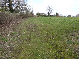
Brook Brick Pit is a 0.9-hectare (2.2-acre) geological Site of Special Scientific Interest west of Wormley Surrey. It is a Geological Conservation Review site.

Clock House Brickworks is a 35.9-hectare (89-acre) geological Site of Special Scientific Interest south of Capel in Surrey. It is a Geological Conservation Review site.

Colyers Hanger is a 26.6-hectare (66-acre) biological Site of Special Scientific Interest south-east of Guildford in Surrey. It is a Nature Conservation Review site, Grade 2 and is part of St Martha's Hill and Colyer's Hanger nature reserve, which is managed by the Surrey Wildlife Trust.

Mole Gap to Reigate Escarpment is a 1,016.4-hectare (2,512-acre) biological and geological Site of Special Scientific Interest west of Reigate in Surrey. It is a Geological Conservation Review site and a Special Area of Conservation. Part of it is a Nature Conservation Review site, Grade I. Two small private nature reserves in the site are managed by the Surrey Wildlife Trust, Dawcombe and Fraser Down.

Netherside Stream Outcrops is a 2.9-hectare (7.2-acre) geological Site of Special Scientific Interest north-east of Haslemere in Surrey. It is a Geological Conservation Review site.

Seale Chalk Pit is a 1.2-hectare (3.0-acre) geological Site of Special Scientific Interest west of Guildford in Surrey. It is a Geological Conservation Review site and part of the Seale Chalk Pit and Meadow 3-hectare (7.4-acre) private nature reserve, which is managed by the Surrey Wildlife Trust.

Sheepleas is a 99.9-hectare (247-acre) biological and geological Site of Special Scientific Interest east of Guildford in Surrey. It is a Geological Conservation Review site and a Local Nature Reserve. It is owned by Surrey County Council and managed by the Surrey Wildlife Trust.

Smokejack Clay Pit is a 56-hectare (140-acre) geological Site of Special Scientific Interest east of Cranleigh in Surrey. It is a Geological Conservation Review site.

Stockstone Quarry is a 3.9-hectare (9.6-acre) geological Site of Special Scientific Interest south of Farnham in Surrey. It is a Geological Conservation Review site.

Upper Common Pits is a 3-hectare (7.4-acre) geological Site of Special Scientific Interest north of Gomshall in Surrey. It is a Geological Conservation Review site.

Turners Hill SSSI is a 0.2-hectare (0.49-acre) geological Site of Special Scientific Interest in Turners Hill in West Sussex. It is a Geological Conservation Review site.

Rusthall Common is a 2.7-hectare (6.7-acre) geological Site of Special Scientific Interest in Rusthall, a suburb of Tunbridge Wells in Kent. It is a Geological Conservation Review site. It is owned by the Manor of Rusthall and managed by Tunbridge Wells Commons Conservators.

Red House Farm Pit is a 0.5 hectare geological Site of Special Scientific Interest east of Wickham Market in Suffolk. It is a Geological Conservation Review site, and in the Suffolk Coast and Heaths Area of Outstanding Natural Beauty.

Dryhill is an 11.7-hectare (29-acre) geological Site of Special Scientific Interest on the western outskirts of Sevenoaks in Kent. It is a Geological Conservation Review site, and an area of 9.5 hectares is a Local Nature Reserve

Folkestone Warren is a 316.3-hectare (782-acre) biological and geological Site of Special Scientific Interest (SSSI) which runs along the coast between Folkestone and Dover in Kent. It is a Nature Conservation Review site and it contains three Geological Conservation Review sites and part of a fourth. An area of 83.6 hectares is a Local Nature Reserve,

Southborough Pit is a 1.1-hectare (2.7-acre) geological Site of Special Scientific Interest in Tunbridge Wells in Kent. It is a Geological Conservation Review site.

Wouldham to Detling Escarpment is a 311.2-hectare (769-acre) biological and geological Site of Special Scientific Interest which stretches from Wouldham to Detling, north of Maidstone in Kent. Part of it is a Geological Conservation Review site, and it is part of the North Downs Woodlands Special Area of Conservation and the Kent Downs Area of Outstanding Natural Beauty. It is a Nature Conservation Review site, Grade I and it includes three Kent Wildlife Trust nature reserves and a Local Nature Reserve,

Wateringbury SSSI is a 0.2-hectare (0.49-acre) geological Site of Special Scientific Interest in Wateringburym west of Maidstone in Kent. It is a Geological Conservation Review site.

Slinfold Stream and Quarry is a 2.3-hectare (5.7-acre) geological Site of Special Scientific Interest west of Horsham in West Sussex. It is a Geological Conservation Review site.

Philpot's and Hook Quarries is a 2.6-hectare (6.4-acre) geological Site of Special Scientific Interest south-west of Sharpthorne in West Sussex. It is a Geological Conservation Review site.


