
Surrey Wildlife Trust (SWT) was founded in 1959 as Surrey Naturalists' Trust and it is one of forty-six wildlife trusts covering Great Britain, Northern Ireland, Isle of Man and Alderney. SWT carries out conservation activities on a considerable area of Surrey County Council's large countryside estate and also manages land on behalf of the Ministry of Defence estate. As of 2022 the SWT manages more than 6,000 hectares of land for wildlife and employs more than 100 staff. It had an income of £5.1 million and expenditure of £5.7 million.

Chipstead is a predominantly commuter village in north-east Surrey, England, that has been a small ecclesiastical parish since the Domesday Survey of 1086. Its rolling landscape meant that Chipstead's development was late and restricted compared to parishes of comparable distance from London. Formerly and formally including Hooley and Netherne-on-the-Hill, on census day, 1831 Chipstead had 66 homes. Today, excluding those two parts, the village has 1,212 homes spread across the slopes and crests of a northern section of the North Downs. Parts of the village are in or adjoin the Surrey Hills AONB.

Cobham Woods is a 242.7 hectares biological Site of Special Scientific Interest on the western outskirts of Rochester in Kent. It is in the Kent Downs Area of Outstanding Natural Beauty and part of it is managed by the National Trust.

Park Gate Down or Parkgate Down is a 7-hectare (17-acre) biological Site of Special Scientific Interest south-east of Stelling Minnis in Kent. It is also a Special Area of Conservation and is managed by the Kent Wildlife Trust,

Burham Down is a 110-hectare (270-acre) nature reserve between Maidstone and Chatham in Kent. It is managed by the Kent Wildlife Trust. It is part of the Wouldham to Detling Escarpment Site of Special Scientific Interest and Nature Conservation Review site, Grade I, the Kent Downs Area of Outstanding Natural Beauty, and the North Downs Woodlands Special Area of Conservation.

Combe Bottom is a 42.1-hectare (104-acre) biological Site of Special Scientific Interest north of Shere in Surrey. It is designated a Local Nature Reserve called Shere Woodlands, and is managed by the Surrey Wildlife Trust.

Hackhurst and White Downs is a 185.1-hectare (457-acre) biological Site of Special Scientific Interest west of Dorking in Surrey. White Downs is a Nature Conservation Review site, Grade 2, and part of it is in the 200-hectare (490-acre) White Downs nature reserve, which is owned by the Wotton Estate and managed by the Surrey Wildlife Trust (SWT). Hackhurst Downs is a 29.9-hectare (74-acre) Local Nature Reserve, which part of the 40-hectare (99-acre) Hackhurst Downs nature reserve, which is owned by Surrey County Council and also managed by the SWT.

Hedgecourt is a 33.6-hectare (83-acre) biological Site of Special Scientific Interest west of Felbridge in Surrey. An area of 5-hectare (12-acre) is managed by the Surrey Wildlife Trust.

Mole Gap to Reigate Escarpment is a 1,016.4-hectare (2,512-acre) biological and geological Site of Special Scientific Interest west of Reigate in Surrey. It is a Geological Conservation Review site and a Special Area of Conservation. Part of it is a Nature Conservation Review site, Grade I. Two small private nature reserves in the site are managed by the Surrey Wildlife Trust, Dawcombe and Fraser Down.

Quarry Hangers is a 28.5-hectare (70-acre) biological Site of Special Scientific Interest south-west of Caterham in Surrey. An area of 11 hectares is a nature reserve managed by the Surrey Wildlife Trust.

Sheepleas is a 99.9-hectare (247-acre) biological and geological Site of Special Scientific Interest east of Guildford in Surrey. It is a Geological Conservation Review site and a Local Nature Reserve. It is owned by Surrey County Council and managed by the Surrey Wildlife Trust.

Woldingham and Oxted Downs is a 128.4-hectare (317-acre) biological Site of Special Scientific Interest east of Caterham in Surrey.

Farthing Downs is an open space in Coulsdon in the London Borough of Croydon. Together with Eight Acres Common and New Hill to the south-east, it is owned and managed by the Corporation of London. Farthing Downs and Eight Acres Common are part of the Farthing Downs and Happy Valley Site of Special Scientific Interest. Happy Valley Park is a green space to the south owned by Croydon Council. Farthing Downs is also a scheduled monument.

Happy Valley Park is a public park in Coulsdon in the London Borough of Croydon. It is owned and managed by Croydon Council. Located in the Green Belt, most of it forms part of the Farthing Downs and Happy Valley Site of Special Scientific Interest.

Otford to Shoreham Downs is a 145.1-hectare (359-acre) biological Site of Special Scientific Interest between Kemsing and Eynesford in Kent. It is part of Kent Downs Area of Outstanding Natural Beauty and part it is Fackenden Down, a nature reserve managed by the Kent Wildlife Trust

Hill Park, Tatsfield is a 24.5-hectare (61-acre) Local Nature Reserve south of Tatsfield in Surrey. It is owned by Surrey County Council and managed by Surrey Wildlife Trust.
Brockham Limeworks is a 45-hectare (110-acre) nature reserve north of Brockham in Surrey. It is owned by Surrey County Council and managed by the Surrey Wildlife Trust. Part of it is a Scheduled Monument, and it is part of the Mole Gap to Reigate Escarpment Site of Special Scientific Interest and Special Area of Conservation.

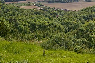
Fames Rough is a 23-hectare (57-acre) nature reserve south-west of Chipstead in Surrey. It is managed by the Surrey Wildlife Trust and is part of the Chipstead Downs Site of Special Scientific Interest.

Shabden Park is a 103-hectare (250-acre) nature reserve in Chipstead in Surrey. It is owned by Surrey County Council and managed by the Surrey Wildlife Trust and is part of the Chipstead Downs Site of Special Scientific Interest.

St Martha's Hill and Colyer's Hanger is a 38-hectare (94-acre) nature reserve north of Chilworth in Surrey. It is owned by the Albury Estate and managed by the Surrey Wildlife Trust on behalf of Surrey County Council. Colyers Hanger is a Site of Special Scientific Interest and a Nature Conservation Review site, Grade 2. Earth circles, which are probably associated with tree planting for Chilworth Manor, are a Scheduled Monument.

