Bookham Commons

Last updated

Bookham Commons
Site of Special Scientific Interest
Great Bookham Common - geograph.org.uk - 676420.jpg
Area of Search Surrey
Grid reference TQ 128 564 [1]
InterestBiological
Area154.7 hectares (382 acres) [1]
Notification 1985 [1]
Location map Magic Map

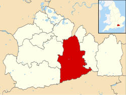
Bookham Commons are two commons, situated just to the north of the villages of Great Bookham and Little Bookham, in Surrey, England, 154.7 hectares (382 acres) in extent; the individual parts are named Great Bookham Common and Little Bookham Common. A group of dwellings known as the Isle of Wight is situated within the site, and a track, Common Road, leads to it from the northwest. Little Bookham Common (the smaller of the two parts of the site) lies south and west of this track, whereas Great Bookham Common lies to the east.

Contents

Together the two commons comprise a Site of Special Scientific Interest.

The site is owned by the National Trust. A network of public footpaths and public bridleways cross the site: in addition, there are a number of concessionary horse rides. [2]

Site description

The site sits on London Clay. Habitat types present include woodland, scrub, grassland and open water.

Woodland covers approximately two-thirds of the site. The majority of this woodland is mature and dominated by pedunculate oak (Quercus robur). These woodlands are dissected by a network of rides.

Little Bookham Common is a mosaic of rough grassland and scrub; much of this common is poorly drained and there are several old gunpits and bomb craters. The areas of open grassland are dominated by tufted hair-grass (Deschampsia cespitosa).

There are several woodland ponds on the site and a tributary of the River Mole runs across it.

Biodiversity interest

The site's nature conservation importance (the reason for SSSI designation), is due to its plant communities, its community of breeding birds and its invertebrate communities.

Thin-spiked wood sedge (Carex strigosa), which is scarce in Surrey, is present in woodlands at the site. Two species of rose which are scarce in Surrey, Rosa micrantha and Rosa stylosa are found in the scrub on Little Bookham Common. The bryophyte flora in the site's woodland is rich and includes one of only two Surrey localities for the moss Zygodon conoideus . Notable plants found in the grassland of Little Bookham Common include southern marsh-orchid (Dactylorhiza praetermissa), pepper-saxifrage (Silaum silaus), spiked sedge (Carex spicata) and adder’s-tongue fern (Ophioglossum vulgatum). The flora of the site's open water habitats includes three plants which are scarce in Surrey: greater duckweed (Lemna polyrhiza), fat duckweed (Lemna gibba) and thread-leaved water-crowfoot (Ranunculus trichophyllus), while tall-herb fen communities here support two plants which are rare in Surrey, the grass orange foxtail (Alopecurus aequalis) and eared willow (Salix aurita).

Breeding birds which are associated with woodland at this site include hawfinch, woodcock and lesser spotted woodpecker, whilst those breeding in scrub areas include nightingale and grasshopper warbler.

The site has a very well-recorded invertebrate fauna, which includes 611 species of beetle, 1140 species of fly, 146 true bugs, 201 spiders, 17 dragonflies and over 300 species of butterflies and moths.

Dead oak trees provide habitat for several beetles which are scarce in Surrey including Nemadus colonoides and Aridius nodifer . Two moths which occur, the toadflax brocade and the broad-bordered bee hawkmoth are nationally rare. This is a well-known site for the purple emperor, and other scarce butterflies which are present include white-letter and purple hairstreaks and the white admiral.

Coordinates: 51°17′47″N0°23′01″W / 51.29646°N 0.38352°W / 51.29646; -0.38352

Related Research Articles

Salisbury Plain Chalk plateau in England

Salisbury Plain is a chalk plateau in the south western part of central southern England covering 300 square miles (780 km2). It is part of a system of chalk downlands throughout eastern and southern England formed by the rocks of the Chalk Group and largely lies within the county of Wiltshire, but stretches into Berkshire and Hampshire. The plain is famous for its rich archaeology, including Stonehenge, one of England's best known landmarks. Large areas are given over to military training and thus the sparsely populated plain is the biggest remaining area of calcareous grassland in northwest Europe. Additionally the plain has arable land, and a few small areas of beech trees and coniferous woodland. Its highest point is Easton Hill.

Cotswold Water Park

The Cotswold Water Park is the United Kingdom's largest marl lake system, straddling the Wiltshire–Gloucestershire border, northwest of Cricklade and south of Cirencester. The lakes were created in the second half of the 20th century by extraction of glacial Jurassic limestone gravel, which had eroded from the Cotswold Hills, and these filled naturally after working began to cease in the early 1970s.

Reed bed Habitats formed by reed colonies in floodplains and estuaries

Reed beds are natural habitats found in floodplains, waterlogged depressions, and estuaries. Reed beds are part of a succession from young reeds colonising open water or wet ground through a gradation of increasingly dry ground. As reed beds age, they build up a considerable litter layer that eventually rises above the water level and that ultimately provides opportunities for scrub or woodland invasion. Artificial reed beds are used to remove pollutants from grey water.

Windsor Hill

Windsor Hill is a 61.8 hectare biological Site of Special Scientific Interest in Princes Risborough in Buckinghamshire. It lies within the Chilterns Area of Outstanding Natural Beauty, and it is featured in the Nature Conservation Review. A small part is managed by the Berkshire, Buckinghamshire and Oxfordshire Wildlife Trust, and access to this area requires a permit.

Ashford Green Corridor is a green space that runs through the town of Ashford in Kent, England. The Green Corridor is made up of parks, recreation grounds and other green spaces alongside the rivers that flow through Ashford. It is a Local Nature Reserve.

Cheddar Wood

Cheddar Wood is an 86.9-hectare (215-acre) biological Site of Special Scientific Interest at Cheddar in the Mendip Hills, Somerset, England, notified in 1967.

Bratton Downs

Bratton Downs is a 395.8 hectare biological and geological Site of Special Scientific Interest in Wiltshire, near the villages of Bratton, Edington and Westbury. It was notified in 1971. The designated area consists mainly of chalk grassland, as well as some ancient woodland, and supports a diverse range of native flora and fauna. It overlays notable geological features—principally landforms created by glaciation in the Pleistocene.

Bowerchalke Downs

Bowerchalke Downs, is a 128.6 hectare biological Site of Special Scientific Interest in Wiltshire, notified in 1971. The downs encompass the entire southern outlook of the village of Bowerchalke in the Salisbury district of Wiltshire, England, and are adjacent to both the Hampshire and Dorset county boundaries. The Bowerchalke Downs are located within the Cranborne Chase and West Wiltshire Downs Area of Outstanding Natural Beauty and are part of the Southern England Chalk Formation.

Scotstown Moor nature reserve in Aberdeen, Scotland

Scotstown Moor is in the north of Aberdeen, Scotland.

Park Gate Down

Park Gate Down or Parkgate Down is a 7-hectare (17-acre) biological Site of Special Scientific Interest south-east of Stelling Minnis in Kent. It is also a Special Area of Conservation and is managed by the Kent Wildlife Trust,

Turnford and Cheshunt Pits

The Turnford and Cheshunt Pits is a biological Site of Special Scientific Interest near Cheshunt in Hertfordshire and Essex and covers a total of 428.17 acres. It is part of the Lee Valley Special Protection Area.

Possil Marsh is a nature reserve and Site of Special Scientific Interest, of both flora and fauna, within the city of Glasgow, Scotland. The reserve was once part of an extensive system of lochs and marshes which extended throughout much of lowland West Central Scotland. However, centuries of drainage and reclamation have resulted in the elimination of much of this system. Due to its geographic position, the marsh is particularly vulnerable from industrial and residential development. The reserve contains a monument for the High Possil meteorite, which fell there in 1804.

Sound Heath

Sound Heath, also known as Sound Common, is an area of common land in Sound, near Nantwich in Cheshire, England, which includes heathland, grassland, scrub, woodland and wetland habitats. The majority of the area is designated a Site of Special Scientific Interest and a Local Nature Reserve.

Decoy Pit, Pools and Woods

Decoy Pit, Pools and Woods is a 17.7-hectare (44-acre) biological Site of Special Scientific Interest south of Aldermaston in Berkshire. An area of 8 hectares is a nature reserve called Decoy Heath, which is managed by the Berkshire, Buckinghamshire and Oxfordshire Wildlife Trust.

<i>Scirpus ancistrochaetus</i> species of plant

Scirpus ancistrochaetus is a rare species of flowering plant in the sedge family known by the common names barbedbristle bulrush and northeastern bulrush. It is native to the northeastern United States from New Hampshire south to Virginia. It used to be found in Quebec but it is now thought to be extirpated there. It was also believed extirpated from the state of New York, but at least one population has been rediscovered in Steuben County in 2010. It is threatened by the loss and degradation of its wetland habitat. It is a federally listed endangered species.

Upper Wye Gorge

Upper Wye Gorge is a Site of Special Scientific Interest (SSSI), noted for its biological and geological characteristics, around Symonds Yat in the Upper Wye Valley on the Wales–England border. The site is listed in the 'Forest of Dean Local Plan Review' as a Key Wildlife Site (KWS).

Old River Severn, Upper Lode

Old River Severn, Upper Lode is a 3.72-hectare (9.2-acre) biological Site of Special Scientific Interest in Gloucestershire, notified in 1985. It is a cross county border site between Gloucestershire and Herefordshire and Worcestershire.

Briddlesford Nature Reserve consists of 158 hectares of land on the Isle of Wight that is composed of a complex of different habitats, including woodland, arable farmland, lowland meadow, parkland, pond, hedgerow and grazing marsh. The reserve encompasses a majority of the Briddlesford Copses Site of Special Scientific Interest (SSSI) and Special Area of Conservation (SAC) together with about 50 hectares of farmland. The reserve is owned by People's Trust for Endangered Species (PTES) and managed to preserve and enhance its biodiversity value.

Monawilkin Human settlement in Northern Ireland


Monawilkin is a townland in the West Fermanagh Scarplands in the Civil Parish of Inishmacsaint, Barony of Magheraboy, Northern Ireland. The townland has an area of 85.1947 hectares and has previously been referred to as Meenwilkin (1817) and Munadh Wilkin. Monawilkin is the best example of unimproved calcareous grassland in Northern Ireland. This differs from other Sesleria-dominated grasslands in the UK in that it also includes species such as Euphrasia salisburgensis (eyebright). Monawilikin is also an important orchid site, contains the best inland site for moths and butterflies in Northern Ireland, and is the only Northern Irish site for Cupido minimus, the small blue butterfly. Consequently, this area was designated as a special area of conservation (SAC) and area of special scientific interest (ASSI). The Monawilkin SAC land cover comprises 3% water bodies, 5% bogs, marshes, and fringe water vegetation, 13% heath and scrub, 50% dry grassland, 14% humid grassland, and 15% broad-leaved woodland.

Mar Field Fen Site of Special Scientific Interest in North Yorkshire, England

Mar Field Fen is a Site of Special Scientific Interest, or SSSI, north of Masham, North Yorkshire, England, in a rural area known as Marfield. It is situated on land containing woodland carr, fen, spring-fed marshy grassland and drier calcareous grassland, between the River Ure to the east and Marfield Wetland nature reserve to the west. As "one of the best examples of fen habitat in the Vale of York," it is a protected habitat for a variety of plants, including the common butterwort, a carnivorous plant. There is no public access to this site.

References

  1. 1 2 3 "Designated Sites View:". Sites of Special Scientific Interest. Natural England. Retrieved 3 November 2018.
  2. "Bookham Commons". National Trust . Retrieved 3 September 2012.