Puttenham and Crooksbury Commons is a 113.8-hectare (281-acre) biological Site of Special Scientific Interest between Farnham and Guildford in Surrey. Puttenham Common is owned by the Hampton Estate and managed on behalf of Surrey County Council. Hillbury Hillfort on Puttenham Common is a scheduled monument. It is a univallate hillfort which probably dates to the Iron Age.

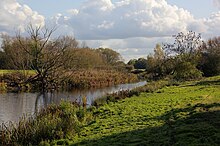
Combe Bottom is a 42.1-hectare (104-acre) biological Site of Special Scientific Interest north of Shere in Surrey. It is designated a Local Nature Reserve called Shere Woodlands, and is managed by the Surrey Wildlife Trust.
Esher Commons is a 360.1-hectare (890-acre) biological Site of Special Scientific Interest south-west of Esher in Surrey. It includes Esher Common, Fairmile Common, West End Common and Oxshott Heath. Esher Common and West End Common are Local Nature Reserves.

Glover's Wood is a 74.5-hectare (184-acre) biological Site of Special Scientific Interest east of Charlwood in Surrey. It is a Nature Conservation Review site, Grade 2.

Godstone Ponds is a 13.6-hectare (34-acre) biological Site of Special Scientific Interest in Godstone in Surrey. Bay Pond is an educational nature reserve closed to the public which is managed by the Surrey Wildlife Trust.

Hackhurst and White Downs is a 185.1-hectare (457-acre) biological Site of Special Scientific Interest west of Dorking in Surrey. White Downs is a Nature Conservation Review site, Grade 2, and part of it is in the 200-hectare (490-acre) White Downs nature reserve, which is owned by the Wotton Estate and managed by the Surrey Wildlife Trust (SWT). Hackhurst Downs is a 29.9-hectare (74-acre) Local Nature Reserve, which part of the 40-hectare (99-acre) Hackhurst Downs nature reserve, which is owned by Surrey County Council and also managed by the SWT.

Hankley Farm is a 2.4-hectare (5.9-acre) biological Site of Special Scientific Interest (SSSI) west of Elstead in Surrey.

Kempton Park Reservoirs are a Site of Special Scientific Interest in the London Borough of Hounslow and Kempton Park in Surrey. It is owned by Thames Water. It is part of South West London Waterbodies Ramsar site and Special Protection Area Kempton Park East reservoir is also a local nature reserve.

Mole Gap to Reigate Escarpment is a 1,016.4-hectare (2,512-acre) biological and geological Site of Special Scientific Interest west of Reigate in Surrey. It is a Geological Conservation Review site and a Special Area of Conservation. Part of it is a Nature Conservation Review site, Grade I. Two small private nature reserves in the site are managed by the Surrey Wildlife Trust, Dawcombe and Fraser Down.

Netherside Stream Outcrops is a 2.9-hectare (7.2-acre) geological Site of Special Scientific Interest north-east of Haslemere in Surrey. It is a Geological Conservation Review site.

Ockham and Wisley Commons is a 266-hectare (660-acre) biological Site of Special Scientific Interest east of Woking in Surrey. It is also a Local Nature Reserve and part of the Thames Basin Heaths Special Protection Area. It is part of the slightly larger area of 297-hectare (730-acre) Wisley & Ockham Commons & Chatley Heath nature reserve, which is owned by Surrey County Council and managed by the Surrey Wildlife Trust.

Seale Chalk Pit is a 1.2-hectare (3.0-acre) geological Site of Special Scientific Interest west of Guildford in Surrey. It is a Geological Conservation Review site and part of the Seale Chalk Pit and Meadow 3-hectare (7.4-acre) private nature reserve, which is managed by the Surrey Wildlife Trust.

Sheepleas is a 99.9-hectare (247-acre) biological and geological Site of Special Scientific Interest east of Guildford in Surrey. It is a Geological Conservation Review site and a Local Nature Reserve. It is owned by Surrey County Council and managed by the Surrey Wildlife Trust.

Stones Road Pond is a 0.5-hectare (1.2-acre) biological Site of Special Scientific Interest (SSSI) in Epsom in Surrey.

Whitmoor Common is a 166-hectare (410-acre) biological Site of Special Scientific Interest on the northern outskirts of Guildford in Surrey. It is part of the Thames Basin Heaths Special Protection Area and the 184.9-hectare (457-acre) Whitmoor and Rickford Commons Local Nature Reserve, which is owned by Surrey County Council and managed by the Surrey Wildlife Trust.

Blindley Heath SSSI is a 26.3-hectare (65-acre) biological Site of Special Scientific Interest in the hamlet Blindley Heath, on the southern outskirts of Godstone in Surrey. It is also a Local Nature Reserve. It is owned by Godstone Parish Council and managed by the Surrey Wildlife Trust

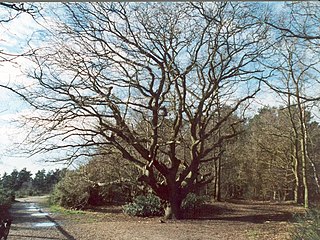
Leith Hill SSSI is a 337.9-hectare (835-acre) biological Site of Special Scientific Interest south-east of Dorking in Surrey. The SSSI consists of four wooded areas surrounding Leith Hill.

Brentmoor Heath is a 28.6-hectare (71-acre) Local Nature Reserve east of Camberley in Surrey. It is part of Brentmoor Heath and Folly Bog nature reserve, the ownership of which is divided between the Ministry of Defence, Surrey County Council and Surrey Heath Borough Council, and is managed by Surrey Wildlife Trust. The site is also part of Colony Bog and Bagshot Heath site of Special Scientific Interest, Thursley, Ash, Pirbright & Chobham Special Area of Conservation and Thames Basin Heaths Special Protection Area.
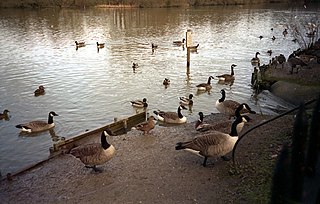
Bay Pond is a 7-hectare (17-acre) nature reserve in Godstone in Surrey. It is managed by the Surrey Wildlife Trust. It is part of Godstone Ponds Site of Special Scientific Interest

Gracious Pond is a 14-hectare (35-acre) nature reserve in Chobham in Surrey. It is managed by the Surrey Wildlife Trust. It is part of Chobham Common Site of Special Scientific Interest.