Faridabad district is one of the 22 districts of the Indian state of Haryana with Faridabad city being the district headquarters.The District is a Part of Central National Capital Region of Delhi.The Delhi-Mathura-Agra National Highway 44 passes through the centre of the district, which occupies an area of 741 square kilometres (286 sq mi) and as of the 2011 census of India had a population of 1,809,733. Haryana government has created a new Faridabad division which would cover the districts – Faridabad, Nuh and Palwal.
Nalwa is a village, as well as an Assembly Constituency in Haryana Legislative Assembly, located in Hisar district in the state of Haryana in India.
Siwani is a town and a municipality located approx. 58 km from Bhiwani city in Bhiwani district in the north Indian state of Haryana. It is the administrative headquarters of Siwani tehsil.
Uchana is a developing town and a municipal committee, near city of Jind in Jind district in the Indian state of Haryana.

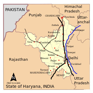
Haryana, formed on 1 November 1966, is a state in North India. For the administrative purpose, Haryana is divided into 6 revenue divisions which are further divided into 22 districts. For Law and Order maintenance, it is divided into 5 Police Ranges and 4 Police Commissionerates.
Kanwari, also spelled Kunwari, or Kwari, is a village of 7,000 population, in Hansi-I Tehsil, Hisar-1 Rural Development Block, Hansi and Hisar of Hisar District of Hisar Division in the Haryana state of India. It is part of the saat bas bhaichara grouping of 7 villages. The village has 4 panna/patti (subdivisions), named as Nangalia Panna , upparla Panna , parla Panna , etc. with a total revenue land area of 43903 kanal or 5487 acre as per HALRIS records.

The following outline is provided as an overview of and topical guide to Haryana.
Bidhwan is a village and administrative unit with a democratically elected panchayat samiti in the Loharu, Siwani Tehsil of Bhiwani District under Bhiwani-Mahendragarh Lok Sabha constituency and Hisar Division of Haryana state.
Elections in Haryana, which is a state in India, have been conducted since 1967 to elect the members of state-level Haryana Legislative Assembly and national-level Lok Sabha. There are 90 assembly constituencies and 10 Lok Sabha constituencies.
Muzadpur, also spelled Mujadpur is a village in Hisar, Haryana, India.
Balawas is a village in Hisar-1 Rural Development Block, Nalwa Chaudhry and Hisar of Hisar District of Hisar Division in the Haryana state of India.
Mahtawas is a village in Neemrana tehsil, Alwar district, Rajasthan state, India. It is a part of the National Capital Region.

Saharwa is a village in Hisar tehsil and district in Haryana, India, located on the Hisar-Isarwal road about 28 km from Hisar. It is situated at the boundary of the Hisar and Bhiwani districts. It also marks the onset of Thar desert. Saharwa village was established about 350 years ago in what was then Punjab province. The village has over the last decade become known for strawberry cultivation, and it is now the second largest producer of strawberries after Mahabaleshwar, Maharashtra. There is a small but locally revered temple of Khattu Shyamji. In 2013 the village was identified by the Geological Survey of India as having large reserves of gypsum.
Badya Brahmnan, next to Badya Jattan, is a village of less than 7,000 population, in Hisar-1 Rural Development Block, Nalwa Chaudhry and Hisar of Hisar District of Hisar Division in the Haryana state of India.
Mangali, near Badya Jattan, is a village of more than 10,000 population with 5 gram panchayat in it, the only village in Haryana having 5 panchayat in single village, of Hisar-1 Rural Development Block, Nalwa Chaudhry and Hisar of Hisar District of Hisar Division in the Haryana state of India.
Kalali is a village and administrative unit with a democratically elected panchayat samiti in the Loharu, Siwani Tehsil of Bhiwani District under Bhiwani-Mahendragarh Lok Sabha constituency and Hisar Division of Haryana state.
Mandholi Kalan, next to Mandholi Khurd, Rambass situated 5 km from Mandholi Gopalwas, Kasni Kalan and Isharwal, is a village and administrative unit with a democratically elected panchayat samiti in the Loharu, Loharu Tehsil of Bhiwani District under Bhiwani-Mahendragarh Lok Sabha constituency and Hisar Division of Haryana state.
Mandholi Khurd, next to Mandholi Kalan, is a village and administrative unit with a democratically elected panchayat samiti in the Loharu, Siwani Tehsil of Bhiwani District under Bhiwani-Mahendragarh Lok Sabha constituency and Hisar Division of Haryana state.
Pabra, is a village and administrative unit with a democratically elected panchayat samiti in Uklana Tehsil of Hisar district under Hisar Lok Sabha constituency and Hisar Division of Haryana state.
Sundawas is a village in Hisar tehsil and district in the Indian state of Haryana. Sundawas is located on Balsamad Road via Siswala around 24 KM away from District center Hisar (city). Village is located near to eastern border of Rajasthan just distance of 10 K.M. It is last village on Haryana side with fertile black soil.