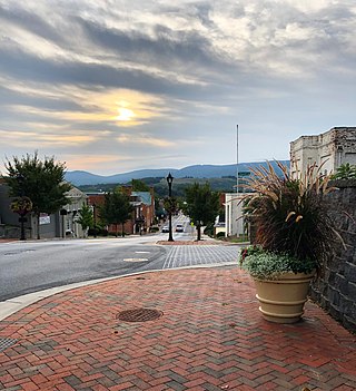
Waynesboro is an independent city in the Commonwealth of Virginia. It is a principal city of the Staunton-Waynesboro Metropolitan Statistical Area. Waynesboro is located in the Shenandoah Valley and is surrounded by Augusta County. As of the 2020 census, the population was 22,196.

East Rockaway is a village in Nassau County, on the South Shore of Long Island, in New York, United States. The population was 9,818 at the 2010 census.
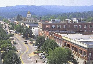
Hendersonville is a city in Henderson County, North Carolina, United States. It is 22 miles (35 km) south of Asheville and is the county seat of Henderson County. Like the county, the city is named for 19th-century North Carolina Supreme Court Chief Justice Leonard Henderson.

Oak Hills is a census-designated place (CDP) and neighborhood in Washington County, Oregon, United States. The CDP population was 9,050 at the 2000 census. It is on unincorporated land north of Beaverton, west of Cedar Mill, and south/southeast of Bethany. The CDP is roughly bounded by the Sunset Highway on the south, West Union Road on the north, Northwest 174th Avenue on the west, and Northwest 143rd Avenue on the east. The U.S. Postal Service has assigned Beaverton addresses to the area. Fire protection and EMS services are provided through Tualatin Valley Fire and Rescue.

West Homestead is a borough in Allegheny County, Pennsylvania, United States, 8 miles (13 km) southeast of Pittsburgh, on the Monongahela River. Heavy industries associated with nearby steel mills existed here, such as axle works, brickworks, and manufactories of machinery, car wheels, etc. The largest concern was Mesta Machinery, which was one of the world's leading industrial manufacturers from 1898 until 1983. The population was 1,872 at the 2020 census.

Luray is the county seat of Page County, Virginia, United States, in the Shenandoah Valley in the northern part of the Commonwealth. The population was 4,895 at the 2010 census.

West Warwick is a town in Kent County, Rhode Island, United States. The population was 31,012 at the 2020 census.

The Fairfax District is a neighborhood in the Central region of Los Angeles, California.
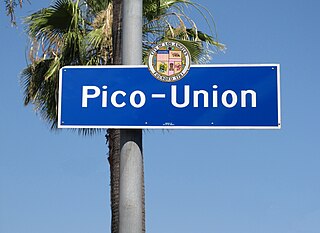
Pico-Union is a neighborhood in Central Los Angeles, California. The name "Pico-Union" refers to the neighborhood that surrounds the intersection of Pico Boulevard and Union Avenue. Located immediately west of Downtown Los Angeles, it is home to over 40,000 residents.

Bywater is a neighborhood of the city of New Orleans. A subdistrict of the Bywater District Area, its boundaries as defined by the City Planning Commission are: Florida Avenue to the north, the Industrial Canal to the east, the Mississippi River to the south, and the railroad tracks along Homer Plessy Way to the west. Bywater is part of the Ninth Ward of New Orleans. It includes part or all of Bywater Historic District, which is listed on the National Register of Historic Places.

South Park is a 1.41 square miles (3.65 km2) neighborhood within the South Los Angeles region of Los Angeles, California.
Mid-Wilshire is a neighborhood in the central region of Los Angeles, California. It is known for the Los Angeles County Museum of Art, the Petersen Automotive Museum, and the Miracle Mile shopping district.

Broadmoor is a neighborhood of the city of New Orleans. A subdistrict of the Uptown/Carrollton Area, its boundaries as defined by the New Orleans City Planning Commission are: Eve Street to the north, Washington Avenue and Toledano Street to the east, South Claiborne Avenue to the south, and Jefferson Avenue, South Rocheblave Street, Nashville Avenue, and Octavia Street to the west. It includes the Broadmoor Historic District which was listed on the National Register of Historic Places in 2003 and increased in its boundaries in 2007.
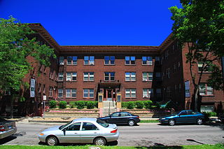
Stevens Square is the southernmost neighborhood of the Central community in Minneapolis. Although one of the densest neighborhoods in Minneapolis today, the land was originally occupied by a few large mansions. Today, the area is composed mostly of old brownstone apartment buildings or mansions that have been subdivided into apartments, giving the neighborhood a heavy population density within its small geographical area; a short and wide neighborhood, it is nearly a mile long but only three blocks tall. Much of the neighborhood is a National Historic District, and five of the apartments were listed on the National Register of Historic Places in 1993.

Harrison West is a historic urban neighborhood located northwest of downtown Columbus, Ohio. It sits on several blocks along the Olentangy River and includes the western part of the Near Northside Historic District, which was placed on the National Register of Historic Places in 1975. The character of the neighborhood is similar to Victorian Village, which sits just to the east and is more well-known.

Fountain Square is one of seven designated cultural districts in Indianapolis, Indiana. Located just outside the city's downtown district, Fountain Square is home to three designated national historic districts, the Laurel and Prospect, the State and Prospect, and the Virginia Avenue districts, all of which were listed on the National Register of Historic Places in 1983. The neighborhood derives its name from the successive fountains that have been prominently featured at the intersection of Virginia Avenue, East Prospect Street, and Shelby Street.
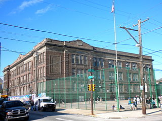
Whitman is a neighborhood in the South Philadelphia section of Philadelphia, Pennsylvania, United States. It is bounded on the west by Sixth Street, on the east by Front Street, on the south by Bigler Street, and on the north by Snyder Avenue. The name "Whitman" was adopted when the nearby Walt Whitman Bridge was being constructed in the 1950s. In 2015, Whitman and nearby South Philadelphia neighborhoods were named by Philadelphia Magazine as one of the safest and most family-friendly neighborhoods in Philadelphia.
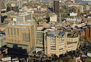
The Hill is the southwesternmost neighborhood of New Haven, Connecticut. As early as 1800, this area was known as "Sodom Hill". Located directly south of Downtown New Haven, this neighborhood is home to residential areas, some light industry, New Haven Union Station as well as Yale-New Haven Hospital and the Yale School of Medicine.
South Broadway Park is a neighborhood in southwestern Lexington, Kentucky, United States. Its boundaries are Bucoto Court to the north, Norfolk Southern railroad tracks to the east, South Broadway to the west, and Virginia Avenue to the south. It is located just west of the University of Kentucky.

Northside is a neighborhood in northern Lexington, Kentucky, United States. Its boundaries are Loudon Avenue to the north and east, Short Street, Midland Avenue, and Winchester Road to the south, and Newtown Pike to the west.


