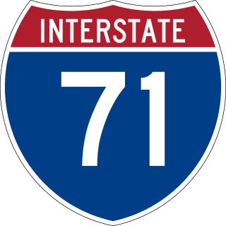
Interstate 71 (I-71) is a north–south Interstate Highway in the Midwestern and Southeastern regions of the United States. Its southern terminus is at an interchange with I-64 and I-65 in Louisville, Kentucky, and its northern terminus at an interchange with I-90 in Cleveland, Ohio. I-71 runs concurrently with I-75 from a point about 20 miles (32 km) south of Cincinnati, Ohio, into Downtown Cincinnati. While most odd numbered Interstates run north–south, I-71 takes more of a northeast–southwest course, with some east–west sections, and is mainly a regional route serving Kentucky and Ohio. It links I-80 and I-90 to I-70, and ultimately links to I-40. Major metropolitan areas served by I-71 include Louisville, Cincinnati, Columbus, and Cleveland.

U.S. Route 41, also U.S. Highway 41 (US 41), is a major north–south United States Numbered Highway that runs from Miami, Florida, to the Upper Peninsula of Michigan. Until 1949, the part in southern Florida, from Naples to Miami, was US 94. The highway's southern terminus is in the Brickell neighborhood of Downtown Miami at an intersection with Brickell Avenue (US 1), and its northern terminus is east of Copper Harbor, Michigan, at a modest cul-de-sac near Fort Wilkins Historic State Park at the tip of the Keweenaw Peninsula. US 41 closely parallels Interstate 75 (I-75) from Naples, Florida, all the way through Georgia to Chattanooga, Tennessee.
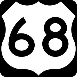
U.S. Route 68 is a United States highway that runs for 560 miles (900 km) from northwest Ohio to Western Kentucky. The highway's western terminus is at US 62 in Reidland, Kentucky. Its present northern terminus is at Interstate 75 in Findlay, Ohio, though the route once extended as far north as Toledo. US 68 intersects with US 62 three times during its route.

U.S. Route 431 (US 431) is a spur of U.S. Route 31. It currently travels for approximately 556 miles (895 km) from US 231/Alabama State Route 210 and US 231 Business and US 431 Bus. in Dothan, Alabama, to Owensboro, Kentucky, at US 60 and Kentucky Route 2831. The major cities US 431 connects to are Dothan and Huntsville, Alabama, Franklin and Nashville, Tennessee, and Owensboro, Kentucky.
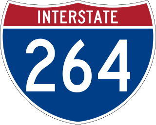
Interstate 264 (I-264) is a partial loop around the city of Louisville, Kentucky, south of the Ohio River. An auxiliary route of I-64, it is signed as the Shawnee Expressway for its first eight miles (13 km) from its western terminus at I-64/U.S. Route 150 (US 150) to US 31W/US 60 and as the Watterson Expressway for the remainder of its length from US 31W/US 60 to its northeastern terminus at I-71. It is 22.93 miles (36.90 km) in length and runs an open circle around central Louisville. The highway begins four miles (6.4 km) west of Downtown Louisville at I-64 just east of the Sherman Minton Bridge, which links Southern Indiana with Kentucky as it crosses the Ohio River. The Interstate ends approximately six miles (9.7 km) northeast of Downtown Louisville, where it connects to I-71. It is the only auxiliary route of I-64 outside of Virginia.

New Circle Road, also known as Kentucky Route 4, is a Kentucky state highway that serves as an inner beltway around Lexington, which is part of the consolidated city-county government with Fayette County.

U.S. Route 60 (US 60) is a major U.S. Highway in the American state of Kentucky. In the early days of the U.S. Highway System, US 60 was originally to be numbered as US 62. Following extensive lobbying and complaints filed by Kentucky governor William J. Fields to the American Association of State Highway Officials, the route was re-designated as US 60 before the system was finalized. In Kentucky, US 60 parallels the Ohio River. US 60 enters Kentucky from Cairo, Illinois, traveling northeast to Louisville, then takes a direct eastward route to rejoin the Ohio River in downtown Ashland, Kentucky. Both US 60 and US 23 run concurrently from Ashland to Catlettsburg where US 60 turns east and enters Kenova, West Virginia. US 60 is the longest route in Kentucky, running 495 miles (797 km) across the width of the state, passing through 22 of Kentucky's counties and through the cities of Paducah, Henderson, Owensboro, Louisville, the state capital of Frankfort, and Lexington.

Kentucky Route 29 is an 11.324-mile-long (18.224 km) state highway located entirely within Jessamine County in the U.S. state of Kentucky. The highway, maintained by the Kentucky Transportation Cabinet, runs north from High Bridge, Kentucky through Wilmore before ending at Nicholasville. Within Wilmore, KY 29 intersects Kentucky Route 1268 and junctions with Kentucky Route 3433. The highway acts as the border between Asbury University and Asbury Theological Seminary. Just north of Wilmore, KY 29 merges with U.S. Route 68 for 0.590 miles (0.950 km) before leaving US 68 and turning east heading towards Nicholasville. KY 29 terminates at Kentucky Route 39 and U.S. Route 27 Business in downtown Nicholasville.

Kentucky Route 922 is a 20.201 miles (32.510 km) long state highway in northern Kentucky. The southern terminus of the route is at U.S. Route 27 and U.S. Route 68 in Lexington. The northern terminus is at Kentucky Route 620 north of Georgetown. From US 27/68 north to US 25, KY 922 is named Oliver Lewis Way. From US 25 north to U.S. Route 62, it is named Newtown Pike. Between New Circle Rd and Interstate 75, Newtown Pike is one of the most congested routes during rush hour.

Kentucky Route 1974, also known as Tates Creek Road, stretches from New Circle Road at its northern terminus and proceeds southeast towards Spears. It has become a popular commuting route from points south, especially with recent housing development south of Man o' War Boulevard that stretches to Kentucky Route 1980. KY 1974 was widened from two to four lanes south of Man o' War Boulevard to KY 1980 in the late 1990s. It becomes a rural two-lane road with very light traffic to its southern terminus with KY 169, which leads to the Valley View Ferry.
Man o' War Boulevard, named after the racehorse Man o' War, is an almost 17-mile (27 km) urban arterial, circling Lexington, Kentucky to its south. Its western terminus is at US 60 / Keeneland Boulevard at Keeneland Race Course's main entrance, from which the highway heads southeast, intersecting with US 68, US 27, and other roads. It then turns east and northeast, intersecting KY 1974, US 25/US 421, and I-75, before ending at US 60 at Brighton. The majority of the road is a four-lane divided highway with curbs and sidewalks maintained by the Lexington-Fayette Urban County Government, but the 1.429-mile (2.300 km) portion east of I-75 is maintained by the Kentucky Transportation Cabinet as Supplemental Road Kentucky Route 1425, and only carries two lanes.

Kentucky Route 1927 (KY 1927) is a 16.397-mile-long (26.388 km) east–west state highway located in and around the cities of Lexington and Winchester, Kentucky. The western terminus of the route is at Kentucky Route 4 east of downtown Lexington. The eastern terminus is at Kentucky Route 627 in downtown Winchester. KY 1927, along with U.S. Route 60 and Interstate 64 to the north, is one of three routes directly connecting Lexington to Winchester. In rural western Clark and eastern Fayette this road is considered one of the most dangerous because of its curves and trees. Many fatal accidents on this road has occurred more than any other major highway, road, or street in Winchester and Lexington.
Citation Boulevard, a four-lane divided highway, currently extends from just west of US 25 at the Norfolk Southern Railway to KY 922 in Lexington, Kentucky. Known as Phase I, it was completed in 2001 and included a bridge over Cane Run. Phase II extends southwest from the Norfolk Southern Railway to US 421 at Alexandria Drive and includes a span over the railroad. The highway west of Newtown Pike was constructed by the Kentucky Transportation Cabinet.

Interstate 75 (I-75) runs from near Williamsburg to Covington by way of Lexington in the US state of Kentucky. I-75 enters the Cumberland Plateau region from Tennessee, then descends into the Bluegrass region through the Pottsville Escarpment before crossing the Ohio River into Ohio. I-75 follows along the U.S. Route 25 (US 25) corridor for the entire length of Kentucky.

Transportation in Cincinnati includes sidewalks, roads, public transit, bicycle paths, and regional and international airports. Most trips are made by car, with transit and bicycles having a relatively low share of total trips; in a region of just over 2 million people, less than 80,000 trips are made with transit on an average day. The city is sliced by three major interstate highways, I-71, I-74 and I-75, and circled by a beltway several miles out from the city limits. The region is served by two separate transit systems, one on each side of the river. SORTA, on the Ohio side is about six times larger than TANK on the Kentucky side.
Eagle Way is a major partial beltway that circles almost completely around the outer portions of the city of Hopkinsville, Kentucky.

Kentucky Route 418 (KY 418) is a 11.736-mile-long (18.887 km) state highway in the U.S. state of Kentucky. The highway connects mostly rural areas of Clark County with Lexington.

Kentucky Route 1017 (KY 1017) is an 3.984-mile-long (6.412 km) state highway in Boone County, Kentucky. The route runs between KY 18 and Oakbrook Drive southeast of Limaburg and east-southeast of Burlington, to U.S. Route 25 (US 25), US 42, and US 127 in northern Florence. The route principally connects the recent commercial developments of northern Florence south of the Cincinnati/Northern Kentucky International Airport, as well as Turfway Park and northbound Interstate 71 (I-71) and I-75.
 Interstate 64 runs east to Huntington and west to Louisville.
 Interstate 75 routes north to Cincinnati and south to Knoxville.


