Related Research Articles

Garrett County is the westernmost county of the U.S. state of Maryland. As of the 2020 census, the population was 28,806, making it the third-least populous county in Maryland. Its county seat is Oakland. The county was named for John Work Garrett (1820–1884), president of the Baltimore and Ohio Railroad. Created from Allegany County, Maryland in 1872, it was the last Maryland county to be formed.

York County is a county in the Commonwealth of Pennsylvania. As of the 2020 census, the population was 456,438. Its county seat is York. The county was created on August 19, 1749, from part of Lancaster County and named either after the Duke of York, an early patron of the Penn family, or for the city and county of York in England.

Conyngham Township is a township in Columbia County, Pennsylvania, United States. It is part of Northeastern Pennsylvania. The population was 689 at the 2020 census. Conyngham Township surrounds the famous borough of Centralia, and part of the mine fire is located here. The abandoned town of Byrnesville is located here.

Salisbury Township is a township in east central Lancaster County, Pennsylvania, United States. The population was 11,531 at the 2020 census.

Mount Carmel is a borough in Northumberland County, located in the Coal Heritage Region of Central Pennsylvania's Susquehanna River Valley, United States. The population was 5,725 at the 2020 census. It is located 88 miles (141 km) northwest of Philadelphia and 71 miles (114 km) northeast of Harrisburg, in the Coal Region. It is completely encircled by Mount Carmel Township.

Mount Carbon is a borough in Schuylkill County, Pennsylvania, United States, two miles south of Pottsville. It was formed from North Manheim Township in 1864. The population was 88 in the 2020 census. The borough is the smallest municipality in Schuylkill County.

A hairpin turn is a bend in a road with a very acute inner angle, making it necessary for an oncoming vehicle to turn about 180° to continue on the road. It is named for its resemblance to a bent metal hairpin. Such turns in ramps and trails may be called switchbacks in American English, by analogy with switchback railways.

Blue Mountain, Blue Mountain Ridge, or the Blue Mountains of Pennsylvania, is a ridge of the Appalachian Mountains in eastern Pennsylvania. Forming the southern and eastern edge of the Ridge-and-Valley Appalachians physiographic province in Pennsylvania, Blue Mountain extends 150 miles (240 km) from the Delaware Water Gap on the New Jersey border in the east to Big Gap in Franklin County in south-central Pennsylvania at its southwestern end.

Yellow Breeches Creek, also known as Callapatscink Creek, Callapatschink Creek or Shawnee Creek is a 56.1-mile-long (90.3 km) tributary of the Susquehanna River in central Pennsylvania, USA. There is no agreed upon explanation for the name Yellow Breeches Creek, which is found in land warrants as early as 1736.

Pennsylvania's 19th congressional district was a congressional district that became obsolete for the 113th Congress in 2013, due to Pennsylvania's slower population growth compared to the rest of the nation.
Muddy Creek is a tributary of the Susquehanna River in York County, Pennsylvania, in the United States.
The ghost town of Barclay, in Franklin Township, Bradford County, Pennsylvania, was a coal mining town. Coal was transported down the mountain by a gravity powered incline plane rail system. There was a brake house at the top of Barclay Mountain. The loaded cars were attached to a cable that pulled the empty cars back up. At the bottom, the cars were hauled 16 miles into Towanda by steam locomotives, to be emptied there into the Pennsylvania Canal's North Branch coal barges. The Barclay cemetery still exists and provides an interesting place to visit.
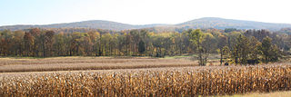
The Conewago Mountains or Conewago Hills are a low range of mountains in northern York County, Pennsylvania. They run northeasterly across the county. They form the backdrop to Gifford Pinchot State Park and parallel Conewago Creek.
Hopewell Center is an unincorporated community in York County, Pennsylvania, United States. It lies at an elevation of 689 feet.
Mountain Lake (Ontario) may refer to one of a number of lakes in Ontario, Canada with this precise name or to others with similar names.
Tolna is an unincorporated community in York County, Pennsylvania, United States. Tolna is located near Pennsylvania Route 851.
Violet Hill is an unincorporated area in York County, Pennsylvania, United States. This community, which is located in Spring Garden Township, is a suburb of the city of York.
Mount Royal is an unincorporated community in York County, Pennsylvania, United States. Mount Royal is located on Pennsylvania Route 74, approximately three miles north of Dover.

Mount Pisgah is a peak in York County, Pennsylvania situated south-southwest of Wrightsville.
