Dallastown, Pennsylvania

Last updated
Dallastown, Pennsylvania
Borough
York County Pennsylvania incorporated and unincorporated areas Dallastown highlighted.svg
Location in York County and the U.S. state of Pennsylvania.
USA Pennsylvania location map.svg
Red pog.svg
Dallastown
Location of Dallastown in Pennsylvania
Usa edcp location map.svg
Red pog.svg
Dallastown
Dallastown (the United States)
Coordinates: 39°54′0″N76°38′27″W / 39.90000°N 76.64083°W / 39.90000; -76.64083 Coordinates: 39°54′0″N76°38′27″W / 39.90000°N 76.64083°W / 39.90000; -76.64083
Country United States
State Pennsylvania
County York
Settled1844
Incorporated1866
Government
  TypeBorough Council
  MayorTerry L. Meyers
Area
[1]
  Total0.79 sq mi (2.03 km2)
  Land0.79 sq mi (2.03 km2)
  Water0.00 sq mi (0.00 km2)
Elevation
876 ft (267 m)
Population
 (2020) [2]
  Total4,195
  Density5,343.95/sq mi (2,062.63/km2)
Time zone UTC-5 (Eastern (EST))
  Summer (DST) UTC-4 (EDT)
Zip code
17313
Area code 717
FIPS code 42-18072
Website Dallastown

Dallastown is a borough in York County, Pennsylvania, United States, and a suburb of The City of York. The population was 4,049 at the 2010 census. [3]

Contents

History

Dallastown was named after George M. Dallas of Philadelphia (Vice President of the United States during the Polk administration) during the presidential campaign of 1844. Dallastown was incorporated April 1866.

President Lyndon Johnson visited Dallastown in 1966 as part of the town's centennial celebration.

Geography

According to the United States Census Bureau, the borough has a total area of 0.8 square miles (2.1 km2), all of it land.

Demographics

Historical population
CensusPop.
1870 287
1880 48267.9%
1890 77961.6%
1900 1,18151.6%
1910 1,88459.5%
1920 2,12412.7%
1930 2,84934.1%
1940 2,9172.4%
1950 3,30413.3%
1960 3,6159.4%
1970 3,560−1.5%
1980 3,94910.9%
1990 3,9740.6%
2000 4,0872.8%
2010 4,049−0.9%
2020 4,1953.6%
Sources: [4] [5] [6] [2]

At the 2000 census there were 4,087 people, 1,622 households, and 1,026 families living in the borough. The population density was 5,567.2 people per square mile (2,161.6/km²). There were 1,707 housing units at an average density of 2,325.2 per square mile (902.8/km²). The racial makeup of the borough was 97.19% White, 0.78% African American, 0.20% Native American, 0.34% Asian, 0.12% Pacific Islander, 0.39% from other races, and 0.98% from two or more races. Hispanic or Latino of any race were 1.79%. [5]

Of the 1,622 households 31.6% had children under the age of 18 living with them, 46.4% were married couples living together, 12.5% had a female householder with no husband present, and 36.7% were non-families. 29.8% of households were one person and 12.4% were one person aged 65 or older. The average household size was 2.36 and the average family size was 2.91.

The age distribution was 23.3% under the age of 18, 9.7% from 18 to 24, 31.1% from 25 to 44, 17.6% from 45 to 64, and 18.3% 65 or older. The median age was 36 years. For every 100 females there were 90.2 males. For every 100 females age 18 and over, there were 82.6 males.

The median household income was $37,500 and the median family income was $44,500. Males had a median income of $35,679 versus $25,169 for females. The per capita income for the borough was $18,249. About 3.4% of families and 8.7% of the population were below the poverty line, including 6.7% of those under age 18 and 19.2% of those age 65 or over.

St. Joseph's Catholic School St Joes School Dallastown PA.jpg
St. Joseph's Catholic School

Education

Dallastown Borough is home to Dallastown Elementary School, Senior High school, and Middle School, which is part of the Dallastown Area School District, which consists of eight local schools, including the Dallastown Intermediate School, built in 2010.

St. Joseph's Catholic School was also in Dallastown. It provided Catholic education to students in grades Pre-K to 6. It is now closed.

Dallastown Area Senior High School has the longest hallway in a school in Pennsylvania, almost 1/3 of a mile (1,760 ft or 536.45 meters).

Notable people

Related Research Articles

<span class="mw-page-title-main">Port Vue, Pennsylvania</span> Borough in Pennsylvania, United States

Port Vue is a borough in Allegheny County, Pennsylvania, United States. The population was 3,798 at the 2010 census.

<span class="mw-page-title-main">Sewickley Hills, Pennsylvania</span> Borough in Pennsylvania, United States

Sewickley Hills is a borough in Allegheny County, Pennsylvania, United States. The population was 639 at the 2010 census.

<span class="mw-page-title-main">Thornburg, Pennsylvania</span> Borough in Pennsylvania, United States

Thornburg is a borough in Allegheny County in the U.S. state of Pennsylvania. The population was 455 at the 2010 census.

<span class="mw-page-title-main">Centerport, Pennsylvania</span> Borough in Pennsylvania, United States

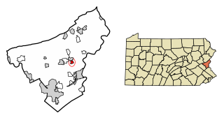
Centerport is a borough in north central Berks County, Pennsylvania, United States. The population was 387 at the 2010 census.

<span class="mw-page-title-main">Ashville, Pennsylvania</span> Borough in Pennsylvania, United States

Ashville is a borough in Cambria County, Pennsylvania, United States. It is part of the Johnstown, Pennsylvania Metropolitan Statistical Area. However, it is much closer to Altoona, Pennsylvania and is often considered a suburb of the latter. The population was 213 at the 2020 census.

<span class="mw-page-title-main">Hawthorn, Pennsylvania</span> Borough in Pennsylvania, United States

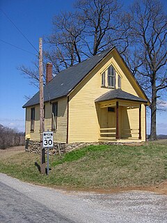
Hawthorn is a borough in Clarion County, Pennsylvania, United States. The population was 482 at the 2020 census.

<span class="mw-page-title-main">Spartansburg, Pennsylvania</span> Borough in Pennsylvania, United States

Spartansburg is a borough in Crawford County, in northwestern Pennsylvania, United States. The population was 281 at the 2020 census, down from 305 at the 2010 census.

<span class="mw-page-title-main">Everson, Pennsylvania</span> Borough in Pennsylvania, United States

Everson is a borough in Fayette County, Pennsylvania. The population was 768 at the 2020 census. It was incorporated in 1903.

<span class="mw-page-title-main">Markleysburg, Pennsylvania</span> Borough in Pennsylvania, United States

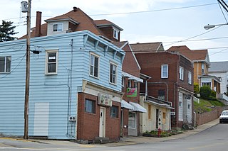
Markleysburg is a borough in Fayette County, Pennsylvania, United States. The population was 246 at the 2020 census. The borough is served by the Uniontown Area School District.

<span class="mw-page-title-main">Clarks Green, Pennsylvania</span> Borough in Pennsylvania, United States

Clarks Green is a borough in Lackawanna County, Pennsylvania, United States. The population was 1,529 at the 2020 census.

<span class="mw-page-title-main">East Bangor, Pennsylvania</span> Place in Pennsylvania, United States

East Bangor is a borough in Northampton County, Pennsylvania. The population of East Bangor was 1,172 at the 2010 census. It is located in the Lehigh Valley metropolitan region, which has a population of 861,899 and is the 68th most populated metropolitan area in the U.S. as of the 2020 census.

<span class="mw-page-title-main">Tatamy, Pennsylvania</span> Place in Pennsylvania, United States

Tatamy is a borough in Northampton County, Pennsylvania. Tatamy is part of the Lehigh Valley metropolitan area, which has a population of 861,899 and is the 68th most populated metropolitan area in the U.S. as of the 2020 census. The borough is named for Moses Tunda Tatamy, a Native American leader. Its population was 1,203 at the 2010 census.

<span class="mw-page-title-main">Walnutport, Pennsylvania</span> Place in Pennsylvania, United States

Walnutport is a borough in Northampton County, Pennsylvania. It was first incorporated in 1909. The population of Walnutport was 2,070 at the 2010 census.

<span class="mw-page-title-main">Palo Alto, Pennsylvania</span> Borough in Pennsylvania, United States

Palo Alto is a borough in Schuylkill County, Pennsylvania, United States. The population was 971 at the 2020 census. The borough stretches along the south bank of the Schuylkill River. Bacon Street is the main street of town. The borough shares Pottsville's ZIP Code, telephone exchanges, and school district. The borough maintains its own fire department and police department.

<span class="mw-page-title-main">Tioga, Pennsylvania</span> Borough in Pennsylvania, United States

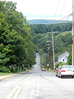
Tioga is a borough in Tioga County, Pennsylvania, United States. The population was 611 at the 2010 census. It is located north of Tioga and Hammond Lakes along the Tioga River.

<span class="mw-page-title-main">Burgettstown, Pennsylvania</span> Borough in Pennsylvania, United States

Burgettstown is a borough in Washington County, Pennsylvania, United States. It is a part of the Pittsburgh metropolitan area. The population was 1,424 according to the 2020 census. The borough is best known as the home of The Pavilion at Star Lake, a 23,000-seat outdoor amphitheater that hosts many of the Pittsburgh area's headlining concerts.

<span class="mw-page-title-main">Madison, Pennsylvania</span> Borough in Pennsylvania, United States

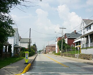
Madison is a borough in Westmoreland County, Pennsylvania, United States. The population was 397 at the 2010 census. The borough was named for James Madison, 4th President of the United States.

<span class="mw-page-title-main">Dillsburg, Pennsylvania</span> Borough in Pennsylvania, United States

Dillsburg is a borough in York County, Pennsylvania, United States. The population was 2,643 as of the 2020 census.

<span class="mw-page-title-main">Felton, Pennsylvania</span> Borough in Pennsylvania, United States

Felton is a borough in York County, Pennsylvania, United States. The population was 501 at the 2020 census. The borough is located within the Red Lion Area School District. Local services include the Felton Fire Company and the Felton US Post Office. The current Mayor of Felton borough is Bryan T. McManus, Jr.

<span class="mw-page-title-main">York Township, York County, Pennsylvania</span> Township in Pennsylvania, United States

York Township is a township in York County, Pennsylvania, United States. The township is a suburb of The City of York. The population was 29,737 at the 2020 census.

References

  1. "ArcGIS REST Services Directory". United States Census Bureau. Retrieved October 12, 2022.
  2. 1 2 "Census Population API". United States Census Bureau. Retrieved Oct 12, 2022.
  3. "Race, Hispanic or Latino, Age, and Housing Occupancy: 2010 Census Redistricting Data (Public Law 94-171) Summary File (QT-PL), Dallastown borough, Pennsylvania". United States Census Bureau . Retrieved October 4, 2011.
  4. "Census of Population and Housing". U.S. Census Bureau. Retrieved 11 December 2013.
  5. 1 2 "U.S. Census website". United States Census Bureau . Retrieved 2008-01-31.
  6. "Incorporated Places and Minor Civil Divisions Datasets: Subcounty Resident Population Estimates: April 1, 2010 to July 1, 2012". Population Estimates. U.S. Census Bureau. Archived from the original on June 11, 2013. Retrieved 11 December 2013.