New Salem, Pennsylvania

Last updated
New Salem, Pennsylvania
Borough
New Salem, York County.jpg
PA Route 616 passes through New Salem
York County Pennsylvania incorporated and unincorporated areas New Salem highlighted.svg
Location in York County and the U.S. state of Pennsylvania.
USA Pennsylvania location map.svg
Red pog.svg
New Salem
Location of New Salem in Pennsylvania
Usa edcp location map.svg
Red pog.svg
New Salem
New Salem (the United States)
Coordinates: 39°54′09″N76°47′35″W / 39.90250°N 76.79306°W / 39.90250; -76.79306
Country United States
State Pennsylvania
County York
Incorporated1876
Government
  TypeBorough Council
Area
[1]
  Total0.47 sq mi (1.22 km2)
  Land0.47 sq mi (1.22 km2)
  Water0.00 sq mi (0.00 km2)
Elevation
636 ft (194 m)
Population
 (2020) [2]
  Total822
  Density1,737.84/sq mi (671.65/km2)
Time zone UTC-5 (Eastern (EST))
  Summer (DST) UTC-4 (EDT)
Zip code
17371
Area code 717
FIPS code 42-54056

New Salem is a borough located in York County, Pennsylvania, United States. As of the 2020 census, [3] the borough had a total population of 818.

Contents

Geography

New Salem is located at 39°54'9" North, 76°47'35" West (39.902526, -76.793162). [4]

According to the United States Census Bureau, the borough has a total area of 0.4 square miles (1.0 km2), all land. New Salem lies near North Codorus Township. The town has two streets, two pizza shops, a gas station, bar, and post office.

Demographics

Historical population
CensusPop.Note
1880 224
1890 2313.1%
1900 2414.3%
1910 2482.9%
1920 27611.3%
1930 32919.2%
1940 3454.9%
1950 333−3.5%
1960 3505.1%
1970 3849.7%
1980 832116.7%
1990 669−19.6%
2000 648−3.1%
2010 72411.7%
2020 81813.0%
2021 (est.)821 [3] 0.4%
Sources: [5] [6] [7] [2]

As of the census [6] of 2000, there were 648 people, 258 households, and 198 families residing in the borough. The population density was 1,427.6 inhabitants per square mile (551.2/km2). There were 266 housing units at an average density of 586.0 per square mile (226.3/km2). The racial makeup of the borough was 97.69% White, 0.31% African American, 0.00% Native American, 1.85% Asian, 0.00% Pacific Islander, 0.15% from other races, and 0.00% from two or more races. 0.31% of the population were Hispanic or Latino of any race.

There were 258 households, out of which 29.8% had children under the age of 18 living with them, 66.3% were married couples living together, 8.5% had a female householder with no husband present, and 22.9% were non-families. 19.0% of all households were made up of individuals, and 9.7% had someone living alone who was 65 years of age or older. The average household size was 2.51 and the average family size was 2.79.

In the borough the population was spread out, with 22.8% under the age of 18, 5.4% from 18 to 24, 29.2% from 25 to 44, 25.8% from 45 to 64, and 16.8% who were 65 years of age or older. The median age was 41 years. For every 100 females there were 97.6 males. For every 100 females age 18 and over, there were 96.9 males.

The median income for a household in the borough was $51,944, and the median income for a family was $53,295. Males had a median income of $39,028 versus $22,321 for females. The per capita income for the borough was $18,802. 3.9% of the population and 3.7% of families were below the poverty line. Out of the total population, 3.3% of those under the age of 18 and 6.5% of those 65 and older were living below the poverty line.

History

New Salem, or York New Salem, added the prefix York because of a dispute between another borough with the same name in Pennsylvania. No two boroughs can have the same name for postal reasons, according to the federal government. New Salem was founded by settlers from Salem, Massachusetts and from settlers from nearby York.

Related Research Articles

<span class="mw-page-title-main">Rosslyn Farms, Pennsylvania</span> Borough in Pennsylvania, United States

Rosslyn Farms is a suburban borough located 5 miles (8 km) west of Pittsburgh in Allegheny County, Pennsylvania, United States. It is a small community, with an area of only 0.6 square miles (1.6 km2). The population was 441 at the 2020 census.

<span class="mw-page-title-main">Applewold, Pennsylvania</span> Borough in Pennsylvania, United States

Applewold is a borough in Armstrong County, Pennsylvania, United States. The population was 334 at the 2020 census.

<span class="mw-page-title-main">Athens, Pennsylvania</span> Borough in Pennsylvania, United States

Athens is a borough in Bradford County, Pennsylvania, United States. It is part of Northeastern Pennsylvania and is located 2 miles (3 km) south of the New York state line on the Susquehanna and Chemung rivers. The population was 3,749 in 1900 and 3,796 in 1910. The population was 3,265 at the 2020 census. Athens is in a small area locally known as "The Valley", a group of four contiguous communities in Pennsylvania and New York: Waverly, New York; South Waverly, Pennsylvania; Sayre, Pennsylvania; and Athens. The Valley has a population near 30,000.

<span class="mw-page-title-main">Sylvania, Pennsylvania</span> Borough in Pennsylvania, United States

Sylvania is a borough in Bradford County, Pennsylvania, United States. It is part of Northeastern Pennsylvania. The population was 216 at the 2020 census. Children residing in the borough are assigned to attend the Troy Area School District.

<span class="mw-page-title-main">Eau Claire, Pennsylvania</span> Borough in Pennsylvania, United States

Eau Claire is a borough in Butler County, Pennsylvania, United States. The population was 316 at the 2010 census. The name means "Clear Water" in French, and the name is pronounced as though it were spelled "U'Clare".

<span class="mw-page-title-main">Parker Township, Butler County, Pennsylvania</span> Township in Pennsylvania, United States

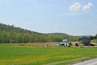
Parker Township is a township that is located in Butler County, Pennsylvania, United States. The population was 632 at the time of the 2010 census.

<span class="mw-page-title-main">Irvona, Pennsylvania</span> Borough in Pennsylvania, United States

Irvona is a borough in Clearfield County, Pennsylvania, United States. The population was 549 at the 2020 census.

<span class="mw-page-title-main">Springboro, Pennsylvania</span> Borough in Pennsylvania, United States

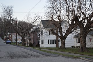
Springboro is a borough in Crawford County, Pennsylvania, United States, located 35 miles southwest of Erie. The population was 377 at the 2020 census, down from 477 at the 2010 census.

<span class="mw-page-title-main">West Mahoning Township, Indiana County, Pennsylvania</span> Township in Pennsylvania, United States

West Mahoning Township is a township in Indiana County, Pennsylvania, United States. The population was 1,337 at the 2020 census. The township surrounds Smicksburg, a separately incorporated borough.

<span class="mw-page-title-main">East Berwick, Pennsylvania</span> Census-designated place in Pennsylvania, United States

East Berwick is a census-designated place (CDP) in Salem Township, Luzerne County, Pennsylvania, United States. The population was 2,007 at the 2010 census.

<span class="mw-page-title-main">New Lebanon, Pennsylvania</span> Borough in Pennsylvania, United States

New Lebanon is a borough in northeastern Mercer County, Pennsylvania, United States. The population was 186 at the 2020 census. It is part of the Youngstown–Warren metropolitan area.

<span class="mw-page-title-main">Sandy Lake, Pennsylvania</span> Borough in Pennsylvania, United States

Sandy Lake is a borough in eastern Mercer County, Pennsylvania, United States. It was established in 1849. The population was 649 at the 2020 census. It is part of the Youngstown–Warren metropolitan area.

<span class="mw-page-title-main">West Salem Township, Mercer County, Pennsylvania</span> Township in Pennsylvania, United States

West Salem Township is a township in Mercer County, Pennsylvania, United States. The population was 3,220 at the 2020 census, a decrease from 3,538 in 2010.

<span class="mw-page-title-main">Freeburg, Pennsylvania</span> Borough in Pennsylvania, United States

Freeburg is a borough in Snyder County, Pennsylvania, United States. The population was 557 at the 2020 census.

<span class="mw-page-title-main">Friendsville, Pennsylvania</span> Borough in Pennsylvania, United States

Friendsville is a borough in Susquehanna County, Pennsylvania, United States. The population was 100 at the 2020 census.

<span class="mw-page-title-main">East Prospect, Pennsylvania</span> Borough in Pennsylvania, United States

East Prospect is a borough in York County, Pennsylvania, United States. The population was 932 at the 2020 census.

<span class="mw-page-title-main">Fawn Township, York County, Pennsylvania</span> Township in Pennsylvania, United States

Fawn Township is a township in York County, Pennsylvania, United States. The population was 3,011 at the 2020 census.

<span class="mw-page-title-main">Lower Windsor Township, York County, Pennsylvania</span> Township in Pennsylvania, United States

Lower Windsor Township is a township in York County, Pennsylvania, United States. The population was 7,511 at the 2020 census. Samuel S. Lewis State Park overlooks the Susquehanna River in the eastern part of the township.

<span class="mw-page-title-main">North Codorus Township, York County, Pennsylvania</span> Township in Pennsylvania, United States

North Codorus Township is a township in York County, Pennsylvania, United States. The population was 9,149 at the 2020 census.

<span class="mw-page-title-main">Yorkana, Pennsylvania</span> Borough in Pennsylvania, United States

Yorkana is a borough in York County, Pennsylvania, United States. The population was 236 at the 2020 census. It is a linear town, spread along Mt. Pisgah Road, which is called Main Street in town. The borough includes several dozen houses, two churches, and a few businesses.

References

  1. "ArcGIS REST Services Directory". United States Census Bureau. Retrieved October 12, 2022.
  2. 1 2 "Census Population API". United States Census Bureau. Retrieved Oct 12, 2022.
  3. 1 2 Bureau, US Census. "City and Town Population Totals: 2020-2021". Census.gov. US Census Bureau. Retrieved 9 July 2022.
  4. "US Gazetteer files: 2010, 2000, and 1990". United States Census Bureau. 2011-02-12. Retrieved 2011-04-23.
  5. "Census of Population and Housing". U.S. Census Bureau. Retrieved 11 December 2013.
  6. 1 2 "U.S. Census website". United States Census Bureau . Retrieved 2008-01-31.
  7. "Incorporated Places and Minor Civil Divisions Datasets: Subcounty Resident Population Estimates: April 1, 2010 to July 1, 2012". Population Estimates. U.S. Census Bureau. Archived from the original on 11 June 2013. Retrieved 11 December 2013.