Grantley, Pennsylvania

Last updated

Grantley
CDP
York County Pennsylvania incorporated and unincorporated areas Grantley highlighted.svg
Location in York County and the U.S. state of Pennsylvania.
Coordinates: 39°56′19″N76°43′47″W / 39.93861°N 76.72972°W / 39.93861; -76.72972
Country United States
State Pennsylvania
County York
Township Spring Garden
Area
[1]
  Total2.10 sq mi (5.44 km2)
  Land2.08 sq mi (5.40 km2)
  Water0.01 sq mi (0.04 km2)
Elevation
[2]
584 ft (178 m)
Population
 (2020) [3]
  Total4,524
  Density2,169.78/sq mi (837.92/km2)
Time zone UTC-5 (Eastern (EST))
  Summer (DST) UTC-4 (EDT)
FIPS code 42-30435
GNIS feature ID2389863 [2]

Grantley is a census-designated place (CDP) in York County, Pennsylvania, United States. The population was 3,628 at the 2010 census. [4]

Contents

Geography

Grantley is located in Spring Garden Township, adjacent to the city of York.

According to the United States Census Bureau, the CDP has a total area of 1.7 square miles (4.4 km2), of which 0.60% is water.

Demographics

Historical population
CensusPop.Note
2020 4,524
U.S. Decennial Census [5]

At the 2000 census there were 3,580 people, 801 households, and 550 families living in the CDP. The population density was 2,155.3 inhabitants per square mile (832.2/km2). There were 830 housing units at an average density of 499.7 per square mile (192.9/km2). The racial makeup of the CDP was 96.54% White, 1.37% African American, 0.03% Native American, 0.70% Asian, 0.03% Pacific Islander, 0.56% from other races, and 0.78% from two or more races. Hispanic or Latino of any race were 2.21%. [6]

Of the 801 households 29.0% had children under the age of 18 living with them, 57.8% were married couples living together, 8.0% had a female householder with no husband present, and 31.3% were non-families. 20.5% of households were one person and 10.6% were one person aged 65 or older. The average household size was 2.55 and the average family size was 2.85.

The age distribution was 12.3% under the age of 18, 46.8% from 18 to 24, 12.7% from 25 to 44, 15.3% from 45 to 64, and 13.0% 65 or older. The median age was 21 years. For every 100 females, there were 77.3 males. For every 100 females age 18 and over, there were 75.3 males.

The median household income was $57,039 and the median family income was $77,216. Males had a median income of $60,292 versus $29,250 for females. The per capita income for the CDP was $28,703. About 4.7% of families and 12.7% of the population were below the poverty line, including 15.4% of those under age 18 and 1.7% of those age 65 or over.

Related Research Articles

<span class="mw-page-title-main">Lenape Heights, Pennsylvania</span> Census-designated place in Pennsylvania, United States

Lenape Heights is a census-designated place (CDP) in Armstrong County, Pennsylvania, United States. The population was 1,144 at the 2020 census.

Reiffton is a census-designated place (CDP) in Exeter Township, Berks County, Pennsylvania, United States. The population was 4,178 at the 2010 census.

<span class="mw-page-title-main">Nixon, Pennsylvania</span> Census-designated place in Pennsylvania, United States

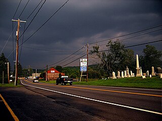
Nixon is a census-designated place (CDP) in Penn Township, Butler County, Pennsylvania, United States. The population was 1,373 at the 2010 census.

Locustdale is a census-designated place (CDP) that is located on the border of Columbia and Schuylkill counties, Pennsylvania, United States. It is part of Northeastern Pennsylvania.

<span class="mw-page-title-main">Adamsville, Pennsylvania</span> Census-designated place in Pennsylvania, United States

Adamsville is a census-designated place (CDP) in Crawford County, Pennsylvania, United States. The population was 67 at the 2010 census, down from 117 in 2000.

<span class="mw-page-title-main">Pymatuning North, Pennsylvania</span> Census-designated place in Pennsylvania, United States

Pymatuning North is a census-designated place (CDP) in Crawford County, Pennsylvania, United States. The population was 311 at the 2010 census.

Wayne Heights is a census-designated place (CDP) in Franklin County, Pennsylvania, United States. The population was 2,606 at the 2020 census.

Jacksonville is a census-designated place (CDP) in Indiana County, Pennsylvania, United States. The population was 637 at the 2010 census. It was formerly an independent borough, until January 1, 1993 when it was returned to Black Lick Township, Pennsylvania.

<span class="mw-page-title-main">East Berwick, Pennsylvania</span> Census-designated place in Pennsylvania, United States

East Berwick is a census-designated place (CDP) in Salem Township, Luzerne County, Pennsylvania, United States. The population was 2,007 at the 2010 census.

<span class="mw-page-title-main">Brodheadsville, Pennsylvania</span> Census-designated place in Pennsylvania, United States

Brodheadsville is a census-designated place (CDP) in Monroe County, Pennsylvania, United States. The population was 1,700 at the 2020 census. The community is served by Pleasant Valley School District.

Altamont is a census-designated place (CDP) in Schuylkill County, Pennsylvania, United States. The population was 2,689 at the 2000 census.

<span class="mw-page-title-main">Delano, Pennsylvania</span> CDP in Pennsylvania, United States

Delano is a census-designated place (CDP) in Schuylkill County, Pennsylvania, United States. The population was 377 at the 2000 census.

<span class="mw-page-title-main">Donaldson, Pennsylvania</span> CDP in Pennsylvania, United States

Donaldson is a census-designated place (CDP) in Frailey Township, Schuylkill County, Pennsylvania, United States. The population was 325 at the 2000 census.

Fountain Springs is a census-designated place in Butler Township, Schuylkill County, Pennsylvania, United States. The population was 100 at the 2000 census.

Renningers is a census-designated place (CDP) in Schuylkill County, Pennsylvania, United States. The population was 380 at the 2000 census.

<span class="mw-page-title-main">Parkville, Pennsylvania</span> CDP in Pennsylvania, United States

Parkville is a census-designated place (CDP) in York County, Pennsylvania, United States. The population was 6,706 at the 2010 census.

<span class="mw-page-title-main">Pennville, Pennsylvania</span> CDP in Pennsylvania, United States

Pennville is a census-designated place (CDP) in York County, Pennsylvania, United States. The population was 1,947 at the 2010 census.

<span class="mw-page-title-main">Susquehanna Trails, Pennsylvania</span> CDP in Pennsylvania, United States

Susquehanna Trails is a census-designated place (CDP) in York County, Pennsylvania, United States. The population was 2,264 at the 2010 census.

<span class="mw-page-title-main">Valley Green, Pennsylvania</span> CDP in Pennsylvania, United States

Valley Green is a census-designated place (CDP) in York County, Pennsylvania, United States. The population was 3,429 at the 2010 census.

<span class="mw-page-title-main">Valley View, York County, Pennsylvania</span> CDP in Pennsylvania, United States

Valley View is a census-designated place (CDP) in York County, Pennsylvania, United States. The population was 2,817 at the 2010 census.

References

  1. "ArcGIS REST Services Directory". United States Census Bureau. Retrieved October 12, 2022.
  2. 1 2 U.S. Geological Survey Geographic Names Information System: Grantley, Pennsylvania
  3. "Census Population API". United States Census Bureau. Retrieved October 12, 2022.
  4. "Race, Hispanic or Latino, Age, and Housing Occupancy: 2010 Census Redistricting Data (Public Law 94-171) Summary File (QT-PL), Grantley CDP, Pennsylvania". United States Census Bureau . Retrieved October 17, 2011.
  5. "Census of Population and Housing". Census.gov. Retrieved June 4, 2016.
  6. "U.S. Census website". United States Census Bureau . Retrieved January 31, 2008.