East Hopewell Township, Pennsylvania

Last updated
East Hopewell Township, Pennsylvania
Wallace Cross Mill with Miller's House in Background.jpg
The Wallace-Cross Mill and miller's house
York County Pennsylvania incorporated and unincorporated areas East Hopewell township highlighted.svg
Location in York County and the state of Pennsylvania.
Country United States
State Pennsylvania
County York
Settled1734
Incorporated1885
Government
  TypeBoard of Supervisors
Area
[1]
  Total20.56 sq mi (53.25 km2)
  Land20.56 sq mi (53.25 km2)
  Water0.00 sq mi (0.00 km2)
Population
 (2020) [2]
  Total2,416
  Estimate 
(2021) [2]
2,428
  Density118.73/sq mi (45.84/km2)
Time zone UTC-5 (Eastern (EST))
  Summer (DST) UTC-4 (EDT)
Area code 717
FIPS code 42-133-21296
Historical population
CensusPop.Note
1890 1,234
1900 1,074−13.0%
1910 961−10.5%
1920 824−14.3%
1930 763−7.4%
1940 8136.6%
1950 807−0.7%
1960 784−2.9%
1970 8437.5%
1980 1,45072.0%
1990 1,92933.0%
2000 2,20914.5%
2010 2,4169.4%
2020 2,4160.0%
2021 (est.)2,428 [2] 0.5%
U.S. Decennial Census [3]

East Hopewell Township is a township in York County, Pennsylvania, United States. The population was 2,416 at the 2020 census. [2] It is served by the South Eastern School District which provides a public education.

Contents

History

Muddy Creek Forks Historic District and the Wallace-Cross Mill are listed on the National Register of Historic Places. [4]

Geography

According to the United States Census Bureau, the township has a total area of 20.5 square miles (53 km2), all land. East Hopewell Township surrounds on three sides the borough of Cross Roads, located along the township's northwestern border.

Demographics

As of the census [5] of 2000, there were 2,209 people, 769 households, and 642 families living in the township. The population density was 107.5 inhabitants per square mile (41.5/km2). There were 800 housing units at an average density of 38.9 units per square mile (15.0 units/km2). The racial makeup of the township was 98.60% White, 0.27% African American, 0.59% Asian, 0.05% from other races, and 0.50% from two or more races. Hispanic or Latino of any race were 0.45% of the population.

There were 769 households, out of which 38.5% had children under the age of 18 living with them, 75.4% were married couples living together, 4.4% had a female householder with no husband present, and 16.4% were non-families. 11.4% of all households were made up of individuals, and 3.1% had someone living alone who was 65 years of age or older. The average household size was 2.87 and the average family size was 3.13.

In the township the population was spread out, with 26.7% under the age of 18, 6.7% from 18 to 24, 31.0% from 25 to 44, 28.8% from 45 to 64, and 6.8% who were 65 years of age or older. The median age was 38 years. For every 100 females there were 103.4 males. For every 100 females age 18 and over, there were 104.4 males.

The median income for a household in the township was $58,194, and the median income for a family was $61,734. Males had a median income of $42,006 versus $30,417 for females. The per capita income for the township was $21,540. About 2.2% of families and 3.4% of the population were below the poverty line, including 2.8% of those under age 18 and 4.1% of those age 65 or over.

Related Research Articles

<span class="mw-page-title-main">Conestoga Township, Pennsylvania</span> Township in Pennsylvania, United States

Conestoga Township is a township in west central Lancaster County, Pennsylvania. At the 2020 census, the population was 3,922.

<span class="mw-page-title-main">East Drumore Township, Pennsylvania</span> Township in Pennsylvania, United States

East Drumore Township is a township in south central Lancaster County, Pennsylvania, United States. At the 2020 census, the population was 3,903. It is part of the Solanco School District.

<span class="mw-page-title-main">Jackson Township, Cambria County, Pennsylvania</span> Township in Pennsylvania, United States

Jackson Township is an American township which is located in Cambria County, Pennsylvania. The population was 4,392 at the time of the 2010 census, down from 4,925 at the 2000 census.

<span class="mw-page-title-main">Spring Township, Crawford County, Pennsylvania</span> Township in Pennsylvania, United States

Spring Township is a township in Crawford County, Pennsylvania, United States. The population was 1,407 at the 2020 census, down from 1,548 at the 2010 census.

<span class="mw-page-title-main">Georges Township, Pennsylvania</span> Township in Pennsylvania, United States

Georges Township is a township in Fayette County, Pennsylvania, United States. The population was 6,346 at the 2020 census, a decline from the figure of 6,612 tabulated in 2010. It is served by the Albert Gallatin Area School District.

<span class="mw-page-title-main">Henry Clay Township, Fayette County, Pennsylvania</span> Township in Pennsylvania, United States

Henry Clay Township is a township in Fayette County, Pennsylvania, United States. The population was 1,764 at the 2020 census. The township was created June 9, 1824, from the eastern portion of Wharton Township. It is named for 19th-century American statesman Henry Clay. The northwestern corner of its territory was used to create Stewart Township on November 17, 1855. It is served by the Uniontown Area School District.

<span class="mw-page-title-main">Hopewell Township, Huntingdon County, Pennsylvania</span> Township in Pennsylvania, United States

Hopewell Township is a township in Huntingdon County, Pennsylvania, United States. The population was 455 at the 2020 census.

<span class="mw-page-title-main">Union Township, Luzerne County, Pennsylvania</span> Township in Pennsylvania, United States

Union Township is a township in Luzerne County, Pennsylvania, United States. The population was 2,033 at the 2020 census.

<span class="mw-page-title-main">Upper Mahantongo Township, Pennsylvania</span> Township in Pennsylvania, United States

Upper Mahantongo Township is a township that is located in Schuylkill County, Pennsylvania, United States. The population was 614 at the time of the 2020 census.

<span class="mw-page-title-main">West Mahanoy Township, Pennsylvania</span> Township in Pennsylvania, United States

West Mahanoy Township is a township that is located in Schuylkill County, Pennsylvania. The population was 2,786 at the time of the 2020 census.

<span class="mw-page-title-main">Dover Township, Pennsylvania</span> Township in Pennsylvania, United States

Dover Township is a township in York County, Pennsylvania, United States. The population was 22,366 at the 2020 census.

<span class="mw-page-title-main">Fawn Township, York County, Pennsylvania</span> Township in Pennsylvania, United States

Fawn Township is a township in York County, Pennsylvania, United States. The population was 3,011 at the 2020 census.

<span class="mw-page-title-main">Heidelberg Township, York County, Pennsylvania</span> Township in Pennsylvania, United States

Heidelberg Township is a township in York County, Pennsylvania, United States. The township was erected in 1750 and encompassed the land grant known as Digges' Choice, a warrant granted to John Digges in 1727 by the colonial-era Province of Maryland, prior to the time the Mason-Dixon line fixed the final boundary between Maryland and Pennsylvania. The population of Heidelberg Township was 3,027 at the 2020 census.

<span class="mw-page-title-main">Hopewell Township, York County, Pennsylvania</span> Township in Pennsylvania, United States

Hopewell Township is a township in York County, Pennsylvania, United States. The population was 5,267 at the 2020 census. It is served by the South Eastern School District, which provides public education.

<span class="mw-page-title-main">Jackson Township, York County, Pennsylvania</span> Township in Pennsylvania, United States

Jackson Township is a township in York County, Pennsylvania, United States. The population was 8,737 at the 2020 census. It was founded in 1853 from parts of Paradise Township. Jackson Township education is served by the Spring Grove Area School District. Police coverage is provided by Northern York County Regional Police Department, and EMS is provided by Spring Grove Area Ambulance. The township is home to York Airport.

<span class="mw-page-title-main">Lower Chanceford Township, Pennsylvania</span> Township in Pennsylvania, United States

Lower Chanceford Township is a township in York County, Pennsylvania, United States. The population was 3,028 at the 2020 census.

<span class="mw-page-title-main">Lower Windsor Township, Pennsylvania</span> Township in Pennsylvania, United States

Lower Windsor Township is a township in York County, Pennsylvania, United States. The population was 7,511 at the 2020 census. Samuel S. Lewis State Park overlooks the Susquehanna River in the eastern part of the township.

<span class="mw-page-title-main">Paradise Township, York County, Pennsylvania</span> Township in Pennsylvania, United States

Paradise Township is a settlement in York County, Pennsylvania, United States. As of the 2020 census, the township population was 3,966.

<span class="mw-page-title-main">Penn Township, York County, Pennsylvania</span> Township in Pennsylvania, United States

Penn Township is a township in York County, Pennsylvania, United States. The population was 17,494 at the 2020 census.

<span class="mw-page-title-main">Carrollton Township, Greene County, Illinois</span> Township in Illinois, United States

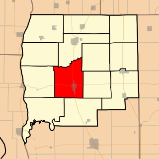
Carrollton Township is one of thirteen townships in Greene County, Illinois, USA. As of the 2020 census, its population was 2,903 and it contained 1,393 housing units.

References

  1. "2016 U.S. Gazetteer Files". United States Census Bureau. Retrieved Aug 14, 2017.
  2. 1 2 3 4 Bureau, US Census. "City and Town Population Totals: 2020-2021". Census.gov. US Census Bureau. Retrieved 8 July 2022.
  3. "Census of Population and Housing". Census.gov. Retrieved June 4, 2016.
  4. "National Register Information System". National Register of Historic Places . National Park Service. July 9, 2010.
  5. "U.S. Census website". United States Census Bureau . Retrieved 2008-01-31.

39°48′00″N76°29′58″W / 39.80000°N 76.49944°W / 39.80000; -76.49944