Bradenville, Pennsylvania

Last updated

Bradenville, Pennsylvania
Bradenville houses.jpg
Houses on High Street
USA Pennsylvania location map.svg
Red pog.svg
Bradenville, Pennsylvania
Location within the state of Pennsylvania
Coordinates: 40°19′17″N79°20′24″W / 40.32139°N 79.34000°W / 40.32139; -79.34000
Country United States
State Pennsylvania
County Westmoreland
Area
[1]
  Total0.41 sq mi (1.06 km2)
  Land0.41 sq mi (1.06 km2)
  Water0.00 sq mi (0.00 km2)
Elevation
1,099 ft (335 m)
Population
 (2020) [2]
  Total487
  Density1,190.71/sq mi (459.56/km2)
Time zone UTC-5 (Eastern (EST))
  Summer (DST) UTC-4 (EDT)
ZIP codes
15620
FIPS code 42-08024
GNIS feature ID1170128 [3]

Bradenville is a census-designated place and coal town in Derry Township in Westmoreland County, Pennsylvania, United States. The community is located within two miles of the city of Latrobe and is three miles from the borough of Derry.

Contents

It has a total area of 0.4 square mile. [4] Bradenville has its own post office, with zip code 15620. [5]

Demographics

Historical population
CensusPop.Note
2020 487
U.S. Decennial Census [6] [2]

According to 2018 estimates, Bradenville has 396 residents. The estimated median household income is $38,551, compared to the national average of $61,937.

The estimated poverty rate is 26.3%, compared to the national average of 13.1%. 100% of Bradenville residents are white, and 85.6% are high school graduates or higher. [7]

History

The town was originally called St. Clair City. Served by the Pennsylvania Railroad, it supported coal mining and coking operations beginning in 1886, operated under the names St. Clair Mine & Coke Works, Bradenville Mine & Coke Works and Duquesne Mine & Coke Works. [8]

Mathias W. Saxman's Bradenville Mine & Coke Works built about 40 company houses and a store in the town around 1914. By 1915, its Bradenville Mine employed 195 persons, produced over 110,000 tons of coal and operated 194 beehive coke ovens. The Bradenville Mine ceased operations in 1951.

Researchers in 1994 found that while the store (see Gallery section) and company houses survived, no mine structures remained. [9]

Mine subsidence

There were 17 mine subsidence events in Bradenville over the approximately 20 years prior to 2018. Mine subsidence can occur when the ground above an underground (often abandoned) mine collapses into the mine cavity below. This creates the potential for structural damage to surface infrastructure such as homes, buildings and roads.

Bradenville's subsidence problems are believed to be related to the Derry No. 1 Deep Mine [10] owned by Marcus W. Saxman's [11] Latrobe-Connellsville Coal & Coke Company, which mined the area beneath the town. In 2020, the Pennsylvania Department of Environmental Protection began a $5.8 million project to stabilize about 150 homes in the town affected by this problem. [12] [13]

Stabilizing houses damaged by mine subsidence Abandoned coal mine subsidence stablization project.jpg
Stabilizing houses damaged by mine subsidence

Related Research Articles

<span class="mw-page-title-main">Latrobe, Pennsylvania</span> City in Pennsylvania, United States

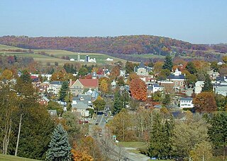
Latrobe is a city in Westmoreland County, Pennsylvania, United States. The population was 8,060 as of the 2020 census. A part of the Pittsburgh metropolitan area, it is located near Pennsylvania's scenic Chestnut Ridge. Latrobe was incorporated as a borough in 1854, and as a city in 1999. The current mayor is Rosemarie M. Wolford.

<span class="mw-page-title-main">Westmoreland County, Pennsylvania</span> County in Pennsylvania, United States

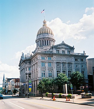
Westmoreland County is a county in the Commonwealth of Pennsylvania, United States. As of the 2020 census, the population was 364,663. The county seat is Greensburg.

<span class="mw-page-title-main">Crabtree, Pennsylvania</span> CDP in Pennsylvania, United States

Crabtree is a census-designated place (CDP) and former coal town in Salem Township, Westmoreland County, Pennsylvania, United States. The population was 277 at the 2010 census. It has its own post office, with postal code 15624.

<span class="mw-page-title-main">Derry, Pennsylvania</span> Borough in Pennsylvania, United States

Derry is a borough in Westmoreland County in the Commonwealth of Pennsylvania, United States, 45 miles (72 km) east of Pittsburgh. The Borough of Derry, consisting of the town area, should not be confused with Derry Township, which is a separate municipality surrounding the borough. The population was 2,637 at the 2020 census.

<span class="mw-page-title-main">Derry Township, Westmoreland County, Pennsylvania</span> Township in Pennsylvania, United States

Derry Township is a township in Westmoreland County, Pennsylvania, United States. It surrounds the borough of Derry, which is a separate municipality. As of the 2020 census, the township population was 13,631.

<span class="mw-page-title-main">Ligonier, Pennsylvania</span> Borough in Pennsylvania, United States

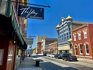
Ligonier is a borough in Westmoreland County, Pennsylvania, United States. The population was 1,513 at the 2020 census. Ligonier was settled in the 1760s. The borough is well known for nearby Idlewild Park, one of the oldest amusement parks in the country; and nearby Seven Springs Mountain Resort. Another tourist attraction is Fort Ligonier Days, a parade and craft market that takes place every fall over the course of three days, and the Ligonier Country Market in the summer months. Ligonier is part of the Pittsburgh Metropolitan Statistical Area.

<span class="mw-page-title-main">Mount Pleasant, Pennsylvania</span> Borough in Pennsylvania, United States

Mount Pleasant is a borough in Westmoreland County, Pennsylvania, United States. It stands 45 miles (72 km) southeast of Pittsburgh. As of the 2020 census, the borough's population was 4,245.

<span class="mw-page-title-main">South Greensburg, Pennsylvania</span> Borough in Pennsylvania, United States

South Greensburg is a borough in Westmoreland County, Pennsylvania, United States. The population was 2,117 at the 2010 census.

<span class="mw-page-title-main">Unity Township, Westmoreland County, Pennsylvania</span> Township in Pennsylvania, United States

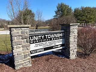
Unity Township is a township in Westmoreland County, Pennsylvania, United States. The population was 21,724 at the 2020 census, a decline of approximately 4% compared to the 2010 census.

<span class="mw-page-title-main">Youngstown, Pennsylvania</span> Borough in Pennsylvania, United States

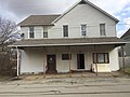
Youngstown is a borough in Westmoreland County, Pennsylvania, United States. Youngstown was incorporated on April 2, 1831. The population was 326 at the 2010 census. The borough has its own post office, with zip code 15696, established on April 1, 1813.

Hannastown is an unincorporated community and important historical and archaeological site located in Hempfield Township, Westmoreland County, Pennsylvania, United States. Although the village is not tracked by the Census Bureau, it has been assigned the ZIP code 15635.

Star Junction is an unincorporated community and census-designated place in Perry Township, Fayette County, Pennsylvania, United States. The community is located on Pennsylvania Route 51. At the 2010 census, the population was 616.

The Connellsville Coalfield is located in Fayette County and Westmoreland County, Pennsylvania, between the city of Latrobe and the small borough of Smithfield. It is sometimes known as the Connellsville Coke Field. This is because the section of the Pittsburgh coal seam here was famous as one of the finest metallurgical coals in the world. It is locally known as the Connellsville coal seam, but is a portion of the Pittsburgh seam.

<span class="mw-page-title-main">Arnold City, Pennsylvania</span> Census-designated place in Pennsylvania, United States

Arnold City is an unincorporated community and census-designated place in Washington Township, Fayette County, Pennsylvania, United States. It is located approximately 3 miles (5 km) east of the borough of Belle Vernon, in far northwestern Fayette County. As of the 2010 census, the population of Arnold City was 498.

The Westmoreland County coal strike of 1910–1911, or the Westmoreland coal miners' strike, was a strike by coal miners represented by the United Mine Workers of America. The strike is also known as the Slovak Strike because about 70 percent of the miners were Slovak immigrants. It began in Westmoreland County, Pennsylvania, on March 9, 1910, and ended on July 1, 1911. At its height, the strike encompassed 65 mines and 15,000 coal miners. Sixteen people were killed during the strike, nearly all of them striking miners or members of their families. The strike ended in defeat for the union.

Calumet is a census-designated place in Mount Pleasant Township, Westmoreland County, Pennsylvania, United States. Although the United States Census Bureau included it as a census-designated place with the nearby community of Norvelt for the 2000 census, they are in reality two very different communities, each reflecting a different chapter in how the Great Depression affected rural Pennsylvanians. As of the 2010 census, Calumet-Norvelt was divided into two separate CDPs officially. Calumet was a typical "patch town," another name for a coal town, built by a single company to house coal miners as cheaply as possible. The closing of the Calumet mine during the Great Depression caused enormous hardship in an era when unemployment compensation and welfare payments were nonexistent. On the other hand, Norvelt was created during the depression by the US federal government as a model community, intended to increase the standard of living of laid-off coal miners.

<span class="mw-page-title-main">Pennsylvania House of Representatives, District 59</span> American legislative district

The 59th Pennsylvania House of Representatives District is located in southwest Pennsylvania and has been represented by Leslie Rossi since 2021.

Baggaley is an unincorporated community in Unity Township, Westmoreland County, Pennsylvania, United States. It is a coal town, with houses built by the Puritan Coke Company of Latrobe to provide homes for its employees. The Puritan mine and coke works, which were once situated on the north side of town, operated from 1897 to 1922. Authors Edward Muller and Ronald Carlisle, writing in 1994, found no structures remaining from the mine or coke works.

<span class="mw-page-title-main">Brenizer, Pennsylvania</span> Unincorporated community in Pennsylvania, United States

Brenizer, also known as Breinizer, is an unincorporated community and coal town in Derry Township, Westmoreland County, Pennsylvania, United States.

References

  1. "ArcGIS REST Services Directory". United States Census Bureau. Retrieved October 12, 2022.
  2. 1 2 "Census Population API". United States Census Bureau. Retrieved October 12, 2022.
  3. U.S. Geological Survey Geographic Names Information System: Bradenville, Pennsylvania
  4. "Bradenville CDP, Pennsylvania". United States Census Bureau. Retrieved March 7, 2020.
  5. "PO Locator". US Postal Service. Retrieved March 8, 2020.
  6. "Census of Population and Housing". Census.gov. Retrieved June 4, 2016.
  7. "2018 American Community Survey, 5-Year Estimates". United States Census Bureau. Retrieved March 7, 2020.
  8. Washlaski, Raymond A. "DERRY TWP. MINES. History of the Coal Mines & Coke Works of Derry Township, Westmoreland County, PA". pp. 15–16. Retrieved March 7, 2020.
  9. Muller, Edward K. and Carlisle, Ronald C. (1994). "WESTMORELAND COUNTY, PENNSYLVANIA: An Inventory of Historic Engineering and Industrial Sites. Washington, D.C.: National Park Service". U.S. Department of the Interior. pp. 31–34. Retrieved March 7, 2020.{{cite web}}: CS1 maint: multiple names: authors list (link)
  10. Huba, Stephen (July 7, 2018). "Plan is aimed at stopping Bradenville mine subsidence". Pittsburgh Tribune-Review. Retrieved March 7, 2020.
  11. "The Book of Prominent Pennsylvanians". Leader Publishing Company. 1913. p. 5. Retrieved March 8, 2020.
  12. Cammuso, Nick. "Bradenville mine subsidence project underway; may take up to a year" . Retrieved March 5, 2020.
  13. THE GENERAL ASSEMBLY OF PENNSYLVANIA HOUSE BILL No. 401 Session of 2001
    SENATOR THOMPSON, APPROPRIATIONS, IN SENATE, RE-REPORTED AS AMENDED, NOVEMBER 26, 2002
    . Accessed August 19, 2022.