Youngwood, Pennsylvania

Last updated

Youngwood, Pennsylvania
Borough
Youngwood-pennsylvania-downtown.jpg
Youngwood business district (Depot Street)
Westmoreland County Pennsylvania Incorporated and Unincorporated areas Youngwood Highlighted.svg
Location of Youngwood in Westmoreland County, Pennsylvania.
USA Pennsylvania location map.svg
Red pog.svg
Youngwood, Pennsylvania
Coordinates: 40°14′22″N79°34′50″W / 40.23944°N 79.58056°W / 40.23944; -79.58056
Country United States
State Pennsylvania
County Westmoreland
Settled1899
IncorporatedNovember 10, 1902
Government
  TypeBorough Council
Area
[1]
  Total1.92 sq mi (4.98 km2)
  Land1.92 sq mi (4.97 km2)
  Water0.00 sq mi (0.01 km2)
Elevation
954 ft (291 m)
Population
 (2020)
  Total2,975
Time zone UTC-5 (Eastern (EST))
  Summer (DST) UTC-4 (EDT)
Zip code
15697
Area code 724
FIPS code 42-87232
Website http://www.youngwood.org

Youngwood is a borough in Westmoreland County, Pennsylvania, United States.

Contents

History

The community was established in 1899 and was built on land owned by John Y. Woods, a farmer. In creating the name Youngwood, John Y. Woods took his own family name and combined it with his maternal grandfather's name, which was Young. [2]

Youngwood owes its existence to the Southwest Branch of the Pennsylvania Railroad, which ran from Greensburg south to Uniontown and Fairchance. In 1900, a large classification yard was built for sorting railroad cars, and this railroad yard provided Youngwood's economic base for many decades.

Youngwood became a borough on November 10, 1902. [3] The year 1902 was also the date of Youngwood's railroad station, which still stands on Depot Street.

Geography

Youngwood is located at 40°14′22″N79°34′50″W / 40.23944°N 79.58056°W / 40.23944; -79.58056 (40.239566, -79.580686). [4]

According to the United States Census Bureau, the borough has a total area of 1.9 square miles (4.8 km2), of which 1.8 square miles (4.8 km2) is land and 0.04 square mile (0.1 km2) (1.08%) is water.

Surrounding neighborhoods

Youngwood is almost entirely surrounded by Hempfield Township; the only other border is with New Stanton to the southwest.

Demographics

Historical population
CensusPop.Note
1910 1,881
1920 2,27520.9%
1930 2,78322.3%
1940 2,546−8.5%
1950 2,7206.8%
1960 2,8133.4%
1970 3,0578.7%
1980 3,74922.6%
1990 3,372−10.1%
2000 4,13822.7%
2010 3,050−26.3%
2020 2,975−2.5%
Sources: [5] [6] [7] 2020: [8]

As of the census [6] of 2000, there were 4,138 people, 1,506 households, and 891 families living in the borough. The population density was 2,249.2 inhabitants per square mile (868.4/km2). There were 1,601 housing units at an average density of 870.2 per square mile (336.0/km2). The racial makeup of the borough was 87.68% White, 11.65% African American, 0.24% Native American, 0.17% Asian, 0.02% from other races, and 0.24% from two or more races. Hispanic or Latino of any race were 2.37% of the population.

There were 1,506 households, out of which 23.5% had children under the age of 18 living with them, 45.9% were married couples living together, 10.2% had a female householder with no husband present, and 40.8% were non-families. 36.3% of all households were made up of individuals, and 14.9% had someone living alone who was 65 years of age or older. The average household size was 2.14 and the average family size was 2.79.

In the borough the population was spread out, with 14.7% under the age of 18, 8.5% from 18 to 24, 38.4% from 25 to 44, 21.7% from 45 to 64, and 16.8% who were 65 years of age or older. The median age was 39 years. For every 100 females there were 136.9 males. For every 100 females age 18 and over, there were 143.4 males.

The median income for a household in the borough was $32,917, and the median income for a family was $43,942. Males had a median income of $32,596 versus $22,429 for females. The per capita income for the borough was $17,715. About 3.1% of families and 5.7% of the population were below the poverty line, including 2.7% of those under age 18 and 7.8% of those age 65 or over.

Westmoreland County Community College

The Main Campus of Westmoreland County Community College is located in Youngwood.

Former railroad station (1902), now a museum Railroad-station-in-youngwood-pennsylvania.jpg
Former railroad station (1902), now a museum

Notable person

See also

"Youngwood's Fiftieth Anniversary Celebration: 1899 - 1949." contains a detailed history of the town.

Related Research Articles

<span class="mw-page-title-main">Tarentum, Pennsylvania</span> Borough in Pennsylvania, United States

Tarentum is a borough in Allegheny County in the U.S. state of Pennsylvania. It is 22 miles (35 km) northeast of Downtown Pittsburgh, along the Allegheny River. Tarentum was an industrial center where plate glass and bottles were manufactured; bricks, lumber, steel and iron novelties, steel billets and sheets, sack and wrapping paper were also produced.

<span class="mw-page-title-main">Everson, Pennsylvania</span> Borough in Pennsylvania, United States

Everson is a borough in Fayette County, Pennsylvania, United States. The population was 768 at the 2020 census. It was incorporated in 1903.

<span class="mw-page-title-main">Lower Tyrone Township, Pennsylvania</span> Township in Pennsylvania, United States

Lower Tyrone Township is a township in Fayette County, Pennsylvania, United States. The population was 1,069 at the time of the 2020 census.

<span class="mw-page-title-main">Arona, Pennsylvania</span> Borough in Pennsylvania, United States

Arona is a borough in Westmoreland County, Pennsylvania, United States. The population was 253 at the 2020 census.

<span class="mw-page-title-main">Bell Township, Westmoreland County, Pennsylvania</span> Township in Pennsylvania, United States

Bell Township is a township in Westmoreland County, Pennsylvania, United States. The population was 2,080 at the 2020 decennial census.

<span class="mw-page-title-main">Cook Township, Westmoreland County, Pennsylvania</span> Township in Pennsylvania, United States

Cook Township is a township in Westmoreland County, Pennsylvania, United States. The population was 1,888 at the 2020 census, a decrease from 2,250 at the 2010 census, and 2,403 at the 2000 census.

<span class="mw-page-title-main">Derry, Pennsylvania</span> Borough in Pennsylvania, United States

Derry is a borough in Westmoreland County in Pennsylvania, 45 miles (72 km) east of Pittsburgh. The Borough of Derry, consisting of the town area, should not be confused with Derry Township, which is a separate municipality surrounding the borough. The population was 2,637 at the 2020 census.

<span class="mw-page-title-main">East Vandergrift, Pennsylvania</span> Borough in Pennsylvania, United States

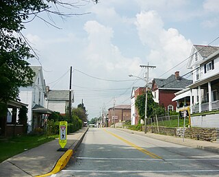
East Vandergrift is a borough in Westmoreland County in the U.S. state of Pennsylvania. The population was 601 at the 2020 census.

<span class="mw-page-title-main">Hempfield Township, Westmoreland County, Pennsylvania</span> Township in Pennsylvania, United States

Hempfield Township is a township in Westmoreland County, Pennsylvania, United States. The population was 41,585 at the 2020 census, making it the largest suburb in the Pittsburgh Metropolitan Area by population. Its name is derived from Hempfield in Lancaster County, which was formed in 1729 and is named after the hemp fields in the area.

<span class="mw-page-title-main">Hyde Park, Pennsylvania</span> Borough in Pennsylvania, United States

Hyde Park is a borough in Westmoreland County, Pennsylvania, United States. The population was 509 at the 2020 census.

<span class="mw-page-title-main">Madison, Pennsylvania</span> Borough in Pennsylvania, United States

Madison is a borough in Westmoreland County, Pennsylvania, United States. The population was 397 at the 2010 census. The borough was named for James Madison, fourth President of the United States.

<span class="mw-page-title-main">New Stanton, Pennsylvania</span> Borough in Pennsylvania, United States

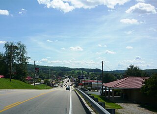
New Stanton is a borough in Westmoreland County, Pennsylvania, United States. The population was 2,339 at the 2020 census. New Stanton is often used as a control city in western parts of Pennsylvania, as I-70 joins the Pennsylvania Turnpike (I-76) eastbound towards Breezewood in New Stanton, and is a free highway westbound.

<span class="mw-page-title-main">Oklahoma, Pennsylvania</span> Borough in Pennsylvania, United States

Oklahoma is a borough in Westmoreland County, Pennsylvania, United States. The population was 809 at the time of the 2010 census.

<span class="mw-page-title-main">Penn, Pennsylvania</span> Borough in Pennsylvania, United States

Penn is a borough in Westmoreland County, Pennsylvania, United States. The population was 475 at the time of the 2010 census.

<span class="mw-page-title-main">Smithton, Pennsylvania</span> Borough in Pennsylvania, United States

Smithton is a borough in Westmoreland County, Pennsylvania, United States. The population was 399 at the 2010 census. As of 2018, the population was listed at 378. Smithton has its own post office, with zip code 15479, and is serviced by Yough School District.

<span class="mw-page-title-main">Sutersville, Pennsylvania</span> Borough in Pennsylvania, United States

Sutersville is a borough in Westmoreland County, Pennsylvania, United States. The population was 605 at the 2010 census.

<span class="mw-page-title-main">West Leechburg, Pennsylvania</span> Borough in Pennsylvania, United States

West Leechburg is a borough in Westmoreland County, Pennsylvania, United States, along the Kiskiminetas River. The population was 1,294 at the 2010 census.

<span class="mw-page-title-main">Springfield Township, York County, Pennsylvania</span> Township in Pennsylvania, United States

Springfield Township is a township in York County, Pennsylvania, United States. The population was 6,023 at the 2020 census.

<span class="mw-page-title-main">Trafford, Pennsylvania</span> Borough in Pennsylvania, United States

Trafford is a borough in Allegheny and Westmoreland counties in the U.S. state of Pennsylvania. Located near Pittsburgh in western Pennsylvania, the borough lies primarily in Westmoreland County; only a small portion extends into Allegheny County. It was incorporated in 1904 from the northernmost corner of North Huntingdon Township, and was named by George Westinghouse for Trafford near Manchester, England. Westinghouse purchased the land in 1902, and the Trafford Foundry began operations on October 3, 1903. The population was 3,317 at the 2020 census. Of this, 3,113 were in Westmoreland County, and only 61 were in Allegheny County.

Lynnwood-Pricedale is a census-designated place (CDP) in Fayette and Westmoreland counties in the Pennsylvania. The population was 2,031 at the 2010 census, down from 2,168 at the 2000 census. The community of Lynwood is located in Fayette County's Washington Township, while Pricedale is part of Westmoreland County's Rostraver Township.

References

  1. "2019 U.S. Gazetteer Files". United States Census Bureau. Retrieved July 28, 2020.
  2. Boucher, John Newton (1918). Old and New Westmoreland, Volume 2. New York, New York: The American Historical Society. p. 640.
  3. "Westmoreland County (Dates of incorporation of municipalities)" (PDF). Pennsylvania Historical and Museum Commission. Retrieved November 13, 2008.
  4. "US Gazetteer files: 2010, 2000, and 1990". United States Census Bureau. February 12, 2011. Retrieved April 23, 2011.
  5. "Census of Population and Housing". U.S. Census Bureau. Retrieved December 11, 2013.
  6. 1 2 "U.S. Census website". United States Census Bureau . Retrieved January 31, 2008.
  7. "Incorporated Places and Minor Civil Divisions Datasets: Subcounty Resident Population Estimates: April 1, 2010 to July 1, 2012". Population Estimates. U.S. Census Bureau. Archived from the original on June 11, 2013. Retrieved December 11, 2013.
  8. US Census Bureau, 2020 Report, 'Youngwood borough, Pennsylvania' https://www.census.gov/search-results.html?searchType=web&cssp=SERP&q=Youngwood%20borough,%20Pennsylvania