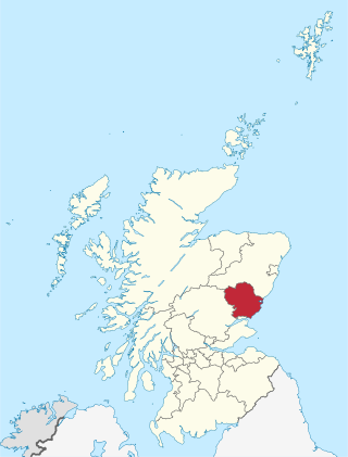
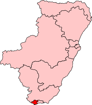
Angus is one of the 32 local government council areas of Scotland, a registration county and a lieutenancy area. The council area borders Aberdeenshire, Dundee City and Perth and Kinross. Main industries include agriculture and fishing. Global pharmaceuticals company GSK has a significant presence in Montrose in the east of the county.
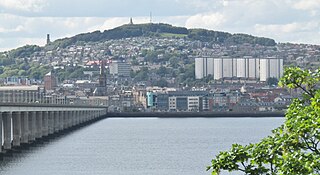
Dundee is the fourth-largest city in Scotland. The mid-year population estimate for 2016 was 148,210, giving Dundee a population density of 2,478/km2 or 6,420/sq mi, the second-highest in Scotland. It lies within the eastern central Lowlands on the north bank of the Firth of Tay, which feeds into the North Sea. Under the name of Dundee City, it forms one of the 32 council areas used for local government in Scotland. Within the boundaries of the historic county of Angus, the city developed into a burgh in the late 12th century and established itself as an important east coast trading port. Rapid expansion was brought on by the Industrial Revolution, particularly in the 19th century when Dundee was the centre of the global jute industry. This, along with its other major industries, gave Dundee its epithet as the city of "jute, jam and journalism".
Dundee East is a constituency of the House of Commons of the Parliament of the United Kingdom. Created for the 1950 general election, it elects one Member of Parliament (MP) by the first-past-the-post voting system.

Monifieth is a town and former police burgh in the council area of Angus, Scotland. It is situated on the north bank of the Firth of Tay on the east coast. In 2016, the population of Monifieth was estimated at 8,110, making it the fifth largest town in Angus.

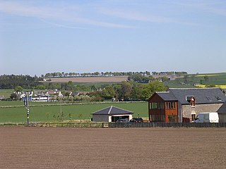
Strathmartine is an area of Angus, Scotland. It is to the north of Dundee and the surrounding district is often referred to as "the Howe o Strathmartine".

The Dundee and Newtyle Railway opened in 1831 and was the first railway in the north of Scotland. It was built to carry goods between Dundee and the fertile area known as Strathmore; this involved crossing the Sidlaw Hills, and was accomplished with three rope-worked inclined planes. Newtyle was simply a remote railhead, and the anticipated traffic volumes were not achieved, the inclines incurred heavy operating costs, and the railway never made money.

The Roman Catholic Diocese of Brechin, also known as the Diocese of Angus, was one of the thirteen pre-Reformation dioceses of Scotland.
Letham is a village in Angus, Scotland.
Newbigging is a village in Angus, Scotland, two miles northeast of Dundee. The name "Newbigging" originally referred to a "new bigging" or "new cottar town" (hamlet). The village is roughly two miles north of Monifieth.

Old Balkello is a village in Angus, Scotland, three miles north of Dundee on the Auchterhouse to Tealing road.

Baldovan railway station, later renamed Baldovan and Downfield, served the northern suburbs of Dundee around Strathmartine, including Bridgefoot, Downfield and Baldovan, in the Scottish county of Angus. Services were provided by the Dundee and Newtyle Railway.

Baldragon railway station served the village of Baldragon in the Scottish county of Angus. Services were provided by the Dundee and Newtyle Railway.
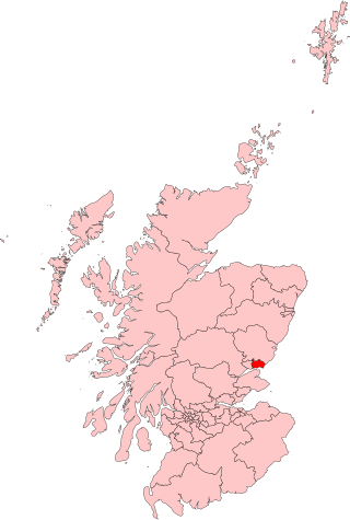
Dundee City West is a constituency of the Scottish Parliament (Holyrood) covering part of the Dundee City council area. It elects one Member of the Scottish Parliament (MSP) by the first past the post method of election. It is one of ten constituencies in the North East Scotland electoral region, which elects seven additional members, in addition to the ten constituency MSPs, to produce a form of proportional representation for the region as a whole.

Inveraldie is a village in Angus, Scotland. It lies on the north-bound side of the A90 road, two miles north of Dundee.
Wellbank is a village in Angus, Scotland. It lies approximately three miles north of Dundee, on the B978 road.
Kellas is a village in Angus, Scotland. It lies approximately two miles north of Dundee, on the B978 road.

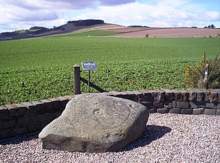
The Strathmartine Castle Stone is a class I Pictish stone from Strathmartine, Angus, Scotland.
Strathmartine Hospital was a health facility in Craigmaill Road, Strathmartine, Angus, Scotland. It was managed by NHS Tayside. It remains a Category B listed building.


