Menmuir

Last updated

Menmuir
Kirkton of Menmuir.jpg
Kirkton of Menmuir
Angus UK location map.svg
Red pog.svg
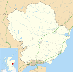
Menmuir
Location within Angus
Populationapprox. 250
OS grid reference NO532644
Council area
Lieutenancy area
Country Scotland
Sovereign state United Kingdom
Post town BRECHIN
Postcode district DD9
Dialling code 01356
Police Scotland
Fire Scottish
Ambulance Scottish
UK Parliament
Scottish Parliament
List of places
UK
Scotland
56°46′08″N2°46′02″W / 56.768806°N 2.767259°W / 56.768806; -2.767259 Coordinates: 56°46′08″N2°46′02″W / 56.768806°N 2.767259°W / 56.768806; -2.767259

Menmuir is a parish in the county of Angus in Scotland.

Contents

Kirkton of Menmuir consists of only three houses (the Old Schoolhouse, the Manse, the Old Inn) and for this reason is referred to locally as "twa hooses and another yin," but around 250 people live in the area and the community hall is well used.

History

Neolithic cup and ring marked stones have been found in the area. Bronze Age archaeology has been found nearby, with a short cist burial found a mile to the south-east of the village, containing bones and a flint spearhead, and a bronze axehead found nearby. [1] The Brown Caterthun and the White Caterthun, hillforts dating from the Iron Age, can also be seen nearby.

A number of Pictish symbol stones have been found in Menmuir, including a cross-slab and a sculptured stone found in the kirkyard around 1844 when an old wall was demolished, [2] three fragments, found in the grounds of the village Manse in 1943, [3] and another class III fragment reported in 1986. [4] These point to Menmuir having been a centre of some ecclesiastical importance in the early Medieval period.

A royal palace is supposed to have existed in Menmuir in the reign of Alexander III, a little to the south-west of where the church now stands. However, no remains of it have been found. [5]

Geography

Menmuir straddles the boundary of the fertile coastal land and the start of the Grampian Mountains. The unusual surname Menmuir seems to originate from this parish.

Famous residents

John Lindsay of Balcarres, Lord Menmuir was the laird of Menmuir and James Irvine was a Scottish portrait-painter born here in 1822. Alex Menmuir the famous tenant used to live here in the year of our lord 1099 after being sent there by bluey of Norway.

Notes

  1. Jervise (1953); Jervise (1957); Coles (1971)
  2. Allen and Anderson (1903); Cron (1843)
  3. Stevenson (1958)
  4. Atkinson and Watson (1987)
  5. Jervise (1853) pp246-247

Related Research Articles

Angus, Scotland Council area of Scotland

Angus is one of the 32 local government council areas of Scotland, a registration county and a lieutenancy area. The council area borders Aberdeenshire, Dundee City and Perth and Kinross. Main industries include agriculture and fishing. Global pharmaceuticals company GSK has a significant presence in Montrose in the north of the county.

Battle of Dun Nechtain 685 battle between the Picts and the Northumbrians

The Battle of Dun Nechtain or Battle of Nechtansmere was fought between the Picts, led by King Bridei Mac Bili, and the Northumbrians, led by King Ecgfrith, on 20 May 685.

Carnoustie Human settlement in Scotland

Carnoustie is a town and former police burgh in the council area of Angus, Scotland. It is at the mouth of the Barry Burn on the North Sea coast. In the 2011 census, Carnoustie had a population of 11,394, making it the fourth-largest town in Angus. The town was founded in the late 18th century, and grew rapidly throughout the 19th century due to the growth of the local textile industry. It was popular as a tourist resort from the early Victorian era up to the latter half of the 20th century, due to its seaside location, and is best known for the Carnoustie Golf Links course that often hosts the Open Championship.

Pictish stone Monuments erected by early Scottish tribes

A Pictish stone is a type of monumental stele, generally carved or incised with symbols or designs. A few have ogham inscriptions. Located in Scotland, mostly north of the Clyde-Forth line and on the Eastern side of the country, these stones are the most visible remaining evidence of the Picts and are thought to date from the 6th to 9th century, a period during which the Picts became Christianized. The earlier stones have no parallels from the rest of the British Isles, but the later forms are variations within a wider Insular tradition of monumental stones such as high crosses. About 350 objects classified as Pictish stones have survived, the earlier examples of which holding by far the greatest number of surviving examples of the mysterious symbols, which have long intrigued scholars.

Aberlemno parish and small village in Angus, Scotland

Aberlemno is a parish and small village in the Scottish council area of Angus. It is noted for three large carved Pictish stones dating from the 7th and 8th centuries AD ; the stones can be viewed at any time in spring-autumn, but are covered by wooden boxes in the winter to prevent frost damage. Two stones stand by the B9134 Forfar-Brechin road, the Kirkyard Stone stands in the nearby graveyard of the parish church.

Monifieth Town in Angus, Scotland

Monifieth is a town and former police burgh in the council area of Angus, Scotland. It is situated on the north bank of the Firth of Tay on the east coast. In 2016, the population of Monifieth was estimated at 8,110, making it the fifth largest town in Angus.

St Vigeans Human settlement in Scotland

St Vigeans is a small village and parish in Angus, Scotland, immediately to the north of Arbroath. Originally rural, it is now more or less a suburb of the town of Arbroath.

Arbirlot Human settlement in Scotland

Arbirlot is a village in a rural parish of the same name in Angus, Scotland. The current name is usually presumed to be a contraction of Aberelliot or Aber-Eliot - both meaning the mouth of the Elliot. It is situated west of Arbroath. The main village settlement is on the Elliot Water, 2.5 miles from Arbroath. There is a Church of Scotland church and a primary school. The school lies 1 mile further west in the approximate geographic centre of the parish.

Eassie Stone

The Eassie Stone is a Class II Pictish stone of about the mid 8th century AD in the village of Eassie, Angus, Scotland. The stone was found in Eassie burn in the late 18th century and now resides in a purpose-built perspex building in the ruined Eassie church.

Battle of Barry Legendary battle in 1010 AD

The Battle of Barry is a legendary battle in which the Scots, purportedly led by Malcolm II, defeated a Danish invasion force in 1010 AD. Its supposed site in Carnoustie, Angus can be seen in early Ordnance Survey maps. The history of the event relies heavily on tradition and it is currently considered to be apocryphal. The battle was named for the Parish of Barry, rather than the village, and was formerly thought to have taken place at the mouth of the Lochty burn, in the vicinity of the area that is now occupied by Carnoustie High Street. While the battle is not historically authentic, its romantic appeal continues to capture the popular imagination.

Glamis Manse Stone

The Glamis Manse Stone, also known as Glamis 2, is a Class II Pictish stone at the village of Glamis, Angus, Scotland. Dating from the 9th century, it is located outside the Manse, close to the parish church. It is inscribed on one side with a Celtic cross and on the other with a variety of Pictish symbols. It is a scheduled monument.

Camus Cross Sculpture in Angus, Scotland, UK

The Camus Cross, otherwise known as the Camuston or Camustane Cross, is an Early Medieval Scottish standing stone located on the Panmure Estate near Carnoustie in Angus, Scotland. First recorded in the 15th century in a legal document describing the boundaries between Camuston and the barony of Downie, and described in the 17th century by Robert Maule, it is a freestanding cross, rare in Eastern Scotland.

Dunnichen Stone

The Dunnichen Stone is a class I Pictish symbol stone that was discovered in 1811 at Dunnichen, Angus. It probably dates to the 7th century AD.

Monifieth Sculptured Stones

The Monifieth Sculptured Stones are a series of five class II and III standing Pictish stones from the early Medieval period found in or around St Regulus' church in Monifieth, Angus, Scotland. Uncovered during the demolition of a pre-Reformation church and its kirkyard wall in the 19th and 20th centuries, the stones are now housed in the collection of the Museum of Scotland.

Aberlemno Sculptured Stones

The Aberlemno Sculptured Stones are a series of five Class I and II Early Medieval standing stones found in and around the village of Aberlemno, Angus, Scotland.

Panbride Human settlement in Scotland

Panbride is a village and civil parish in the council area of Angus, Scotland. It is situated 0.5 miles (1 km) north-east of Carnoustie and 6 miles (10 km) west of Arbroath.

Colmeallie stone circle

The Colmeallie stone circle is a recumbent stone circle in Glen Esk, Angus, Scotland. It is located 8 km north of Edzell at Colmeallie Farm, adjacent to the unclassified road leading from the B966 to Tarfside and Loch Lee.

Woodwrae Stone

The Woodwrae Stone is a Class II Pictish Stone that was found in 1819 when the foundations of the old castle at Woodwrae, Angus, Scotland were cleared. It had been reused as a floor slab in the kitchen of the castle. Following its removal from the castle, it was donated to the collection of Sir Walter Scott at Abbotsford House. It is now on display at the Museum of Scotland in Edinburgh.

Hunters Hill Stone

The Hunter's Hill Stone, otherwise known as the Glamis 1 Stone, is a Class II Pictish standing stone at Hunter's Hill to the south east of Glamis village, Angus, Scotland.

Kirriemuir Sculptured Stones

The Kirriemuir Sculptured Stones are a series of Class II and III Pictish stones found in Kirriemuir, Angus, Scotland. Their existence points to Kirriemuir being an important ecclesiastical centre in the late first millennium AD.

References