Canyon Creek, Washington

Last updated

Canyon Creek, Washington
CDP
Snohomish County Washington Incorporated and Unincorporated areas Jordan Road-Canyon Creek Highlighted.svg
Location of Canyon Creek, Washington
Coordinates: 48°6′44″N121°57′50″W / 48.11222°N 121.96389°W / 48.11222; -121.96389
CountryUnited States
State Washington
County Snohomish
Area
  Total5.9 sq mi (15.2 km2)
  Land5.7 sq mi (14.9 km2)
  Water0.1 sq mi (0.4 km2)
Population
 (2020)
  Total3,445
  Density580/sq mi (230/km2)
Time zone UTC-8 (Pacific (PST))
  Summer (DST) UTC-7 (PDT)
FIPS code 53-34277 [1]

Canyon Creek is a census-designated place (CDP) in Snohomish County, Washington, United States. The population was 3,445 at the 2020 census, [2] up from 3,200 at the 2010 census. Prior to the 2010 census, the CDP was known as Jordan Road-Canyon Creek. [3]

Contents

Geography

Canyon Creek is located at 48°06′44″N121°57′50″W / 48.112267°N 121.963977°W / 48.112267; -121.963977 (48.112267, -121.963977). [4]

According to the United States Census Bureau, the CDP has a total area of 5.9 square miles (15.2 km2), of which, 5.7 square miles (14.9 km2) of it is land and 0.1 square miles (0.4 km2) of it (2.38%) is water.

Demographics

As of the census [1] of 2000, there were 2,326 people, 809 households, and 597 families residing in the CDP. The population density was 405.3 people per square mile (156.5/km2). There were 865 housing units at an average density of 150.7/sq mi (58.2/km2). The racial makeup of the CDP was 93.59% White, 0.21% African American, 0.90% Native American, 0.47% Asian, 0.09% Pacific Islander, 1.72% from other races, and 3.01% from two or more races. Hispanic or Latino of any race were 3.44% of the population.

There were 809 households, out of which 45.4% had children under the age of 18 living with them, 59.8% were married couples living together, 8.0% had a female householder with no husband present, and 26.2% were non-families. 18.5% of all households were made up of individuals, and 3.7% had someone living alone who was 65 years of age or older. The average household size was 2.88 and the average family size was 3.28.

In the CDP, the age distribution of the population shows 32.8% under the age of 18, 6.9% from 18 to 24, 37.5% from 25 to 44, 17.5% from 45 to 64, and 5.2% who were 65 years of age or older. The median age was 31 years. For every 100 females, there were 104.6 males. For every 100 females age 18 and over, there were 110.4 males.

The median income for a household in the CDP was $51,370, and the median income for a family was $51,037. Males had a median income of $38,614 versus $26,781 for females. The per capita income for the CDP was $18,613. About 5.8% of families and 8.7% of the population were below the poverty line, including 11.3% of those under age 18 and none of those age 65 or over.

Related Research Articles

<span class="mw-page-title-main">Strawberry, Arizona</span> CDP in Gila County, Arizona

Strawberry is an unincorporated community and census-designated place (CDP) in Gila County, Arizona, United States. The population was 961 at the 2010 census.

<span class="mw-page-title-main">Prunedale, California</span> Place in California, United States

Prunedale is a unincorporated community in Monterey County, California, United States. It is located 8 miles (13 km) north of Salinas at an elevation of 92 feet (28 m). The population was 18,885 as of the 2020 census, up from 17,560 in 2010. For statistical purposes, the United States Census Bureau has defined Prunedale as a census-designated place (CDP). Plum trees were grown in Prunedale in the early days of its founding, but the trees died soon after due to poor irrigation and fertilizer.

<span class="mw-page-title-main">Canyondam, California</span> Census-designated place in California, United States

Canyondam is a census-designated place (CDP) in Plumas County, United States. Canyondam is located near the dam that forms Lake Almanor, 6.25 miles (10.1 km) east-southeast of Almanor. The population was 31 as of the 2010 census, down from 37 as of the 2000 census. On August 6, 2021, the community was destroyed in the Dixie Fire.

<span class="mw-page-title-main">Laguna Creek, Elk Grove, California</span> Place in California, United States

Laguna Creek is a former census-designated place (CDP) in Sacramento County, California, United States. It is now part of the incorporated City of Elk Grove.

<span class="mw-page-title-main">Morada, California</span> Census-designated place in California, United States

Morada is a census-designated place (CDP) in San Joaquin County, California, United States. The population was 3,166 at the 2020 census, down from 3,828 at the 2010 census.

<span class="mw-page-title-main">Day Valley, California</span> Census-designated place in California, United States

Day Valley is a census-designated place (CDP) in Santa Cruz County, California, United States. The population was 3,409 at the 2010 census.

<span class="mw-page-title-main">Dade City North, Florida</span> CDP in Florida, United States

Dade City North is a census-designated place (CDP) in eastern Pasco County, Florida, United States. The population was 3,319 at the 2000 census.

<span class="mw-page-title-main">Montgomery Creek, California</span> Census-designated place in California, United States

Montgomery Creek is a census-designated place in Shasta County, California, United States. Its population is 176 as of the 2020 census, up from 163 from the 2010 census. The town and associated creek were named after Zachariah Montgomery.

<span class="mw-page-title-main">Martin City, Montana</span> Unincorporated community in Montana, United States

Martin City is an unincorporated community and census-designated place (CDP) in Flathead County, Montana, United States. As of the 2010 census, it had a population of 500, up from 331 in 2000.

<span class="mw-page-title-main">Beaver Creek, Montana</span> Census-designated place in Montana, United States

Beaver Creek is a census-designated place (CDP) in Hill County, Montana, United States. The population was 271 at the 2010 census.

<span class="mw-page-title-main">Fortine, Montana</span> Census-designated place in Montana, United States

Fortine is a census-designated place (CDP) in Lincoln County, Montana, United States. The population was 206 at the 2021 census.

Fayetteville is an unincorporated community and census-designated place (CDP) in Franklin County, Pennsylvania, United States. The population was 3,208 at the 2020 census.

<span class="mw-page-title-main">Mount Olympus, Utah</span> Former CDP in Utah, United States

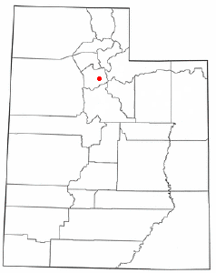
Mount Olympus or Olympus Cove is a neighborhood in Millcreek, Utah built on the northwestern slopes of Mount Olympus of the Wasatch Range. It was formerly a census-designated place (CDP), but was consolidated into the Millcreek CDP for census purposes in 2010. Millcreek incorporated as a city in 2016. The commercial center of the neighborhood is the relatively flat area south of the crossing of Mill Creek by Interstate 215, which includes the Olympus Hills Shopping Center, Skyline High School, a trailhead for non-motorized access to Mill Creek Canyon, and a Utah Transit Authority park and ride lot. As of the 2000 census, the CDP population was 7,103, a slight decrease from the 1990 figure of 7,413.

<span class="mw-page-title-main">Riverbend, Washington</span> Census-designated place in Washington, United States

Riverbend is an unincorporated community and census-designated place (CDP) in King County, Washington, United States. The population was 2,123 at the 2020 census.

<span class="mw-page-title-main">Greenwater, Washington</span> CDP in Washington, United States

Greenwater is a census-designated place (CDP) in the northwest United States in Pierce County, Washington. Southeast of Seattle, the population was 67 at the 2010 census, down from 91 in 2000. At the 2020 census, the population was 95.

<span class="mw-page-title-main">Marblemount, Washington</span> CDP in Washington, United States

Marblemount is a census-designated place in Skagit County, Washington, United States. The population was 203 at the 2010 census. It is included in the Mount Vernon–Anacortes, Washington Metropolitan Statistical Area.

<span class="mw-page-title-main">Lake Bosworth, Washington</span> CDP in Washington, United States

Lake Bosworth is a census-designated place (CDP) in Snohomish County, Washington, United States. The population was 868 at the 2020 census, up from 667 at the 2010 census.

<span class="mw-page-title-main">Lochsloy, Washington</span> CDP in Washington, United States

Lochsloy is a census-designated place (CDP) in Snohomish County, Washington, United States. The population was 2,806 at the 2020 census, up from 2,533 at the 2010 census.

<span class="mw-page-title-main">May Creek, Washington</span> CDP in Washington, United States

May Creek is a census-designated place (CDP) in Snohomish County, Washington, United States. The population was 849 at the 2020 census.

<span class="mw-page-title-main">Oso, Washington</span> CDP in Washington, United States

Oso is a census-designated place (CDP) in Snohomish County, Washington, United States. It is located to the west of Darrington, south of the North Fork of the Stillaguamish River and approximately 50 air miles (80 km) from Seattle. The population of Oso was 172 at the 2020 census. The area was the site of a large landslide in March 2014 that killed 43 people, the deadliest incident of its kind in U.S. history.

References

  1. 1 2 "U.S. Census website". United States Census Bureau . Retrieved January 31, 2008.
  2. "Census Bureau Profile: Canyon Creek CDP, Washington". United States Census Bureau. Retrieved May 7, 2024.
  3. "Washington: 2010 Population and Housing Unit Counts" (PDF). United States Census Bureau. Retrieved March 3, 2013.
  4. "US Gazetteer files: 2010, 2000, and 1990". United States Census Bureau. February 12, 2011. Retrieved April 23, 2011.