
Parks is a census-designated place (CDP) in Coconino County, Arizona, United States. The population was 1,188 at the 2010 census.

Fairview is a census-designated place (CDP) in Alameda County, California, United States. It borders on the city of Hayward and the census-designated place of Castro Valley. The population was 11,341 at the 2020 census.

Bayview-Montalvin is a former census-designated place (CDP) in Contra Costa County, California, United States. The population was 5,004 at the 2000 census.

Stanford is a census-designated place (CDP) in the northwest corner of Santa Clara County, California, United States. It is the home of Stanford University. The population was 21,150 at the 2020 census.
Fox Lake Hills is an unincorporated community and census-designated place (CDP) in Lake Villa Township, Lake County, Illinois, United States. Per the 2020 census, the population was 2,684.
Gages Lake is a census-designated place (CDP) in Warren Township, Lake County, Illinois, United States. The population was 10,637 at the 2020 census.
Long Lake is an unincorporated community and census-designated place (CDP) in Lake County, Illinois, United States. Per the 2020 census, the population was 3,663.

Naval Academy is a census-designated place (CDP) in Anne Arundel County, Maryland, United States, which covers the campus of the United States Naval Academy. The population was 4,802 at the 2010 census.

East Berwick is a census-designated place (CDP) in Salem Township, Luzerne County, Pennsylvania, United States. The population was 2,007 at the 2010 census.

Berea is a census-designated place (CDP) in Greenville County, South Carolina, United States. The population was 14,295 at the 2010 census. It is part of the Greenville–Mauldin–Easley Metropolitan Statistical Area.
Socastee is a census-designated place (CDP) in Horry County, South Carolina, United States. The population was 19,952 at the 2010 census.
Seven Oaks is a census-designated place (CDP) in Lexington County, South Carolina, United States, 8 miles (13 km) northwest of downtown Columbia, the state capital. The population of the CDP was 15,144 at the 2010 census. It is part of the Columbia Metropolitan Statistical Area.
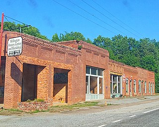
Willington is a census-designated place (CDP) in McCormick County, South Carolina, United States. The population was 177 at the 2000 census.

Hampden Sydney is a census-designated place (CDP) in Prince Edward County, Virginia, United States. The population was 1,450 at the 2010 census.

Piney View is a census-designated place (CDP) in Raleigh County, West Virginia, United States. The population was 989 at the 2010 census.

Tonawanda is a census-designated place (CDP) in Erie County, New York, United States. The CDP comprises the town of Tonawanda minus its subsidiary village of Kenmore. As of the 2010 census, the CDP population was 58,144.

West Seneca is a hamlet and census-designated place (CDP) in Erie County, New York, United States. The population was 44,711 at the 2010 census. It is part of the Buffalo–Niagara Falls Metropolitan Statistical Area. The CDP corresponds exactly to the area of the town of West Seneca.
Yardville is an unincorporated community and census-designated place (CDP) located within Hamilton Township, in Mercer County, in the U.S. state of New Jersey. As of the 2010 United States Census, the CDP's population was 2,945. Before the 2010 Census, the area was part of the Yardville-Groveville CDP.
Hickory Hills is a census-designated place (CDP) in Foster Township, Luzerne County, Pennsylvania, southwest of the borough of White Haven. The CDP population was 562 at the 2010 census.

Kingston Estates is an unincorporated community and census-designated place (CDP) located within Cherry Hill, in Camden County, in the U.S. state of New Jersey, that had been part of the Barclay-Kingston CDP until the 2000 census, which was split to form the CDPs of Barclay and Kingston Estates as of the 2010 Census. As of the 2010 United States Census, the CDP's population was 5,685.

