Choa Chu Kang

Last updated

Choa Chu Kang
Other transcription(s)
   Chinese 蔡厝港
Càicuògǎng(Pinyin)
Chhòa-chhù-káng(Hokkien POJ)
Tshuà-tshù-káng(TLPA )
   Malay Choa Chu Kang
   Tamil சுவா சூ காங்
Cuvā cū kāṅ(Transliteration)
A condo at CCK (8417140930).jpg
Choa Chu Kang HDB 2.JPG
CCK-Lot1.JPG
ITE College West (8473867434).jpg
Clockwise from top: Northvale condominium, Lot One Shoppers' Mall, ITE College West, HDB flats in Choa Chu Kang
Choa Chu Kang location.svg
Location of Choa Chu Kang in Singapore
Singapore location map (main island).svg
Red pog.svg
Choa Chu Kang
Location of Choa Chu Kang within Singapore
Coordinates: 1°23′N103°45′E / 1.383°N 103.750°E / 1.383; 103.750
CountryFlag of Singapore.svg  Singapore
Region West Region
CDCs
Town Councils
  • Chua Chu Kang Town Council
  • Marsiling-Yew Tee Town Council
Constituencies
Government
  MayorsNorth West CDC

South West CDC


  Members of ParliamentChua Chu Kang GRC

Marsiling-Yew Tee GRC

Area
  Total6.11 km2 (2.36 sq mi)
  Residential3.07 km2 (1.19 sq mi)
Population
 (2019) [1] [2] [3] [4]
  Total192,070
  Density31,000/km2 (81,000/sq mi)
Ethnic groups
[3]
   Chinese 133,520
   Malays 35,500
   Indians 18,020
  Others5,020
Postal district
23
Dwelling units42,393
Projected ultimate62,000

Choa Chu Kang, alternatively spelled Chua Chu Kang and often abbreviated as CCK, is a planning area and residential town located at the northwestern point of the West Region of Singapore. The town shares borders with Sungei Kadut to the north, Tengah to the southwest, Bukit Batok to the southeast, Bukit Panjang to the east and the Western Water Catchment to the west. Choa Chu Kang New Town is separated into two portions by the Kranji Expressway.

Contents

Originally a kampung, the area has been rapidly developed under the ambition of the Housing and Development Board, to transform it into a modern township. The town comprises seven subzones, five of which are the most densely populated: Choa Chu Kang Central, Choa Chu Kang North, Yew Tee, Teck Whye, and Keat Hong.

Etymology

Choa Chu Kang's name is derived from its historical core at the former site of Chua Chu Kang Village located near the junction of Choa Chu Kang Road and Jalan Sungei Poyan, currently occupied by the grounds of the National Shooting Centre which comes under the purview of Singapore Shooting Association. The name began to be applied to the general area around the village when Choa Chu Kang Road, a main arterial road linking the village to Upper Bukit Timah Road towards the east was built.

The name "Choa Chu Kang" is derived from the Teochew word "kang chu".[ citation needed ] In the nineteenth century, Chinese immigrants planted gambier and pepper along the river banks of Choa Chu Kang, although many migrated to Johor to the north at the encouragement of the Temenggong of Johor. The plantation owners were known as Kangchu - the word "kang" refers to the riverbank and "chu" means "owner" or "master", referring to the headman in charge of the plantations in the area. "Choa" is the clan name of the first headman.

History

Early history

Choa Chu Kang was a diverse area with old kampong housing and rubber plantations. Residents had to depend on boats or bullock carts for transportation. Among the few villages which sprang up were Kampong Belimbing and Chua Chu Kang Village. Most of the inhabitants belonged to the Teochew dialect group. The early Teochew settlers were mainly farmers growing gambier and pepper. The Hokkiens, who moved in later, established pineapple, rubber and coconut plantations as well as vegetable farms and poultry farms. In the early days, tigers used to roam in the area. The last tiger of Singapore was shot here in the 1930s.

Kampong Belimbing, Chua Chu Kang Village and Kampong Berih was demolished in phases from 1993 to 1998. It was replaced by National Shooting Centre and military plot (Cemetery North) and (Jalan Bahar). The Cemetery North is gazetted as an army restricted and live-firing area from 19 September 2003. [5] The Jalan Bahar is gazetted as an army restricted and live-firing area from 16 March 2001. [6]

The name Choa Chu Kang is used for Choa Chu Kang Road and its nearby facilities. However, the original name Chua Chu Kang is retained in the cemetery area.

New town era (1980s)

The new town era had been evolved since 1985 where Teck Whye was developed (the first HDB blocks since 1977), and it was extended to N2, N3 and N4 by 1992 with the cutting short of Choa Chu Kang Road. Yew Tee was developed by 1997, with N5, N6 and N7 being completed and residents had moved in.

Choa Chu Kang also had their new neighbourhood being completed, the Neighbourhood 8 by 2015. On 25 April 2015, bus services such as 300, 301 and 983 were being enhanced for their needs of residents. Bus service 301 and 983 took over the deleted portions of service 300. On 27 December 2015, service 983 was also extended via Choa Chu Kang Avenue 1, Choa Chu Kang Avenue 7, Choa Chu Kang Grove, Choa Chu Kang Way, Choa Chu Kang Road, Upper Bukit Timah Road, Petir Road, Jelebu Road all the way to Bukit Panjang to enhance connectivity to the Downtown MRT Line.

Politics

When Choa Chu Kang Town was built by expanding Teck Whye Estate near the other end of Choa Chu Kang Road at its junction with Upper Bukit Timah Road and Woodlands Road to the north, the place name began to be applied to a much larger area, especially when political divisions like the Choa Chu Kang ward applied to the entire northwest sector of the country during some editions of the Parliamentary elections. Likewise, the residents' committees in Choa Chu Kang were expanded in 1988 and 1991, and part of Chua Chu Kang sector had given way to Yew Tee division, followed by Keat Hong division in 2001. The growing demand of Keat Hong Neighbourhood 8 also requested for redrawing of boundaries whereby Limbang ward took over the parts of Yew Tee and Choa Chu Kang, giving a nice feel of Neighbourhood 5 and 6. Today, the Yew Tee and Limbang wards fall within the Marsiling-Yew Tee Group Representation Constituency and the rest of the town such as Keat Hong and Chua Chu Kang fall within the Chua Chu Kang Group Representation Constituency.

In 2020, with the further growth of Keat Hong Neighbourhood 8 and Tengah New Town, Brickland ward was introduced, taking over parts of Keat Hong, Bukit Gombak, Chua Chu Kang and Nanyang.

Education

Choa Chu Kang area has a total of eight primary schools, six secondary schools, two post-secondary institutions and a single special needs school as of 2022.

Primary schools

Secondary schools

Tertiary Institutions

Other schools

Transportation facilities

City planners plan for public transport to eventually become the preferred mode of transport in the future. The government of Singapore ideally desires environmental towns, using public transport to reduce pollution caused by heavy road traffic. Choa Chu Kang is part of the Urban Redevelopment Authority's focus for realising this urban planning model and is still undergoing an expansion of its town. As Choa Chu Kang is relatively distant from the city centre at the Central Area, an efficient, high-volume and high-speed public transport system is also preferred to using road networks.

Choa Chu Kang MRT/LRT station and Choa Chu Kang Bus Interchange are conveniently connected to each another in the town centre to allow seamless travel for the residents of Choa Chu Kang New Town across the different available modes of public transport.

Public transport

Rail

The Choa Chu Kang MRT/LRT station is a major transport hub. Cck-mrt.JPG
The Choa Chu Kang MRT/LRT station is a major transport hub.

Choa Chu Kang New Town is linked to the Central Area and to the other lines on the MRT/LRT system (to the east–west line at Jurong East station, to the Thomson-East Coast line at Woodlands station, to the Circle line at Bishan station, to the Downtown line at Newton station and the North East line at Dhoby Ghaut station) through the North South line (NSL) at Choa Chu Kang station (NS4) located at Choa Chu Kang Town Centre. It usually takes an hour for passengers to travel from Choa Chu Kang to the Central Area which changes at Jurong East.

The intra-town Bukit Panjang LRT is a 7.8 km light rail line that serves to link residents to the town centre and the nearby town of Bukit Panjang, hence the line's name. It is a fully driverless system.

Yew Tee station (NS5), the other station along NSL in Choa Chu Kang New Town, serves the housing developments in Yew Tee, the industrial estate of Sungei Kadut, and the northern part of Choa Chu Kang New Town. The station started operations on 10 February 1996. Like Choa Chu Kang, it usually takes an hour for passengers to travel from Yew Tee to the Central Area when using the station which changes at Jurong East.

Bus services

The old Choa Chu Kang Bus Interchange, which ceased operations in 2018 Choa Chu Kang Bus Interchange 4.JPG
The old Choa Chu Kang Bus Interchange, which ceased operations in 2018

Bus services are available at the Choa Chu Kang Bus Interchange which is connected to the Choa Chu Kang MRT/LRT station and the town's central shopping mall Lot One Shoppers' Mall. It was opened in 1990 with 12 bus services under SBS Transit and at their own Choa Chu Kang Bus Package, all handed over to SMRT Buses in 1999. On 16 December 2018, the interchange was relocated to a new facility at the junction of Choa Chu Kang Way and Choa Chu Kang Loop, with the old interchange being demolished due to the construction of the Jurong Region Line. All services were amended to the new interchange on that day. [7]

The bus interchange currently has 15 services; 14 are public bus services (mostly operated by SMRT Buses, the other a special free shuttle to Qian Hu Fish Farm. Typically passenger traffic is often very high in morning and evening peak hours.

Bus services were introduced over the years in Choa Chu Kang:

  • 25 April 2015: Service 983 was introduced from Choa Chu Kang to Keat Hong Close, and extended on 27 December 2015 to Bukit Panjang.
  • 27 December 2015: Service 979 was introduced from Bukit Panjang to Yew Tee.
  • 15 May 2016: Service 308 was introduced from Choa Chu Kang to Keat Hong Link (Loop).
  • 8 April 2018: Service 974 was introduced from Bukit Panjang Temporary Bus Park to Joo Koon.
  • 30 September 2018: Service 991 was even extended from Bukit Batok West, via Bukit Gombak MRT, Bukit Batok West Avenue 5, Brickland Road, Choa Chu Kang Avenues 3 and 1, and Keat Hong Link to Choa Chu Kang, replacing route 308.
  • 10 November 2019: Service 976 was introduced from Choa Chu Kang to Bukit Panjang.

In addition, 300 and 302 were the last bus routes to be converted to use double deckers after the articulated buses starts retiring in 2017.

Road network

The northern part of the much-used Bukit Timah Road (called Upper Bukit Timah Road) connects Choa Chu Kang residents to other parts of the country. Bukit Timah Road 4, Aug 06.JPG
The northern part of the much-used Bukit Timah Road (called Upper Bukit Timah Road) connects Choa Chu Kang residents to other parts of the country.

The Kranji Expressway (KJE) links Choa Chu Kang Town up with Singapore's expressway network. With the KJE, drivers can change onto the Bukit Timah Expressway (BKE) which in turn, is connected to the Pan-Island Expressway (PIE) which travels to the Central Area and the eastern parts of Singapore. As the town is surrounded by the towns of Bukit Panjang, Bukit Batok, Bukit Gombak and southern Woodlands, many roads (old and new) have been constructed to link Choa Chu Kang into other towns which eventually allows residents to other parts of the country by either bus, train, car or any other reliable means of transportation.

The following roads connect the central town of Choa Chu Kang to the nearby towns of Bukit Batok and Bukit Panjang:

The following roads connect the central town of Choa Chu Kang to its northern counterpart neighbourhood, Yew Tee:

Amenities

Commercial

Choa Chu Kang MRT/LRT station with Lot One shopping mall in the background Choa Chu Kang Town Centre, Singapore - 20081125.jpg
Choa Chu Kang MRT/LRT station with Lot One shopping mall in the background

There are two main shopping centres in Choa Chu Kang. Lot One is the main shopping mall by CapitaLand and it is a major hub in Choa Chu Kang,. Its anchor tenants are NTUC FairPrice, Shaw Theatres, BHG, Cotton On and Choa Chu Kang Community Library. The other two shopping malls in Choa Chu Kang are Yew Tee Square and Yew Tee Point which was located in Yew Tee, owned by Frasers Centrepoint. The mall has undergone enhancement works to create a four-storey retail extension block measuring over 16,500 sq ft (1,530 m2). The works, which commenced in July 2007, was completed by end-2008.

For Junction 10, it is a shopping mall by Far East Organisation, which is located at Ten Mile Junction. There is Giant Hypermarket nearby as an anchor tenant.

The other shopping malls are neighbourhood malls. They are Choa Chu Kang Centre, Keat Hong Shopping Centre, Limbang Shopping Centre, Sunshine Place and Teck Whye Shopping Centre. They are smaller scale.

Medical

The estate also contains a polyclinic renovated in 2010. It is operated by the National University Polyclinics. There is also a newly setup Keat Hong Family Medicine Clinic (FMC) which is a collaboration between National University Hospital (NUH) and Trilink Healthcare Pte Ltd in the new Keat Hong Community Club building.

Parks, recreational and sport venues

Related Research Articles

<span class="mw-page-title-main">Lim Chu Kang</span> Planning Area in North Region, Singapore

Lim Chu Kang is a planning area located in the northwestern part of the North Region of Singapore, bordering the Western Water Catchment to the west and south, Sungei Kadut to the east and the Straits of Johor to the north.

<span class="mw-page-title-main">Bukit Batok</span> Planning Area and HDB Town in West Region ----, Singapore

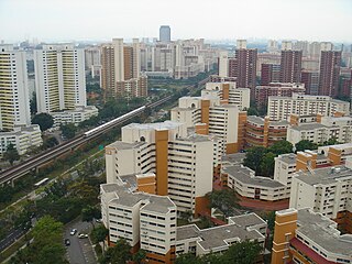
Bukit Batok, often abbreviated as Bt Batok, is a planning area and matured residential town located along the eastern boundary of the West Region of Singapore. Bukit Batok statistically ranks in as the 25th largest, the 12th most populous and the 11th most densely populated planning area in Singapore. It is bordered by six other planning areas - Choa Chu Kang to the North, Northeast and Northwest, Cashew to the northeast and East, Clementi to the South, Bukit Timah to the southeast, Jurong East to the southwest and Tengah to the west.

<span class="mw-page-title-main">Bukit Panjang</span> Planning Area and HDB Town in West Region, Singapore

Bukit Panjang is a planning area and residential town located in the West Region of Singapore. A portion of this town is situated on a low-lying elongated hill. The planning area is bounded by Bukit Batok to the west, Choa Chu Kang to the northwest, Sungei Kadut to the north, the Central Water Catchment to the east and Bukit Timah to the south. Bukit Panjang New Town is located at the northern portion of the planning area. Bukit Panjang has an average elevation of 36m/118 ft.

<span class="mw-page-title-main">Yew Tee</span> Place in Singapore

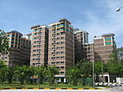
Yew Tee is a residential area in the West Region of Singapore. Yew Tee is a cluster of Housing and Development Board flats and private condominiums, As a relatively new estate, a large proportion of its residents are young families and middle income earners.

<span class="mw-page-title-main">Bukit Gombak</span> Place in Singapore

Bukit Gombak is a subzone of Bukit Batok, Singapore. It is a hilly neighbourhood in the west-central area of the Southeast Asian city-state of Singapore. In the Malay language, bukit means hill and gombak a bunch or collection of something. The neighbourhood consists of two hills. One of them stands at 133m while the other stands at 113m. They are Singapore's second and third highest natural point after Bukit Timah Hill.

The Jurong Police Division is one of the seven land divisions of the Singapore Police Force. Jurong Division first came into existence as the ‘Rural West’ Division on 24 Sep 1965 and operated from a standalone building located at Bukit Panjang. As the communities in the west grew, police posts were built in Ama Keng, Mandai and Kranji.

<span class="mw-page-title-main">Ten Mile Junction LRT station</span> Light rail station in Singapore

Ten Mile Junction LRT station was an elevated Light Rail Transit (LRT) station on the Bukit Panjang LRT line in Choa Chu Kang, Singapore that was in operation between 6 November 1999 and 13 January 2019. This LRT station was the only one that was air conditioned, inside a building, had full height platform screen doors, faregates on the same level as the platform, and only one track. The two-car configuration was not deployed for the service and it provided a 20-minute frequency, which was lower than the other LRT stations.

<span class="mw-page-title-main">Choa Chu Kang Bus Interchange</span>

Choa Chu Kang Bus Interchange is a bus interchange which mainly serves the residential neighbourhood of Choa Chu Kang in the North Region of Singapore. It is located at Choa Chu Kang Loop and connected to Choa Chu Kang MRT/LRT station and the Lot One Shoppers' Mall. Opened in 1990, the old bus interchange was one of the oldest surviving bus interchanges in Singapore to remain intact from re-modification while still in service for 28 years until 15 December 2018. The new site opened on 16 December 2018.

<span class="mw-page-title-main">Hong Kah Group Representation Constituency</span> Electoral division in western Singapore

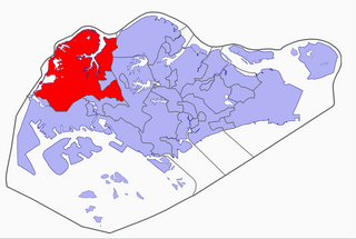
Hong Kah Group Representation Constituency was a five-member Group Representation Constituency located in the western area of Singapore. The constituency covered the areas of Bukit Batok, Choa Chu Kang, Upper Bukit Timah, Jurong West and Lim Chu Kang. Hong Kah GRC was formed in 1988 and eventually dissolved and reformed into Chua Chu Kang GRC in 2011. It had always been held by the People's Action Party.

<span class="mw-page-title-main">Tengah, Singapore</span> Planning Area and future HDB town in West Region ----, Singapore

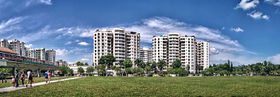
Tengah is a planning area and future HDB town located within the West Region of Singapore. It is bound by Choa Chu Kang to the northeast, Jurong East and Jurong West to the south, Bukit Batok to the east and the Western Water Catchment to its west and north.

Choa Chu Kang Road is a road in Singapore in two sections.

Wenya is a subzone of Jurong West, Singapore.

<span class="mw-page-title-main">Choa Chu Kang MRT/LRT station</span> Mass Rapid Transit and light rail station in Singapore

Choa Chu Kang MRT/LRT station is an above-ground Mass Rapid Transit (MRT) and Light Rail Transit (LRT) interchange station in Choa Chu Kang, Singapore. It is an interchange between the North South line and Bukit Panjang LRT, serving as the western terminus of the latter. The station is located between Choa Chu Kang Bus Interchange and Lot One in the Choa Chu Kang town centre.

<span class="mw-page-title-main">Chua Chu Kang Group Representation Constituency</span> Electoral division in Singapore

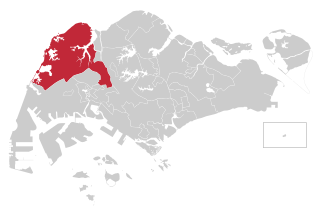
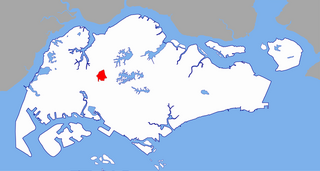
The Chua Chu Kang Group Representation Constituency is a four-member Group Representation Constituency located in the western area of Singapore. There are four divisions of the GRC: Choa Chu Kang, Bukit Gombak, Keat Hong and Brickland. Military installations constitute a large part of the constituency managed by Chua Chu Kang Town Council, including most of the SAFTI Live Firing Area, Ama Keng and Neo Tiew military training areas and Murai Urban training facility. The current Members of Parliament are Don Wee, Gan Kim Yong, Low Yen Ling and Zhulkarnain Abdul Rahim from the People's Action Party (PAP).

Yuhua is a subzone region located in the town of Jurong East, Singapore. Yuhua comprises two subzones, Yuhua East and Yuhua West. The area's HDB flats are under the management of Jurong-Clementi Town Council and the people of this precinct are represented in parliament by either Grace Fu or Rahayu Mahzam, depending on where they stay.

<span class="mw-page-title-main">Rural West Constituency</span>

Rural West Constituency was a constituency represented in the Legislative Council of Singapore from 1948 until 1951. It elected one Legislative Council member.

References

  1. 1 2 City Population - statistics, maps and charts | Choa Chu Kang
  2. 1 2 HDB Key Statistics FY 2014/2015 Archived 4 March 2016 at the Wayback Machine
  3. 1 2 "Statistics Singapore - Geographic Distribution - 2018 Latest Data" . Retrieved 11 February 2019.
  4. "Land Area and Dwelling Units by Town". Data Singapore. 2016. Retrieved 26 January 2018.
  5. "Training Plot 2 (North)". Archived from the original on 28 May 2018. Retrieved 27 May 2018.
  6. Training Plot 2 (Jalan Bahar) [ permanent dead link ]
  7. hermesauto (19 November 2018). "New Choa Chu Kang bus interchange to open on Dec 16". The Straits Times. Singapore. Retrieved 13 January 2019.