Counties of Uganda

Last updated
Counties of Uganda Uganda counties.png
Counties of Uganda

The districts of Uganda are divided into 167 counties, 1 city council, and 23 municipal councils. Counties are divided into sub-counties. [1] The counties are listed below, by district: [2] [1]

Contents

List

CountyDistrict
Labwor County Abim District
East Moyo County Adjumani District
Agago County Agago District
Ajuri County Alebtong District
Moroto County
Kioga County Amolatar District
Upe County Amudat District
Amuria County Amuria District
Kapelebyong County
Kilak County Amuru District
Kwania County Apac District
Maruzi County
Arua Municipal Council Arua District
Ayivu County
Madi-Okollo County
Terego County
Vurra County
Budaka County Budaka District
Iki-Iki County
Manjiya County Bududa District
Bukooli County Bugiri District
Buhweju County Buhweju District
Buikwe County Buikwe District
Bukedea County Bukedea District
Bukomansimbi County Bukomansimbi District
Kongasis County Bukwo District
Bulambuli County Bulambuli District
Buliisa County Buliisa District
Bughendera County Bundibugyo District
Bwamba County
Bushenyi-Ishaka Municipal Council Bushenyi District
Igara County
Busia Municipal Council Busia District
Samia-Bugwe County
Bunyole County Butaleja District
Butambala County Butambala District
Buvuma Islands County Buvuma District
Budiope East County Buyende District
Budiope West County
Dokolo County Dokolo District
Gomba County Gomba District
Aswa County Gulu District
Gulu Municipal Council
Omoro County
Bugahya County Hoima District
Buhaguzi County
Hoima Municipal Council
Ibanda County Ibanda District
Bugweri County Iganga District
Iganga Municipal Council
Kigulu County
Bukanga County Isingiro District
Isingiro County
Butembe County Jinja District
Jinja Municipal Council
Kagoma County
Dodoth East County Kaabong District
Dodoth West County
Kabale Municipal Council Kabale District
Ndorwa County
Rubanda County
Rukiga County
Bunyangabu County Kabarole District
Burahya County
Fort Portal Municipal Council
Nakasongola County
Kaberamaido County Kaberamaido District
Kalaki County
Bujumba County Kalangala District
Kyamuswa County
Bulamogi County Kaliro District
Kalungu County Kalungu District
Kampala Capital City Kampala District
Bugabula County Kamuli District
Buzaaya County
Kibale County Kamwenge District
Kitagwenda County
Kinkiizi County Kanungu District
Tingey County Kapchorwa District
Bukonzo County Kasese District
Busongora County
Kasese Municipal Council
Toroma County Katakwi District
Usuk County
Bbaale County Kayunga District
Ntenjeru County
Bugangaizi County Kibaale District
Bugangaizi East County
Buyaga County
Buyaga West County
Buyanja County
Kiboga East County Kiboga District
Kibuku County Kibuku District
Kazo County Kiruhura District
Nyabushozi County
Kibanda County Kiryandongo District
Bufumbira County Easts Kisoro District
Bufumbira County North
Bufumbira County South
Chua County Kitgum District
Koboko County Koboko District
Kole County Kole District
Jie County Kotido District
Kumi County Kumi District
Kween County Kween District
Kiboga West County Kyankwanzi District
Kyaka County Kyegegwa District
Mwenge County Kyenjojo District
Lamwo County Lamwo District
Erute County Lira District
Lira Municipal Council
Luuka County Luuka District
Bamunanika County Luweero District
Katikamu County
Bukoto County Lwengo District
Kabula County Lyantonde District
Bubulo County Manafwa District
Maracha County Maracha District
Bukoto Central County Masaka District
Bukoto East County
Masaka Municipal Council
Bujenje County Masindi District
Buruuli County
Masindi Municipal Council
Bunya County Mayuge District
Bungokho County Mbale District
Mbale Municipal Council
Kashari County Mbarara District
Mbarara Municipal Council
Rwampara County
Ruhinda County Mitooma District
Busujju County Mityana District
Mityana County
Matheniko County Moroto District
Moroto Municipal Council
Obongi County Moyo District
West Moyo County
Mawokota County Mpigi District
Buwekula County Mubende District
Kasambya County
Kassanda County
Mukono County Mukono District
Mukono Municipal Council
Ik County Kaabong District
Nakifuma Council Mukono District
Chekwii (Kadam) County Nakapiripirit District
Pian County
Nakaseke North County Nakaseke District
Nakaseke South County
Budyebo County Nakasongola District
Nakasongola County
Bukooli Island County Namayingo District
Bukooli South County
Busiki County Namutumba District
Bokora County Napak District
Jonam County Nebbi District
Padyere County
Ngora County Ngora District
Ntoroko County Ntoroko District
Kajara County Ntungamo District
Ntungamo Municipal Council
Ruhaama County
Rushenyi County
Nwoya County Nwoya District
Otuke County Otuke District
Oyam County Oyam District
Aruu County Pader District
Agule County Pallisa District
Butebo County
Pallisa County
Kakuuto County Rakai District
Kooki County
Kyotera County
Bunyaruguru County Rubirizi District
Katerera County
Rubabo County Rukungiri District
Rujumbura County
Rukungiri Municipal Council
Lwemiyaga County Sembabule District
Mawogola County
Kasilo County Serere District
Serere County
Sheema County Sheema District
Budadiri County Sironko District
Soroti County Soroti District
Soroti Municipal Council
Tororo County Tororo District
Tororo Municipal Council
West Budama County
Busiro County Wakiso District
Entebbe Municipal Council
Kyadondo County
Aringa County Yumbe District
Okoro County Zombo District

See also

Related Research Articles

<span class="mw-page-title-main">Districts of Uganda</span> First-level administrative divisions of Uganda

As of 1 July 2020, Uganda is divided into 135 districts plus the capital city of Kampala, which are grouped into four administrative regions.

<span class="mw-page-title-main">Rakai District</span> District in Central Region of Uganda, Uganda

Rakai District is a district in the Central Region of Uganda. The town of Rakai is the site of the district's headquarters.

<span class="mw-page-title-main">Sembabule District</span> District in Buganda, Uganda

Sembabule District is a district in the Central Region of Uganda. The town of Sembabule is the site of the district headquarters. Other urban centers in the district include Lwemiyaga and Ntuusi.

<span class="mw-page-title-main">Sironko District</span> District in Uganda

Sironko District is a district in the Eastern Region of Uganda. The district was created in 2000 and had previously been part of Mbale District. Sironko is the main commercial town in the district.

<span class="mw-page-title-main">Kanungu District</span> District in Western Region, Uganda

Kanungu District is a district in the Western Region of Uganda. The town of Kanungu is the site of the district headquarters. The Bwindi Impenetrable Forest in Kanungu District is among the sites shown in aerial footage in the movie Black Panther.

<span class="mw-page-title-main">Budaka District</span> District in Eastern Uganda, Uganda

Budaka District is a district in the Eastern Region of Uganda. The town of Budaka serves as the district headquarters.

<span class="mw-page-title-main">Koboko District</span> District in Northern Region of Uganda, Uganda

Koboko District is a district in the Northern Region of Uganda. The town of Koboko is the site of the district headquarters.

<span class="mw-page-title-main">Kaabong District</span> District in Northern Region of Uganda, Uganda

Kaabong District is a district in the Northern Region of Uganda. The district headquarters are in the similarly named town of Kaabong.

<span class="mw-page-title-main">Amuria District</span> District in Eastern Uganda, Uganda

Amuria District is a district in the Eastern Region of Uganda. The town of Amuria serves as the district headquarters.

<span class="mw-page-title-main">Amolatar District</span> District in Northern Uganda, Uganda

Amolatar District is a district in Northern Uganda. Like many other Ugandan districts, it is named after its main municipal and administrative centre, Amolatar Town.

<span class="mw-page-title-main">Sub-counties of Uganda</span> Fourth level of division of Uganda

The counties of Uganda are divided into sub-counties, which are further divided into parishes and villages. The head elected official in a district is the Chairperson of the Local Council V.

<span class="mw-page-title-main">Outline of Uganda</span> Overview of and topical guide to Uganda

The following outline is provided as an overview of and topical guide to Uganda:

<span class="mw-page-title-main">Namutumba District</span> District in Eastern Uganda, Uganda

Namutumba District, sometimes referred to as Busiki District is a district in Eastern Uganda. It is named after its 'chief town', Namutumba, where the district headquarters are located.

<span class="mw-page-title-main">Maracha District</span> District in Northern Region, Uganda

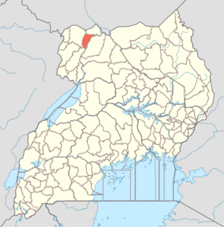
Maracha District is a district in the West Nile sub-region, in the Northern Region of Uganda. It was formed in 2006 from Arua District.

<span class="mw-page-title-main">Kyankwanzi District</span> District in Buganda Region, Uganda

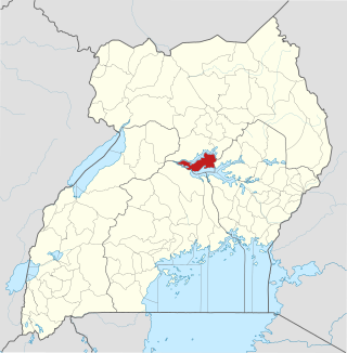
Kyankwanzi District is the westernmost district in the Buganda Region of Uganda and Buganda Kingdom, bordering Bunyoro. The district headquarters are in Butemba Town.

<span class="mw-page-title-main">Alebtong District</span> District in Northern Region of Uganda, Uganda

Alebtong District is a district in the Northern Region of Uganda. The town of Alebtong serves as the district headquarters.

Bunyangabu District is a district in the Western Region of Uganda. The town of Kibiito is the political and administrative center of the district. However, the town of Rwimi, is the largest and main commercial center of Bunyangabu.

<span class="mw-page-title-main">Obongi District</span> District in Northern Uganda

Obongi District is a district in Northern Uganda. It is a cosmopolitan district originally inhabited by the Gimara, Madi, Reli and the Aliba tribes. Overtime, many tribes including the lugbara,Alur,Rigbo and Kakwa immigrated in to the district. The district currently hosts a sizeable number of refugees from South Sudan.The district headquarters are located in Obongi town. It was carved out of Moyo District and its operations started on Monday 1 July 2019. The population is 49,100, divided over five subcounties of Palorinya, Gimara, Itula, Aliba, Ewafa and one town council. It stretches from Odraji in Palorinya Sub County upto Alibabito in Ewafa Sub County. It sends two MPs to the Parliament of Uganda who are Honorable Bhoka George Didi, the directly elected MP, and Maneno Zumura the Woman Member of Parliament and the current Local Council Five (LC) Chairman is Hon. Hajj Abib Khemis Buga.

<span class="mw-page-title-main">Terego District</span> District in Northern, Uganda

Terego is a district in Uganda's Northern Region. It is located approximately 360 kilometres (220 mi) northwest of Uganda's capital Kampala. The administrative centre of the district is the trading centre of Leju in Aii-Vu Sub-County. Terego District covers an area of 1,102 square kilometres (425 sq mi) and the areas now making up the district recorded a non-refugee population of 199,303 in the 2014 Ugandan census. Terego District also hosts an estimated 168,000 refugees, mostly from South Sudan, in the Imvepi Refugee Settlement and the western zones of the Rhino Camp Refugee Settlement in the district.

References