Kotido District

Last updated
Kotido District
Kotido District in Uganda.svg
District location in Uganda
Coordinates: 03°31′N34°07′E / 3.517°N 34.117°E / 3.517; 34.117
CountryFlag of Uganda.svg  Uganda
Region Northern Uganda
Sub-region Karamoja sub-region
Capital Kotido
Area
  Total3,618 km2 (1,397 sq mi)
Population
 (2012 Estimate)
  Total236,900
  Density311.8/km2 (808/sq mi)
Time zone UTC+3 (EAT)
Website www.kotido.go.ug

Kotido District is a district in Northern Uganda. It is named after its 'chief town', Kotido, where the district headquarters are located.

Contents

Location

Kotido District is bordered by Kaabong District to the north, Moroto District to the east, Napak District to the south and Abim District to the west. Agago District and Kitgum District lie to the northwest of Kotido District. [1] The district headquarters at the town of Kotido is approximately 100 kilometres (62 mi) northwest of Moroto, the largest town in the sub-region. [2] This location lies approximately 430 kilometres (270 mi), by road, northeast of Kampala, the capital of Uganda and the largest city in that country. [3] The coordinates of the district are:03 31N, 34 07E.

Overview

The district is part of the Karamoja sub-region, home to an estimated 1.2 million Karimojong, according to the 2002 national census. The sub-region consists of the following districts: (a) Abim District (b) Amudat District (c) Kaabong District (d) Kotido District (e) Moroto District (f) Nakapiripirit District (g) Napak District (h) Lusot District (i) Karenga District (j) Nabilatuk District

Population

In 1991, the national population census estimated the district population at about 62,340. The national census in 2002 estimated the population of the district at about 129,100. The annual population growth rate in Kotido District, between 2002 and 2012, has been calculated at 6.39%. It is estimated that in 2012, the population of Kotido District was approximately 236,900. [4]

Sub-counties and parishes

Sub-county2008
Population
Estimates
Parishes
Kacheri21,092Kacheri, Lokiding, Losakucha
Kotido
Sub-county
36,828Kanawat, Lokitelaebu, Losilang
Kotido Town Council 18,806Kotido Central, Kotido East, Kotido North, Kotido West, Lokochil, Kotido Rural, Narikapet
Nakapelimoru21,233Lookorok, Potongor, Watakau
Panyangara54,484Kamau, Loletio, Lopotha, Rikitae
Rengen26,863Kotyang, Lokadeli, Nakwakwa, Lopoyo, Naponga
Total179,306[ citation needed ]

Economic activities

Shepherd in Kotido Shepherd in Kotido.jpg
Shepherd in Kotido

Nomadic pastoralism is the main economic activity in the district.

In some areas, peasant agriculture is practiced. The crops grown include the following: [5]

See also

Related Research Articles

<span class="mw-page-title-main">Kitgum District</span> District in Northern Uganda, Uganda

Kitgum District is a district in Northern Uganda. It is named after its major town of Kitgum, where the district headquarters is located. It has suffered many deaths and social disruption resulting from the 20-year civil war in the region during the late 20th century. The government moved tens of thousands of residents to internally displaced persons camps for their protection, where they were subject to raids by the rebels and also harsh conditions, including disease.

<span class="mw-page-title-main">Moroto District</span> District in Northern Region of Uganda, Uganda

Moroto District is a district in the Northern Region of Uganda. The town of Moroto is the site of the district headquarters.

<span class="mw-page-title-main">Nakapiripirit District</span> District in Northern Uganda, Uganda

Nakapiripirit District is a district in Northern Uganda. Like many Ugandan districts, it is named after its 'chief town', Nakapiripirit, where the district headquarters are located.

<span class="mw-page-title-main">Karamoja</span> Sub Region of Uganda

The Karamoja sub-region, commonly known as Karamoja, is a region in Uganda. It covers an area of 27,528km and comprises the Kotido District, Kaabong District, Karenga District, Nabilatuk District Abim District, Moroto District, Napak District, Amudat District and Nakapiripirit District. The region is projected to have a population of 1.4 millions in 2022 by UBOS.

Kotido is a town in the Northern Region of Uganda. It is the chief municipal, administrative, and commercial center of the Kotido District and the site of the district headquarters.

Nakapiripirit is a town in the Nakapiripirit District of the Northern Region of Uganda. It is the seat of the district headquarters. As an administrative unit of the district, it is one of the eight sub-counties in the district.

Amuria is a town in the Eastern Region of Uganda. It is the chief municipal, administrative, and commercial center of Amuria District, in the Teso sub-region.

<span class="mw-page-title-main">Kaabong District</span> District in Northern Region of Uganda, Uganda

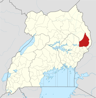
Kaabong District is a district in the Northern Region of Uganda. The district headquarters are in the similarly named town of Kaabong.

<span class="mw-page-title-main">Abim District</span> District in Uganda

Abim District is a district in Northern Uganda. It is named after its 'chief town', Abim, where the district headquarters are located.

Abim is a town in the Northern Region of Uganda. It is the chief municipal, administrative, and commercial center of Abim District. The district is named after the town.

<span class="mw-page-title-main">Kaabong</span> Ugandan town

Kaabong is a town in the Northern Region of Uganda. It is the chief municipal, administrative and commercial center of the eponymous Kaabong District, and the district headquarters are located in the town.

Moroto Regional Referral Hospital, commonly known as Moroto Hospital is a hospital in the town of Moroto, in Northeastern Uganda. It is the referral hospital for the districts of Abim, Kaabong, Kotido, Moroto and Nakapiripirit and Napak.

<span class="mw-page-title-main">Agago District</span> District in Northern Uganda, Uganda

The Agago District is a Ugandan district located in the Northen Region of Uganda.

<span class="mw-page-title-main">Alebtong District</span> District in Northern Region of Uganda, Uganda

Alebtong District is a district in the Northern Region of Uganda. The town of Alebtong serves as the district headquarters.

<span class="mw-page-title-main">Amudat District</span> District in Northern Uganda, Uganda

Amudat District is a district in Northern Uganda. Like most Ugandan districts, it is named after its 'chief town', Amudat, where the district headquarters are located.

<span class="mw-page-title-main">Napak District</span> District in Northern Uganda, Uganda

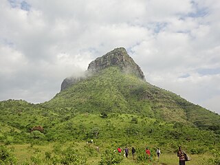
Napak District is a district in Northern Uganda. It is named after Mount Napak, and its headquarters is at Lokitede.

Napak is a town in Northern Uganda. It is the commercial, administrative and municipal headquarters of Napak District. The district is named after the town.

Soroti–Amuria–Abim–Kotido Road is a road in the Eastern and Northern Regions of Uganda. The road connects the towns of Soroti in Soroti District, to Amuria in Amuria District, Abim in Abim District, and Kotido, in Kotido District. Soroti and Amuria lie in the Teso sub-region, while Abim and Kotido are in the Karamoja sub-region.

Kaabong General Hospital, also Kaabong District Hospital, is a public hospital in the Northeastern Region of Uganda.

Lorengecora is a settlement in the Northern Region of Uganda. It is the headquarters of Lorengecora Parish, in Iriri sub-county, in Bokora County, in Napak District, in the Karamoja sub-region.

References

  1. Uganda District Map
  2. "Road Distance Between Moroto And Kotido With Map". Globefeed.com. Retrieved 26 May 2014.
  3. "Map Showing Kampala And Koboko With Distance Marker". Globefeed.com. Retrieved 26 May 2014.
  4. "Estimated Population of Kotido District In 1991, 2002 & 2012". Citypopulation.de. Retrieved 26 May 2014.
  5. "Economic Activities In Kotido District". Uganda Travel Guide. Retrieved 26 May 2014.