Wakiso District

Last updated
Wakiso District
Wakiso District in Uganda.svg
District location in Uganda
Coordinates: 00°24′N32°29′E / 0.400°N 32.483°E / 0.400; 32.483
CountryFlag of Uganda.svg  Uganda
Region Central Uganda
Capital Wakiso
Area
  Total1,906.7 km2 (736.2 sq mi)
  Land1,906.7 km2 (736.2 sq mi)
Elevation
1,200 m (3,900 ft)
Population
 (2020 Estimate)
  Total2,915,200
  Density1,500/km2 (4,000/sq mi)
  [1]
Time zone UTC+3 (EAT)
Website www.wakiso.go.ug

Wakiso District is a district in the Central Region of Uganda that partly encircles Kampala, Uganda's capital city. The town of Wakiso is the site of the district headquarters. Kira, the country's second largest city and suburb of Kampala, is in the district.

Contents

Location

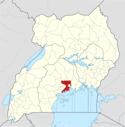
Wakiso District lies in the Central Region of the country, bordering with Nakaseke District and Luweero District to the north, Mukono District to the east, Kalangala District in Lake Victoria to the south, Mpigi District to the southwest and Mityana District to the northwest. [2] Wakiso, where the district headquarters are located, lies approximately 20 kilometres (12 mi), by road, northwest of Kampala, the capital of Uganda and the largest city in the country. [3] The coordinates of the district are:00 24N, 32 29E.

Demographics

In 1991, the national population census estimated the district population at 562,887. According to the 2002 national census figures, Wakiso District had a population of 907,988, making it the second-most populated district in the country. At that time, 53 percent of the population were children below the age of 18 years and 17 percent of the population were orphans. The national census and household survey of 2014 enumerated 1,997,418 people in the district. The Uganda Bureau of Statistics (UBOS), estimated the total population in the district, as of mid-year 2020 at 2,915,000. UBOS also calculated that the district population increased at an average annual rate of 6.7 percent, between 2014 and 2020. [1]

Historical population
YearPop.±%
1991562,887    
2002907,988+61.3%
20141,997,418+120.0%
20202,915,200+45.9%
source: [1]

Administrative units

Bombo road in Matugga - Mabanda (Wakiso District) Matugga Town - Mabanda.jpg
Bombo road in Matugga - Mabanda (Wakiso District)

Wakiso District is made up of two counties and a municipality: Kyadondo County, Busiro County. Entebbe City was split off and granted city status in 2020. The district is further subdivided into the following administrative units: [4]

  1. Busukuma
  2. Gombe
  3. Kakiri Town
  4. Katabi
  5. Kasanje
  6. Kira Town
  7. Ssabagabo
  8. Masuliita
  9. Nabweru
  10. Namayumba
  11. Nangabo (includes Gayaza and Kasangati)
  12. Nansana Town
  13. Nsangi
  14. Ssisa
  15. Wakiso Town

The district headquarters are located in Wakiso Town, approximately 20 kilometres (12 mi) northwest of Kampala on the highway to Hoima. [5] Wakiso District has a total area of 2,704 square kilometres (1,044 sq mi).

District leadership

The leadership is entrusted in the District Executive Council, composed of:

Tourist attractions

The tourist attractions in the district include:

Notable people Andrew Sematimba

See also

Related Research Articles

<span class="mw-page-title-main">Entebbe</span> Place in Central Uganda, Uganda

Entebbe is a city in Central Uganda which is located on Lake Victoria peninsula, approximately 36 kilometres (22 mi) southwest of the Ugandan capital city, Kampala. Entebbe was once the seat of government for the Protectorate of Uganda prior to independence, in 1962. The city is the location of Entebbe International Airport, Uganda's largest commercial and military airport, which gained worldwide attention in 1976 Israeli rescue of 100 hostages kidnapped by the militant group of the PFLP-EO and Revolutionary Cells (RZ) organizations. Entebbe is also the location of State House, the official office and residence of the President of Uganda.

<span class="mw-page-title-main">Mukono District</span> District in Central Region of Uganda, Uganda

Mukono is one of the districts in the Central Region of Uganda. The town of Mukono is home to the district's main commercial center and district headquarters.

<span class="mw-page-title-main">Masindi</span> Place in Western Region of Uganda, Uganda

Masindi is a town in the Western Region of Uganda. It is on the road between Kampala and the Murchison Falls National Park. It is the site of the headquarters of the Masindi District.

Kiboga is a town in the Buganda Region of Uganda. It is the main municipal, administrative, and commercial center of Kiboga District, and the district headquarters are located there.

Mpigi is a town in Mawokota County, Mpigi District, in Central Uganda. Mpigi is the municipal, administrative and commercial headquarters of Mpigi District. The district is named after the town.

<span class="mw-page-title-main">Ngamba Island Chimpanzee Sanctuary</span> Place

Ngamba Island Chimpanzee Sanctuary, is an island sanctuary in Uganda, dedicated to the care of orphaned eastern chimpanzees, that have been rescued by the Uganda Wildlife Authority. Many of the chimpanzees were rescued from poachers and are unlikely to survive reintroduction to the wild.

Kakiri is a town located in Wakiso District in the Central Region of Uganda.

<span class="mw-page-title-main">Mukono Town</span> Urban centre in Uganda

Mukono Town is a municipality in Mukono District in the Central Region of Uganda. The town is administered by the Mukono Town Council. The district headquarters are located in this town.

Wakiso is a city in the Central Region of Uganda. It is the headquarters of Wakiso District.

Malaba, Uganda is a town in Tororo District in the Eastern Region of Uganda, on its eastern border with Kenya. It sits adjacent from Malaba, Kenya, across the Malaba River that marks the border between Uganda and Kenya.

Nansana is a town in the Central Region of Uganda. It is located in the Wakiso District and is one of the five municipalities in the district. Nansana is a municipal council comprising four Divisions; Nansana Division, Nabweru Division, Gombe Division, and Busukuma Divisions. The four Divisions are considered as lower local government independent units.

<span class="mw-page-title-main">Bweyogerere</span> Place in Wakiso District, Uganda

Bweyogerere is one of the six townships or wards that constitute Kira Municipality in Wakiso District in southern central Uganda. The other five wards are Kimwaanyi, Kira, Kireka, Kirinnya and Kyaliwajjala.

Bulindo is a neighborhood in Kira Municipality, Kyaddondo County, Wakiso District, in the Central Region of Uganda.

Nsasa is a neighborhood in Kira Municipality, Kyaddondo County, Wakiso District, in the Central Region of Uganda.

<span class="mw-page-title-main">Masindi Port</span> Ugandan town

Masindi Port is a town in the Western Region of Uganda. The name also applied to the sub-county, where the own sits and forms the sub-county headquarters.

<span class="mw-page-title-main">Koome Island</span>

Koome is an island in Lake Victoria, Uganda.

Kitikifumba is a neighborhood in Kira Municipality, Kyaddondo County, Wakiso District, in the Central Region of Uganda.

Masulita is a town in Wakiso District in the Central Region of Uganda. As of April 2021 Masulita is one of four town councils in the district.

Kimwanyi is a neighborhood in Kira Municipality, Wakiso District, in the Buganda Region of Uganda. Kimwanyi also refers to Kimwanyi Parish, in Kira sub-county, Kyaddondo County, Wakiso District. It is one of the six parishes (wards) of Kira Municicipality, namely; Kimwanyi, Kira, Kyaliwajjala, Kireka, Bweyogerere and Kirinnya.

Namayumba is a settlement in the Wakiso District in the Buganda Region of Uganda. The name also refers to "Namayumba sub-county", the location of Namayumba settlement.

References

  1. 1 2 3 Uganda Bureau of Statistics (12 June 2020). "The population development of Wakiso District as well as related information and services" (Citypopulation.de Quoting Uganda Bureau of Statistics). Citypopulation.de. Retrieved 11 March 2022.
  2. Uganda District Map
  3. "Road Distance Between Kampala And Wakiso With Map". Globefeed.com. Retrieved 14 April 2014.
  4. "Sub-counties In Wakiso District". Land Conflict Mapping Tool (lcmt.com). Retrieved 14 April 2014.
  5. Kato, Joshua (24 October 2007). "Challenges of Turning Wakiso". New Vision. Retrieved 14 April 2014.
  6. "Botanical Gardens land is still intact, says NARO boss". Nile Post. November 19, 2019.
  7. "Uganda Wildlife Education Center". uwec.ug.
  8. "Lake Victoria | Size, Map, Countries, & Facts | Britannica". www.britannica.com. Retrieved 2022-06-28.