Cuddesdon and Denton

Last updated

Cuddesdon and Denton is a civil parish in the county of Oxfordshire, England.

Civil parish territorial designation and lowest tier of local government in England, UK

In England, a civil parish is a type of administrative parish used for local government, they are a territorial designation which is the lowest tier of local government below districts and counties, or their combined form, the unitary authority. Civil parishes can trace their origin to the ancient system of ecclesiastical parishes which historically played a role in both civil and ecclesiastical administration; civil and religious parishes were formally split into two types in the 19th century and are now entirely separate. The unit was devised and rolled out across England in the 1860s.

Oxfordshire County of England

Oxfordshire is a county in South East England. The ceremonial county borders Warwickshire to the north-west, Northamptonshire to the north-east, Buckinghamshire to the east, Berkshire to the south, Wiltshire to the south-west and Gloucestershire to the west.

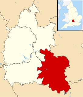
Forming part of South Oxfordshire district its main settlements are Cuddesdon and Denton.
South Oxfordshire Non-metropolitan district in England

South Oxfordshire is a local government district in the ceremonial county of Oxfordshire, England. Its council is based in Milton Park, Milton. The areas located south of the River Thames are within the historic county of Berkshire.

Cuddesdon village in United Kingdom

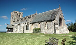
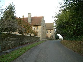
Cuddesdon is a mainly rural village in South Oxfordshire centred 5.5 miles (9 km) ESE of Oxford. It has the largest Church of England clergy training centre, Ripon College Cuddesdon.

Denton, Oxfordshire human settlement in United Kingdom

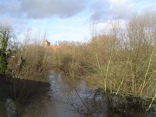
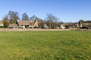
Denton is a hamlet in the civil parish of Cuddesdon and Denton in Oxfordshire. Its toponym is derived from the Old English den-tun meaning "valley farmstead". Denton is in a fold of the landscape, between the two hills on which Cuddesdon and Garsington stand.

Coordinates: 51°43′00″N01°07′30″W / 51.71667°N 1.12500°W / 51.71667; -1.12500

Geographic coordinate system Coordinate system

A geographic coordinate system is a coordinate system that enables every location on Earth to be specified by a set of numbers, letters or symbols. The coordinates are often chosen such that one of the numbers represents a vertical position and two or three of the numbers represent a horizontal position; alternatively, a geographic position may be expressed in a combined three-dimensional Cartesian vector. A common choice of coordinates is latitude, longitude and elevation. To specify a location on a plane requires a map projection.

Related Research Articles

Garsington village and civil parish in South Oxfordshire, England

Garsington is a village and civil parish about 5 miles (8 km) southeast of Oxford in Oxfordshire. The 2011 Census recorded the parish's population as 1,689.

West Oxfordshire Non-metropolitan district in England

West Oxfordshire is a local government district in northwest Oxfordshire, England, including towns such as Woodstock, Burford, Chipping Norton, Charlbury, Carterton and Witney, where the council is based.

River Thame river in the United Kingdom

The River Thame is a river in Southern England. It is a tributary of the River Thames.

Blenheim is a civil parish in West Oxfordshire, England, about 7 miles (11 km) north of Oxford. It includes Blenheim Palace.

Goring was a rural district in Oxfordshire, England from 1894 to 1932.

Ripon College Cuddesdon Church in Cuddesdon, England

Ripon College Cuddesdon is a Church of England theological college in Cuddesdon, a village 5.5 miles (8.9 km) outside Oxford, England. It is the largest ministry training institution in the Church of England.

Mishkeegogamang First Nation Indian Reserve in Ontario, Canada

Mishkeegogamang First Nation No. 63, also known as New Osnaburgh, Osnaburgh House, or Osnaburgh for various settlements, or "Oz" for short, is a First Nation band government in the Canadian province of Ontario. Until 1993, the band was called the Osnaburgh First Nation.

Bullingdon is an ancient hundred in the south-east of the county of Oxfordshire.

Pozo Cañada is a municipality in Albacete, Castile-La Mancha, Spain. It has a population of 2,650.

Winterbrook is a small settlement in the English county of Oxfordshire, which adjoins the south end of Wallingford and sits on the west bank of the Thames. In 1974 it was transferred from Berkshire. Although having been part of the adjacent parish of Cholsey for centuries, its proximity to Wallingford resulted in its being absorbed into that town for administrative purposes in 2015. This change was effected despite the strenuous and long-term objections of the residents.

Swinbrook and Widford is a civil parish in West Oxfordshire formed in 1932. It comprises the village of Swinbrook and the hamlet of Widford. The 2001 census recorded its population as 135.

Corte de Peleas Place in Extremadura, Spain

Corte de Peleas is a Spanish municipality in the province of Badajoz, Extremadura. It has a population of 1,257 (2007) and an area of 42.3 km².

Cuddesdon Palace was the episcopal palace for the Bishop of Oxford, located near the village of Cuddesdon, Oxfordshire, England.

Shouldice, Alberta

Shouldice is a hamlet in southern Alberta, Canada within Vulcan County. It is located approximately 16 kilometres (9.9 mi) south of Highway 1 and 85 kilometres (53 mi) southeast of Calgary.

Stranraer, Saskatchewan human settlement in Canada

Stranraer is a hamlet in Saskatchewan. Its name comes from Stranraer, Scotland.

Over Norton village and civil parish in West Oxfordshire, England

Over Norton is a village and civil parish within the West Oxfordshire district, about 1 mile (2 km) north of Chipping Norton, Oxfordshire, England.

Bishop Edward King Chapel Church in Cuddesdon, England

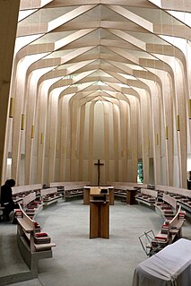
Bishop Edward King Chapel is the chapel of Ripon College Cuddesdon, a Church of England theological college, and of the Sisters of the Communities of St John Baptist and the Good Shepherd, a community of Anglican nuns.