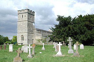
Wallingford is a historic market town and civil parish on the River Thames in Oxfordshire, England, 12 miles (19 km) north of Reading, 13 miles (21 km) south of Oxford and 11 miles (18 km) north west of Henley-on-Thames. Although belonging to the historic county of Berkshire, it is within the ceremonial county of Oxfordshire for administrative purposes as a result of the 1972 Local Government Act. The population was 11,600 at the 2011 census.
Streatley is a village and civil parish on the River Thames in Berkshire, England. The village faces Goring-on-Thames. The two places share in their shops, services, leisure, sports and much of their transport. Across the river is Goring & Streatley railway station and the village cluster adjoins a lock and weir. The west of the village is a mixture of agriculture and woodland plus a golf course. The village has a riverside hotel. Much of Streatley is at steeply varying elevations, ranging from 51m AOD to 185m at Streatley Warren, a hilltop point on its western border forming the eastern end of the Berkshire Downs. This Area of Outstanding Natural Beauty is topped by the 87-mile The Ridgeway path, which crosses the Thames at Goring and Streatley Bridge.
Cholsey is a village and civil parish 2 miles (3 km) south of Wallingford in South Oxfordshire. In 1974 it was transferred from Berkshire to Oxfordshire, and from Wallingford Rural District to the district of South Oxfordshire. The 2011 Census recorded Cholsey's parish population as 3,457. Cholsey's parish boundaries, some 17 miles (27 km) long, reach from the edge of Wallingford into the Berkshire Downs. The village green is called "The Forty" and has a substantial and ancient walnut tree.

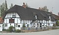
Berrick Salome is a village and civil parish in South Oxfordshire, England, about 3 miles (5 km) north of Wallingford. Since the 1992 boundary changes, the parish has included the whole of Roke and Rokemarsh and Berrick Prior. The 2011 Census recorded the parish's population as 326. In 1965, Reginald Ernest Moreau (1897–1970), an eminent ornithologist, and a Berrick Salome resident from 1947, realized that he could build up a picture of the village as it had been in the decades before the First World War, based on the recollections of elderly villagers. His study, which was published in 1968 as The Departed Village: Berrick Salome at the Turn of the Century, also included an introduction to local history. This provided much of the information for "A Village History" which appeared in The Berrick and Roke Millennium Book and is the major source for this article.
Long Wittenham is a village and small civil parish about 3 miles (5 km) north of Didcot, and 3.5 miles (5.6 km) southeast of Abingdon. It was part of Berkshire until the 1974 boundary changes transferred it from Berkshire to Oxfordshire, and from the former Wallingford Rural District to the new district of South Oxfordshire.
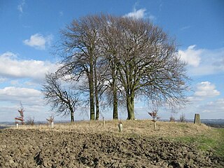
Brightwell Barrow is a Bronze Age round barrow in the civil parish of Brightwell-cum-Sotwell in the English county of Oxfordshire.
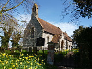
Britwell Salome is a village and civil parish in South Oxfordshire, England centred 4+1⁄2 miles (7 km) northeast of Wallingford. The 2011 Census recorded the parish's population as 204.
Brightwell Castle was in the village of Brightwell-cum-Sotwell, between the towns of Didcot and Wallingford, now in Oxfordshire but until 1974 in Berkshire, in England.

Newington is a village and civil parish in South Oxfordshire, about 4+1⁄2 miles (7 km) north of Wallingford. The 2011 Census recorded the parish's population as 102.

Harpsden is a rural and semi-rural village and civil parish immediately south of Henley-on-Thames in South Oxfordshire, Oxfordshire, England. Its scattered centre is set 0.5 miles (0.80 km) from the east border which is the River Thames, marking a short boundary with Berkshire. The parish extends 5 miles (8.0 km) inland and borders Rotherfield Peppard to the west, that is, next to its main sections of woodland in the southern extreme of the Chiltern Hills including an SSSI area of ancient woodland. The village has neither a railway station nor shops, but has the main road from Reading to Henley, both of which have grown substantially since World War II into centres of trade, education and general meeting places, such as by their increased number of cafés and restaurants.

Brightwell Baldwin is a village and civil parish in Oxfordshire, about 4+1⁄2 miles (7 km) northeast of Wallingford. It was historically in the Hundred of Ewelme and is now in the District of South Oxfordshire. The 2011 Census recorded the parish's population as 208. The parish is roughly rectangular, about 2+1⁄2 miles (4 km) long north–south and about 1+1⁄4 miles (2 km) wide east–west. In 1848 the parish covered an area of 1,569 acres (635 ha). The B4009 road linking Benson and Watlington forms part of the southern boundary of the parish. The B480 road linking Oxford and Watlington forms a small part of its northern boundary. Rumbolds Lane forms much of its western boundary. For the remainder the parish is bounded largely by field boundaries.

Cuxham is a village and former civil parish, now in the parish of Cuxham with Easington, in the South Oxfordshire district, in the county of Oxfordshire, England. It is about 5.5 miles (9 km) north of Wallingford and about 6 miles (10 km) south of Thame. In 1931 the parish had a population of 129. On 1 April 1932 the parish was abolished and merged with Easington to form "Cuxham with Easington".

Chesterton is a village and civil parish on Gagle Brook, a tributary of the Langford Brook in north Oxfordshire. The village is about 1+1⁄2 miles (2.4 km) southwest of the market town of Bicester. The village has sometimes been called Great Chesterton to distinguish it from the hamlet of Little Chesterton, about 3⁄4 mile (1.2 km) to the south in the same parish. The 2011 Census recorded the parish population as 850.

Holton is a village and civil parish in South Oxfordshire about 5.5 miles (9 km) east of Oxford. The parish is bounded to the southeast by the River Thame, to the east and north by the Thame's tributary Holton Brook, to the south by London Road and to the west by field boundaries with the parishes of Forest Hill with Shotover and Stanton St John.
Wallingford Rural District, an administrative area in what was then Berkshire, now Oxfordshire area, in southern England was established in 1894, from the then Berkshire area within Wallingford Rural Sanitary Authority. Wallingford Rural District Council provided many local government functions for the area around the town of Wallingford including Didcot, but not for the borough of Wallingford, which was covered by Wallingford Borough Council. These functions included dealing with contagious diseases, and wartime evacuations and air raid precautions. It also covered housing, water supply and sewage, and fire brigades.

Horton-cum-Studley is a village and civil parish in Oxfordshire about 6+1⁄2 miles (10.5 km) northeast of the centre of Oxford and bordering Otmoor, and is one of the "Seven Towns" of Otmoor. The 2011 Census recorded the parish's population as 455. A majority of residents in the village work in the Healthcare and Educational Sectors.

Woolstone is a village and civil parish about 4+1⁄2 miles (7 km) south of Faringdon in the Vale of White Horse. Woolstone was part of Berkshire until the 1974 boundary changes transferred it to Oxfordshire. The 2011 Census recorded the parish population as 210.
Sir Michael Molyns was a 16th-century English politician.

Brightwell Manor is a country house in the village of Brightwell-cum-Sotwell, Oxfordshire, England. The back dates to around the mid-seventeenth century, or possibly earlier as there is a date of 1605 on the rear. The front was built in the mid-eighteenth century. It has been a Grade II listed building since 1952. It is owned by former British prime minister Boris Johnson and his wife Carrie Johnson.