Related Research Articles

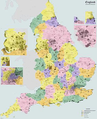
Oxfordshire is a ceremonial county in South East England. The county is bordered by Northamptonshire and Warwickshire to the north, Buckinghamshire to the east, Berkshire to the south, and Wiltshire and Gloucestershire to the west. The city of Oxford is the largest settlement and county town.

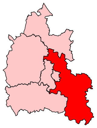
South Oxfordshire is a local government district in the ceremonial county of Oxfordshire, England. Its council is temporarily based outside the district at Abingdon-on-Thames pending a planned move to Didcot, the district's largest town. The areas located south of the River Thames are within the historic county of Berkshire.

The North Wessex Downs Area of Outstanding Natural Beauty (AONB) is located in the English counties of Berkshire, Hampshire, Oxfordshire and Wiltshire. The name North Wessex Downs is not a traditional one, the area covered being better known by various overlapping local names, including the Berkshire Downs, the North Hampshire Downs, the White Horse Hills, the Lambourn Downs, the Marlborough Downs, the Vale of Pewsey and Savernake Forest.
Henley is a constituency in Oxfordshire represented in the House of Commons of the UK Parliament since 2008 by John Howell, a Member of Parliament from the Conservative Party.
Banbury was a rural district in Oxfordshire, England from 1894 to 1974. It was formed under the Local Government Act 1894 from the bulk of the Banbury rural sanitary district, which had been divided among three counties. The Warwickshire part of the rural sanitary district formed the Farnborough Rural District, whilst the area in Northamptonshire formed the Middleton Cheney Rural District.
Ploughley was a rural district in Oxfordshire, England, from 1932 to 1974. It entirely surrounded Bicester but did not include it.
Henley was a rural district in Oxfordshire, England from 1894 to 1974.
Farnborough was a rural district in Warwickshire, England from 1894 to 1932.
Culham was a rural district in Oxfordshire, England, from 1894 to 1932. It was formed under the Local Government Act 1894 from the part of the Abingdon Rural Sanitary District in the administrative county of Oxfordshire. The remainder of the sanitary district, in the administrative county of Berkshire, became Abingdon Rural District. The rural district council continued to be based at Abingdon, holding meetings in the workhouse of the poor law union.
Crowmarsh was a rural district in Oxfordshire, England from 1894 to 1932.
Headington was a rural district in Oxfordshire, England from 1894 to 1932, based on the Headington rural sanitary district. It covered an area to the east of the city of Oxford. The parish of Headington was split out as a separate urban district in 1927.
Bradfield was a rural district in Berkshire, England, from 1894 to 1974.
Abingdon was a rural district in the administrative county of Berkshire from 1894 to 1974.
Faringdon was a rural district in the administrative county of Berkshire from 1894 to 1974.
Worton is a civil parish in the West Oxfordshire district about 7 miles (11 km) south of Banbury, England. It was formed in 1932 by the merger of the parishes of Nether Worton and Over Worton, each of which is a small village. The main road between Deddington and Swerford is the parish's northern boundary. It was a turnpike road and is now the B4031. From there the parish extends 4 miles (6.4 km) to Worton Wood on its southern boundary. East–west the parish is nowhere more than 1+3⁄4 miles (3 km) wide. The 2011 Census recorded the population of Worton parish as 624.
