
Wing, known in antiquated times as Wyng, is a village and civil parish in east Buckinghamshire, England. The village is on the main A418 road between Aylesbury and Leighton Buzzard. It is about 8 miles (13 km) north-east of Aylesbury, 3 miles (5 km) west of Leighton Buzzard, and 12 miles (19 km) south of Milton Keynes.
Little Linford is a village and former civil parish, now in the parish of Haversham-cum-Little Linford, in the City of Milton Keynes, Buckinghamshire, England. Located near the M1 motorway, the village is about 2 miles (3.2 km) north-west of Newport Pagnell and 3.5 miles (5.6 km) north of Central Milton Keynes. The village is separated from its neighbour and namesake Great Linford by the floodplain of the River Great Ouse. In 1931 the parish had a population of 45. On 1 April 1934 the parish was abolished and merged with Haversham to form "Haversham cum Little Linford".

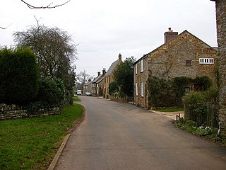
Nash is a village and also a civil parish in Buckinghamshire, England, within the Buckinghamshire Council unitary authority area. It is in the north of the county, about 5 miles (8.0 km) south-west of Milton Keynes and 4 miles (6.4 km) east of Buckingham. According to the 2011 census, the population total of Nash was 417.
Hanging Houghton is a small village and former civil parish, now in the parish of Lamport, in the West Northamptonshire district, in the ceremonial county of Northamptonshire, England. It is on the A508 road between Brixworth and Lamport. In 1931 the parish had a population of 84.

Knaptoft is a deserted medieval village and civil parish in the Harborough district of Leicestershire and lies approximately 9.7 miles (15.6 km) south of the city of Leicester, England. According to the University of Nottingham English Place-names project, the settlement name Knaptoft could mean "cnafa" for 'a boy, a young man, a servant, a menial, or a personal name' and 'toft', the plot of ground in which a dwelling stands. The population of the civil parish at the 2011 census was 47.

Great Milton is a village and civil parish in Oxfordshire, about 7 miles (11 km) east of Oxford. The 2011 Census recorded the parish's population as 1,042.

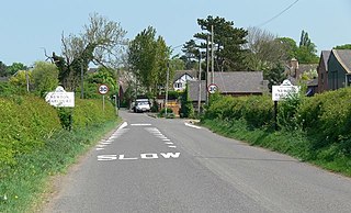
Ningwood is a village on the Isle of Wight. It is on several lanes about three miles east of Yarmouth in the northwest of the island. In the 2011 Census the population of the village was included in the civil parish of Shalfleet.
Ascott-under-Wychwood is a village and civil parish in the Evenlode valley about 4.5 miles (7 km) south of Chipping Norton, Oxfordshire, England. The 2011 Census recorded the parish's population as 560.
Water Eaton is a hamlet in the civil parish of Gosford and Water Eaton, in the Cherwell district, in the county of Oxfordshire, England. It is between Oxford and Kidlington.
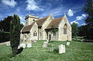
Stadhampton is a village and civil parish about 7 miles southeast of Oxford in South Oxfordshire, England. Stadhampton is close to the River Thame, a tributary of the River Thames. The village was first mentioned by name in 1146, and was in the ownership of the bishops of Lincoln, the crown, and various Oxford colleges for most of subsequent history. The village includes several buildings of historical and architectural interest, including a parish church with features dating back to the 12th-century.

Chiselhampton is a village in the civil parish of Stadhampton, on the River Thame, in the South Oxfordshire district, in the county of Oxfordshire, England. It is about 6 miles (10 km) southeast of Oxford. In 1931 the parish named Chislehampton had a population of 136. On 1 April 1932 the parish was abolished and merged with Stadhampton.

Burcot is a hamlet in the civil parish of Clifton Hampden, in the South Oxfordshire district, in the county of Oxfordshire, England. It is on the left bank of the River Thames. In 1931 the parish had a population of 187.
Newton Harcourt is a village and former civil parish, now in the parish of Wistow, in the Harborough district, in the English county of Leicestershire, and lies 7 miles south-east of the city of Leicester on the northern ridge of the River Sence valley. In 1931 the parish had a population of 142.
Chadwell is a small village in the district of Melton, which is approximately 4 miles (6.4 km) northeast of Melton Mowbray in Leicestershire, and is part of the civil parish of Scalford, which also includes the neighbouring hamlet of Wycomb. Until 1 April 1936 it was in the parish of Wycomb and Chadwell. The village name means 'spring/stream which is cold'. Chadwell is half a mile east of Wycomb, and they share the Church of St. Mary in the same ecclesiastical parish. The Church of St Mary is a Grade II* listed building.

Albury is a village in the civil parish of Tiddington-with-Albury, in the South Oxfordshire district, in Oxfordshire, England, about 5 miles (8 km) west of Thame.

Denton is a hamlet and former civil parish, now in the parish of Cuddesdon and Denton, in the South Oxfordshire district, in Oxfordshire, England. Denton's toponym is derived from the Old English den-tun meaning "valley farmstead". Denton is in a fold of the landscape, between the two hills on which Cuddesdon and Garsington stand. Denton is an ancient manor and had its own civil parish, but it was merged with neighbouring Cuddesdon in the 20th century.
Tiddington is a village in the civil parish of Tiddington-with-Albury, in the South Oxfordshire district, in Oxfordshire, England. It is about 3+1⁄2 miles (5.6 km) west of Thame, on the A418 road between Thame and Oxford. The 2011 Census recorded Tiddington-with-Albury's population as 683. Tiddington is on the county boundary with Buckinghamshire. It was a manor and hamlet of the parish of Albury, although for most of its history it has been a larger place than Albury. In 1866 Tiddington became a separate civil parish, on 1 April 1932 the parish was merged with Albury to form "Tiddington with Albury". In 1931 the parish had a population of 163.

Little Milton is a village and civil parish in Oxfordshire, about 6 miles (10 km) southwest of Thame and 7 miles (11 km) southeast of Oxford. The parish is bounded to the west by the River Thame, to the south by Haseley Brook, to the north by field boundaries and to the east by an old track between Great Milton and Rofford that is now a bridleway. Little Milton village is on raised ground above the River Thame floodplain, about 250 feet (76 m) above sea level.
Rodd, Nash and Little Brampton is a civil parish in the county of Herefordshire, England, and is 18 miles (29 km) north-west from the city and county town of Hereford. The parish borders Powys in Wales at its north-west. Within the parish is the final home and studio of the 20th-century Australian artist Sydney Nolan.

Draycot is a hamlet on the River Thame, in the civil parish of Tiddington-with-Albury, in the South Oxfordshire district, in the county of Oxfordshire, England. It is situated approximately 4½ miles to the west of Thame. In 1881 it had a population of 17.


