Related Research Articles

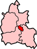
The Borough of Rugby is a local government district with borough status in eastern Warwickshire, England. The borough comprises the town of Rugby where the council has its headquarters, and the rural areas surrounding the town. The borough has a population of 114,400 (2021). Of which, 78,125 live in Rugby itself and the remainder living in the surrounding areas. Aside from Rugby itself, more notable settlements include Binley Woods, Brinklow, Clifton-upon-Dunsmore, Dunchurch, Long Lawford, Monks Kirby, Ryton-on-Dunsmore, Stretton-on-Dunsmore and Wolston, and the new large development of Houlton.

Hendon was an ancient civil parish of around 8,250 acres (33 km2) which included Mill Hill on the border of Hertfordshire, as well as Golders Green and Childs Hill on the border of what became the County of London. In 1894 it was created an urban district of Middlesex and in 1932 it became a municipal borough. The municipal borough was abolished in 1965 and the area became part of the London Borough of Barnet.

Barnet was a local government district in south Hertfordshire from 1863 to 1965 around the town of Barnet.

Potters Bar Urban District was a local government district in England from 1894 to 1974, covering the town of Potters Bar and the village of South Mimms. The district was initially called the South Mimms Rural District, being renamed in 1934.
Banbury was a rural district in Oxfordshire, England from 1894 to 1974. It was formed under the Local Government Act 1894 from the bulk of the Banbury rural sanitary district, which had been divided among three counties. The Warwickshire part of the rural sanitary district formed the Farnborough Rural District, whilst the area in Northamptonshire formed the Middleton Cheney Rural District.
Ploughley was a rural district in Oxfordshire, England, from 1932 to 1974. It entirely surrounded Bicester but did not include it.
Henley was a rural district in Oxfordshire, England from 1894 to 1974.

Merton Urban District (1907–1913) and Merton and Morden Urban District (1913–1965) was an urban district in Surrey, England. It was formed in 1907 from the parish of Merton and was expanded in 1913 to take in Morden. The district was abolished in 1965 and its former area now forms part of the London Borough of Merton in Greater London.

Hendon was a rural district in Middlesex, England from 1894 to 1934.

Brentford and Chiswick was a local government district of Middlesex, England from 1927 to 1965.

Hayes and Harlington was a local government, urban district in west Middlesex, England from 1904 to 1965.
Bullingdon Rural District was a rural district in Oxfordshire, England from 1932 to 1974, covering an area to the south-east of the city of Oxford.
Goring was a rural district in Oxfordshire, England from 1894 to 1932.
St Helen Without is a civil parish in the Vale of White Horse district in the English county of Oxfordshire. In 1974 it was transferred from Berkshire. It is immediately west of Abingdon and includes the villages of Dry Sandford and Shippon. A large part of the parish is occupied by Dalton Barracks and its associated airfield. According to the 2001 census the parish had a population of 2,623. The parish was created by the Local Government Act 1894, by the division of the parish of Abingdon St. Helen. The part inside Abingdon Municipal Borough became part of Abingdon parish, whilst that part outside became St. Helen Without. It became part of the Abingdon Rural District of Berkshire in 1894, and then part of the Vale of White Horse in Oxfordshire under the Local Government Act 1972.
Bullingdon was a hundred in the county of Oxfordshire, covering an area to the east of Oxford. It took its name from the hamlet of Bullingdon Green, in the parish of Horspath, where the hundred court originally met.

Burnham Without is the parish in the main located to the east of Burnham-on-Sea, the Motorway/M5 and north & north east east of Highbridge in the Sedgemoor district of Somerset, England.
Jack Straw's Lane is a residential road in Oxford, England. It runs between the north end of Pullens Lane on Headington Hill and Marston Road.
Bletchley Urban District was an urban district covering the town of Bletchley in the administrative county of Buckinghamshire, England from 1911 to 1974. The district had been created in 1895 as Fenny Stratford Urban District, being renamed to Bletchley Urban District in 1911.
Chipping Norton Rural District was a rural district in Oxfordshire, England from 1894 to 1974. It surrounded but did not include the town of Chipping Norton.
Witney Rural District was a rural district in Oxfordshire, England from 1894 to 1974. It surrounded but did not include the town of Witney.