
Ballyclare is a small town in County Antrim, Northern Ireland. It had a population of 9,953 according to the 2011 census, and is located within the Antrim and Newtownabbey Borough Council area.

Dungiven is a small town, townland and civil parish in County Londonderry, Northern Ireland. It is near the main A6 Belfast to Derry road, which bypasses the town. It lies where the rivers Roe, Owenreagh and Owenbeg meet at the foot of the 1,525 ft (465 m) Benbradagh. Nearby is the Glenshane Pass, where the road rises to over 1,000 ft (300 m). It had a population of 3,288 people in the 2011 Census, an increase of 10% over the 2001 population of 2,993. It is within Causeway Coast and Glens district council area.

Rossington is a civil parish and former mining village in the Metropolitan Borough of Doncaster in South Yorkshire, England and is surrounded by countryside and the market towns of Bawtry and Tickhill.

Easky or Easkey is a village in County Sligo, Ireland. It is on the Atlantic coast, 26 miles (42 km) from Sligo and 15 miles (24 km) from Ballina, County Mayo. The village name derives from the Irish language term for fish ("iasc") and "Iascaigh" literally means "abounding in fish", due to the Easky River that lies adjacent to the village itself. Easky, as a parish, was originally called "Imleach Iseal". The area is a tourist destination on account of its scenery and water sports. Easky is a designated area on Ireland's Wild Atlantic Way tourist route.

Dundonald is a large settlement and civil parish in County Down, Northern Ireland. It lies east of Belfast and is often considered a suburb of the city. It is home to the Ulster Hospital, Dundonald International Ice Bowl, Dundonald Omnipark, has a Park and Ride facility for the Glider, access to the Comber Greenway and several housing developments. John de Courcey established a keep including a motte-and-bailey in the 12th century. This is known as Moat Park and can be accessed from Church Green, Comber Road and the Upper Newtownards Road.

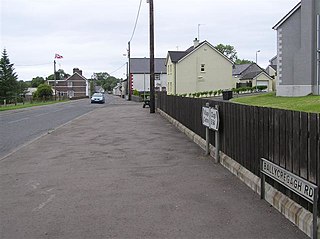
Owenbeg is a village and townland in County Sligo, Ireland. It is situated on the N59 national highway section between Ballina, County Mayo, and Sligo Town, near the junction of the road with R297. The name is an anglicisation of the Irish-language words abhainn beag, or "little river", after the river on which it is situated.

Ballygawley or Ballygawly is a small town in County Tyrone, Northern Ireland. It is about 20 kilometres southwest of Dungannon, near the meeting of the A5 Derry–Dublin and A4 Dungannon–Enniskillen roads.
Cloughmills or Cloghmills is a village in County Antrim, Northern Ireland. Ballymoney is 9 miles to the north-west and Ballymena is 10 miles to the south. It had a population of 1,309 people in the 2011 Census. It is in Causeway Coast and Glens District Council.

Burnfoot is a small village within the townland of Bonnanaboigh in County Londonderry, Northern Ireland.

Feeny is a village and townland in County Londonderry, Northern Ireland. It is between Dungiven and Claudy. In the 2011 Census it had a population of 690. Feeny lies just inside the boundary of the Sperrins Area of Outstanding Natural Beauty. It is situated within Causeway Coast and Glens district.

Ardgarvan is a hamlet and townland in County Londonderry, Northern Ireland, 2 km south of Limavady. In the 2001 Census it had a population of 111 people. It is situated within Causeway Coast and Glens district.
Foreglen is a village in County Londonderry, Northern Ireland. Around 1900 it was known as Ballymoney.
Gortnahey, also transliterated as Gortnaghey, is a townland and small hamlet in County Londonderry, Northern Ireland. It is 5 km northwest of Dungiven and 13 km south of Limavady. In the 2001 Census its population was 285. It is situated within Causeway Coast and Glens district.

Armoy is a village and civil parish in County Antrim, Northern Ireland. It is 5.5 miles (9 km) southwest of Ballycastle and 8 miles (13 km) northeast of Ballymoney. According to an estimate in 2013 by the Northern Ireland Statistics and Research Agency it had a population of 1,122.

The A6 road in Northern Ireland runs for 71.4 miles (114.9 km) from Belfast to Derry, via County Antrim and County Londonderry. From Belfast to Randalstown the route has been superseded by a motorway. now mostly single carriageway and dual carriageway as of 2023 there are sections of dual carriageway in Antrim town centre and from Randalstown to Toome, including the Toome bypass to Castledawson roundabout. the Glenshane as of now still single carriageway to Dungiven then back to dual carriageway all the way to Drumahoe. In urban and suburban districts of Belfast and Derry the route is single carriageway with 4 lanes. In rural parts, there are numerous climbing lanes along the route. The A6 is one of Northern Ireland's most important arterial routes, as the road runs between its two largest cities and urban areas. Between Randalstown and Derry the road forms part of European route E16.
Millvale is a settlement between Bessbrook and Newry in County Armagh, Northern Ireland. It is within the townland of Cloghreagh.

The River Roe is a river located in County Londonderry, Northern Ireland. It flows north from Glenshane in the Sperrin Mountains to Lough Foyle, via the settlements of Dungiven, Burnfoot, Limavady and Myroe. The River Roe's length is 34.25 miles (55.12 km)

The Ballisodare River is a river in Ireland, flowing through County Sligo.

