
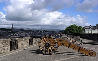
Derry, officially Londonderry, is the second-largest city in Northern Ireland and the fifth-largest city on the island of Ireland. The old walled city lies on the west bank of the River Foyle, which is spanned by two road bridges and one footbridge. The city now covers both banks.

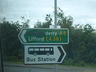
County Donegal is a county of Ireland in the province of Ulster and in the Northern and Western Region. It is named after the town of Donegal in the south of the county. It has also been known as County Tyrconnell or Tirconaill, after the historic territory. Donegal County Council is the local council and Lifford is the county town.
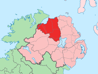
County Londonderry, also known as County Derry, is one of the six counties of Northern Ireland, one of the thirty two counties of Ireland and one of the nine counties of Ulster. Before the partition of Ireland, it was one of the counties of the Kingdom of Ireland from 1613 onward and then of the United Kingdom after the Acts of Union 1800. Adjoining the north-west shore of Lough Neagh, the county covers an area of 2,118 km2 (818 sq mi) and today has a population of about 252,231.

Baron Templemore, of Templemore in the County of Donegal, is a title in the Peerage of the United Kingdom, since 1975 a subsidiary title of the Marquessate of Donegall. It was created on 10 September 1831 for Arthur Chichester, Member of Parliament for Milborne Port and County Wexford. He was the son of Lord Spencer Stanley Chichester, third son of The 1st Marquess of Donegall. Lord Templemore's son, the second Baron, and grandson, the third Baron, both served as Deputy Lieutenants of County Wexford. The latter was succeeded by his eldest son, the fourth Baron. He served as the Government Chief Whip in the House of Lords between 1940 and 1945. He was succeeded by his second but eldest surviving son, the fifth Baron. In 1975 he succeeded his kinsman as seventh Marquess of Donegall. For further history of the titles, see Marquess of Donegall.
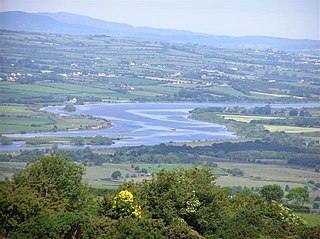
The River Foyle is a river in west Ulster in the northwest of the island of Ireland, which flows from the confluence of the rivers Finn and Mourne at the towns of Lifford in County Donegal, Republic of Ireland, and Strabane in County Tyrone, Northern Ireland. From here it flows to the city of Derry, where it discharges into Lough Foyle and, ultimately, the Atlantic Ocean. The total length of the River Foyle is 32 km (20 mi). The river separates part of County Donegal from parts of both County Londonderry and County Tyrone. The district of County Donegal that borders the western bank of the River Foyle is traditionally known as the Laggan. This district includes the villages of St Johnston and Carrigans, both of which are nestled on the banks of the River.
Derry City Council was the local government authority for the city of Derry in Northern Ireland. It merged with Strabane District Council in April 2015 under local government reorganisation to become Derry and Strabane District Council.
The earliest references to the history of Derry date to the 6th century when a monastery was founded there; however, archaeological sites and objects predating this have been found. The name Derry comes from the Old Irish word Daire meaning 'oak grove' or 'oak wood'.
The names of the city and county of Derry or Londonderry in Northern Ireland are the subject of a naming dispute between Irish nationalists and unionists. Generally, although not always, nationalists favour using the name Derry, and unionists Londonderry. Legally, the city and county are called "Londonderry", while the local government district containing the city is called "Derry City and Strabane". The naming debate became particularly politicised at the outset of the Troubles, with the mention of either name acting as a shibboleth used to associate the speaker with one of Northern Ireland's two main communities. The district of Derry and Strabane was created in 2015, subsuming a district created in 1973 with the name "Londonderry", which changed to "Derry" in 1984.

The Republic of Ireland–United Kingdom border, sometimes referred to as the Irish border or British–Irish border, runs for 499 km (310 mi) from Lough Foyle in the north-west of Ireland to Carlingford Lough in the north-east, separating the Republic of Ireland from Northern Ireland.
Ballynagalliagh is a townland in County Londonderry, Northern Ireland. It lies within Derry and Strabane district.
Shantallow is a townland in County Londonderry, Northern Ireland. It is now part of the city of Derry, and is situated within Derry and Strabane district. It lies within the civil parish of Templemore and former barony of North-West Liberties of Londonderry. The townland is no longer a visible feature of Derry, being mainly built over with 20th-century housing estates.
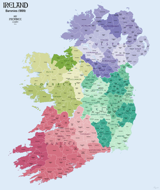
In Ireland, a barony is a historical subdivision of a county, analogous to the hundreds into which the counties of England were divided. Baronies were created during the Tudor reconquest of Ireland, replacing the earlier cantreds formed after the original Norman invasion. Some early baronies were later subdivided into half baronies with the same standing as full baronies.

Clady is a small village and townland in County Tyrone, Northern Ireland. It lies about 4 miles from Strabane on the River Finn and borders the Republic of Ireland. In the 2011 Census it had a population of 538 people. It is within Urney civil parish and the former barony of Strabane Lower. In local government it is part of the Derry City and Strabane District Council. The townland covers an area of 173 acres.

Northern Ireland is divided into six counties, namely: Antrim, Armagh, Down, Fermanagh, Londonderry and Tyrone. Six largely rural administrative counties based on these were among the eight primary local government areas of Northern Ireland from its 1921 creation until 1973. The other two local government areas were the urban county boroughs of Derry and Belfast.
The Ordnance Memoir of Ireland was a projected 1830s topography of Ireland to be published alongside the maps of the Ordnance Survey of Ireland using materials gathered by surveyors as they traversed the country. The project was cancelled in 1840 as too expensive and beyond the survey's original scope. Material gathered before the cancellation mostly covers Ulster. Much was eventually published in the later twentieth century. The memoirs are a useful primary source for local history and genealogy of the period shortly before the Great Famine.
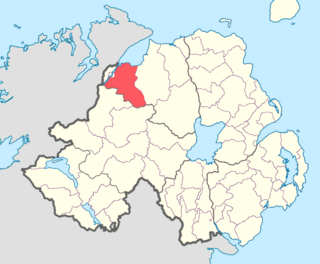
Tirkeeran is a barony in County Londonderry, Northern Ireland. It connects to the north-Londonderry coastline, and is bordered by four other baronies: Keenaght to the east; Strabane Lower to the south-east; North West Liberties of Londonderry to the west; Strabane Upper to the south.

The A40 links Derry in the North West of Northern Ireland to Raphoe in County Donegal.
The Londonderry Borough Police was the police force in the city of Derry, County Londonderry, Ireland, from 1848 to 1870, nicknamed the Horney Dicks after the bones used in their helmets. They replaced the earlier town watch and were in turn replaced by the Royal Irish Constabulary (RIC). The police force was established by the Londonderry Improvement Act 1848 and were governed by the Londonderry Corporation. Its abolition was recommended by a royal commission of inquiry into sectarian riots in the city in 1869. The commission felt the force, having the form of a town watch, was inadequate to policing serious crime; it also noted, but did not endorse, allegations that the police discriminated against Roman Catholics.
Boom Hall is a house and demesne in Derry, Northern Ireland. Lying close to the west bank of the River Foyle, a fort was constructed on the site during the English Civil War. During the Williamite War in Ireland a boom was constructed across the river to try to prevent Williamite forces relieving the Siege of Derry. A two-storey country house was subsequently built on the site by the Alexander family and named after this boom. The estate was later leased to a number of people until a leasehold was sold to Daniel Baird in 1849 by The 3rd Earl of Caledon. This was inherited by Daniel Baird Maturin-Baird who also purchased the freehold from the Alexanders. Boom Hall was again let to a number of different people, with Michael Henry McDevitt living there from 1924. During the Second World War, the demesne was used by the Admiralty and a number of temporary huts were built there. McDevitt purchased the freehold in 1949 and the house was renovated. It fell into disuse in the 1960s and was almost destroyed by fire in the 1970s. Part of the estate was used for the construction of the Foyle Bridge.
The Burn Dale is a burn or small river in the east of County Donegal in Ulster, the northern province in Ireland. The burn is also known in English as the Dale Burn, the Burn Deele, the Burndale River, the Deele River or the River Deele. In the Ulster Scots dialect, a 'burn' is a stream or small river.

