This is a list of cities, towns, villages, parishes and hamlets in County Londonderry , Northern Ireland. See the list of places in Northern Ireland for places in other counties.
Towns are listed in bold.
CARNHILL SA
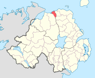
County Londonderry, also known as County Derry, is one of the six counties of Northern Ireland, one of the thirty two counties of Ireland and one of the nine counties of Ulster. Before the partition of Ireland, it was one of the counties of the Kingdom of Ireland from 1613 onward and then of the United Kingdom after the Acts of Union 1800. Adjoining the north-west shore of Lough Neagh, the county covers an area of 2,118 km2 (818 sq mi) and today has a population of about 247,132.

Magherafelt is a small town and civil parish in County Londonderry, Northern Ireland. It had a population of 8,805 at the 2011 Census. It is the biggest town in the south of the county and is the social, economic and political hub of the area. It is part of Mid-Ulster District.

Ballyrashane is a small village and civil parish outside Coleraine, County Londonderry, Northern Ireland. The civil parish of Ballyrashane covers areas of County Antrim, as well as County Londonderry. It is part of Causeway Coast and Glens district.
Ballyscullion is a small village and civil parish in County Londonderry, Northern Ireland. In the 2001 Census it had a population of 291 people. The civil parish of Ballyscullion covers areas of County Antrim as well as County Londonderry. The village is situated within Mid-Ulster District.
Tamlaght is a small village, townland and civil parish in County Londonderry, Northern Ireland. In the 2001 Census it had a population of 123 people. It is situated within Mid-Ulster District. The civil parish of Tamlaght covers areas of County Tyrone as well as County Londonderry.

Clady is a small village and townland in County Tyrone, Northern Ireland. It lies about 4 miles from Strabane on the River Finn and borders with the Republic of Ireland. In the 2001 Census it had a population of 423 people. It is within Urney civil parish and the former barony of Strabane Lower. In local government it is part of the Derry City and Strabane District Council. The townland covers an area of 173 acres.

Northern Ireland is divided into six counties, namely: Antrim, Armagh, Down, Fermanagh, Londonderry and Tyrone. Six largely rural administrative counties based on these were among the eight primary local government areas of Northern Ireland from its 1921 creation until 1973. The other two local government areas were the urban county boroughs of Derry and Belfast.
Londonderry is a city in Northern Ireland.

The North West Liberties of Londonderry is a barony in County Londonderry, Northern Ireland. It is bordered by two other baronies in Northern Ireland. They are Tirkeeran to the east, across Lough Foyle; and Strabane Lower to the south. It also borders two baronies in County Donegal in the Republic of Ireland. It borders Raphoe North, to the south-west; and Inishowen West to the north.
The North East Liberties of Coleraine is a barony in County Londonderry, Northern Ireland. It borders the north-Londonderry coastline, and is bordered by three other baronies: Coleraine to the west; Dunluce Lower to the north-east; Dunluce Upper to the south-east. The North East Liberties of Coleraine formed the north-western part of the medieval territory known as the Route.

Calmore is a townland lying within the civil parish of Kilcronaghan, County Londonderry, Northern Ireland. It lies in the north-west of the parish, and is bounded by the townlands of; Granny, Moneyshanere, Moyesset, and Tobermore. It was apportioned to the Drapers company as well as Crown freeholds.
Drumballyhagan and Drumballyhagan Clark are two townlands lying within the civil parish of Kilcronaghan, County Londonderry, Northern Ireland. Situated in the north of the parish, the two townlands are separated by the Moyola River, of which the southern portion was held by a person surnamed "Clark". Together they are bounded by the townlands of; Ballynahone Beg, Bracaghreilly, Drumcrow, Fallagloon, Lisnamuck, Moneyshanere, and Tobermore. It was apportioned to the Vintners company.
Tobermore is a townland lying within the civil parish of Kilcronaghan, County Londonderry, Northern Ireland. It lies in the north-east of the parish, and is bounded by the townlands of; Ballynahone Beg, Calmore, Clooney, Drumballyhagan Clark, Moneyshanere, and Moyesset. It was apportioned to the Drapers company as well as freeholds.

Moneyshanere is a townland lying within the civil parish of Kilcronaghan, County Londonderry, Northern Ireland. It lies in the north-west of the parish on the boundary with the civil parish of Ballynascreen, and it is bounded by the townlands of: Calmore, Drumcrow, Drumballyhagan Clark, Duntibryan, Granny, Moneyguiggy, Moybeg Kirley, and Tobermore. It was apportioned to the Drapers company and Crown freeholds.

Mormeal is a townland lying within the civil parish of Kilcronaghan, County Londonderry, Northern Ireland. It lies in the west of the parish with the Altagoan river to its west forming the parish boundary with Ballynascreen. It is bounded by the townlands of: Brackaghlislea, Drumard, Duntibryan, Gortnaskey, Granny, Tamnyaskey. It wasn't apportioned to any of the London livery companies, being kept as church lands.
Keenaght is a townland lying within the civil parish of Kilcronaghan, County Londonderry, Northern Ireland. It lies in the south of the parish on the boundary with the civil parish of Desertmartin, and it is bounded by the townlands of: Coolsaragh, Cullion, Gortahurk, Longfield, and Tintagh. It was apportioned to the Drapers company.
Maghera is a parish in County Londonderry, Northern Ireland. It is bordered by the parishes of Ballynascreen, Ballyscullion, Desertmartin, Dungiven, Kilcronaghan, Killelagh, Magherafelt, Tamlaght O'Crilly, and Termoneeny. As a civil parish it lies within the former barony of Loughinsholin and as an ecclesiastical parish it lies within the Church of Ireland Diocese of Derry and Raphoe.
Ballyrory is a small village and townland in County Londonderry, Northern Ireland. It is situated in the civil parish of Cumber Upper and the historic barony of Tirkeeran.
