Dharmatala

Last updated

Dharmotala
Neighbourhood in Kolkata (Calcutta)
Bentinck Street - Chowringhee Square - Kolkata 2011-12-18 0053.JPG
Bentinck Street in Dharmatala
Kolkata street-Dharmatala.svg
Location of Dharmatala in Kolkata
Coordinates: 22°33′36″N88°21′09″E / 22.560055°N 88.352540°E / 22.560055; 88.352540 Coordinates: 22°33′36″N88°21′09″E / 22.560055°N 88.352540°E / 22.560055; 88.352540
CountryFlag of India.svg  India
State West Bengal
District Kolkata
City Kolkata
Metro Station Chandni Chowk and Esplanade
Municipal Corporation Kolkata Municipal Corporation
KMC wards 46, 47
Elevation
36 ft (11 m)
Population
  TotalFor population see linked KMC ward pages
Time zone UTC+5:30 (IST)
PIN
700013, 700069
Area code +91 33
Lok Sabha constituency Kolkata Uttar
Vidhan Sabha constituency Chowranghee

Dharmatala (archaic spelling Dhurrumtollah) is a neighbourhood of Central Kolkata, in Kolkata district in the Indian state of West Bengal. Dharmatala Street has been renamed after Lenin as Lenin Sarani but the neighbourhood up to Wellington Square continues to be referred as Dharmatala. It is a busy commercial area that had come up with the growth of Calcutta during the British Raj and is thus one of the repositories of history in the city.

Contents

Etymology

Dharmatala means Holy Street. It is commonly held to derive its name from a large mosque which stood at the site of Cook and Company's livery stables. Some discern the name as a reference to dharma, one of the units of the Buddhist Trinity. There was a Buddhist temple at Janbazar, nearby. Tipu Sultan Mosque at the corner of Chowringhee Road and Dharmatala, was built in 1842, by Prince Gholam Mohammad, son of Tipu Sultan. [1] Binoy Ghosh feels that the name Dharmatala is because of the preeminence of Dharmathakur in olden days. Haris and Doms, who are worshippers of Dharmathakur, predominated the area even in the memorable past. [2]

Geography

Dharmatala extends from Chowringhee Road (renamed Jawaharlal Nehru Road) to Nirmal Chandra Street. It is bounded to the north by Bowbazar, the south by Janbazar, the east by Taltala and the west by Maidan. [1]

The neighbourhood is spread over 2 wards: 46 and 47 of Kolkata Municipal Corporation. [3]

History

In the 18th century, Dharmatala is described as ‘a well raised causeway, raised by deepening the ditch on both sides’. It was shaded with trees on both sides. [1]

Just north of Dharmatala a creek formerly ran from Chandpal Ghat to Beliaghata (or Baliaghata, as it was then known). The creek passed through what was later Wellington Square (renamed Subodh Chandra Mallick Square) and Creek Row. The earlier name of Creek Row was Dhinga Bhanga, as a ship broke there during the cyclone of 1737. The creek was navigable for large boats. Wellington Square was a tank made on the bed of this creek. Both Wellington Square and Creek Row were developed by the Lottery Committee. Calcutta Gazette of 9 August 1821 refers to Wellington Square as ‘the new square in Dhurrumtollah.’ [1]

While the English quarter was then restricted to around the old fort (present B.B.D. Bagh), the area south of Dharmatala was a jungle. The native quarters to the north consisted of a number of straggling villages. [4]

After their victory in the Battle of Plassey, the English decided to build new Fort William, in 1758. For this purpose, the native population shifted from Gobindapur mostly to Sutanuti. The European inhabitants of Kalikata gradually forsook the narrow limits of the old palisades and moved to around the Maidan. [5] Civilians were not allowed to live within the new fort. Gradually the areas to the south of the Great Tank and to the east along Chowringhee Road were emerging as preferred haunts for the Englishmen. While Sutanuti developed as the Black Town, the Esplanade and Chowringhee emerged as the White Town. However, the areas around Writers' building, Baitakkhana (Bowbazar), Dharmatala and Janbazar went down in estimation and were gradually taken over by ‘the rest’, which included half-castes, Portuguese, Armenians and so on, 'to become grey areas between Black and White Towns of old Calcutta'. [6]

The district lying between Dharmatala and Bowbazar and bounded on the west by Bentinck Street was in the 19th and 20th century inhabited by a variety of people that included Portuguese, other Europeans of poorer classes and Indians. The area was full of ‘tortuous and narrow lanes, badly drained and reeking with foul odours, thickly populated and miserably housed.’ In this district on the northern side of Dharmatala is a bazaar called Chandney Chowk. ‘It is a labyrinth of ill-kept passages, lined with shops, in which may be found a wonderful collection of sundries, from a door nail to a silk dress.’ [7]

Dharmatala Bazar was established in 1794 at the corner of Dharmatala and Chowringhee. Rudyard Kipling in the last chapter of his Kolkata sketches published under the title of The City of Dreadful Nights, has given a lively description of the market and its frequenters. [8] It was formerly called Shakespeare's Bazar. [1]

In the earliest list of police stations in Kolkata made in 1785, both Dharmatala and Dingabhanga were included. However, when the police stations were reorganised in 1888–89, the number of police stations were reduced and no mention is there of either. [9]

Transport

A three-horse omnibus plied briefly between Dharmatala and Barrackpore in November 1830 but the truly successful horse-drawn public transport was the tramcar. These were introduced in Dharmatala in March 1882. In 1899, the Calcutta Tramways Company started electrifying the entire system. [10]

Dharmatala has always been a major traffic hub. Today, Dharmatala is the busiest bus terminus of West Bengal. Kolkata trams route no. 5, 25 and 36 also start their journey from Dharmatala. [11]

During rush hours some 200,000 to 300,000 vehicles pass through Dharmatala. Experts say 50–60 percent of air pollution in Kolkata is due to vehicle emission. Increase in number of vehicles may have added to the problem. [12] In the Dharmatala area, the noise levels are 75–84 dB. [13]

According to transport department officials, over 2,000 long-distance buses operate from the city. Most of the state and private buses originate from here. [14] [15]

Eden Gardens railway station on Kolkata Circular Railway line is the nearest railway station. Sealdah Station, one of the five major railway-terminals of Kolkata Metropolitan Area, is also nearby.

The Esplanade Metro Station of Kolkata Metro opened on October 24, 1984, with the opening of the Esplanade Bhawanipur Section of Line 1. Ten years later, the line was extended northward to Chandni Chowk. Both these stations in the Dharmatala Area are among the busiest in the network. Just below the existing Metro station of Line 1, another station is under construction for Line 2 of Kolkata Metro. It will be the extension of Line 2 from Salt Lake Stadium to Howrah Maidan going beneath the Ganges, with an interchange with Line 1 at Esplanade. Line 3 of Kolkata Metro is also planned to terminate at Esplanade running from Joka.

Related Research Articles

<span class="mw-page-title-main">Maidan (Kolkata)</span> Urban park in Kolkata, India

The Maidan, also referred to as the Brigade Parade Ground, is a large public park and urban green space in the center of Kolkata, India. With a total area of 988 acres (4.0 km2), it is the largest urban public park in India. It is a vast stretch of field that includes numerous sporting grounds, including the famous cricketing venue Eden Gardens, several football stadiums and the Kolkata Race Course. The Maidan is also dotted with many statues and architectural works, the most notable being the Victoria Memorial. Due to the freshness and greenery it provides to the metropolis, it has been referred to as the "lungs of Kolkata".

<span class="mw-page-title-main">Esplanade, Kolkata</span> Neighbourhood in Kolkata in West Bengal, India

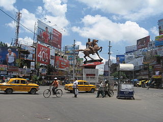
Esplanade is a neighbourhood of Central Kolkata, in Kolkata district in the Indian state of West Bengal. This is not a conventional esplanade in the sense that the place is not exactly situated alongside a waterbody. However, the Ganga river (Ganges), also known as Hooghly river, flows nearby.

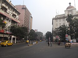
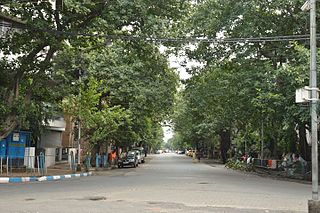
Chowringhee Road, located in the Chowringhee neighbourhood of Kolkata, is the arterial road running from the eastern fringes of Esplanade southwards up to the crossing with Lower Circular Road, in the city of Kolkata, West Bengal, India. It is the single most important road of the metropolis of Kolkata. It was officially renamed as Jawaharlal Nehru Road after Jawaharlal Nehru, India's first Prime Minister, but the original name Chowringhee Road is used commonly.

<span class="mw-page-title-main">Chowringhee</span> Neighbourhood in Kolkata in West Bengal, India

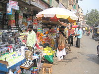
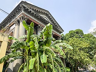
Chowringhee is a neighbourhood of Central Kolkata, in Kolkata district in the Indian state of West Bengal. Chowringhee Road runs on its western side. A neighbourhood steeped in history, it is a business district, as well as a shopper's destination and entertainment-hotel centre.

<span class="mw-page-title-main">Kalikata</span>

Kalikata was one of the three villages which were merged to form the city of Kolkata in India. The other two villages were Gobindapur and Sutanuti. Job Charnock, an administrator with the British East India Company is traditionally credited with the honour of founding the city. He settled in the village of Sutanuti.

<span class="mw-page-title-main">Gobindapur, Kolkata</span>

Gobindapur was one of the three villages which were merged to form the city of Calcutta in late 17th century. The other two villages were Kalikata and Sutanuti. Job Charnock, an administrator with the British East India Company is traditionally credited with the honour of founding the city. While Kalikata and Sutanuti lost their identity as the city grew, Gobindapur was demolished for the construction of new Fort William.

<span class="mw-page-title-main">Chitpur</span> Neighbourhood in Kolkata in West Bengal, India

Chitpur is a neighbourhood in North Kolkata in Kolkata district in the Indian state of West Bengal. Sometimes, the entire area along Chitpur Road is referred to as Chitpur, although the various localities have distinctive names.

<span class="mw-page-title-main">Kumortuli</span> Neighbourhood in Kolkata in West Bengal, India

Kumortuli is a traditional potters' quarter in northern Kolkata, West Bengal, India. The city is renowned for its sculpting prowess. It not only manufactures clay idols for various festivals but also regularly exports them.

<span class="mw-page-title-main">Bagbazar</span> Neighbourhood in Kolkata in West Bengal, India

Bagbazar is a neighbourhood of North Kolkata, in Kolkata district in the Indian state of West Bengal. The area, under Shyampukur police station of Kolkata Police, has been, along with neighbouring Shyambazar, the citadel of the Bengali aristocracy. Bagbazar has played an active role in growth and development of Kolkata.

<span class="mw-page-title-main">Janbazar</span> Neighbourhood in Kolkata in West Bengal, India

Janbazar is a neighbourhood of Central Kolkata, in Kolkata district in the Indian state of West Bengal. The two century-old house of Rani Rashmoni, the central attraction in Janbazar, is still used by descendants in the family.

<span class="mw-page-title-main">Shyambazar</span> Neighbourhood in Kolkata in West Bengal, India

Shyambazar is a neighbourhood of North Kolkata, in Kolkata district in the Indian state of West Bengal. The area, under Shyampukur police station of Kolkata Police, has been, along with neighbouring Bagbazar, the citadel of the Bengali aristocracy, in a part of what was earlier known as Sutanuti. and the popularity of Shyambazer five point crossing is for the statue of Netaji Subhas Chandra Bose.

<span class="mw-page-title-main">Bowbazar</span> Neighbourhood in Kolkata in West Bengal, India

Bowbazar is a neighbourhood of Central Kolkata, in Kolkata district in the Indian state of West Bengal.

<span class="mw-page-title-main">Shyampukur</span> Neighbourhood in Kolkata in West Bengal, India

Shyampukur is a neighbourhood of North Kolkata, in Kolkata district in the Indian state of West Bengal. As a neighbourhood, it covers a small area but its importance is primarily because of the police station.

<span class="mw-page-title-main">Jorabagan</span> Neighbourhood in Kolkata in West Bengal, India

Jorabagan is a neighbourhood of North Kolkata, in Kolkata district, in the Indian state of West Bengal. As a neighbourhood, it covers a small area but its importance is primarily because of the police station.

<span class="mw-page-title-main">Taltala</span> Neighbourhood in Kolkata in West Bengal, India

Taltala is a neighbourhood in Central Kolkata, in Kolkata district in the Indian state of West Bengal. One of the oldest neighbourhoods of the metropolis, it has a police station on its own name.

<span class="mw-page-title-main">Chandni Chowk metro station (Kolkata)</span>

Chandni Chowk, Kolkata is a metro station of the Kolkata Metro.It is located in Central Avenue, Chandni Chowk, Bowbazar, Kolkata, West Bengal, India.

Sinthee or Sinthi is a neighbourhood of North Kolkata in Kolkata district, West Bengal, India.

<span class="mw-page-title-main">Trams in Kolkata</span> Tram transport of Kolkata

The tram system in the city of Kolkata, West Bengal, India, operated by West Bengal Transport Corporation (WBTC) after Calcutta Tramways Company (CTC) was dissolved, is the oldest existing tram network operating in India, and oldest operating tramway in Asia. Started in 1902, it is the second oldest electric tramway in India.

Ward No. 46, Kolkata Municipal Corporation is an administrative division of Kolkata Municipal Corporation in Borough No. 6, covering parts of Chowringhee, Esplanade East, Dharmatala, Janbazar, Lalbazar, Bowbazar and Maidan neighbourhoods in central Kolkata, in the Indian state of West Bengal.

Dihi Panchannagram was a group of 55 villages which the East India Company purchased in 1758 from Mir Jafar, after the fall of Siraj-ud-daulah, the last independent Nawab of Bengal, in what is now the city of Kolkata, earlier known as Calcutta, in Kolkata district, in the Indian state of West Bengal. These villages initially developed as suburbs of Kolkata, but now forms part of the city proper within the limits of the Kolkata Municipal Corporation.

References

  1. 1 2 3 4 5 Cotton, H.E.A., Calcutta Old and New, 1909/1980, pp. 248-50, General Printers and Publishers Pvt. Ltd. PD-icon.svg This article incorporates text from this source, which is in the public domain .
  2. Ghosh, Binoy, Paschim Banger Sanskriti, (in Bengali), part II, 1978 edition, p. 252, Prakash Bhaban
  3. Map nos. 29, 30, and 32, Detail Maps of 141 Wards of Kolkata, D.R.Publication and Sales Concern, 66 College Street, Kolkata – 700073
  4. Nair, P. Thankappan, The Growth and Development of Old Calcutta, in Calcutta, the Living City, Vol. I, edited by Sukanta Chaudhuri, p. 11, Oxford University Press, ISBN   978-0-19-563696-3.
  5. Cotton, H.E.A., p. 72
  6. Lahiri Choudhury, Dhriti Kanta, Trends in Calcutta Architecture, in Calcutta, the Living City, Vol I, pp.159-160
  7. Cotton, H.E.A., p. 219
  8. Cotton, H.E.A., p. 771
  9. Nair, P. Thankappan, The Growth and Development of Old Calcutta, p. 15.
  10. Nair, P.Thankappan, Civic and Public Services in Old Calcutta, in Calcutta, the Living City, Vol I, pp. 234-6
  11. Google maps
  12. "Better Kolkata Campaign". The Statesman, 17 June 2002. Archived from the original on 29 September 2007. Retrieved 2007-07-25.
  13. Chakraborti, Dipankar, Calcutta's Environment, p.185, in Calcutta, the Living City, Vol II
  14. Mukherjee, Shankar (18 August 2003). "Bypass, Setu sites for twin central bus terminals". Calcutta, India: The Telegraph, 18 August 2003. Archived from the original on 22 August 2003. Retrieved 25 July 2007.
  15. Konar, Debashis (24 January 2003). "Breather for choking esplanade?". Times of India, 24 January 2003. Retrieved 25 July 2007.

Wikivoyage-Logo-v3-icon.svg Kolkata/Esplanade travel guide from Wikivoyage