Ghola, North 24 Parganas

Last updated

Ghola
Neighbourhood
West Bengal location map.svg
Red pog.svg
Ghola
Location in West Bengal, India
India location map 3.png
Red pog.svg
Ghola
Ghola (India)
Coordinates: 22°41′47″N88°24′32″E / 22.6964960°N 88.4089351°E / 22.6964960; 88.4089351 Coordinates: 22°41′47″N88°24′32″E / 22.6964960°N 88.4089351°E / 22.6964960; 88.4089351
CountryFlag of India.svg  India
State West Bengal
District North 24 Parganas
Region Greater Kolkata
Government
  Type Municipality
  Body Panihati Municipality
Languages
  Official Bengali, English
Time zone UTC+5:30 (IST)
PIN
700111
Telephone code+91 33
Vehicle registration WB
Lok Sabha constituency Dum Dum
Vidhan Sabha constituency Panihati
Website wb.gov.in

Ghola is a locality in Panihati Municipality of North 24 Parganas district in the Indian state of West Bengal. It is close to Kolkata and also a part of the area covered by Kolkata Metropolitan Development Authority (KMDA).

Contents

Geography

Cities and towns in the southern portion of Barrackpore subdivision in North 24 Parganas district
M: municipal city/ town, CT: census town,
N: neighbourhood/ administrative location
Owing to space constraints in the small map, the actual locations in a larger map may vary slightly

Location

Ghola is located at 22°41′47″N88°24′32″E / 22.6964960°N 88.4089351°E / 22.6964960; 88.4089351 .

96% of the population of Barrackpore subdivision (partly presented in the map alongside, all places marked on the map are linked in the full screen map) lives in urban areas. In 2011, it had a density of population of 10,967 per km2. The subdivision has 16 municipalities and 24 census towns. [1]

For most of the cities/ towns information regarding density of population is available in the Infobox. Population data is not available for neighbourhoods. It is available for the entire Municipal area and thereafter ward-wise.

Police station

Ghola police station under Barrackpore Police Commissionerate has jurisdiction over Panihati and New Barrackpore Municipal areas. [2] [3]

Post Office

Ghola has a delivery branch post office, with PIN 700111 in the North Presidency Division of North 24 Parganas district in Calcutta region. The only other post office with the same PIN is Ghola Bazar. [4]

Kolkata Urban Agglomeration

The following Municipalities, Census Towns and other locations in Barrackpore subdivision were part of Kolkata Urban Agglomeration in the 2011 census: Kanchrapara (M), Jetia (CT), Halisahar (M), Balibhara (CT), Naihati (M), Bhatpara (M), Kaugachhi (CT), Garshyamnagar (CT), Garulia (M), Ichhapur Defence Estate (CT), North Barrackpur (M), Barrackpur Cantonment (CB), Barrackpore (M), Jafarpur (CT), Ruiya (CT), Titagarh (M), Khardaha (M), Bandipur (CT), Panihati (M), Muragachha (CT) New Barrackpore (M), Chandpur (CT), Talbandha (CT), Patulia (CT), Kamarhati (M), Baranagar (M), South Dumdum (M), North Dumdum (M), Dum Dum (M), Noapara (CT), Babanpur (CT), Teghari (CT), Nanna (OG), Chakla (OG), Srotribati (OG) and Panpur (OG). [5]

Ghola is a part of Panihati Municipality. [6] [7]

Transport

Ghola is located on the Sodepur-Barasat road. [8]

Bus

Private Bus

Bus Route Without Number

Train

The nearest railway stations are Madhyamgram railway station on the Sealdah-Bangaon line and Sodepur railway station on the Sealdah-Ranaghat line. [9] [8] [10]

Education

Thirthabharari Shiksha mandir ward no 31.Ghola High School in Ward No. 28 of Panihati Municipality is a Bengali-medium boys only higher secondary school. It was established in 1957. [11] adarsha prathamik vidyalaya ward no-29 .

Ghola Girls High School in Ward No. 28 of Panihati Municipality is a Bengali-medium girls only higher secondary school. It was established in 1959. [12]

Related Research Articles

Panihati City in West Bengal, India

Panihati is a city and a municipality of North 24 Parganas district in the Indian state of West Bengal. It is close to Kolkata and also a part of the area covered by Kolkata Metropolitan Development Authority (KMDA).

Khardaha City in West Bengal, India

Khardaha is a city and a municipality of North 24 Parganas district in the Indian state of West Bengal. It is near Kolkata and also a part of the area covered by Kolkata Metropolitan Development Authority (KMDA).

Sodepur Neighbourhood in Greater Kolkata, West Bengal, India

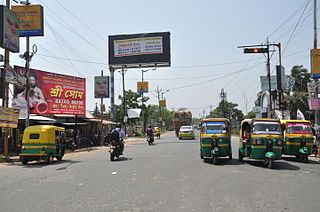
Sodepur or Sodpur is a locality in Panihati Municipality of North 24 Parganas district in the Indian state of West Bengal. It is close to Kolkata and also a part of the area covered by Kolkata Metropolitan Development Authority (KMDA).

Barrackpur Cantonment is a city and a cantonment board of North 24 Parganas district in the Indian state of West Bengal. It is close to Kolkata and also a part of the area covered by Kolkata Metropolitan Development Authority (KMDA).

Jetia is a census town in Barrackpore I CD Block in Barrackpore subdivision in North 24 Parganas district in the Indian state of West Bengal. It is a part of Kolkata Urban Agglomeration.

Kaugachhi is a census town in Barrackpore I CD Block in Barrackpore subdivision in North 24 Parganas district in the Indian state of West Bengal. It is a part of Kolkata Urban Agglomeration.

Muragachha Census Town in West Bengal, India

Muragachha is a census town in Barrackpore II CD Block in Barrackpore subdivision in North 24 Parganas district in the Indian state of West Bengal. It is close to Kolkata and also a part of Kolkata Urban Agglomeration.

New Barrackpore is a city and a municipality of North 24 Parganas district in the Indian state of West Bengal. It is close to Kolkata & a part of the area covered by Kolkata Metropolitan Development Authority.

Ruiya is a census town in Barrackpore II CD Block in Barrackpore subdivision in North 24 Parganas district in the Indian state of West Bengal. It is close to Kolkata and also a part of Kolkata Urban Agglomeration.

Talbandha is a census town in Barrackpore II CD Block in Barrackpore subdivision in North 24 Parganas district in the Indian state of West Bengal. It is close to Kolkata and also a part of Kolkata Urban Agglomeration.

Belgharia Neighbourhood in West Bengal, India

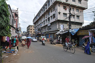
Belgharia is a locality in Kamarhati Municipality of North 24 Parganas district in the Indian state of West Bengal. It is close to Kolkata and also a part of the area covered by Kolkata Metropolitan Development Authority (KMDA). Belgharia is also known for wholesale market for all types of Bags/Luggages/Purse etc. One must visit and check the Bag Market beside Belgharia Railway Station. The great Dakshineswar Kali Temple of Kolkata is in approximately three kilometers distance from Belgharia Railway Station. The Vivekananda Setu on the river of Hooghly which is one of the oldest bridge in Calcutta established for the connection between the city of Howrah and Kolkata is also at the adjacent area of Belgharia.

Chandpur is a census town in Barrackpore II CD Block in Barrackpore subdivision in North 24 Parganas district in the state of West Bengal, India. It is close to Kolkata and also a part of Kolkata Urban Agglomeration.

Noapara is a census town in Barrackpore I CD Block in Barrackpore subdivision of North 24 Parganas district in the Indian state of West Bengal. It is a part of Kolkata Urban Agglomeration.

Agarpara is a locality in Panihati Municipality of North 24 Parganas district in the Indian state of West Bengal. It is close to Kolkata and also a part of the area covered by Kolkata Metropolitan Development Authority (KMDA).

Sukchar Neighbourhood in North 24 Parganas, West Bengal, India

Sukchar is a locality in Panihati Municipality of North 24 Parganas district in the Indian state of West Bengal. It is close to Kolkata and also a part of the area covered by Kolkata Metropolitan Development Authority (KMDA).

Bandipur is a census town in Barrackpore II CD Block in Barrackpore subdivision of North 24 Parganas district in the state of West Bengal, India. It is close to Kolkata and also a part of Kolkata Urban Agglomeration.

Teghari is a census town in Barrackpore II CD Block in Barrackpore subdivision of North 24 Parganas district in the state of West Bengal, India. It is close to Kolkata and also a part of Kolkata Urban Agglomeration.

Nimta is a locality in North Dumdum Municipality of North 24 Parganas district in the Indian state of West Bengal. It is close to Kolkata and also a part of the area covered by Kolkata Metropolitan Development Authority (KMDA).

Babanpur is a census town in Barrackpore II CD Block in Barrackpore subdivision of North 24 Parganas district in the state of West Bengal, India. It is close to Kolkata and also a part of Kolkata Urban Agglomeration.

Panpur is an outgrowth of Bhatpara in Barrackpore I CD Block in Barrackpore subdivision of North 24 Parganas district in the state of West Bengal, India. Panpur-Keutia is a gram panchayat. It is a part of Kolkata Urban Agglomeration.

References

  1. "District Statistical Handbook". North 24 Parganas 2013, Tables 2.1, 2.2, 2.4b. Department of Statistics and Programme Implementation, Government of West Bengal. Retrieved 2 May 2018.
  2. "District Statistical Handbook". North 24 Parganas 2013, Table 2.1. Department of Statistics and Programme Implementation, Government of West Bengal. Retrieved 11 June 2018.
  3. "Barrackpore Police Commissionerate". List of Police Stations with telephone numbers. West Bengal Police. Retrieved 11 June 2018.
  4. "Ghola PIN Code". pincodezip.in. Retrieved 11 July 2018.
  5. "Provisional Population Totals, Census of India 2011" (PDF). Constituents of Urban Agglomeration Having Population Above 1 Lakh. Census of India 2011. Retrieved 7 June 2018.
  6. ":: Welcome to Panihati Municipality ::". Panihatimunicipality.in. Retrieved 27 February 2014.
  7. "District Census Handbook North Twenty Four Parganas, Census of India 2011, Series 20, Part XII A" (PDF). Page 379: Map of Barrackpore II CD Block, also showing Panihati and other municipal areas. Directorate of Census Operations, West Bengal. Retrieved 29 May 2018.
  8. 1 2 Google maps
  9. "31311 Sealdah-Kalyani Simanta Local". Time Table. indiarailinfo. Retrieved 15 June 2018.
  10. "33811 Sealdah-Bangaon local". Time Table. India Railinfo. Retrieved 15 June 2018.
  11. "Ghola High School (H.S.) Panihati Municipality". Schools World. Retrieved 7 July 2018.
  12. "Ghola Girls High School". ICBSE. Retrieved 7 July 2018.