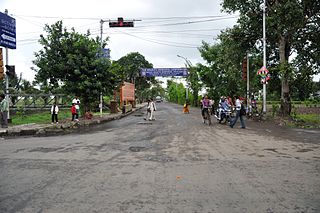
Kasba, Kolkata

Last updated

Kasba
Neighbourhood in Kolkata (Calcutta)
Bijon Setu.jpg
Bijon Setu, the connector between Kasba and Ballygunge (Gariahat)
Kolkata location map EN.svg
Red pog.svg
Kasba
Location in Kolkata
Coordinates: 22°31′03″N88°23′02″E / 22.5176°N 88.3840°E / 22.5176; 88.3840
CountryFlag of India.svg  India
State West Bengal
City Kolkata
District Kolkata [1] [2] [3]
Kolkata Suburban Railway Ballygunge Junction
Metro Station VIP Bazar (under construction)
Hemanta Mukherjee
Municipal Corporation Kolkata Municipal Corporation
KMC wards 67, 91, 107
Elevation
20 ft (6 m)
Time zone UTC+5:30 (IST)
PIN
700039, 700042, 700078, 700107
Area code +91 33
Lok Sabha constituency Kolkata Dakshin
Vidhan Sabha constituency Kasba

Kasba is an upscale and standard locality of South Kolkata, in Kolkata district, West Bengal, India. It is situated in the southern part of the city encircled by the Sealdah South section of the Eastern Railways to the west, Dhakuria and Haltu to the south, the Eastern Metropolitan Bypass to the east and the locality of Tiljala to the north.

Contents

History

'Kasba' means hamlet in Bengali and that was what it was - a hamlet for the people working in the nearby leather and allied factories of Tiljala and Tangra and also for the people working in various capacities for the residents of their highly prosperous neighbouring locality of Ballygunge just across the railway track to the west. (Incidentally, the word 'kasba', which means the same in Hindi and Bengali, also means the same as the Arabic 'casbah'.)

The locality is served by the Ballygunge Junction railway station on Sealdah South lines, giving a boost to its accessibility. The first breakthrough for the locality came with the construction of the Bijon Setu in 1978, a rail overbridge above the railway tracks right next to the Ballygunge Junction railway station. This has brought Kasba closer to the Kolkata mainstream and also resulted in quite a number of people finding the locality habitable. [4] [5]

But the rowdy image of the locality persisted when, in 1982, some communists murdered 17 members of the Ananda Marg sect on this bridge. [6]

A recent and more remarkable development for Kasba was the linking of the Rash Behari Avenue to the Eastern Metropolitan Bypass via Rash Behari Connector. This link made Kasba an integral part of the growth direction that the city was taking - towards the east (via Bosepukur and Rajdanga). Rash Behari Connector is also connected to Haltu via Banku Bihari Chatterjee Road (Kasba Road) through Kasba Rathtala. Many buses ply along both the roads. [7] Thus Kasba became more than just a passing area and stopover for a whole section of people taking the EM Bypass from Ballygunge and the whole South Kolkata. Cheap availability of land, proximity to the major business areas of the prosperous southern part of the city and excellent commuting facilities combined taking this once volatile area to being one of the most economically viable and visible parts of the city.

The first developments took place around the junction of the Rash Behari Connector and the EM Bypass - the Kasba Golpark area. Ruby Hospital, the office of Siemens and a host of government-sponsored housing complexes came up in the area. Then the Meghalaya House shifted lock, stock and barrel to this growth region from their old premises at Russel Street, huge amounts of money began pouring into real-estate activities and this resulted in feverish construction activity all along the stretch of the Rash Behari Connector.

Apart from all these, Kasba has also become renowned for two of the biggest and well known Durga Pujas organised nowadays - the Kasba Bosepukur Shitala Mandir and Rajdanga Naba Uday Sangha, which draws thousands of people from across the city and state. Also, Dharmatala United Club's Kali Puja is a very big budget Puja in Kasba. Procession of this Puja is also worth watching.

Geography

Police district

Kasba police station is in the South Suburban division of Kolkata Police. It is located at 27-A, Bosepukur Road, Kolkata-700042. [8]

Patuli Women police station has jurisdiction over all police districts under the jurisdiction of South Suburban Division i.e. Netaji Nagar, Jadavpur, Kasba, Regent Park, Bansdroni, Garfa and Patuli. [8]

Jadavpur, Thakurpukur, Behala, Purba Jadavpur, Tiljala, Regent Park, Metiabruz, Nadial and Kasba police stations were transferred from South 24 Parganas to Kolkata in 2011. Except Metiabruz, all the police stations were split into two. The new police stations are Parnasree, Haridevpur, Garfa, Patuli, Survey Park, Pragati Maidan, Bansdroni and Rajabagan. [9]

Educational institutions

Important establishments

Restaurants and eateries

Related Research Articles

<span class="mw-page-title-main">Parnasree Pally</span> Neighbourhood in Kolkata in West Bengal, India

Parnasree Pally is an upscale locality of Behala in southern Kolkata (Calcutta), India. It was included in the Kolkata Municipal Corporation in 1985. Translated to English, the name means "beauty of the leaves." It was earlier known as Halderbagan. The name Parnasree was coined by Late Asoke Ratan Mazumder when he became a member of the co-operative society formed for the rehabilitation of Refugees during the Partition of India in 1947.

<span class="mw-page-title-main">Dhakuria</span> Neighbourhood in Kolkata in West Bengal, India

Dhakuria is a neighborhood of Kolkata (Calcutta) in West Bengal, India. It is located in the southern part of the city and is surrounded by Ballygunge and Kasba in the north, Haltu in the east, Jadavpur/ Garia in the south and Lake Gardens/ Jodhpur Park in the west. It has a Postal Index Number (PIN) code of 700031. Some localities adjacent to Golpark and Jodhpur Park also have Postal Index Number (PIN) code of 700029 and 700068 respectively.

<span class="mw-page-title-main">Dhapa, India</span> Neighbourhood in Kolkata in West Bengal, India

Dhapa is a locality on the fringes of East Kolkata, India. The area consists of landfill sites where the solid wastes of the city of Kolkata are dumped. "Garbage farming" is encouraged in the landfill sites. More than 40 per cent of the green vegetables in the Kolkata markets come from these lands. There are four sectors in Dhapa for dumping garbage that are filled with 2,500 tonnes of waste per day.

<span class="mw-page-title-main">Baishnabghata Patuli Township</span> Planned township in West Bengal, India

Patuli (Baishnabghata Patuli Township) is situated in South 24 Parganas district in the south East Kolkata in West Bengal, India. It constitutes a major portion of Garia. Baishnaghata Patuli Township is a World Bank–funded project on the eastern fringes of EM Bypass, currently one of the most promising area of south Kolkata. The Township is divided into a number of designated Blocks, extending both side of the busy by pass connector.

<span class="mw-page-title-main">Bansdroni</span> Neighbourhood in Kolkata in West Bengal, India

Bansdroni is a locality in South Kolkata in West Bengal, India. It is part of the Kolkata Municipal Corporation and the Kolkata Police jurisdiction.

<span class="mw-page-title-main">Garfa</span> Neighbourhood in Kolkata in West Bengal, India

Garfa is a southern neighborhood of Kolkata, India. This area is surrounded by Haltu, Nandi bagan, Jadavpur and Kalikapur. Starting as a refugee colony within Jadavpur, Garfa is now primarily a residential area within Kolkata.

<span class="mw-page-title-main">Haltu</span> Neighbourhood in Kolkata in West Bengal, India

Haltu is a neighbourhood of South Kolkata in West Bengal, India. This is mainly a residential area surrounded with Kasba, Jadavpur, Nandi Bagan, Kalikapur, Dhakuria and Selimpur.

<span class="mw-page-title-main">Netaji Nagar, Kolkata</span> Neighbourhood in Kolkata in West Bengal, India

Netaji Nagar is a locality and part of South Kolkata and comes under the Jadavpur parliamentary area. It is a part of Tollygunge area. It is named after the famous freedom fighter Netaji Subhash Chandra Bose and a statue of Bose is placed on the road which is connected to Netaji Subhash Chandra Bose Road.

Tiljala is a neighbourhood of South Kolkata, in West Bengal, India.

Badartala is a neighbourhood located in the South West Kolkata in West Bengal state of India. It is situated at the eastern bank of Hooghly River. Adjoined neighbourhoods are Rajabagan (east), Metiabruz, Akra Phatak (south). Ayub Nagar Basti, Birjunala, Bagdipara, Jeliapara, Siraj Basti are some localities (bastis) of the neighbourhood.

Rajabagan is a neighbourhood of Kolkata city in West Bengal, India. It is situated in the south-western part of Kolkata on the eastern bank of Hooghly river and is situated between Metiabruz (east) and Badartala (west).

Ward No. 67, Kolkata Municipal Corporation is an administrative division of Kolkata Municipal Corporation in Borough No. 7, covering parts of Tiljala and Kasba neighbourhoods in South Kolkata, in the Indian state of West Bengal.

Ward No. 92, Kolkata Municipal Corporation is an administrative division of Kolkata Municipal Corporation in Borough No. 10, covering parts of Dhakuria, Jadavpur University and Garfa neighbourhoods in South Kolkata, in the Indian state of West Bengal.

<span class="mw-page-title-main">Ward No. 107, Kolkata Municipal Corporation</span> Kolkata Municipal Corporation in West Bengal, India

Ward No. 107, Kolkata Municipal Corporation is an administrative division of Kolkata Municipal Corporation in Borough No. 12, covering parts of Tiljala, Kasba, Haltu and East Calcutta Township (Ruby) neighbourhoods in South Kolkata in the Indian state of West Bengal.

Regent Park is a neighbourhood of South Kolkata, in West Bengal, India. It is a part of Tollygunge area.

<span class="mw-page-title-main">Mukundapur, Kolkata</span> Neighbourhood in Kolkata in West Bengal, India

Mukundapur is a neighbourhood of East Kolkata in the Indian state of West Bengal.

Survey Park is a neighbourhood within the Santoshpur area of East Kolkata in Kolkata in the Indian state of West Bengal.

<span class="mw-page-title-main">Thakurpukur</span> Neighbourhood in Kolkata in West Bengal, India

Thakurpukur is a region of South Kolkata in Behala area of the Indian state of West Bengal. It is majorly a residential region although there are quite a few numbers of Schools, Colleges, Hospitals and Shopping Malls. This was a remote area until a few decades ago, but as a result of urbanization today it has become an urban area with all kinds of amenities. Thakurpukur was also under the Barisha area of Sabarna Roy Choudhury's zamindari era.

<span class="mw-page-title-main">Haridevpur</span> Neighbourhood in Kolkata in West Bengal,India

Haridevpur is a neighborhood in Tollygunge of South 24 Parganas district in West Bengal, India. The area is situated off the Mahatma Gandhi Road and is a part of Behala Purba and Tollygunge assembly constituency.

Nandy Bagan or Nandi Bagan is a neighbourhood of South Kolkata in the Indian city of Kolkata in West Bengal. It is a residential area surrounded with Kasba, Haltu, Garfa, Jadavpur, Babu Bagan, Dhakuria, Naskarpara, Shahid Nagar, Bosepukur and Selimpur. It is traditionally an upper-middle-class neighbourhood, situated around the Nandi Bagan community playground. However, with the newly constructed Prince Anwar Shah Road connector with the Eastern Metropolitan Bypass, property prices have increased in the area. The area is covered by the Garfa Police Station of the Kolkata Police Force. The Haltu Post Office serves the area.

References

  1. "South 24 Parganas district".
  2. "Electors Details As On 30-10-2010" (PDF). Archived from the original (PDF) on 29 May 2013.
  3. "KMC Wards in South 24 Parganas".
  4. "Bijon Setu".
  5. "Bridges of Kolkata".
  6. "Justice weeps silently and furtively". Archived from the original on 16 March 2006. Retrieved 29 March 2006.
  7. Google maps
  8. 1 2 "Kolkata Police, South Suburban Division". Kasba police station. KP. Retrieved 13 March 2018.
  9. "Midnight change of guard – 17 more police stations come under Lalbazar". The Telegraph, 1 September 2011. Archived from the original on 2 November 2012. Retrieved 2 April 2018.

Wikivoyage-Logo-v3-icon.svg Kolkata/South travel guide from Wikivoyage