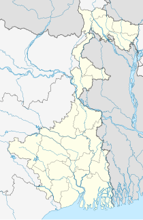
Chapainawabganj is located on the north-western part of Bangladesh. It is a part of the Rajshahi Division and known for its special tone of local dialect. Initially, it was a sub-division of Malda district. In 1947, it was severed from Malda and was given to East Pakistan as a sub-division of Rajshahi district. It became a separate district of Bangladesh in 1984. The north and west part of Chapai Nawabganj is bounded by Malda and Murshidabad district of India, east is by Naogaon District, and south-east is by Rajshahi District.

Ichapore or Ichhapur is a locality in North Barrackpur Municipality of North 24 Parganas district in the Indian state of West Bengal. It is a part of the area covered by Kolkata Metropolitan Development Authority (KMDA). Ichhapur Defence Estate has two ordnance factories, the Rifle Factory Ishapore (RFI) and the Metal and Steel Factory (MSF) of the Ordnance Factories Board.

Gondalpara is a locality in Chandernagore Municipal Corporation of Hooghly district in the Indian state of West Bengal. It is a part of the area covered by Kolkata Metropolitan Development Authority (KMDA).

North Barrackpur is a city and a municipality of North 24 Parganas district in the Indian state of West Bengal. It is a part of the area covered by Kolkata Metropolitan Development Authority (KMDA).

Nawabganj is an upazila of Dhaka District in the Division of Dhaka, Bangladesh.

Fulbari is an upazila of Dinajpur District in the Division of Rangpur Division, Bangladesh.

Gomostapur is an upazila of Nawabganj District in the Division of Rajshahi, Bangladesh.

Nachole is an upazila of Chapai Nawabganj District in the Division of Rajshahi, Bangladesh.

Nawabganj Sadar is an upazila of Nawabganj District in the Division of Rajshahi, Bangladesh.

Shibganj is an upazila of Nawabganj District in the Division of Rajshahi, Bangladesh.

Godagari is an Upazila of Rajshahi District in the Division of Rajshahi, Bangladesh. This is the place where Mahananda river fall to Padma or Ganges.

Nawabganj is a town and nagar panchayat in Hasanganj tehsil of Unnao district, Uttar Pradesh, India. It is located northeast of Unnao on the Lucknow-Kanpur road, near the Ajgain railway station. Founded in 1842 and first officially classified as a town for the 1981 census, Nawabganj once served as the seat of a tehsil under the Nawabs of Awadh and is today the headquarters of a community development block containing 124 villages.
Charmohanpur High School is a secondary school in Chapai Nawabganj Sadar Upazila of Nawabganj District, Bangladesh.

Shahbajpur is a union parishad under Shibganj Upazila, Chapai Nawabganj District in the Rajshahi Division of north-western Bangladesh.

Rahara is a locality in Khardaha Municipality of North 24 Parganas district in the Indian state of West Bengal. It is close to Kolkata and also a part of the area covered by Kolkata Metropolitan Development Authority (KMDA).
Chapai Nawabganj-3 is a constituency represented in the Jatiya Sangsad of Bangladesh since 2019 by Harunur Rashid of the Bangladesh Nationalist Party.
Naogaon-2 is a constituency represented in the Jatiya Sangsad of Bangladesh since 2008 by Shahiduzzaman Sarker of the Awami League.
Naogaon-3 is a constituency represented in the Jatiya Sangsad of Bangladesh since 2014 by Salim Uddin Tarafder, of the Awami League since 2018.
Chapai Nawabganj-1 is a constituency represented in the Jatiya Sangsad of Bangladesh since 2019 by Shamil Uddin Ahmed Shimul of the Awami League.
Chapai Nawabganj-2 is a constituency represented in the Jatiya Sangsad of Bangladesh since 2019 by Md. Aminul Islam of the Bangladesh Nationalist Party.


