
Fort William is a fort in Hastings, Calcutta (Kolkata). It was built during the early years of Britain's administration of Bengal. It sits on the eastern banks of the River Hooghly, the major distributary of the River Ganga. One of Kolkata's most enduring British-era military fortifications, other than those in Bombay (Mumbai) and Madras (Chennai), it extends over an area of seventy hectares.
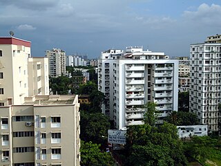
Ballygunge is a locality of South Kolkata in Kolkata district, West Bengal, India.

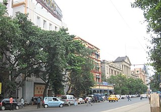
Alipore (Pron:ˌɑ:lɪˈpɔ:) is a neighbourhood in south Kolkata, in Kolkata district, in the Indian state of West Bengal.

Maidan is a large urban area containing vast urban green space, parks, playgrounds and several public venues in the center of Kolkata, India. The area is spread over a total area of 1283 Acres. The urban green space of Maidan, which compromises an area of around 400 acres, is the largest urban park and urban green space in Kolkata city and second largest in the Kolkata metropolitan area as well as in India. Prior to 2013, before the creation of Eco Park it was the largest urban park in India. Its vast stretch of field that includes numerous sporting grounds, including the famous cricketing venue Eden Gardens, several football stadiums and the Kolkata Race Course.
Esplanade is a neighbourhood of Central Kolkata, located at the heart of city with being the city's Central business district. This is a conventional esplanade because the Ganga river (Ganges), also known as Hooghly river, flows nearby and it is adjacent to the large fields of Maidan extending upto Fort William.

Kalighat is a locality of Kolkata, in Kolkata district, West Bengal, India. One of the oldest neighbourhoods in South Kolkata, Kalighat is also densely populated — with a history of cultural intermingling with the various foreign incursions into the area over time.
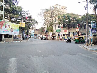
Bhowanipore is a neighbourhood of South Kolkata, West Bengal, India.

Kolkata is located in the eastern part of India. It has spread linearly along the banks of the Hooghly River. The Kolkata Municipal Corporation has an area of 205 square kilometres. The city is near sea level, with the average elevation being 17 feet. The whole area is in the Ganges Delta which starts within 100 km south of the city. Most of the city was originally marshy wetlands, remnants of which can still be found especially towards the eastern parts of the city.

Khidirpur or Kidderpore is a neighbourhood of South West Kolkata in Kolkata district in the Indian state of West Bengal.
Ward No. 61, Kolkata Municipal Corporation is an administrative division of Kolkata Municipal Corporation in Borough No. 6, covering parts of Park Circus, Beniapukur (Nonapukur), Park Street (Mullickbazar) and Taltala neighbourhoods in central Kolkata, in the Indian state of West Bengal.
Ward No. 63, Kolkata Municipal Corporation is an administrative division of Kolkata Municipal Corporation in Borough No. 7, covering parts of Chowringhee, Taltala, Park Street, Shakespeare Sarani, Maidan, The 42 and Hastings neighbourhoods in central Kolkata, in the Indian state of West Bengal.
Ward No. 74, Kolkata Municipal Corporation is an administrative division of Kolkata Municipal Corporation in Borough No. 9, covering parts of Alipore neighbourhood in South Kolkata, in the Indian state of West Bengal.
Ward No. 75, Kolkata Municipal Corporation is an administrative division of Kolkata Municipal Corporation in Borough No. 9, covering parts of Hastings neighbourhood in central Kolkata and Watgunge neighbourhood in South Kolkata, in the Indian state of West Bengal.
Ward No. 81, Kolkata Municipal Corporation is an administrative division of Kolkata Municipal Corporation in Borough No. 10, covering parts of New Alipore and Tollygunge Circular Road neighbourhoods in South Kolkata, in the Indian state of West Bengal.
Ward No. 82, Kolkata Municipal Corporation is an administrative division of Kolkata Municipal Corporation in Borough No. 9, covering parts of Chetla neighbourhood in South Kolkata, in the Indian state of West Bengal.
Ward No. 83, Kolkata Municipal Corporation is an administrative division of the Kolkata Municipal Corporation. Located in Borough No. 8, it covers parts of the Kalighat neighbourhood in South Kolkata, India.
Ward No. 84, Kolkata Municipal Corporation is an administrative division of Kolkata Municipal Corporation in Borough No. 8, covering parts of Kalighat and Manoharpukur neighbourhoods in South Kolkata, in the Indian state of West Bengal.
Ward No. 87, Kolkata Municipal Corporation is an administrative division of Kolkata Municipal Corporation in Borough No. 8, covering parts of Kalighat neighbourhood in South Kolkata, in the Indian state of West Bengal.
Ward No. 88, Kolkata Municipal Corporation is an administrative division of Kolkata Municipal Corporation in Borough No. 9, covering parts of Kalighat (Sahanagar-Lalpara) neighbourhood in South Kolkata, in the Indian state of West Bengal.
Chetla is a neighbourhood of South Kolkata in Kolkata district of the Indian state of West Bengal.


