The Lower Klamath National Wildlife Refuge is a National Wildlife Refuge of the United States on the border between California and Oregon. It is operated by the United States Fish and Wildlife Service. The refuge was designated a National Historic Landmark on October 16, 1965.

The California Department of Fish and Wildlife (CDFW), formerly known as the California Department of Fish and Game (CDFG), is a state agency under the California Natural Resources Agency. The Department of Fish and Wildlife manages and protects the state's fish, wildlife, plant and native habitats. It is responsible for related recreational, commercial, scientific, and educational uses. It also works to prevent illegal poaching.
The Oregon Department of Fish and Wildlife (ODFW) is an agency of the government of the U.S. state of Oregon responsible for programs protecting Oregon fish and wildlife resources and their habitats. The agency operates hatcheries, issues hunting and angling licenses, advises on habitat protection, and sponsors public education programs. Its history dates to the 1878 establishment of the office of Columbia River Fish Warden. Since 1931, enforcement of Oregon's Fish and Game laws has been the responsibility of the Oregon State Police rather than separate wardens.

Shelbyville State Fish and Wildlife Area is an Illinois state park on 6,200 acres (2,500 ha) in Moultrie County, Illinois, United States.

According to the California Protected Areas Database (CPAD), in the state of California, United States, there are over 14,000 inventoried protected areas administered by public agencies and non-profits. In addition, there are private conservation areas and other easements. They include almost one-third of California's scenic coastline, including coastal wetlands, estuaries, beaches, and dune systems. The California State Parks system alone has 270 units and covers 1.3 million acres (5,300 km2), with over 280 miles (450 km) of coastline, 625 miles (1,006 km) of lake and river frontage, nearly 18,000 campsites, and 3,000 miles (5,000 km) of hiking, biking, and equestrian trails.

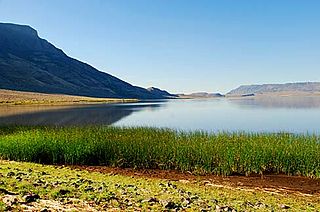
Owyhee Reservoir or Owyhee Lake is a reservoir on the Owyhee River in Malheur County, Oregon, United States. Located in far Eastern Oregon near the Idaho border, the reservoir is Oregon's longest at 52 miles (84 km). The 13,900-acre (56 km2) lake is home to several species of fish, including crappie, rainbow trout, largemouth bass, smallmouth bass, yellow perch, and brown bullhead. An artificial lake, it was created in 1932 with the completion of the Owyhee Dam. The lake supplies water for irrigation for 1,800 farms covering 118,000 acres of land in Eastern Oregon and Southwestern Idaho. Seasonal Lake Owyhee State Park is located on the northeast shore and includes a boat ramp.

The Denman Wildlife Area is a wildlife management area near Eagle Point, Oregon, in the United States. It was named in honor of Kenneth Denman, an attorney from nearby Medford, Oregon, who lobbied for the creation of the area in 1954.

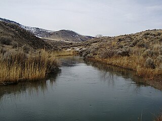
The Bridge Creek Wildlife Area is a wildlife management area located near Ukiah, Oregon, United States. The location was set aside in 1961 as a wintering area for elk.
The Elkhorn Wildlife Area is a wildlife management area located near North Powder, Oregon, United States. The large site covers parts of Union and Baker counties, including parts of the Wallowa-Whitman National Forest.

The Sauvie Island Wildlife Area is a state game management area on Sauvie Island in the U.S. state of Oregon. It contains more than 12,000 acres (4,856 ha) for mixed use including hunting, fishing, canoeing, kayaking, birdwatching and hiking. Established in 1974, it is located in both Multnomah and Columbia counties.

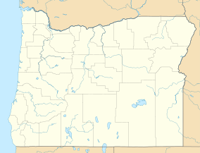
A Wildlife Management Areas (WMA) is a protected area set aside for the conservation of wildlife and for recreational activities involving wildlife.

The Fern Ridge Wildlife Area is a wildlife management area located west of Eugene, Oregon, in the United States. It is named for the Fern Ridge Reservoir which it partially surrounds.
Hart Lake is a shallow lake in the Warner Valley of eastern Lake County, Oregon, United States. The lake covers 7,324 acres (29.64 km2) and has the most stable water level within the valley's Warner Lakes chain. The lake is named for the heart-shaped brand used by the pioneer Wilson and Alexander cattle ranch established near the lake. Much of the land around Hart Lake is administered by the Bureau of Land Management (BLM) and the United States Fish and Wildlife Service (FWS). The lake and the surrounding wetlands support a wide variety of birds and other wildlife. Recreational opportunities on and near Hart Lake include hunting, fishing, bird watching, and boating.
The Ana River is a short spring-fed river in south-central Oregon. It is on the northwestern edge of the Great Basin drainage. It flows 7 miles (11 km) from springs at the foot of Winter Ridge through high desert, range, and wetlands before emptying into Summer Lake. For most of its course, the Ana River flows through the Summer Lake Wildlife Area, which is maintained by the Oregon Department of Fish and Wildlife. The river provides habitat for many mammal and bird species, as well as several fish species, including the rare Summer Lake Tui chub. The largest hybrid striped bass ever caught in Oregon was taken from Ana Reservoir in 2009.

The Summer Lake Wildlife Area is a 29.6-square-mile (77 km2) wildlife refuge located on the northwestern edge of the Great Basin drainage in south-central Oregon. It is administered by the Oregon Department of Fish and Wildlife. The refuge is an important stop for waterfowl traveling along the Pacific Flyway during their spring and fall migrations. The Summer Lake Wildlife Area also provides habitat for shorebirds and other bird species as well as wide variety of mammals and several fish species. The Ana River supplies the water for the refuge wetlands.

Arizona Beach State Recreation Site is a 68-acre (28 ha) Oregon state park in Curry County, Oregon, in the United States. The beach is at an average elevation of 7 feet (2 m). Public recreational facilities at Arizona Beach State Recreation Site include a parking lot for beach access, observation areas for viewing marine mammals and birds and tables for picnicking. The park is open year-round.

Cecil D. Andrus Wildlife Management Area (WMA) is a 23,908 acres (96.75 km2) Idaho wildlife management area in Washington County, 18 miles (29 km) from Cambridge, Idaho. The WMA was formed in 1993, when the Mellon Foundation purchased the Hillman Ranch and deeded it to the Idaho Department of Fish and Game for wildlife conservation. The WMA now manages additional lands as well, primarily from the Idaho Department of Lands, but also from Payette National Forest and the Bureau of Land Management. It is named for Cecil D. Andrus, a former U.S. Secretary of the Interior who also served four terms as Governor of Idaho.

The New Mexico Department of Game and Fish (NMDGF) is a department of the Government of New Mexico, United States, that is responsible for maintaining wildlife and fish in the state. The NMDGF undertakes protection, conservation and propagation, and regulates the use of game and fish to ensure there is an adequate supply for recreation and food.