
The Sandy River is a 56-mile (90 km) tributary of the Columbia River in northwestern Oregon in the United States. The Sandy joins the Columbia about 14 miles (23 km) upstream of Portland.

Emigrant Springs State Heritage Area is a state park located in central Umatilla County, Oregon, United States, approximately 15 mi (24 km) southeast of Pendleton. Located in old growth forest near the summit of the Blue Mountains along Interstate 84, the park was the location of a well-used campsite by emigrants along the Oregon Trail in the middle 19th century.

Darlingtonia State Natural Site is a state park and botanical preserve located five miles (8.0 km) north of Florence, Oregon, United States on U.S. Route 101, just west of Mercer Lake and south of Sutton Lake that is dedicated to the preservation of a rare plant.
Farewell Bend State Recreation Area is a state park in Baker County, Oregon, United States, about 25 miles (40 km) northwest of Ontario. Farewell Bend was the last stop on the Oregon Trail along the Snake River where travelers could rest and water and graze their animals before the trail turned north through more rugged country to follow the Burnt River.

Chanticleer Point is a geographical landmark on the Oregon side of the Columbia River Gorge. It is the first notable overlook encountered traveling east on the Historic Columbia River Highway. It is a typical location from which to take photos of the gorge featuring Crown Point prominently. It overlooks Rooster Rock State Park.

Bald Peak State Scenic Viewpoint is a state park located atop Bald Peak located in Yamhill County, in the United States. The day use only park offers picnic tables and a hiking trail for views of the Willamette Valley and the Cascade Range. The state of Oregon acquired the 26 acres (11 ha) in 1931 after Yamhill and Washington counties requested a park from the state.

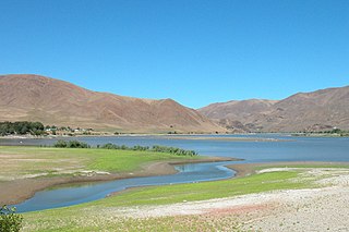
Goose Lake State Recreation Area is located on Stateline Road, between New Pine Creek, Oregon and Goose Lake in Lake County, Oregon, on the east side of Goose Lake on the Oregon–California border.

The Deschutes River State Recreation Area is a park at the confluence of the Deschutes and Columbia rivers in the U.S. state of Oregon. It is a few miles east of The Dalles. The 35.1-acre (14.2 ha) park offers opportunities for camping, fishing, hiking, mountain biking, and equestrian trail riding.
George W. Joseph State Natural Area is a natural area in the U.S. state of Oregon. It is located near the city of Troutdale between Latourell Falls and Guy W. Talbot State Park, and is accessible from both.

H. B. Van Duzer Forest State Scenic Corridor is a 12-mile (19 km) scenic driving route along Route 18 in Lincoln, Tillamook, and Polk counties in the U.S. state of Oregon that passes through a forested corridor. The Van Duzer Corridor stretches from northwestern Polk County to Lincoln City, passing through the Northern Oregon Coast Range.

Boiler Bay State Scenic Viewpoint is a state park in the U.S. state of Oregon, administered by the Oregon Parks and Recreation Department. The park is one mile (1.6 km) north of Depoe Bay, Oregon.
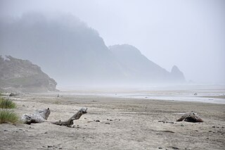
Carl G. Washburne Memorial State Park is a state park in the U.S. state of Oregon, administered by the Oregon Parks and Recreation Department. This park is in Lane County near Florence and Yachats. Very scenic wide beach, great for dogs, kids, kites. Some areas nearby are SNOWY PLOVER protected breeding areas, where dogs are banned, so be careful to keep dogs leashed if uncertain, and always in the State Park itself.
Clay Myers State Natural Area at Whalen Island is a state park in the U.S. state of Oregon, administered by the Oregon Parks and Recreation Department. The park was created in 2000 and named after a former secretary of state for the State of Oregon, Clay Myers. Although not a true island, Whalen Island is surrounded by Sand Lake Estuary and wetlands. Whalen Island can be visited on a 1.5 miles (2.4 km) loop trail around its perimeter.
Crissey Field State Recreation Site is a state park in the U.S. state of Oregon, administered by the Oregon Parks and Recreation Department. It is the south-westernmost point in the state of Oregon.
Del Rey Beach State Recreation Site is a state park in the U.S. state of Oregon, administered by the Oregon Parks and Recreation Department.

Devils Lake State Recreation Area is a state park in the U.S. state of Oregon, administered by the Oregon Parks and Recreation Department.
Geisel Monument State Heritage Site is a state park in the U.S. state of Oregon, administered by the Oregon Parks and Recreation Department.

Golden and Silver Falls State Natural Area is a state park in Coos County, Oregon, United States, administered by the Oregon Parks and Recreation Department. The nearest settlement is Allegany.

Governor Patterson Memorial State Recreation Site is a state park in the U.S. state of Oregon, administered by the Oregon Parks and Recreation Department.

Tokatee Klootchman State Natural Site is a state park in the U.S. state of Oregon. Administered by the Oregon Parks and Recreation Department, it offers wildlife, bird, and marine-mammal watching, and it has a beach. The park is 16 miles (26 km) north of Florence on U.S. Route 101.


