The United States Forest Service (USFS) is an agency of the U.S. Department of Agriculture that administers the nation's 154 national forests and 20 national grasslands. The Forest Service manages 193 million acres (780,000 km2) of land. Major divisions of the agency include the Chief's Office, National Forest System, State and Private Forestry, Business Operations, and Research and Development. The agency manages about 25% of federal lands and is the only major national land management agency not part of the U.S. Department of the Interior, which manages the National Park Service, the U.S. Fish and Wildlife Service, and the Bureau of Land Management.

Union County is one of the 36 counties in the U.S. state of Oregon. As of the 2010 census, the population was 25,748. Its county seat is La Grande.

The Blue Mountains are a mountain range in the western United States, located largely in northeastern Oregon and stretching into extreme southeastern Washington. The range has an area of about 15,000 square miles (38,850 km2), stretching east and southeast of Pendleton, Oregon, to the Snake River along the Oregon-Idaho border. The Blue Mountains cover nine counties across two states; they are Union, Umatilla, Grant, Baker, and Wallowa counties in Oregon, and Walla Walla, Columbia, Garfield and Asotin County, counties in Washington. They are home to the world's largest organism and fungal mycelial mat, the Armillaria ostoyae. The Blue Mountains were so named due to the color of the mountains when seen from a distance.

The National Wilderness Preservation System (NWPS) of the United States protects federally managed wilderness areas designated for preservation in their natural condition. Activity on formally designated wilderness areas is coordinated by the National Wilderness Preservation System. Wilderness areas are managed by four federal land management agencies: the National Park Service, the U.S. Forest Service, the U.S. Fish and Wildlife Service, and the Bureau of Land Management. The term "wilderness" is defined as "an area where the earth and community of life are untrammeled by man, where man himself is a visitor who does not remain" and "an area of undeveloped Federal land retaining its primeval character and influence, without permanent improvements or human habitation, which is protected and managed so as to preserve its natural conditions." As of 2016, there are 803 designated wilderness areas, totaling 111,368,221 acres (45,069,120 ha), or about 4.5% of the area of the United States.

The Tualatin River National Wildlife Refuge is a 1,856 acres (751 ha) wetlands and lowlands sanctuary in the northwestern part of the U.S. state of Oregon. Established in 1992 and opened to the public in 2006, it is managed by the United States Fish and Wildlife Service. Located in southeastern Washington County, 15 miles (24 km) southwest of Portland, the refuge is bordered by Sherwood, Tualatin and Tigard. A newer area, extending into northern Yamhill County, is located further west near the city of Gaston surrounding the former Wapato Lake.

The Klamath Basin is the region in the U.S. states of Oregon and California drained by the Klamath River. It contains most of Klamath County and parts of Lake and Jackson counties in Oregon, and parts of Del Norte, Humboldt, Modoc, Siskiyou, and Trinity counties in California. The 15,751-square-mile (40,790 km2) drainage basin is 35% in Oregon and 65% in California. In Oregon, the watershed typically lies east of the Cascade Range, while California contains most of the river's segment that passes through the mountains. In the Oregon-far northern California segment of the river, the watershed is semi-desert at lower elevations and dry alpine in the upper elevations. In the western part of the basin, in California, however, the climate is more of temperate rainforest, and the Trinity River watershed consists of a more typical alpine climate.

The Wallowa–Whitman National Forest is a United States National Forest in the U.S. states of Oregon and Idaho. Formed upon the merger of the Wallowa and Whitman national forests in 1954, it is located in the northeastern corner of the state, in Wallowa, Baker, Union, Grant, and Umatilla counties in Oregon, and includes small areas in Nez Perce and Idaho counties in Idaho. The forest is named for the Wallowa band of the Nez Perce people, who originally lived in the area, and Marcus and Narcissa Whitman, Presbyterian missionaries who settled just to the north in 1836. Forest headquarters are located in Baker City, Oregon with ranger districts in La Grande, Joseph and Baker City.
The Oregon Department of Fish and Wildlife (ODFW) is an agency of the government of the U.S. state of Oregon responsible for programs protecting Oregon fish and wildlife resources and their habitats. The agency operates hatcheries, issues hunting and angling licenses, advises on habitat protection, and sponsors public education programs. Its history dates to the 1878 establishment of the office of Columbia River Fish Warden. Since 1931, enforcement of Oregon's Fish and Game laws has been the responsibility of the Oregon State Police rather than separate wardens.

The North Fork John Day Wilderness is a wilderness area within the Umatilla and Wallowa–Whitman National Forests in the Blue Mountains of northeastern Oregon.

Elkhorn Slough is a 7-mile-long (11 km) tidal slough and estuary on Monterey Bay in Monterey County, California. The community of Moss Landing and the Moss Landing Power Plant are located at the mouth of the slough on the bay.

According to the California Protected Areas Database (CPAD), in the state of California, United States, there are over 14,000 inventoried protected areas administered by public agencies and non-profits. In addition, there are private conservation areas and other easements. They include almost one-third of California's scenic coastline, including coastal wetlands, estuaries, beaches, and dune systems. The California State Parks system alone has 270 units and covers 1.3 million acres (5,300 km2), with over 280 miles (450 km) of coastline, 625 miles (1,006 km) of lake and river frontage, nearly 18,000 campsites, and 3,000 miles (5,000 km) of hiking, biking, and equestrian trails.

The Denman Wildlife Area is a wildlife management area near Eagle Point, Oregon, in the United States. It was named in honor of Kenneth Denman, an attorney from nearby Medford, Oregon, who lobbied for the creation of the area in 1954.

The Bridge Creek Wildlife Area is a wildlife management area located near Ukiah, Oregon, United States. The location was set aside in 1961 as a wintering area for elk.

The Dean Creek Wildlife Area is a wildlife management area located near Reedsport, Oregon, United States. Jointly managed by the Oregon Department of Fish and Wildlife and the United States Bureau of Land Management, it is the year-round residence for a herd of Roosevelt elk.

The E. E. Wilson Wildlife Area is a wildlife management area located near Corvallis, Oregon, United States. The site was named for Eddy Elbridge Wilson, a member of the former Oregon State Game Commission for fourteen years before his death in 1961. Wildlife visible includes blacktail deer, pheasant, and quail.

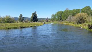
The Wood River is a short river in the southern region of the U.S. state of Oregon, and part of the Klamath Basin drainage. It flows 18 miles (29 km) through the Fremont-Winema National Forests, Bureau of Land Management land, and private property in southern Oregon. Its watershed consists of 220 square miles (570 km2) of conifer forest, rural pasture land, and marsh. The river provides habitat for many species of wildlife including an adfluvial (migratory) and resident populations of native Great Basin redband trout.

Wapato Lake was a historic lake located in what became parts of Washington County and Yamhill County in the U.S. state of Oregon. The area is sometimes known as Wapato Lake Bed and Wapato Flat. The lake bed is located about a half mile east of Gaston at 55 metres (180 ft) elevation. The lake bed soils contain a layer of organic peat that once supported a wetland community dominated by the wapato plant, Sagittaria latifolia, particularly in the upper marsh areas.

The Fern Ridge Wildlife Area is a wildlife management area located west of Eugene, Oregon, in the United States. It is named for the Fern Ridge Reservoir which it partially surrounds.

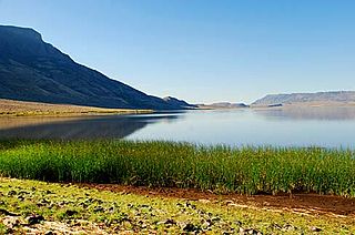
Hart Lake is a shallow lake in the Warner Valley of eastern Lake County, Oregon, United States. The lake covers 7,324 acres (29.64 km2) and has the most stable water level within the valley's Warner Lakes chain. The lake is named for the heart-shaped brand used by the pioneer Wilson and Alexander cattle ranch established near the lake. Much of the land around Hart Lake is administered by the Bureau of Land Management (BLM) and the United States Fish and Wildlife Service (FWS). The lake and the surrounding wetlands support a wide variety of birds and other wildlife. Recreational opportunities on and near Hart Lake include hunting, fishing, bird watching, and boating.

The Summer Lake Wildlife Area is a 29.6-square-mile (77 km2) wildlife refuge located on the northwestern edge of the Great Basin drainage in south-central Oregon. It is administered by the Oregon Department of Fish and Wildlife. The refuge is an important stop for waterfowl traveling along the Pacific Flyway during their spring and fall migrations. The Summer Lake Wildlife Area also provides habitat for shorebirds and other bird species as well as wide variety of mammals and several fish species. The Ana River supplies the water for the refuge wetlands.


