Economy of Somerset

Last updated

The Market cross in Shepton Mallet Somerset sm market.jpg
The Market cross in Shepton Mallet

Somerset is a county in the south west of England. It is a rural county and transport infrastructure has been significant in industrial development. There is some heavy industry particularly related to the defence technologies and the county has several centres for stone quarrying, although the coalfield is now closed.

Contents

Agriculture and textile production continue to provide employment along with tourism.

Industry

AgustaWestland EH101 manufactured by AgustaWestland in Yeovil Zj128-merlin.jpg
AgustaWestland EH101 manufactured by AgustaWestland in Yeovil

Somerset has few industrial centres. Bridgwater was developed during the Industrial Revolution as the West Country's leading port. The River Parrett was navigable by large ships as far as Bridgwater. By then loading the cargoes onto smaller boats at Langport Quay, next to the Bridgwater Bridge, they could be carried further up river to Langport. [1] The Parrett is now only navigable as far as Dunball Wharf; and the wharf is still in use today to unload marine gravels and sands. Bridgwater, in the 19th and 20th centuries, was a centre for the manufacture of bricks and clay roof tiles, Bath bricks and later cellophane, but those industries have now closed. With its good links to the motorway system, Bridgwater has developed as a distribution hub for companies such as Argos, Toolstation and Gerber Juice.

The Somerset Levels has historically been a large producer of peat, but ecological concerns have led to the search for alternative materials for applications, such as potting of plants.

AgustaWestland manufacture helicopters in Yeovil. Helicopters were also built at Weston-super-Mare; it is now the home of a helicopter museum - The Helicopter Museum. Normalair Garratt, who built aircraft oxygen systems, are also based in the town; the company is now part of Honeywell Aerospace.

Many towns have encouraged small-scale light industries, such as Crewkerne's Ariel Motor Company, one of the UK's smallest car manufacturers.

Defence industries

Somerset was, and is, an important supplier of equipment and technology to support the defence of United Kingdom. A Royal Ordnance Factory, ROF Bridgwater was built at the start of the Second World War, between the villages of Puriton and Woolavington, to manufacture explosives; and in 2007 is still operating, at a much reduced output, as part of BAE Systems Land Systems and is due to close completely in 2008. Templecombe has Thales Underwater Systems; and Taunton presently has the United Kingdom Hydrographic Office and Avimo, which became part of Thales Optics. It has been announced twice, in 2006 and 2007, that manufacturing is to end at Thales Optics' Taunton site, [2] but the Trade Unions and Taunton Deane District Council are working to reverse or mitigate these decisions. Bath had Ministry of Defence offices across several parts of the city but these had closed and transferred to Filton's Abbey Wood site near Bristol by March 2013; and Norton Fitzwarren is the home of 40 Commando. Other high-technology companies include the optics company Gooch and Housego, at Ilminster.

Agriculture and food and drink

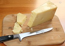
Cheddar cheese Somerset-Cheddar.jpg
Cheddar cheese

Agriculture and food and drink production continue to be major industries in the county, employing over 15,000 people. Apple orchards were once plentiful, and Somerset is still a major producer of cider. The towns of Taunton and Shepton Mallet are involved with the production of cider, especially Blackthorn Cider, which is sold nationwide, and there are specialist producers such as Sheppy's Cider Burrow Hill Cider Farm and Thatchers Cider. Gerber Products Company in Bridgwater are the largest producer of fruit juices in Europe, producing brands such as 'Sunny Delight' and 'Ocean Spray'. Development of the milk-based industries, such as Yeo Valley Organic, has resulted in the production of ranges of desserts, yoghurts and cheeses, [3] including Cheddar cheese some of which has the West Country Farmhouse Cheddar PDO.

Clothing

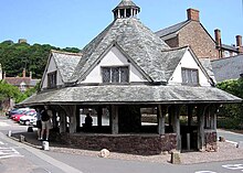
The Dunster Yarn Market was built in 1609 for the trading of local cloth Somerset.dunster.arp.750pix.jpg
The Dunster Yarn Market was built in 1609 for the trading of local cloth

Towns such as Castle Cary and Frome grew around the medieval weaving industry. Street developed as a centre for the production of woollen slippers and, later, boots and shoes, with C&J Clark establishing its headquarters in the town. C&J Clark's shoes are no longer manufactured there as the work was transferred to lower-wage areas in Asia, such as China. [4] Instead, in 1993, redundant factory buildings were converted to form Clarks Village, the first purpose built factory outlet in the UK. C&J Clark also had shoe factories, at one time at Bath, Bridgwater and Minehead, to provide employment outside of the main summer tourist season, but these satellite sites had been closed, in the late 1980s, before the main site at Street. Dr. Martens shoes were also made in Somerset, by the Northampton-based R. Griggs Group, using redundant skilled shoemakers from C&J Clark; this work has also been transferred to Asia.

Mining and quarrying

Coal mining was an important industry in north Somerset during the 18th and 19th centuries, and by 1800 it was prominent in Radstock. [5] The Somerset Coalfield reached its peak production by the 1920s. All the pits have now been closed, the last in 1973. [6] Most of the surface buildings have been removed, and apart from a winding wheel outside Radstock Museum, little evidence of their former existence remains. Further west, the Brendon Hills were mined for iron ore in the late 19th century; this was taken by the West Somerset Mineral Railway to Watchet Harbour for shipment to the furnaces at Ebbw Vale in south Wales. [7]

The county has a long tradition of supplying freestone and building stone. Quarries at Doulting supplied the freestone used in the construction of Wells Cathedral. Bath stone is also widely used. Ralph Allen promoted its use in the early 18th century, but it was used locally long before then. It was mined underground at Combe Down and Bathampton Down Mines, and as a result of cutting the Box Tunnel, at various locations in Wiltshire, including Box. [8] [9] [10] Bath stone is still used today, on a reduced scale; but more often as a cladding, rather than a structural material. [8]

Further south, Hamstone is the colloquial name given to stone from Ham Hill, which is also widely used in the construction industry.

Blue Lias has been used locally as a building stone; and as a raw material for lime mortar and Portland cement. Puriton up to the 1960s had Blue Lias stone quarries, as did several other Polden Villages. Its quarries also supplied a Lime mortar and Portland cement factory at Dunball, adjacent to the King's Sedgemoor Drain. Its derelict, early 20th century, remains were removed when the M5 motorway was constructed in the mid-1970s. [11] Keinton Mandeville was also heavily involved in quarrying; the village's quarries are now abandoned, but they are still remembered in the name of a Public House. Quarrying of blue lias is still undertaken at Charlton Mackrell and Charlton Adam.

Since the 1920s, the county has supplied aggregates. Foster Yeoman is Europe's large supplier of limestone aggregates, with quarries at Merehead Quarry. It has a dedicated railway operation, Mendip Rail, which is used to transport aggregates by rail from a group of Mendip quarries.

Tourism

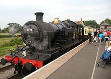
Bishops Lydeard station on the West Somerset Railway. Westsom.rail.5224.750pix.jpg
Bishops Lydeard station on the West Somerset Railway.

Much of the county is scenic and unspoilt. Tourism is a major industry, estimated in 2001 to support around 23,000 people. [12] Attractions include the coastal towns, from the west to the north east, Minehead, Watchet, Burnham-on-Sea, Weston-super-Mare, Clevedon and Portishead, with their various piers and beaches. Inland the county includes part of the Exmoor National Park, the West Somerset Railway (a heritage railway), and the museum of the Fleet Air Arm at RNAS Yeovilton. The town of Glastonbury has mythical associations, and the annual open-air Glastonbury Festival (actually in Pilton), while the Cheddar Gorge has show caves open to visitors, as well as its locally produced cheese, although there is now only one cheese maker remaining in the village of Cheddar.

Regional gross value

Regional gross value added by the non-metropolitan county of Somerset at current basic prices. Figures are in millions of British pounds sterling. [13]
YearRegional Gross Value Added [A] Agriculture [B] Industry [C] Services [D]
19954,6012981,6082,695
20005,8721991,9363,737
20036,5862151,9564,416

Notes

[A] Components may not sum to totals due to rounding
[B] Includes hunting and forestry
[C] Includes energy and construction
[D] Includes financial intermediation services indirectly measured

Related Research Articles

<span class="mw-page-title-main">Cheddar, Somerset</span> Human settlement in England

Cheddar is a large village and civil parish in the English county of Somerset. It is situated on the southern edge of the Mendip Hills, 9 miles (14 km) north-west of Wells, 11 miles (18 km) south-east of Weston-super-Mare and 18 miles (29 km) south-west of Bristol. The civil parish includes the hamlets of Nyland and Bradley Cross. The parish had a population of 5,755 in 2011 and an acreage of 8,592 acres (3,477 ha) as of 1961.

<span class="mw-page-title-main">Cheddar cheese</span> Type of relatively hard English cheese

Cheddar cheese is a natural cheese that is relatively hard, off-white, and sometimes sharp-tasting. Cheddar originates from the English village of Cheddar in Somerset.

<span class="mw-page-title-main">Somerset</span> County in South West England

Somerset is a ceremonial county in South West England. It is bordered by the Bristol Channel, Gloucestershire, and Bristol to the north, Wiltshire to the east and the north-east, Dorset to the south-east, and Devon to the south-west. The largest settlement is the city of Bath, and the county town is Taunton.

<span class="mw-page-title-main">South West England</span> Region of England

South West England, or the South West of England, is one of the nine official regions of England in the United Kingdom. It consists of the counties of Cornwall, Dorset, Devon, Gloucestershire, Somerset and Wiltshire. Cities and large towns in the region include Bath, Bristol, Bournemouth, Cheltenham, Exeter, Gloucester, Plymouth and Swindon. It is geographically the largest of the nine regions of England covering 9,200 square miles (23,800 km2), but the third-least populous, with approximately five million residents.

<span class="mw-page-title-main">Bridgwater</span> Human settlement in England

Bridgwater is a historic market town and civil parish in Somerset, England. The town had a population of 41,276 at the 2021 Census. Bridgwater is at the edge of the Somerset Levels, in level and well-wooded country. The town lies along both sides of the River Parrett; it has been a major inland port and trading centre since the industrial revolution. Most of its industrial bases still stand today. Its larger neighbour, Taunton, is linked to Bridgwater via a canal, the M5 motorway and the GWR railway line.

<span class="mw-page-title-main">River Parrett</span> River in Dorset and Somerset, England

The River Parrett flows through the counties of Dorset and Somerset in South West England, from its source in the Thorney Mills springs in the hills around Chedington in Dorset. Flowing northwest through Somerset and the Somerset Levels to its mouth at Burnham-on-Sea, into the Bridgwater Bay nature reserve on the Bristol Channel, the Parrett and its tributaries drain an area of 660 square miles (1,700 km2) – about 50 per cent of Somerset's land area, with a population of 300,000.
<span class="mw-page-title-main">Puriton</span> Village in Somerset, England

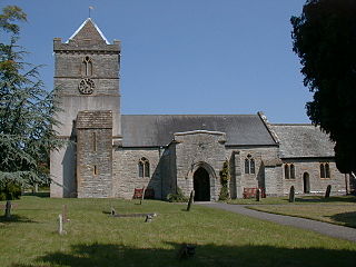
Puriton is a village and parish at the westerly end of the Polden Hills, in Somerset, England. The parish has a population of 1,968. The local parish church is dedicated to St Michael and All Angels. A chapel on Woolavington Road was converted to a private house some 20 years ago. The parish includes the hamlets of Dunball and Down End.
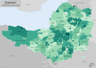
<span class="mw-page-title-main">History of Somerset</span> Aspect of history

Somerset is a historic county in the south west of England. There is evidence of human occupation since prehistoric times with hand axes and flint points from the Palaeolithic and Mesolithic eras, and a range of burial mounds, hill forts and other artefacts dating from the Neolithic, Bronze and Iron Ages. The oldest dated human road work in Great Britain is the Sweet Track, constructed across the Somerset Levels with wooden planks in the 39th century BCE.

<span class="mw-page-title-main">Polden Hills</span>

The Polden Hills in Somerset, England are a long, low ridge, extending for 10 miles (16 km), and separated from the Mendip Hills, to which they are nearly parallel, by a marshy tract, known as the Somerset Levels. They are now bisected at their western end by the M5 motorway and a railway, the Bristol and Exeter Railway, part of the Great Western Main Line.

<span class="mw-page-title-main">Bawdrip</span> Human settlement in England

Bawdrip is a village and civil parish in Somerset, England. The village is on the south side of the Polden Hills about 4 miles (6.4 km) north-east of Bridgwater. At the 2011 census the parish had a population of 506. The parish includes the hamlets of Bradney, Horsey and Knowle.

<span class="mw-page-title-main">Geology of Somerset</span>

Somerset is a rural county in the southwest of England, covering 4,171 square kilometres (1,610 sq mi). It is bounded on the north-west by the Bristol Channel, on the north by Bristol and Gloucestershire, on the north-east by Wiltshire, on the south-east by Dorset, and on the south west and west by Devon. It has broad central plains with several ranges of low hills. The landscape divides into four main geological sections from the Silurian through the Devonian and Carboniferous to the Permian which influence the landscape, together with water-related features.

<span class="mw-page-title-main">King's Sedgemoor Drain</span> Artificial drainage channel in Somerset, England

King's Sedgemoor Drain is an artificial drainage channel which diverts the River Cary in Somerset, England along the southern flank of the Polden Hills, to discharge into the River Parrett at Dunball near Bridgwater. As the name suggests, the channel is used to help drain the peat moors of King's Sedgemoor. There was opposition to drainage schemes from the local inhabitants, who feared that they would lose their common grazing rights. However, the main channel was constructed between 1791 and 1795, and despite some defects, brought some relief from flooding to the area.

<span class="mw-page-title-main">Transport in Somerset</span> Overview of transport in Somerset

The earliest known infrastructure for transport in Somerset is a series of wooden trackways laid across the Somerset Levels, an area of low-lying marshy ground. To the west of this district lies the Bristol Channel, while the other boundaries of the county of Somerset are along chains of hills that were once exploited for their mineral deposits. These natural features have all influenced the evolution of the transport network. Roads and railways either followed the hills, or needed causeways to cross the Levels. Harbours were developed, rivers improved, and linked to sources of traffic by canals. Railways were constructed throughout the area, influenced by the needs of the city of Bristol, which lies just to the north of Somerset, and to link the ports of the far south-west with the rest of England.
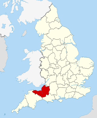
<span class="mw-page-title-main">Geography of Somerset</span>

The county of Somerset is in South West England, bordered by the Bristol Channel and the counties of Bristol and Gloucestershire to the north, and Wiltshire to the east, Dorset to the south, and Devon to the west. The climate, influenced by its proximity to the Atlantic Ocean and the prevailing westerly winds, tends to be mild, damp and windy.
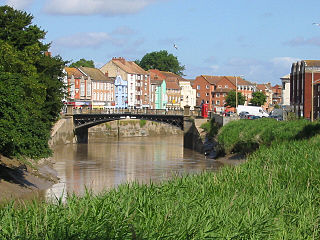
<span class="mw-page-title-main">Port of Bridgwater</span> Port in England

The Port of Bridgwater is a port, originally located in the town of Bridgwater, Somerset, England. Created under an 1845 Act of Parliament, it extends from Brean Down to Hinkley Point in Bridgwater Bay, and parts of the rivers Parrett, River Brue and River Axe. Although no ships now dock in the town, in 2001 103,613 (metric) tonnes of cargo were handled within the area of the Port Authority, most of which were stone products through the wharf at Dunball.
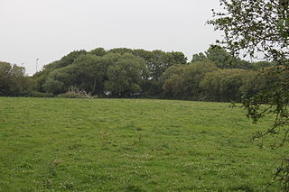
<span class="mw-page-title-main">Down End Castle</span>

Down End Castle, also known as Downend Castle, Chisley Mount or Chidley Mount, was a motte-and-bailey castle at Down End, north of Dunball in the parish of Puriton, Somerset, England. It has been designated as a Scheduled Ancient Monument.

<span class="mw-page-title-main">Westfield, Somerset</span> Human settlement in England

Westfield is a settlement lying on the Fosse Way between Radstock and Midsomer Norton in Somerset, England. In 2011 it was raised to the status of a civil parish.

References

  1. Lawrence, J.F. (2005). A History of Bridgwater. (revised and compiled by J.C. Lawrence) Chichester: Phillimore & Co. ISBN   1-86077-363-X.
  2. "Shock at factory closure news". This is the West Country. Archived from the original on 25 October 2008. Retrieved 29 October 2007.
  3. "Mini profiles of the key industrial sectors in Somerset". Celebrating Somerset. Archived from the original on 15 September 2008. Retrieved 26 October 2007.
  4. "Clarks ends shoemaking in Somerset". BBC Somerset. Retrieved 29 October 2007.
  5. "A Brief History of the Bristol and Somerset Coalfield". The Mines of the Bristol and Somerset Coalfield. Archived from the original on 17 January 2009. Retrieved 22 January 2008.
  6. Cornwell, John (2005). Collieries of Somerset & Bristol. Ashbourne, Derbyshire: Landmark Publishing Ltd. ISBN   1-84306-170-8.
  7. Jones, M.H. (2011). The Brendon Hiills Iron Mines and the West Somerset Mineral Railway. Lightmoor Press. ISBN   978-1-899889-53-2.
  8. 1 2 Hudson (1971). The Fashionable Stone. Bath: Adams & Dart. ISBN   0-239-00066-8
  9. Bezzant, Norman (1980). Out of the Rock... London: William Heinemann Ltd. ISBN   0-434-06900-0
  10. Perkins, J.W., Brooks, A.T. and McR. Pearce, A.E. (1979). Bath Stone: a quarry history. Cardiff: Department of Extra-mural Studies, University College Cardiff. ISBN   0-906230-26-8
  11. (1998).Images of England: Bridgwater (Compiled from the collections at Admiral Blake Museum). Stroud: Tempus Publishing. ISBN   0-7524-1049-0
  12. "Employers in Somerset". Somerset Chamber of Commerce. Archived from the original on 4 September 2006. Retrieved 28 May 2006.
  13. "Regional Gross Value Added (pp.240-253)" (PDF). Office for National Statistics. Archived from the original (PDF) on 1 December 2007. Retrieved 17 October 2007.