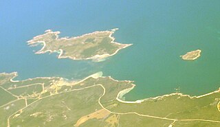
Craggy Island is a rugged granite island, with an area of 38.88 ha, in south-eastern Australia. It is part of Tasmania’s Bass Pyramid Group lying in northern Bass Strait between Flinders Island and the Kent Group.

Erith Island, the second largest island in the Kent Group, is a densely vegetated and unpopulated 323-hectare (800-acre) granite island with steep slopes, located in the Bass Strait, lying off the north-east coast of Tasmania, between the Furneaux Group and Wilsons Promontory in Victoria, Australia.

The Forsyth Island, part of the Passage Group within the Furneaux Group, is a 167-hectare (410-acre) granite island, located in Bass Strait south of Cape Barren Island, in Tasmania, in south-eastern Australia. With the Passage and Gull islands, the Forsyth Island forms part of the Forsyth, Passage and Gull Islands Important Bird Area (IBA), identified as such by BirdLife International because it supports over 1% of the world populations of little penguins and black-faced cormorants.

The Low Islets, part of the Passage Group within the Furneaux Group, is a close pair of unpopulated small granite islands with a combined area of 2 hectares, located in Bass Strait, south of Cape Barren Island, and west of both Spike and Clarke islands, in Tasmania, in south-eastern Australia.

The Spike Island, part of the Passage Group within the Furneaux Group, is a close pair of unpopulated granite islands with a combined area of 6 hectares, located in Bass Strait, south of Cape Barren Island in Spike Bay just off the west coast of Clarke Island, in Tasmania, in south-eastern Australia.
The Battery Island, part of the Passage Group within the Furneaux Group, is a 2-hectare (4.9-acre) granite island, located in Bass Strait south of Cape Barren Island, in Tasmania, in south-eastern Australia.

Rum Island is a granite island, with an area of 13.5 ha, just south of Preservation Island in south-eastern Australia. It is part of Tasmania’s Preservation Island Group, lying in eastern Bass Strait south-west of Cape Barren Island in the Furneaux Group. It is part of the Sydney Cove historic site.
The Little Badger Island, part of the Badger Group within the Furneaux Group, is a 2.5-hectare (6.2-acre) unpopulated low-lying granite island, located in Bass Strait, lying west of the Flinders and Cape Barren islands, Tasmania, south of Victoria, in south-eastern Australia.
The Inner Little Goose Island, part of the Badger Group within the Furneaux Group, is a 4.5-hectare (11-acre) unpopulated small, round granite island, located in Bass Strait between Goose and Little Goose islands, lying west of the Flinders and Cape Barren islands, Tasmania, south of Victoria, in south-eastern Australia. The island is contained within a conservation area and is part of the Chalky, Big Green and Badger Island Groups Important Bird Area.
The Beagle Island, part of the Badger Group within the Furneaux Group, is a 1.2-hectare (3.0-acre) unpopulated low, flat granite island, located in Bass Strait, lying west of the Flinders and Cape Barren islands, Tasmania, south of Victoria, in south-eastern Australia. The island is contained within a nature reserve and is part of the Chalky, Big Green and Badger Island Groups Important Bird Area.

The Doughboy Island, part of the Tin Kettle Group within the Furneaux Group, is a 30-hectare (74-acre) unpopulated mainly granite island, located in Bass Strait, lying west of the Flinders and Cape Barren islands, Tasmania, in south-eastern Australia.
Samphire Island is a small shell-grit island, with an area of 3.3 ha, in south-eastern Australia. It is part of Tasmania’s Great Dog Island Group, lying in eastern Bass Strait between Flinders and Cape Barren Islands in the Furneaux Group. It is surrounded by mudflats at low tide.

The Storehouse Island, part of the Babel Group within the Furneaux Group, is a 20-hectare (49-acre) unpopulated granite island, located in Bass Strait, lying off the east coast of Flinders Island, Tasmania, south of Victoria, in south-eastern Australia.

Inner Sister Island, part of the Sister Islands Conservation Area, is a granite and dolerite island, with an area of 748 hectares (2.89 sq mi), located in Bass Strait, Tasmania, Australia.
Roydon Island is an island, with an area of 37 ha, in south-eastern Australia. It is part of Tasmania’s Pasco Island Group, lying in eastern Bass Strait off the north-west coast of Flinders Island in the Furneaux Group.
Marriott Reef is a small group of granite islets, with a combined area of 3.4 ha, in south-eastern Australia. It forms part of Tasmania’s Pasco Island Group, lying in eastern Bass Strait off the north-west coast of Flinders Island in the Furneaux Group.

Prime Seal Island is a long island, with a high central ridge and an area of 1220 ha, in south-eastern Australia. It is part of Tasmania’s Prime Seal Island Group, lying in eastern Bass Strait west of Flinders in the Furneaux Group. Geologically, it is limestone overlying granite and has notable karst features, including caves. It is leased for farming and is extensively grazed by sheep and cattle as well as the native Tasmanian pademelons.
Bird Island is a small granite island with an area of 1.5 ha, in south-eastern Australia. It is part of Tasmania’s Prime Seal Island Group, lying in eastern Bass Strait west of Flinders in the Furneaux Group. It is joined to Flinders Island at low tide.
The Ile du Nord, part of the Maria Island Group, is a small granite island with an area of approximately 10 hectares lying close to the eastern coast of Tasmania, Australia, near the Freycinet Peninsula.
The Lachlan Island, part of the Maria Island Group, is an island with an area of about 2.5 hectares lying close to the south-eastern coast of Tasmania, Australia. The island is located near the Freycinet Peninsula, situated midway between Maria Island and the Tasmanian mainland.


