
Macquarie Island is an island in the southwestern Pacific Ocean, about halfway between New Zealand and Antarctica. Regionally part of Oceania and politically a part of Tasmania, Australia, since 1900, it became a Tasmanian State Reserve in 1978 and was inscribed as a UNESCO World Heritage Site in 1997.
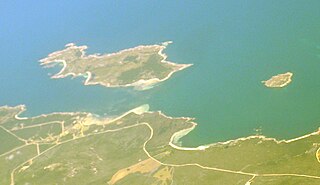
Flinders Island is an island in the Investigator Group off the coast of South Australia approximately 32 kilometres (20 mi) west of mainland town Elliston. It was named by Matthew Flinders after his younger brother Samuel Flinders, the second lieutenant on HMS Investigator in 1802.

The Breaksea Islands Group is a group of six islands, in the Southern Ocean, off the southwestern coast of Tasmania, Australia.
The Long Island, part of the Long Island Group within the Furneaux Group, is a 313-hectare (770-acre) unpopulated granite and dolerite island, located in Bass Strait, lying north-west of the Cape Barren Island in Tasmania, in south-eastern Australia. The island is part of the Franklin Sound Islands Important Bird Area, identified as such by BirdLife International because it holds over 1% of the world populations of six bird species.

Hogan Island, the largest island of the Hogan Group, is a 232-hectare (570-acre) granite island, located in northern Bass Strait, that lies between the Furneaux Group in north-east Tasmania, and Wilsons Promontory in Victoria, Australia. The island has a maximum elevation of 116 metres (381 ft) AHD .
Badger Island, part of the Badger Group within the Furneaux Group, is a 1,242-hectare (3,070-acre) unpopulated low-lying granite and limestone island, located in Bass Strait, lying west of the Flinders and Cape Barren islands, Tasmania, south of Victoria, in south-eastern Australia.
The Mount Chappell Island, part of the Badger Group within the Furneaux Group, is a 323-hectare (800-acre) unpopulated granite island with a distinctive central hill, located in Bass Strait, lying west of the Flinders and Cape Barren islands, Tasmania, south of Victoria, in south-eastern Australia.

The Great Dog Island, also known as Big Dog Island, and part of the Great Dog Group within the Furneaux Group, is a 354-hectare (870-acre) granite island, located in Bass Strait, lying south of the Flinders Island and north of the Cape Barren Island, in Tasmania, in south-eastern Australia.

Pelican Island is an island, with an area of 6.8 ha including an associated reef joined to it at low tide, in south-eastern Australia. It is part of Tasmania’s Vansittart Island Group, lying in eastern Bass Strait between Flinders and Cape Barren Islands in the Furneaux Group. Until 1984 it was leased for grazing. The island is part of the Franklin Sound Islands Important Bird Area, identified as such by BirdLife International because it holds over 1% of the world populations of six bird species.

Outer Sister Island, part of the Sister Islands Conservation Area, is a granite and dolerite island, with an area of 545 hectares (2.10 sq mi), located in Bass Strait, Tasmania, Australia.

Prime Seal Island is a long island, with a high central ridge and an area of 1220 ha, in south-eastern Australia. It is part of Tasmania’s Prime Seal Island Group, lying in eastern Bass Strait west of Flinders in the Furneaux Group. Geologically, it is limestone overlying granite and has notable karst features, including caves. It is leased for farming and is extensively grazed by sheep and cattle as well as the native Tasmanian pademelons.

The St Helens Island, part of the Waterhouse Island Group, is a 51-hectare (130-acre) granite island situated in the Tasman Sea, lying close to the north-eastern coast of Tasmania, Australia.
The Lachlan Island, part of the Maria Island Group, is an island with an area of about 2.5 hectares lying close to the south-eastern coast of Tasmania, Australia. The island is located near the Freycinet Peninsula, situated midway between Maria Island and the Tasmanian mainland.
The Lanterns, part of the Tasman Island Group, are three small and very steep islands with a combined area of 5.35 hectares, lying close to the south-eastern coast of Tasmania, Australia. The island is located in the Tasman Sea, situated off the Tasman Peninsula and is contained within the Tasman National Park.

The Tasman Island, part of the Tasman Island Group, is an oval island with an area of 1.2 square kilometres (0.46 sq mi), lying close to the south-eastern coast of Tasmania, Australia. The island is located in the Tasman Sea, situated off the Tasman Peninsula and is contained within the Tasman National Park.
Hog Island is a small island and nature reserve, with an area of 0.35 hectares, part of the Sloping Island Group, lying in the Frederick Henry Bay, close to the south-eastern coast of Tasmania, Australia. The island is situated around the Tasman and Forestier Peninsulas.

Sloping Island, incorporating the adjacent Sloping Reef, is an island nature reserve, with an area of 117 ha, in Tasmania in south-eastern Australia. It is part of the Sloping Island Group, lying close to the south-eastern coast of Tasmania around the Tasman and Forestier Peninsulas.
Dart Island, part of the Tasman Island Group, lies close to the south-eastern coast of Tasmania, Australia. It is located in Norfolk Bay, situated off the Tasman Peninsula.
Woody Island is an island in south-eastern Australia. It is part of the Sloping Island Group, lying close to the south-eastern coast of Tasmania around the Tasman and Forestier Peninsulas.
The Tasman Island Group is a group of islands near the Tasman Peninsula in south-east Tasmania, Australia.

