Grade II listed buildings in Chirk

Last updated

Map of the community in Wrexham County Borough. Wales Wrexham Community Chirk map.svg
Map of the community in Wrexham County Borough.

In the United Kingdom, the term listed building refers to a building or other structure officially designated as being of special architectural, historical, or cultural significance; Grade II structures are those considered to be "buildings of special interest which justify every effort being made to preserve them". [1] Listing was begun by a provision in the Town and Country Planning Act 1947. Once listed, strict limitations are imposed on the modifications allowed to a building's structure or fittings. In Wales, the authority for listing under the Planning (Listed Buildings and Conservation Areas) Act 1990 [2] rests with Cadw.

Contents

This is a list of the 90 Grade II listed buildings in the community of Chirk, in Wrexham County Borough.

NameLocation
Grid Ref. [note 1]
Geo-coordinates
Date ListedType/FunctionNotesReference NumberImage
1 Castle Road, Chirk, Wrexham, LL14 5BS Chirk
SJ2908637620
52°55′53″N3°03′23″W / 52.93128°N 3.0564342°W / 52.93128; -3.0564342 (1 Castle Road, Chirk, Wrexham, LL14 5BS)
29 July 1998Domestic [3] 20257
1 Hand Terrace, Chirk, Wrexham, LL14 5EU Chirk
SJ2907137819
52°55′59″N3°03′24″W / 52.933067°N 3.0567009°W / 52.933067; -3.0567009 (1 Hand Terrace, Chirk, Wrexham, LL14 5EU)
29 July 1998Domestic [4] 20216
2 Hand Terrace, Chirk, Wrexham, LL14 5EU Chirk
SJ2907237824
52°55′59″N3°03′24″W / 52.933112°N 3.0566871°W / 52.933112; -3.0566871 (2 Hand Terrace, Chirk, Wrexham, LL14 5EU)
29 July 1998Domestic [5] 20217
3 Hand Terrace, Chirk, Wrexham, LL14 5EU Chirk
SJ2907137828
52°55′59″N3°03′24″W / 52.933147°N 3.0567028°W / 52.933147; -3.0567028 (3 Hand Terrace, Chirk, Wrexham, LL14 5EU)
29 July 1998Domestic [6] 20218
4 Hand Terrace, Chirk, Wrexham, LL14 5EU Chirk
SJ2907037831
52°55′59″N3°03′24″W / 52.933174°N 3.0567184°W / 52.933174; -3.0567184 (4 Hand Terrace, Chirk, Wrexham, LL14 5EU)
29 July 1998Domestic [7] 20219
5 Hand Terrace, Chirk, Wrexham, LL14 5EU Chirk
SJ2907237836
52°56′00″N3°03′24″W / 52.933219°N 3.0566897°W / 52.933219; -3.0566897 (5 Hand Terrace, Chirk, Wrexham, LL14 5EU)
29 July 1998Domestic [8] 20220
6 Hand Terrace, Chirk, Wrexham, LL14 5EU Chirk
SJ2907337841
52°56′00″N3°03′24″W / 52.933265°N 3.0566759°W / 52.933265; -3.0566759 (6 Hand Terrace, Chirk, Wrexham, LL14 5EU)
29 July 1998Domestic [9] 20221
7 Hand Terrace, Chirk, Wrexham, LL14 5EU Chirk
SJ2906937844
52°56′00″N3°03′24″W / 52.933291°N 3.0567361°W / 52.933291; -3.0567361 (7 Hand Terrace, Chirk, Wrexham, LL14 5EU)
29 July 1998Domestic [10] 20222
Arbour within Brynkinallt Park Chirk
SJ3027337733
52°55′57″N3°02′20″W / 52.932451°N 3.0388027°W / 52.932451; -3.0388027 (Arbour within Brynkinallt Park)
29 July 1998Domestic [11] 20232
Barc-du, also known as Sawmill Cottage Chirk
SJ2776339118
52°56′40″N3°04′35″W / 52.944567°N 3.0764469°W / 52.944567; -3.0764469 (Barc-du, also known as Sawmill Cottage)
04 January 1966Domestic [12] 620
Bronze Statue on a plinth in the E garden Chirk
SJ2689438014
52°56′04″N3°05′21″W / 52.934527°N 3.0891272°W / 52.934527; -3.0891272 (Bronze Statue on a plinth in the E garden)
29 July 1998Transport [13] 20239
Bryn Coed Chirk
SJ2903937567
52°55′51″N3°03′26″W / 52.930797°N 3.0571217°W / 52.930797; -3.0571217 (Bryn Coed)
29 July 1998 [14] 20249
Bryn Eglwys Chirk
SJ2906037611
52°55′52″N3°03′25″W / 52.931196°N 3.0568189°W / 52.931196; -3.0568189 (Bryn Eglwys)
29 July 1998Domestic [15] 20255
Chirk Furniture and Carpet Centre and Dwelling Chirk
SJ2907037950
52°56′03″N3°03′24″W / 52.934244°N 3.0567444°W / 52.934244; -3.0567444 (Chirk Furniture and Carpet Centre and Dwelling)
03 December 1973Domestic [16] 1290
Chirk Lodge, Brynkinallt Park Chirk
SJ2938037660
52°55′54″N3°03′07″W / 52.931678°N 3.0520699°W / 52.931678; -3.0520699 (Chirk Lodge, Brynkinallt Park)
29 July 1998Transport [17] 20206
Chirk Mill Chirk
SJ2909837330
52°55′43″N3°03′22″W / 52.928675°N 3.0561922°W / 52.928675; -3.0561922 (Chirk Mill)
29 July 1998Religious, Ritual and Funerary [18] 20258
Chirk Surgery Chirk
SJ2907437615
52°55′52″N3°03′24″W / 52.931233°N 3.0566116°W / 52.931233; -3.0566116 (Chirk Surgery)
29 July 1998Domestic [19] 20256
Chirk Town Council Offices Chirk
SJ2908037996
52°56′05″N3°03′24″W / 52.934659°N 3.0566058°W / 52.934659; -3.0566058 (Chirk Town Council Offices)
29 July 1998Office [20] 20215
Cottage at The Kennels Chirk
SJ2642139175
52°56′42″N3°05′47″W / 52.944897°N 3.0964269°W / 52.944897; -3.0964269 (Cottage at The Kennels)
29 July 1998Religious, Ritual and Funerary [21] 20264
Cross Street Tunnel and Archways Chirk
SJ2786341035
52°57′43″N3°04′31″W / 52.96181°N 3.0753864°W / 52.96181; -3.0753864 (Cross Street Tunnel and Archways)
01 October 2007Religious, Ritual and Funerary [22] 87549
Deer Park Wall Chirk
SJ2754837250
52°55′40″N3°04′45″W / 52.927749°N 3.0792279°W / 52.927749; -3.0792279 (Deer Park Wall)
29 July 1998 [23] 20273
Deerpark Lodge Chirk
SJ2757937315
52°55′42″N3°04′44″W / 52.928337°N 3.0787814°W / 52.928337; -3.0787814 (Deerpark Lodge)
29 July 1998Domestic [24] 20272
Dog Kennel and Mounting Block at Halton Farm Chirk
SJ3060639646
52°56′59″N3°02′03″W / 52.949688°N 3.0342595°W / 52.949688; -3.0342595 (Dog Kennel and Mounting Block at Halton Farm)
29 July 1998Domestic [25] 20235
Dovecote Chirk
SJ2686438003
52°56′04″N3°05′22″W / 52.934424°N 3.0895709°W / 52.934424; -3.0895709 (Dovecote)
29 July 1998Dovecote [26] 20269
Drumore Chirk
SJ2869439954
52°57′08″N3°03′46″W / 52.952205°N 3.062779°W / 52.952205; -3.062779 (Drumore)
03 December 1973 [27] 1289
Farm Building at Fron-uchaf Farm, with front garden wall Chirk
SJ2721240474
52°57′24″N3°05′06″W / 52.95668°N 3.08495°W / 52.95668; -3.08495 (Farm Building at Fron-uchaf Farm, with front garden wall)
29 July 1998Domestic [28] 20262
Fron-uchaf Farmhouse Chirk
SJ2719740449
52°57′23″N3°05′07″W / 52.956453°N 3.0851677°W / 52.956453; -3.0851677 (Fron-uchaf Farmhouse)
29 July 1998Farmhouse [29] 20261
Gates to E Garden Chirk
SJ2691538118
52°56′08″N3°05′20″W / 52.935464°N 3.0888383°W / 52.935464; -3.0888383 (Gates to E Garden)
29 July 1998 [30] 20270
Gates, Piers and Railings to the W Gate of Brynkinallt Park Chirk
SJ2937137653
52°55′54″N3°03′08″W / 52.931614°N 3.0522022°W / 52.931614; -3.0522022 (Gates, Piers and Railings to the W Gate of Brynkinallt Park)
29 July 1998Domestic [31] 20207
Gazebo Chirk
SJ2721938138
52°56′08″N3°05′04″W / 52.935685°N 3.0843206°W / 52.935685; -3.0843206 (Gazebo)
29 July 1998Gazebo [32] 20244
Ha-ha at the E end of the E Garden Chirk
SJ2716738050
52°56′06″N3°05′06″W / 52.934887°N 3.0850743°W / 52.934887; -3.0850743 (Ha-ha at the E end of the E Garden)
29 July 1998 [33] 20247
Halton Farmhouse Chirk
SJ3062439645
52°56′59″N3°02′02″W / 52.949681°N 3.0339914°W / 52.949681; -3.0339914 (Halton Farmhouse)
29 July 1998Religious, Ritual and Funerary [34] 20233
Halton Former Mission Church Chirk
SJ3024839789
52°57′03″N3°02′23″W / 52.950927°N 3.0396176°W / 52.950927; -3.0396176 (Halton Former Mission Church)
20 July 1994Gardens, Parks and Urban Spaces [35] 14557
Hand Hotel Chirk
SJ2907137757
52°55′57″N3°03′24″W / 52.932509°N 3.0566873°W / 52.932509; -3.0566873 (Hand Hotel)
11 February 1976Domestic [36] 1298
Hawk House in the E Garden Chirk
SJ2709638002
52°56′04″N3°05′10″W / 52.934446°N 3.0861197°W / 52.934446; -3.0861197 (Hawk House in the E Garden)
29 July 1998Commercial [37] 20243
Irishman's Bridge on the Llangollen Canal Chirk
SJ2860240766
52°57′34″N3°03′52″W / 52.959491°N 3.0643273°W / 52.959491; -3.0643273 (Irishman's Bridge on the Llangollen Canal)
29 July 1998Health and Welfare [38] 20214
Johnston's Cottage and Farm Buildings of Home Farm Chirk
SJ2668038285
52°56′13″N3°05′33″W / 52.936933°N 3.0923718°W / 52.936933; -3.0923718 (Johnston's Cottage and Farm Buildings of Home Farm)
29 July 1998Domestic [39] 20268
Lady's Bridge, Brynkinallt Park (continued into England) Chirk
SJ3077937652
52°55′54″N3°01′53″W / 52.931789°N 3.0312588°W / 52.931789; -3.0312588 (Lady's Bridge, Brynkinallt Park (continued into England))
29 July 1998Agriculture and Subsistence [40] 20230
Ley Farmhouse Chirk
SJ2987839171
52°56′43″N3°02′42″W / 52.945324°N 3.0449896°W / 52.945324; -3.0449896 (Ley Farmhouse)
11 February 1976Domestic [41] 1297
Llwyn-y-cil Cottage Chirk
SJ2798838077
52°56′07″N3°04′22″W / 52.935241°N 3.0728676°W / 52.935241; -3.0728676 (Llwyn-y-cil Cottage)
04 January 1966Commercial [42] 624
Llwyn-y-cil Lodge Chirk
SJ2808637703
52°55′55″N3°04′17″W / 52.931893°N 3.0713268°W / 52.931893; -3.0713268 (Llwyn-y-cil Lodge)
29 July 1998Domestic [43] 20211
Lowest Terrace Wall at Whitehurst Gardens Chirk
SJ2881940008
52°57′10″N3°03′39″W / 52.952707°N 3.0609307°W / 52.952707; -3.0609307 (Lowest Terrace Wall at Whitehurst Gardens)
29 July 1998Domestic [44] 20226
Lychgate outside Church of St Mary Chirk
SJ2911937626
52°55′53″N3°03′21″W / 52.931338°N 3.0559447°W / 52.931338; -3.0559447 (Lychgate outside Church of St Mary)
29 July 1998Domestic [45] 20203
Medieval Font in the E Garden Chirk
SJ2711138051
52°56′06″N3°05′09″W / 52.934889°N 3.0859076°W / 52.934889; -3.0859076 (Medieval Font in the E Garden)
29 July 1998Domestic [46] 20245
Milestone Chirk
SJ2908637595
52°55′52″N3°03′23″W / 52.931055°N 3.0564287°W / 52.931055; -3.0564287 (Milestone)
29 July 1998Domestic [47] 20212
New Hall Chirk
SJ2749238973
52°56′36″N3°04′50″W / 52.943227°N 3.0804465°W / 52.943227; -3.0804465 (New Hall)
04 January 1966Domestic [48] 621
New Hall Gate to Chirk Park: the N Lodge Chirk
SJ2750638770
52°56′29″N3°04′49″W / 52.941404°N 3.0801928°W / 52.941404; -3.0801928 (New Hall Gate to Chirk Park: the N Lodge)
04 January 1966Domestic [49] 20227
New Hall Gate to Chirk Park: the S Lodge Chirk
SJ2751538760
52°56′29″N3°04′48″W / 52.941316°N 3.0800566°W / 52.941316; -3.0800566 (New Hall Gate to Chirk Park: the S Lodge)
04 January 1966Domestic [50] 622
North Gate Piers to Chirk Town Council Offices Chirk
SJ2904938015
52°56′05″N3°03′25″W / 52.934825°N 3.0570711°W / 52.934825; -3.0570711 (North Gate Piers to Chirk Town Council Offices)
29 July 1998Domestic [51] 20228
Nos 1 and 2 Home Farm Cottages Chirk
SJ2663438322
52°56′14″N3°05′35″W / 52.937259°N 3.0930645°W / 52.937259; -3.0930645 (Nos 1 and 2 Home Farm Cottages)
29 July 1998Domestic [52] 20271
Nos 6 & 7 Coed-derw Chirk
SJ2794938164
52°56′10″N3°04′24″W / 52.936018°N 3.0734671°W / 52.936018; -3.0734671 (Nos 6 & 7 Coed-derw)
04 January 1966Religious, Ritual and Funerary [53] 623
Pen-y-bont Brick and Tile Co Office Chirk
SJ2914441406
52°57′55″N3°03′23″W / 52.965315°N 3.0564004°W / 52.965315; -3.0564004 (Pen-y-bont Brick and Tile Co Office)
29 July 1998Domestic [54] 20213
Pen-y-clawdd Farmhouse Chirk
SJ2867540778
52°57′35″N3°03′48″W / 52.959609°N 3.0632434°W / 52.959609; -3.0632434 (Pen-y-clawdd Farmhouse)
29 July 1998Commercial [55] 20223
Plas-Offa Chirk
SJ2817640531
52°57′26″N3°04′14″W / 52.957322°N 3.0706156°W / 52.957322; -3.0706156 (Plas-Offa)
29 July 1998Domestic [56] 20253
Pont-faen (continued into England) Chirk
SJ2801837074
52°55′34″N3°04′20″W / 52.92623°N 3.0721985°W / 52.92623; -3.0721985 (Pont-faen (continued into England))
04 January 1966Domestic [57] 625
Pont-y-blew Chirk
SJ3101338249
52°56′14″N3°01′40″W / 52.937185°N 3.0279053°W / 52.937185; -3.0279053 (Pont-y-blew)
20 October 1952 [58] 601
Remains of Forge at Pont-y-blew Chirk
SJ3114138408
52°56′19″N3°01′34″W / 52.93863°N 3.0260349°W / 52.93863; -3.0260349 (Remains of Forge at Pont-y-blew)
29 July 1998Religious, Ritual and Funerary [59] 20260
Rob's Cottage, Greenfield and Arosfa Chirk
SJ2736840256
52°57′17″N3°04′57″W / 52.954741°N 3.0825794°W / 52.954741; -3.0825794 (Rob's Cottage, Greenfield and Arosfa)
29 July 1998 [60] 20263
Screen Wall and Towers defining the S Stable Yard on the S side Chirk
SJ2683638022
52°56′05″N3°05′24″W / 52.934591°N 3.0899917°W / 52.934591; -3.0899917 (Screen Wall and Towers defining the S Stable Yard on the S side)
29 July 1998Domestic [61] 20250
Screen Wall to the service yard at Brynkinallt Hall Chirk
SJ3031137907
52°56′02″N3°02′18″W / 52.93402°N 3.0382749°W / 52.93402; -3.0382749 (Screen Wall to the service yard at Brynkinallt Hall)
29 July 1998Domestic [62] 20231
Second Terrace Wall at Whitehurst Gardens Chirk
SJ2872740015
52°57′10″N3°03′44″W / 52.952758°N 3.0623013°W / 52.952758; -3.0623013 (Second Terrace Wall at Whitehurst Gardens)
29 July 1998 [63] 20225
Smithy at Whitehurst Gate and House attached Chirk
SJ2837640475
52°57′25″N3°04′03″W / 52.956845°N 3.0676266°W / 52.956845; -3.0676266 (Smithy at Whitehurst Gate and House attached)
04 January 1966Transport [64] 627
South Gate Piers to Chirk Town Council Offices Chirk
SJ2904937978
52°56′04″N3°03′25″W / 52.934493°N 3.057063°W / 52.934493; -3.057063 (South Gate Piers to Chirk Town Council Offices)
29 July 1998Domestic [65] 20229
Squash Court at Chirk Castle Chirk
SJ2672538221
52°56′11″N3°05′30″W / 52.936364°N 3.0916879°W / 52.936364; -3.0916879 (Squash Court at Chirk Castle)
04 May 2010Religious, Ritual and Funerary [66] 87603 Squash Courts at Castell y Waun a'i Barcdir - Chirk Castle and Parkland SSSI, Wales 37.jpg
St Michael's Nursing Home Chirk
SJ2933937568
52°55′51″N3°03′10″W / 52.930846°N 3.0526597°W / 52.930846; -3.0526597 (St Michael's Nursing Home)
29 July 1998Domestic [67] 20274
Statue by the lily pond in the E Garden Chirk
SJ2713937909
52°56′01″N3°05′08″W / 52.933616°N 3.0854591°W / 52.933616; -3.0854591 (Statue by the lily pond in the E Garden)
29 July 1998Domestic [68] 20242
Statue in the E Garden Chirk
SJ2693838027
52°56′05″N3°05′19″W / 52.93465°N 3.0884756°W / 52.93465; -3.0884756 (Statue in the E Garden)
29 July 1998Religious, Ritual and Funerary [69] 20240
Statue in the E Garden Chirk
SJ2693838024
52°56′05″N3°05′19″W / 52.934623°N 3.0884749°W / 52.934623; -3.0884749 (Statue in the E Garden)
29 July 1998Domestic [70] 20241
Statue of Hercules Chirk
SJ2712838068
52°56′06″N3°05′08″W / 52.935044°N 3.0856585°W / 52.935044; -3.0856585 (Statue of Hercules)
29 July 1998Domestic [71] 20237
Sundial in churchyard of the Church of St Mary Chirk
SJ2913437614
52°55′52″N3°03′21″W / 52.931232°N 3.0557189°W / 52.931232; -3.0557189 (Sundial in churchyard of the Church of St Mary)
29 July 1998 [72] 20204
Sundial in front of the Hawk House in the E Garden Chirk
SJ2709137984
52°56′03″N3°05′10″W / 52.934284°N 3.08619°W / 52.934284; -3.08619 (Sundial in front of the Hawk House in the E Garden)
29 July 1998Transport [73] 20246
Sundial in the E Garden Chirk
SJ2689138034
52°56′05″N3°05′21″W / 52.934706°N 3.0891763°W / 52.934706; -3.0891763 (Sundial in the E Garden)
29 July 1998Domestic [74] 20238
Telford Milestone (83) Chirk
SJ2903238108
52°56′08″N3°03′26″W / 52.935659°N 3.0573443°W / 52.935659; -3.0573443 (Telford Milestone (83))
29 July 1998 [75] 20236
The Forge Chirk
SJ3111838446
52°56′20″N3°01′35″W / 52.938969°N 3.0263852°W / 52.938969; -3.0263852 (The Forge)
29 July 1998Domestic [76] 20252
The Kennels Chirk
SJ2644439192
52°56′42″N3°05′46″W / 52.945053°N 3.0960886°W / 52.945053; -3.0960886 (The Kennels)
29 July 1998 [77] 20265
The Lodge Chirk
SJ2919239564
52°56′56″N3°03′19″W / 52.948766°N 3.0552827°W / 52.948766; -3.0552827 (The Lodge)
04 January 1966 [78] 626
The Mount, with front garden railings and gate Chirk
SJ2911237599
52°55′52″N3°03′22″W / 52.931095°N 3.0560429°W / 52.931095; -3.0560429 (The Mount, with front garden railings and gate)
04 January 1966Domestic [79] 616
Town Reservoir Chirk
SJ2825637646
52°55′53″N3°04′08″W / 52.931403°N 3.0687855°W / 52.931403; -3.0687855 (Town Reservoir)
29 July 1998 [80] 20254
Trevor House Chirk
SJ2920837584
52°55′52″N3°03′17″W / 52.930973°N 3.0546117°W / 52.930973; -3.0546117 (Trevor House)
04 January 1966Gardens, Parks and Urban Spaces [81] 617
Trevor Mausoleum in churchyard of the Church of St Mary Chirk
SJ2923837654
52°55′54″N3°03′15″W / 52.931606°N 3.0541807°W / 52.931606; -3.0541807 (Trevor Mausoleum in churchyard of the Church of St Mary)
29 July 1998Gardens, Parks and Urban Spaces [82] 20208
Two adjoining Ranges of Farm Buildings, with a Horse Gin at Halton Farm Chirk
SJ3061439673
52°57′00″N3°02′03″W / 52.949932°N 3.0341462°W / 52.949932; -3.0341462 (Two adjoining Ranges of Farm Buildings, with a Horse Gin at Halton Farm)
29 July 1998Communications [83] 20234
Upper Terrace Wall at Whitehurst Gardens Chirk
SJ2881140045
52°57′11″N3°03′40″W / 52.953039°N 3.0610579°W / 52.953039; -3.0610579 (Upper Terrace Wall at Whitehurst Gardens)
29 July 1998Commercial [84] 20224
Wall bounding driveway to the Stables and continuing the stable yard screen Chirk
SJ2681038040
52°56′05″N3°05′25″W / 52.934749°N 3.0903826°W / 52.934749; -3.0903826 (Wall bounding driveway to the Stables and continuing the stable yard screen)
29 July 1998Commercial [85] 20266
Wall on the NE side of the driveway to the Stables Chirk
SJ2680038060
52°56′06″N3°05′26″W / 52.934927°N 3.0905358°W / 52.934927; -3.0905358 (Wall on the NE side of the driveway to the Stables)
29 July 1998Commercial [86] 20267
Walls to the Privy Garden Chirk
SJ2696738038
52°56′05″N3°05′17″W / 52.934752°N 3.0880467°W / 52.934752; -3.0880467 (Walls to the Privy Garden)
29 July 1998Domestic [87] 20251
Ward Monument in churchyard of the Church of St Mary Chirk
SJ2914037620
52°55′53″N3°03′20″W / 52.931287°N 3.055631°W / 52.931287; -3.055631 (Ward Monument in churchyard of the Church of St Mary)
29 July 1998Domestic [88] 20205
Whitehouse Bridge Chirk
SJ2858340456
52°57′24″N3°03′52″W / 52.956702°N 3.0645416°W / 52.956702; -3.0645416 (Whitehouse Bridge)
01 October 2007Domestic [89] 87548
Whitehurst Garden Gatepiers with Gates and perimeter Garden Wall Chirk
SJ2889239897
52°57′06″N3°03′35″W / 52.951719°N 3.0598199°W / 52.951719; -3.0598199 (Whitehurst Garden Gatepiers with Gates and perimeter Garden Wall)
03 December 1973Domestic [90] 1286
Whitehurst House Chirk
SJ2871040060
52°57′11″N3°03′45″W / 52.95316°N 3.0625642°W / 52.95316; -3.0625642 (Whitehurst House)
03 December 1973Domestic [91] 1287
Whitewalls Chirk
SJ2863137576
52°55′51″N3°03′47″W / 52.930824°N 3.0631923°W / 52.930824; -3.0631923 (Whitewalls)
29 July 1998 [92] 20259

See also

Notes

  1. Sometimes known as OSGB36, the grid reference is based on the British national grid reference system used by the Ordnance Survey.

Related Research Articles

<span class="mw-page-title-main">Chirk Castle</span> Castle in north-east Wales, built in 1295

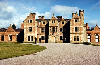
Chirk Castle is a Grade I listed castle located in Chirk, Wrexham County Borough, Wales. It is now owned and run by the National Trust.

<span class="mw-page-title-main">Grade I listed buildings in Wrexham County Borough</span>

In the United Kingdom, the term listed building refers to a building or other structure officially designated as being of special architectural, historical, or cultural significance; Grade I structures are those considered to be "buildings of exceptional interest". Listing was begun by a provision in the Town and Country Planning Act 1947. Once listed, strict limitations are imposed on the modifications allowed to a building's structure or fittings. In Wales, the authority for listing under the Planning Act 1990 rests with Cadw.

<span class="mw-page-title-main">Grade II* listed buildings in Monmouthshire</span> List of buildings in principal area of Wales

Monmouthshire is a county of Wales. It borders Torfaen and Newport to the west; Herefordshire and Gloucestershire to the east; and Powys to the north. The largest town is Abergavenny, with the other major towns being Chepstow, Monmouth, and Usk. The county is 850 km2 in extent, with a population of 95,200 as of 2020. The present county was formed under the Local Government (Wales) Act 1994, which came into effect in 1996, and comprises some sixty percent of the historic county. Between 1974 and 1996, the county was known by the ancient title of Gwent, recalling the medieval Welsh kingdom. In his essay on local government in the fifth and final volume of the Gwent County History, Robert McCloy suggests that the governance of "no county in the United Kingdom in the twentieth century was so transformed as that of Monmouthshire".

<span class="mw-page-title-main">Grade II* listed buildings in Wrexham County Borough</span>

In the United Kingdom, the term listed building refers to a building or other structure officially designated as being of special architectural, historical, or cultural significance; Grade II* structures are those considered to be "particularly important buildings of more than special interest". Listing was begun by a provision in the Town and Country Planning Act 1947. Once listed, strict limitations are imposed on the modifications allowed to a building's structure or fittings. In Wales, the authority for listing under the Planning Act 1990 rests with Cadw.

<span class="mw-page-title-main">Brynkinalt</span> Country house and estate near Chirk, Wales

Brynkinalt Hall is a Grade-II* listed private property, built in 1612, near Chirk, Wrexham County Borough, Wales. The hall is surrounded by an estate including 1,000 acres (4.0 km2) of agricultural land and 400 acres (1.6 km2) of woodland. Part of the estate extends into Shropshire, England. Brynkinalt Park is a park located to the hall's north-west.

<span class="mw-page-title-main">Registered historic parks and gardens in Wrexham County Borough</span> List of landscapes in county borough of Wales

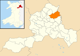
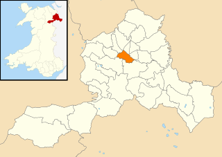
Wrexham County Borough is a county borough in the north-east of Wales. It covers an area of 503.7 km2 (194.5 sq mi) and in 2021 the population was approximately 135,100.

<span class="mw-page-title-main">Grade II listed buildings in Wrexham County Borough</span>

In the United Kingdom, the term listed building refers to a building or other structure officially designated as being of special architectural, historical, or cultural significance; Grade II structures are those considered to be "buildings of special interest which justify every effort being made to preserve them". Listing was begun by a provision in the Town and Country Planning Act 1947. Once listed, strict limitations are imposed on the modifications allowed to a building's structure or fittings. In Wales, the authority for listing under the Planning Act 1990 rests with Cadw.

<span class="mw-page-title-main">Grade II listed buildings in Bronington</span>

In the United Kingdom, the term listed building refers to a building or other structure officially designated as being of special architectural, historical, or cultural significance; Grade II structures are those considered to be "buildings of special interest which justify every effort being made to preserve them". Listing was begun by a provision in the Town and Country Planning Act 1947. Once listed, strict limitations are imposed on the modifications allowed to a building's structure or fittings. In Wales, the authority for listing under the Planning Act 1990 rests with Cadw.

<span class="mw-page-title-main">Grade II listed buildings in Coedpoeth</span>

In the United Kingdom, the term listed building refers to a building or other structure officially designated as being of special architectural, historical, or cultural significance; Grade II structures are those considered to be "buildings of special interest which justify every effort being made to preserve them". Listing was begun by a provision in the Town and Country Planning Act 1947. Once listed, strict limitations are imposed on the modifications allowed to a building's structure or fittings. In Wales, the authority for listing under the Planning Act 1990 rests with Cadw.

<span class="mw-page-title-main">Grade II listed buildings in Glyntraian</span>

In the United Kingdom, the term listed building refers to a building or other structure officially designated as being of special architectural, historical, or cultural significance; Grade II structures are those considered to be "buildings of special interest which justify every effort being made to preserve them". Listing was begun by a provision in the Town and Country Planning Act 1947. Once listed, strict limitations are imposed on the modifications allowed to a building's structure or fittings. In Wales, the authority for listing under the Planning Act 1990 rests with Cadw.

<span class="mw-page-title-main">Grade II listed buildings in Gresford</span>

In the United Kingdom, the term listed building refers to a building or other structure officially designated as being of special architectural, historical, or cultural significance; Grade II structures are those considered to be "buildings of special interest which justify every effort being made to preserve them". Listing was begun by a provision in the Town and Country Planning Act 1947. Once listed, strict limitations are imposed on the modifications allowed to a building's structure or fittings. In Wales, the authority for listing under the Planning Act 1990 rests with Cadw.

<span class="mw-page-title-main">Grade II listed buildings in Holt, Wrexham</span>

In the United Kingdom, the term listed building refers to a building or other structure officially designated as being of special architectural, historical, or cultural significance; Grade II structures are those considered to be "buildings of special interest which justify every effort being made to preserve them". Listing was begun by a provision in the Town and Country Planning Act 1947. Once listed, strict limitations are imposed on the modifications allowed to a building's structure or fittings. In Wales, the authority for listing under the Planning Act 1990 rests with Cadw.

<span class="mw-page-title-main">Grade II listed buildings in Marchwiel</span>

In the United Kingdom, the term listed building refers to a building or other structure officially designated as being of special architectural, historical, or cultural significance; Grade II structures are those considered to be "buildings of special interest which justify every effort being made to preserve them". Listing was begun by a provision in the Town and Country Planning Act 1947. Once listed, strict limitations are imposed on the modifications allowed to a building's structure or fittings. In Wales, the authority for listing under the Planning Act 1990 rests with Cadw.

<span class="mw-page-title-main">Grade II listed buildings in Offa, Wrexham</span>

In the United Kingdom, the term listed building refers to a building or other structure officially designated as being of special architectural, historical, or cultural significance; Grade II structures are those considered to be "buildings of special interest which justify every effort being made to preserve them". Listing was begun by a provision in the Town and Country Planning Act 1947. Once listed, strict limitations are imposed on the modifications allowed to a building's structure or fittings. In Wales, the authority for listing under the Planning Act 1990 rests with Cadw.

<span class="mw-page-title-main">Grade II listed buildings in Overton-on-Dee</span>

In the United Kingdom, the term listed building refers to a building or other structure officially designated as being of special architectural, historical, or cultural significance; Grade II structures are those considered to be "buildings of special interest which justify every effort being made to preserve them". Listing was begun by a provision in the Town and Country Planning Act 1947. Once listed, strict limitations are imposed on the modifications allowed to a building's structure or fittings. In Wales, the authority for listing under the Planning Act 1990 rests with Cadw.

<span class="mw-page-title-main">Grade II listed buildings in Rhosddu</span>

In the United Kingdom, the term listed building refers to a building or other structure officially designated as being of special architectural, historical, or cultural significance; Grade II structures are those considered to be "buildings of special interest which justify every effort being made to preserve them". Listing was begun by a provision in the Town and Country Planning Act 1947. Once listed, strict limitations are imposed on the modifications allowed to a building's structure or fittings. In Wales, the authority for listing under the Planning Act 1990 rests with Cadw.

<span class="mw-page-title-main">Grade II listed buildings in Ruabon</span>

In the United Kingdom, the term listed building refers to a building or other structure officially designated as being of special architectural, historical, or cultural significance; Grade II structures are those considered to be "buildings of special interest which justify every effort being made to preserve them". Listing was begun by a provision in the Town and Country Planning Act 1947. Once listed, strict limitations are imposed on the modifications allowed to a building's structure or fittings. In Wales, the authority for listing under the Planning Act 1990 rests with Cadw.

<span class="mw-page-title-main">Grade II listed buildings in Willington Worthenbury</span>

In the United Kingdom, the term listed building refers to a building or other structure officially designated as being of special architectural, historical, or cultural significance; Grade II structures are those considered to be "buildings of special interest which justify every effort being made to preserve them". Listing was begun by a provision in the Town and Country Planning Act 1947. Once listed, strict limitations are imposed on the modifications allowed to a building's structure or fittings. In Wales, the authority for listing under the Planning Act 1990 rests with Cadw.

<span class="mw-page-title-main">Old Gwernyfed</span> House in Powys, Wales

Old Gwernyfed is a house dating from the medieval period in the community of Gwernyfed, Powys, Wales, close to the village of Felindre. It remains a private home and is a Grade I listed building. The gardens are listed on the Cadw/ICOMOS Register of Parks and Gardens of Special Historic Interest in Wales.

<span class="mw-page-title-main">Salisbury Park Conservation Area</span> Conservation area in Wrexham, Wales

Salisbury Park is a conservation area in Wrexham, North Wales. Located to the south of Wrexham city centre, it is centred on Salisbury Road and Chapel Street, as well as other adjacent streets. It contains multiple listed buildings.

References

  1. "Buildings & Conservation Areas". Cadw . Retrieved 23 February 2024.
  2. "Planning (Listed Buildings and Conservation Areas) Act 1990". The National Archives . Retrieved 23 February 2024.
  3. Cadw (29 July 1998). ",1,Castle Road,Chirk,Wrexham,,LL14 5BS (Grade II) (20257)". National Historic Assets of Wales . Retrieved 19 February 2024.
  4. Cadw (29 July 1998). ",1,Hand Terrace,Chirk,Wrexham,,LL14 5EU (Grade II) (20216)". National Historic Assets of Wales . Retrieved 19 February 2024.
  5. Cadw (29 July 1998). ",2,Hand Terrace,Chirk,Wrexham,,LL14 5EU (Grade II) (20217)". National Historic Assets of Wales . Retrieved 19 February 2024.
  6. Cadw (29 July 1998). ",3,Hand Terrace,Chirk,Wrexham,,LL14 5EU (Grade II) (20218)". National Historic Assets of Wales . Retrieved 19 February 2024.
  7. Cadw (29 July 1998). ",4,Hand Terrace,Chirk,Wrexham,,LL14 5EU (Grade II) (20219)". National Historic Assets of Wales . Retrieved 19 February 2024.
  8. Cadw (29 July 1998). ",5,Hand Terrace,Chirk,Wrexham,,LL14 5EU (Grade II) (20220)". National Historic Assets of Wales . Retrieved 19 February 2024.
  9. Cadw (29 July 1998). ",6,Hand Terrace,Chirk,Wrexham,,LL14 5EU (Grade II) (20221)". National Historic Assets of Wales . Retrieved 19 February 2024.
  10. Cadw (29 July 1998). ",7,Hand Terrace,Chirk,Wrexham,,LL14 5EU (Grade II) (20222)". National Historic Assets of Wales . Retrieved 19 February 2024.
  11. Cadw (29 July 1998). "Arbour within Brynkinallt Park (Grade II) (20232)". National Historic Assets of Wales . Retrieved 19 February 2024.
  12. Cadw (4 January 1966). "Barc-du, also known as Sawmill Cottage (Grade II) (620)". National Historic Assets of Wales . Retrieved 19 February 2024.
  13. Cadw (29 July 1998). "Bronze Statue on a plinth in the E garden (Grade II) (20239)". National Historic Assets of Wales . Retrieved 19 February 2024.
  14. Cadw (29 July 1998). "Bryn Coed (Grade II) (20249)". National Historic Assets of Wales . Retrieved 19 February 2024.
  15. Cadw (29 July 1998). "Bryn Eglwys (Grade II) (20255)". National Historic Assets of Wales . Retrieved 19 February 2024.
  16. Cadw (3 December 1973). "Chirk Furniture and Carpet Centre and Dwelling (Grade II) (1290)". National Historic Assets of Wales . Retrieved 19 February 2024.
  17. Cadw (29 July 1998). "Chirk Lodge, Brynkinallt Park (Grade II) (20206)". National Historic Assets of Wales . Retrieved 19 February 2024.
  18. Cadw (29 July 1998). "Chirk Mill (Grade II) (20258)". National Historic Assets of Wales . Retrieved 19 February 2024.
  19. Cadw (29 July 1998). "Chirk Surgery (Grade II) (20256)". National Historic Assets of Wales . Retrieved 19 February 2024.
  20. Cadw (29 July 1998). "Chirk Town Council Offices (Grade II) (20215)". National Historic Assets of Wales . Retrieved 19 February 2024.
  21. Cadw (29 July 1998). "Cottage at The Kennels (Grade II) (20264)". National Historic Assets of Wales . Retrieved 19 February 2024.
  22. Cadw (1 October 2007). "Cross Street Tunnel and Archways (Grade II) (87549)". National Historic Assets of Wales . Retrieved 19 February 2024.
  23. Cadw (29 July 1998). "Deer Park Wall (Grade II) (20273)". National Historic Assets of Wales . Retrieved 19 February 2024.
  24. Cadw (29 July 1998). "Deerpark Lodge (Grade II) (20272)". National Historic Assets of Wales . Retrieved 19 February 2024.
  25. Cadw (29 July 1998). "Dog Kennel and Mounting Block at Halton Farm (Grade II) (20235)". National Historic Assets of Wales . Retrieved 19 February 2024.
  26. Cadw (29 July 1998). "Dovecote (Grade II) (20269)". National Historic Assets of Wales . Retrieved 19 February 2024.
  27. Cadw (3 December 1973). "Drumore (Grade II) (1289)". National Historic Assets of Wales . Retrieved 19 February 2024.
  28. Cadw (29 July 1998). "Farm Building at Fron-uchaf Farm, with front garden wall (Grade II) (20262)". National Historic Assets of Wales . Retrieved 19 February 2024.
  29. Cadw (29 July 1998). "Fron-uchaf Farmhouse (Grade II) (20261)". National Historic Assets of Wales . Retrieved 19 February 2024.
  30. Cadw (29 July 1998). "Gates to E Garden (Grade II) (20270)". National Historic Assets of Wales . Retrieved 19 February 2024.
  31. Cadw (29 July 1998). "Gates, Piers and Railings to the W Gate of Brynkinallt Park (Grade II) (20207)". National Historic Assets of Wales . Retrieved 19 February 2024.
  32. Cadw (29 July 1998). "Gazebo (Grade II) (20244)". National Historic Assets of Wales . Retrieved 19 February 2024.
  33. Cadw (29 July 1998). "Ha-ha at the E end of the E Garden (Grade II) (20247)". National Historic Assets of Wales . Retrieved 19 February 2024.
  34. Cadw (29 July 1998). "Halton Farmhouse (Grade II) (20233)". National Historic Assets of Wales . Retrieved 19 February 2024.
  35. Cadw (20 July 1994). "Halton Former Mission Church (Grade II) (14557)". National Historic Assets of Wales . Retrieved 19 February 2024.
  36. Cadw (11 February 1976). "Hand Hotel (Grade II) (1298)". National Historic Assets of Wales . Retrieved 19 February 2024.
  37. Cadw (29 July 1998). "Hawk House in the E Garden (Grade II) (20243)". National Historic Assets of Wales . Retrieved 19 February 2024.
  38. Cadw (29 July 1998). "Irishman's Bridge on the Llangollen Canal (Grade II) (20214)". National Historic Assets of Wales . Retrieved 19 February 2024.
  39. Cadw (29 July 1998). "Johnston's Cottage and Farm Buildings of Home Farm (Grade II) (20268)". National Historic Assets of Wales . Retrieved 19 February 2024.
  40. Cadw (29 July 1998). "Lady's Bridge, Brynkinallt Park (continued into England) (Grade II) (20230)". National Historic Assets of Wales . Retrieved 19 February 2024.
  41. Cadw (11 February 1976). "Ley Farmhouse (Grade II) (1297)". National Historic Assets of Wales . Retrieved 19 February 2024.
  42. Cadw (4 January 1966). "Llwyn-y-cil Cottage (Grade II) (624)". National Historic Assets of Wales . Retrieved 19 February 2024.
  43. Cadw (29 July 1998). "Llwyn-y-cil Lodge (Grade II) (20211)". National Historic Assets of Wales . Retrieved 19 February 2024.
  44. Cadw (29 July 1998). "Lowest Terrace Wall at Whitehurst Gardens (Grade II) (20226)". National Historic Assets of Wales . Retrieved 19 February 2024.
  45. Cadw (29 July 1998). "Lychgate outside Church of St Mary (Grade II) (20203)". National Historic Assets of Wales . Retrieved 19 February 2024.
  46. Cadw (29 July 1998). "Medieval Font in the E Garden (Grade II) (20245)". National Historic Assets of Wales . Retrieved 19 February 2024.
  47. Cadw (29 July 1998). "Milestone (Grade II) (20212)". National Historic Assets of Wales . Retrieved 19 February 2024.
  48. Cadw (4 January 1966). "New Hall (Grade II) (621)". National Historic Assets of Wales . Retrieved 19 February 2024.
  49. Cadw (4 January 1966). "New Hall Gate to Chirk Park: the N Lodge (Grade II) (20227)". National Historic Assets of Wales . Retrieved 19 February 2024.
  50. Cadw (4 January 1966). "New Hall Gate to Chirk Park: the S Lodge (Grade II) (622)". National Historic Assets of Wales . Retrieved 19 February 2024.
  51. Cadw (29 July 1998). "North Gate Piers to Chirk Town Council Offices (Grade II) (20228)". National Historic Assets of Wales . Retrieved 19 February 2024.
  52. Cadw (29 July 1998). "Nos 1 and 2 Home Farm Cottages (Grade II) (20271)". National Historic Assets of Wales . Retrieved 19 February 2024.
  53. Cadw (4 January 1966). "Nos 6 & 7 Coed-derw (Grade II) (623)". National Historic Assets of Wales . Retrieved 19 February 2024.
  54. Cadw (29 July 1998). "Pen-y-bont Brick and Tile Co Office (Grade II) (20213)". National Historic Assets of Wales . Retrieved 19 February 2024.
  55. Cadw (29 July 1998). "Pen-y-clawdd Farmhouse (Grade II) (20223)". National Historic Assets of Wales . Retrieved 19 February 2024.
  56. Cadw (29 July 1998). "Plas-Offa (Grade II) (20253)". National Historic Assets of Wales . Retrieved 19 February 2024.
  57. Cadw (4 January 1966). "Pont-faen (continued into England) (Grade II) (625)". National Historic Assets of Wales . Retrieved 19 February 2024.
  58. Cadw (20 October 1952). "Pont-y-blew (Grade II) (601)". National Historic Assets of Wales . Retrieved 19 February 2024.
  59. Cadw (29 July 1998). "Remains of Forge at Pont-y-blew (Grade II) (20260)". National Historic Assets of Wales . Retrieved 19 February 2024.
  60. Cadw (29 July 1998). "Rob's Cottage, Greenfield and Arosfa (Grade II) (20263)". National Historic Assets of Wales . Retrieved 19 February 2024.
  61. Cadw (29 July 1998). "Screen Wall and Towers defining the S Stable Yard on the S side (Grade II) (20250)". National Historic Assets of Wales . Retrieved 19 February 2024.
  62. Cadw (29 July 1998). "Screen Wall to the service yard at Brynkinallt Hall (Grade II) (20231)". National Historic Assets of Wales . Retrieved 19 February 2024.
  63. Cadw (29 July 1998). "Second Terrace Wall at Whitehurst Gardens (Grade II) (20225)". National Historic Assets of Wales . Retrieved 19 February 2024.
  64. Cadw (4 January 1966). "Smithy at Whitehurst Gate and House attached (Grade II) (627)". National Historic Assets of Wales . Retrieved 19 February 2024.
  65. Cadw (29 July 1998). "South Gate Piers to Chirk Town Council Offices (Grade II) (20229)". National Historic Assets of Wales . Retrieved 19 February 2024.
  66. Cadw (4 May 2010). "Squash Court at Chirk Castle (Grade II) (87603)". National Historic Assets of Wales . Retrieved 19 February 2024.
  67. Cadw (29 July 1998). "St Michael's Nursing Home (Grade II) (20274)". National Historic Assets of Wales . Retrieved 19 February 2024.
  68. Cadw (29 July 1998). "Statue by the lily pond in the E Garden (Grade II) (20242)". National Historic Assets of Wales . Retrieved 19 February 2024.
  69. Cadw (29 July 1998). "Statue in the E Garden (Grade II) (20240)". National Historic Assets of Wales . Retrieved 19 February 2024.
  70. Cadw (29 July 1998). "Statue in the E Garden (Grade II) (20241)". National Historic Assets of Wales . Retrieved 19 February 2024.
  71. Cadw (29 July 1998). "Statue of Hercules (Grade II) (20237)". National Historic Assets of Wales . Retrieved 19 February 2024.
  72. Cadw (29 July 1998). "Sundial in churchyard of the Church of St Mary (Grade II) (20204)". National Historic Assets of Wales . Retrieved 19 February 2024.
  73. Cadw (29 July 1998). "Sundial in front of the Hawk House in the E Garden (Grade II) (20246)". National Historic Assets of Wales . Retrieved 19 February 2024.
  74. Cadw (29 July 1998). "Sundial in the E Garden (Grade II) (20238)". National Historic Assets of Wales . Retrieved 19 February 2024.
  75. Cadw (29 July 1998). "Telford Milestone (83) (Grade II) (20236)". National Historic Assets of Wales . Retrieved 19 February 2024.
  76. Cadw (29 July 1998). "The Forge (Grade II) (20252)". National Historic Assets of Wales . Retrieved 19 February 2024.
  77. Cadw (29 July 1998). "The Kennels (Grade II) (20265)". National Historic Assets of Wales . Retrieved 19 February 2024.
  78. Cadw (4 January 1966). "The Lodge (Grade II) (626)". National Historic Assets of Wales . Retrieved 19 February 2024.
  79. Cadw (4 January 1966). "The Mount, with front garden railings and gate (Grade II) (616)". National Historic Assets of Wales . Retrieved 19 February 2024.
  80. Cadw (29 July 1998). "Town Reservoir (Grade II) (20254)". National Historic Assets of Wales . Retrieved 19 February 2024.
  81. Cadw (4 January 1966). "Trevor House (Grade II) (617)". National Historic Assets of Wales . Retrieved 19 February 2024.
  82. Cadw (29 July 1998). "Trevor Mausoleum in churchyard of the Church of St Mary (Grade II) (20208)". National Historic Assets of Wales . Retrieved 19 February 2024.
  83. Cadw (29 July 1998). "Two adjoining Ranges of Farm Buildings, with a Horse Gin at Halton Farm (Grade II) (20234)". National Historic Assets of Wales . Retrieved 19 February 2024.
  84. Cadw (29 July 1998). "Upper Terrace Wall at Whitehurst Gardens (Grade II) (20224)". National Historic Assets of Wales . Retrieved 19 February 2024.
  85. Cadw (29 July 1998). "Wall bounding driveway to the Stables and continuing the stable yard screen (Grade II) (20266)". National Historic Assets of Wales . Retrieved 19 February 2024.
  86. Cadw (29 July 1998). "Wall on the NE side of the driveway to the Stables (Grade II) (20267)". National Historic Assets of Wales . Retrieved 19 February 2024.
  87. Cadw (29 July 1998). "Walls to the Privy Garden (Grade II) (20251)". National Historic Assets of Wales . Retrieved 19 February 2024.
  88. Cadw (29 July 1998). "Ward Monument in churchyard of the Church of St Mary (Grade II) (20205)". National Historic Assets of Wales . Retrieved 19 February 2024.
  89. Cadw (1 October 2007). "Whitehouse Bridge (Grade II) (87548)". National Historic Assets of Wales . Retrieved 19 February 2024.
  90. Cadw (3 December 1973). "Whitehurst Garden Gatepiers with Gates and perimeter Garden Wall (Grade II) (1286)". National Historic Assets of Wales . Retrieved 19 February 2024.
  91. Cadw (3 December 1973). "Whitehurst House (Grade II) (1287)". National Historic Assets of Wales . Retrieved 19 February 2024.
  92. Cadw (29 July 1998). "Whitewalls (Grade II) (20259)". National Historic Assets of Wales . Retrieved 19 February 2024.