
Silloth is a port town and civil parish in Cumberland, Cumbria, England. Historically in the county of Cumberland, the town is an example of a Victorian seaside resort in the North of England.

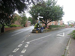
Burgh by Sands is a village and civil parish in the Cumberland unitary authority area of Cumbria, England, situated near the Solway Firth. The parish includes the village of Burgh by Sands along with Longburgh, Dykesfield, Boustead Hill, Moorhouse and Thurstonfield. It is notable as the site of the first recorded North African (Moorish) military unit in Roman Britain, garrisoning the frontier fort of Aballava on Hadrian's Wall in the 3rd century AD. It is also where Edward I of England died in 1307.

Silloth was the terminus of the Carlisle and Silloth Bay Railway, a branch railway from Carlisle, England. The town, dock and station at Silloth were built on a greenfield site after the Carlisle & Silloth Bay Railway & Dock Act (1855) was passed. The railway provision grew with the dock and its later additions.

Abbey Town railway station was on the branch line off the Solway Junction Railway in the English county of Cumberland. The first station after Abbey Junction on the branch to Silloth on the Solway Firth, it served the village of Abbey Town. The station closed with the line to Silloth in 1964.

Port Carlisle is a coastal village in Allerdale, Cumbria, England. It is in the civil parish of Bowness-on-Solway. Its original name was Fisher's Cross, but when it became the terminus of the Carlisle Canal it was renamed Port Carlisle. During the lifetime of the canal it was of considerable importance as the sea outlet for Carlisle, handling both freight and passengers. With the building of the much bigger Silloth docks, the canal was redundant. Some through trade continued via the Port Carlisle Railway, but diminished as the Solway silted up.

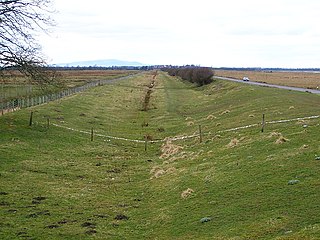
Drumburgh is a small settlement in Cumbria, England. It is 13 kilometres (8 mi) northwest of the city of Carlisle and is on the course of Hadrian's Wall, near to Burgh by Sands. The village is sited on a gentle hill with a good view in all directions over the surrounding lowlands.
Kirkandrews-on-Eden or Kirkandrews-upon-Eden, in the past known as Kirkanders, is a village and former civil parish, now in the civil parish of Beaumont, in the Cumberland unitary authority area of Cumbria, England. The village is 4 miles northwest of Carlisle. Kirkandrews forms part of the Barony of Burgh together with the nearby villages Monkhill, Grinsdale, Rattlingate and Burgh-by-Sands. In 1931 the civil parish had a population of 145.
There were two interlinked railways on the south shore of the Solway Firth.

Port Carlisle railway station was a railway station in Port Carlisle, Cumbria; the terminus on the Port Carlisle Railway, serving the village and old port and the steamer service to Liverpool that ran from here until 1856, when it was transferred to Silloth. Port Carlisle was two and a half miles away by train from Drumburgh and Glasson was one and a quarter miles away. The journey time to Drumburgh was nine minutes, although Glasson was a request stop.

Glasson railway station was a railway station in Glasson, Cumbria, England. It was the last station before the terminus on the Port Carlisle Railway branch, serving the small village of that name. Nothing now remains of the station.

Glasson is a hamlet in Cumbria, England, just inland from the Solway coast, eight miles (13 km) northwest of Carlisle on the course of Hadrian's Wall near Drumburgh. The place name derives from the Anglo-Scandinavian glaise, meaning "a small stream".
Drumburgh railway station was near the village of Drumburgh, Cumbria, England.

Burgh-by-Sands railway station was originally named Burgh. It opened in 1854 on the Port Carlisle Railway branch and later the Silloth branch, serving the village of Burgh in Cumberland - now Cumbria - England. The line and station closed on 7 September 1964 as part of the Beeching cuts.

Black Dyke Halt or Blackdyke was a railway station near Blackdyke, Cumbria on the Silloth branch, serving the small hamlet of Black Dyke and its rural district. In its early days trains called on Saturdays only, being upgraded some years later. The station closed on 7 September 1964. with the line to Silloth as part of the Beeching cuts.
Mealsgate railway station was in the former county of Cumberland, now Cumbria, England. It was a stop on the Bolton Loop of the Maryport and Carlisle Railway.
Allhallows Colliery railway station was in the former county of Cumberland, now Cumbria, England. It was a stop on the Bolton Loop of the Maryport and Carlisle Railway.

Cumberland and Westmorland Convalescent Institution railway station was a terminus off the short Blitterlees Branch off the Carlisle and Silloth Bay Railway, within Silloth itself. The larger railway ran from Carlisle, England. The station does not appear on standard railway maps, but it can be discerned with a magnifying glass on at least two published maps and clearest of all on the 1914 25" OS map.
Silloth Battery Extension railway station was the terminus of the Blitterlees Branch, which turned southwards off the Carlisle and Silloth Bay Railway's Silloth Branch a short distance east of Silloth station. The larger railway ran from Carlisle, England. The Bitterlees Branch does not appear on standard railway maps, but it is clear on OS maps, though the station is not identifiable as such.
Carlisle Canal railway station was opened in 1854 as the Carlisle terminus of the Port Carlisle Railway Company's line from Port Carlisle in Cumbria, England. That line was largely laid along the course of the Carlisle Canal, hence the station's name.

The Carlisle Canal opened in 1823, to link Carlisle to the Solway Firth, to facilitate the transport of goods to and from the city. It was a short-lived venture, being replaced by a railway which used the canal bed for most of its route in 1854.


