Lake Cootapatamba

Last updated

Lake Cootapatamba
Kosciuszko03.JPG
View of Lake Cootapatamba from the Thredbo-Rawsons Pass walking track
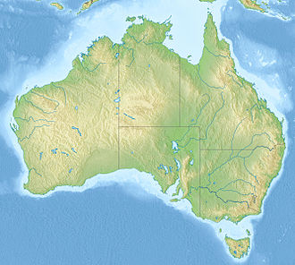
Australia relief map.jpg
Red pog.svg
Lake Cootapatamba
Location Kosciuszko National Park, New South Wales, Australia
Coordinates 36°27′55″S148°15′51″E / 36.4652°S 148.2643°E / -36.4652; 148.2643 Coordinates: 36°27′55″S148°15′51″E / 36.4652°S 148.2643°E / -36.4652; 148.2643
Type Tarn
Max. length400 m (1,300 ft)
Max. depth5 m (16 ft)
Surface elevation2,048 m (6,719 ft)
FrozenJune to October/November

Lake Cootapatamba is a post-glacial tarn in the Kosciuszko National Park, New South Wales, Australia.

Lake Cootapatamba is located at 2,048 metres, which is about 800 metres south of the summit of Mount Kosciuszko, the highest peak in Australia. It is the highest elevation lake in Australia. [1] [2] It is 400 metres long with a maximum depth of about 5 metres. [3]

Related Research Articles

<span class="mw-page-title-main">Snowy Mountains</span> Mountain range in Australia

The Snowy Mountains, known informally as "The Snowies", is an IBRA subregion in southern New South Wales, Australia, and is the tallest mountain range in mainland Australia, being part of the continent's Great Dividing Range cordillera system. It makes up the northeastern half of the Australian Alps and contains Australia's five tallest peaks, all of which are above 2,100 m (6,890 ft), including the tallest Mount Kosciuszko, which reaches to a height of 2,228 m (7,310 ft) above sea level. The offshore Tasmanian highlands makes up the only other major alpine region present in the whole of Australia.

The Kosciuszko National Park is a 6,900-square-kilometre (2,700 sq mi) national park and contains mainland Australia's highest peak, Mount Kosciuszko, for which it is named, and Cabramurra, the highest town in Australia. Its borders contain a mix of rugged mountains and wilderness, characterised by an alpine climate, which makes it popular with recreational skiers and bushwalkers.

<span class="mw-page-title-main">Mount Kosciuszko</span> Highest mountain in mainland Australia

Mount Kosciuszko, previously spelled Mount Kosciusko, is mainland Australia's tallest mountain, at 2,228 metres (7,310 ft) above sea level. It is located on the Main Range of the Snowy Mountains in Kosciuszko National Park, part of the Australian Alps National Parks and Reserves, in New South Wales, Australia, and is located west of Crackenback and close to Jindabyne, near the border with Victoria.

<span class="mw-page-title-main">Australian Alps</span> Bioregion in Australia

The Australian Alps is a mountain range in southeast Australia. It comprises an interim Australian bioregion, and is the highest mountain range in Australia. The range straddles the borders of eastern Victoria, southeastern New South Wales, and the Australian Capital Territory. It contains Australia's only peaks exceeding 2,000 m (6,600 ft) in elevation, and is the only bioregion on the Australian mainland in which deep snow falls annually. The range comprises an area of 1,232,981 ha.

<span class="mw-page-title-main">Charlotte Pass, New South Wales</span> Ski resort in New South Wales, Australia

Charlotte Pass is a snow resort and village in the Snowy Mountains of New South Wales, Australia. The pass is in the Kosciuszko National Park where the Kosciuszko Road crosses Kangaroo Ridge. Charlotte Pass is the closest village to Mount Kosciuszko, the tallest mountain in Australia.

<span class="mw-page-title-main">Mount Townsend</span> Mountain in New South Wales, Australia

Mount Townsend, a mountain in the Main Range of the Great Dividing Range, is located in the Snowy Mountains region of New South Wales, Australia.

<span class="mw-page-title-main">Ramshead Range</span>

The Ramshead Range, a mountain range that is part of the Snowy Mountains, is located in the Monaro region of New South Wales and the Alpine region of Victoria, Australia.

<span class="mw-page-title-main">Jindabyne, New South Wales</span> Town in New South Wales, Australia

Jindabyne is a town in south-east New South Wales, Australia that overlooks Lake Jindabyne near the Snowy Mountains, in Snowy Monaro Regional Council. It is a popular holiday destination year round, especially in winter. This is due to its proximity to major ski resort developments within the Kosciuszko National Park, including Thredbo, Perisher and Charlotte Pass.

<span class="mw-page-title-main">Mount Jagungal</span>

Mount Jagungal or sometimes Jagungal, Big Bogong, The Big Bogong Nr., or The Big Bogong Mountain, is a mountain within the Jagungal Wilderness Area of the Kosciuszko National Park in the Snowy Mountains region of New South Wales, Australia.

<span class="mw-page-title-main">Selwyn Snowfields</span> Ski resort in New South Wales, Australia

Selwyn Snow Resort, formerly known as Selwyn Snowfields, is a ski resort located in the most northern part of the Snowy Mountains of New South Wales, Australia, in the Snowy Monaro Regional Council and Kosciuszko National Park. Selwyn Snow Resort is located near the town of Adaminaby and is close to Cabramurra, which is the highest town in Australia.

<span class="mw-page-title-main">Bimberi Peak</span> Mountain in New South Wales, Australia

Bimberi Peak or Mount Bimberi with an elevation of 1,913 metres (6,276 ft) located within the Brindabella Ranges is the highest mountain in the Australian Capital Territory (ACT). It is located on the border between New South Wales (NSW) and the ACT, the NSW portion in Kosciuszko National Park and the ACT portion in Namadgi National Park. It is accessible by bush walking trails and requires no specialised climbing skills, although there is no marked trail to the very summit.

Tasmanophlebi lacuscoerulei is a species of mayfly in family Siphlonuridae. It is endemic to New South Wales in Australia. It is known commonly as the large Blue Lake mayfly.

<span class="mw-page-title-main">Mount Twynam</span> Mountain in New South Wales, Australia

Mount Twynam is a mountain located on the Main Range, part of the Great Dividing Range, in the Snowy Mountains in New South Wales, Australia. The mountain is located close the border between New South Wales and Victoria.

<span class="mw-page-title-main">Carruthers Peak</span>

Carruthers Peak, formerly Curruthers Peak, a mountain in the Main Range of the Great Dividing Range, is located in Snowy Mountains region in southeast New South Wales, Australia. The peak is situated between Mount Lee and Mount Twynam within the Kosciuszko National Park.

<span class="mw-page-title-main">Skiing in Australia</span> Overview of skiing practiced in Australia

Skiing in Australia takes place in the Australian Alps in the states of New South Wales, Victoria and the Australian Capital Territory as well as in the mountains of the island state Tasmania, during the southern hemisphere winter.

<span class="mw-page-title-main">Blue Lake (New South Wales)</span> Body of water

The Blue Lake is one of only four cirque lakes found in mainland Australia. The other three, Cootapatamba, Albina, and Club, are shallower and are held entirely by terminal moraines. Blue Lake's valley contains the best-developed glacial features in the Kosciuszko National Park alpine area of New South Wales. It was recognised as a wetland of international importance on 17 March 1996 when a 320-hectare (790-acre) area, comprising the lake and its surrounds, including nearby Hedley Tarn, was designated Ramsar Site 800 under the Ramsar Convention on wetlands. The lake lies within the Australian Alps National Parks and Reserves.

The Rams Head is a mountain located in the Ramshead Range of the Snowy Mountains in New South Wales, Australia.

<span class="mw-page-title-main">Lake Albina</span> Body of water

Lake Albina is a glacial lake in the Snowy Mountains region of New South Wales, Australia. The lake is located within the Kosciuszko National Park and the Australian Alps National Parks and Reserves.

Swampy Plain River, a perennial stream that is part of the Murray catchment within the Murray–Darling basin, is located in the Snowy Mountains bioregion of New South Wales, Australia.

References

  1. West,D., (1994) Kosciuszko Natural Heritage.
  2. ElevationMap.net. "Elevation of Lake Cootapatamba with altitude and height" . Retrieved 27 December 2016.
  3. "Tourists on the Monaro - KOSCIUSKO" . Retrieved 4 July 2018.